The sound hit me before the sight did—a thunderous roar echoing through the old-growth cedars that made me stop mid-stride on the trail.
When I finally rounded that last bend during my visit last summer, Little North Fork Falls revealed itself in full glory: a powerful cascade plunging through a moss-covered canyon that felt more Pacific Northwest than Montana.
This hidden gem in the Cabinet Mountains Wilderness remains one of the most underrated destinations among Montana waterfalls, and I’m convinced it deserves far more attention than it currently receives.
- Location: Cabinet Mountains Wilderness, northwest Montana near Libby
- Trail Distance: Approximately 4.2 miles round trip
- Difficulty: Moderate with some steep sections and creek crossings
- Best Time: Late May through early July for peak water flow
- Permit Required: No fee or permit needed
- Crowd Level: Very light—I saw only two other hikers during my entire visit
- Don’t Miss: The upper cascade viewpoint about 0.3 miles past the main falls
Where Exactly Is Little North Fork Falls?
Little North Fork Falls sits tucked away in the Cabinet Mountains Wilderness of Lincoln County, roughly 25 miles south of Libby, Montana. This isn’t a drive-up waterfall situation—you’ll need to earn this one on foot, which is precisely why it stays relatively empty even during peak summer months.
The falls form along the Little North Fork of the Bull River, a tributary that drains snowmelt from the surrounding peaks. When I was there in late June, the water volume was impressive, creating that thunderous sound I mentioned earlier.
Getting to the trailhead requires navigating a series of forest roads that can challenge even confident drivers. I’ll break down the exact route shortly, but know that the adventure starts well before you lace up your hiking boots.
The Drive to Little North Fork Trailhead
From Libby, head south on Highway 2 for approximately 18 miles until you reach the Bull River Road (Forest Road 407). Turn right here—the turn is well-marked, so you shouldn’t miss it.
Follow Bull River Road for about 7 miles, keeping an eye out for Forest Road 398 on your left. This junction can sneak up on you, especially if you’re distracted by the stunning river views. I missed it on my first attempt and had to backtrack.
Once on Forest Road 398, continue for another 3.5 miles to reach the trailhead parking area. During my visit, there was room for maybe six vehicles, and only one other car occupied a spot at 8 AM on a Saturday.
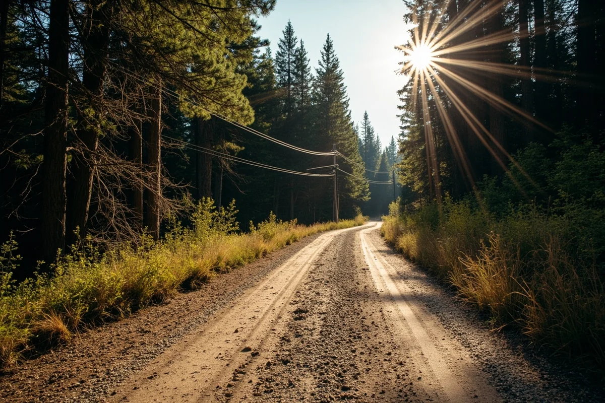
Road Conditions You Should Know About
Forest Road 398 is where things get interesting. The first two miles are reasonably maintained gravel, but the final stretch narrows considerably and features some impressive potholes.
I drove a Toyota 4Runner during my trip, which handled everything without issue. However, I watched a sedan struggle significantly on the return trip—the driver had to creep along at walking pace to avoid bottoming out.
High clearance is strongly recommended. Four-wheel drive isn’t strictly necessary in dry conditions, but it certainly provides peace of mind on the steeper grades.
During spring snowmelt or after heavy rains, this road can become impassable. I spoke with a local at the Libby Ranger Station who mentioned they don’t even attempt to maintain it until late May most years.
Trail Description: What to Expect Every Step of the Way
The Little North Fork Trail (#992) begins at the obvious trailhead sign and immediately plunges into dense forest. I loved how quickly civilization disappeared—within five minutes, I felt completely enveloped by wilderness.
First Mile: Gentle Introduction
The opening section follows the creek at a reasonable distance, climbing gradually through a mixed forest of western red cedar, hemlock, and Douglas fir. The trail surface here consists mostly of packed dirt with occasional root obstacles.
I noticed several old blazes on trees that suggested this trail has been in use for generations. The path felt historic in a way that newer trails simply don’t capture.
Wildlife signs were everywhere during my hike. I spotted fresh elk tracks, what appeared to be black bear scat (though I’m no expert), and countless squirrel activity zones. Keep your eyes open and your bear spray accessible.
Miles One Through Two: The Climb Begins
Around the one-mile mark, the trail’s personality shifts. You’ll start gaining elevation more noticeably, and the switchbacks begin in earnest.
This section tested my cardiovascular fitness more than I’d anticipated. The grade isn’t extreme—maybe 15-20% in the steeper sections—but the sustained climbing adds up.
What helped was the incredible scenery distracting from the effort. I paused multiple times, ostensibly to appreciate the views but honestly to catch my breath. Massive old-growth cedars, some easily 500 years old, tower overhead in this stretch.
The first creek crossing appears at approximately 1.4 miles. During my late June visit, the water ran about knee-deep and moved swiftly. I saw stepping stones that might work during lower water periods, but I simply accepted wet boots and waded across.
Final Push to the Falls
After the creek crossing, the trail becomes rougher and less defined in places. Pay close attention to trail markers—I lost the path briefly when I got distracted photographing a particularly striking rock formation.
The sound of the falls grows increasingly prominent as you approach. I remember hearing it clearly from about a quarter mile out, which built tremendous anticipation.
The final descent to the falls viewing area requires some careful footwork. Roots and rocks create a natural staircase of sorts, but rain could make this section quite slippery. Trekking poles would have been helpful here—I didn’t bring mine and regretted that choice.
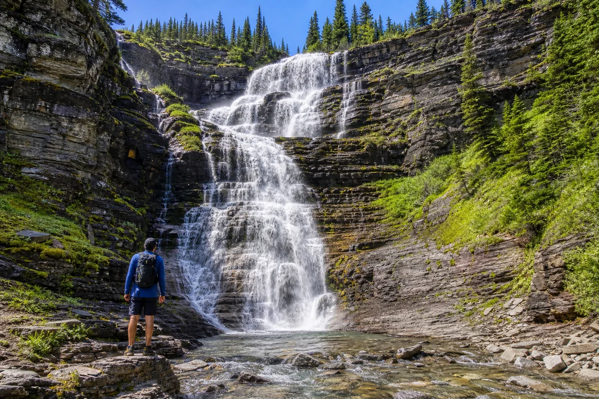
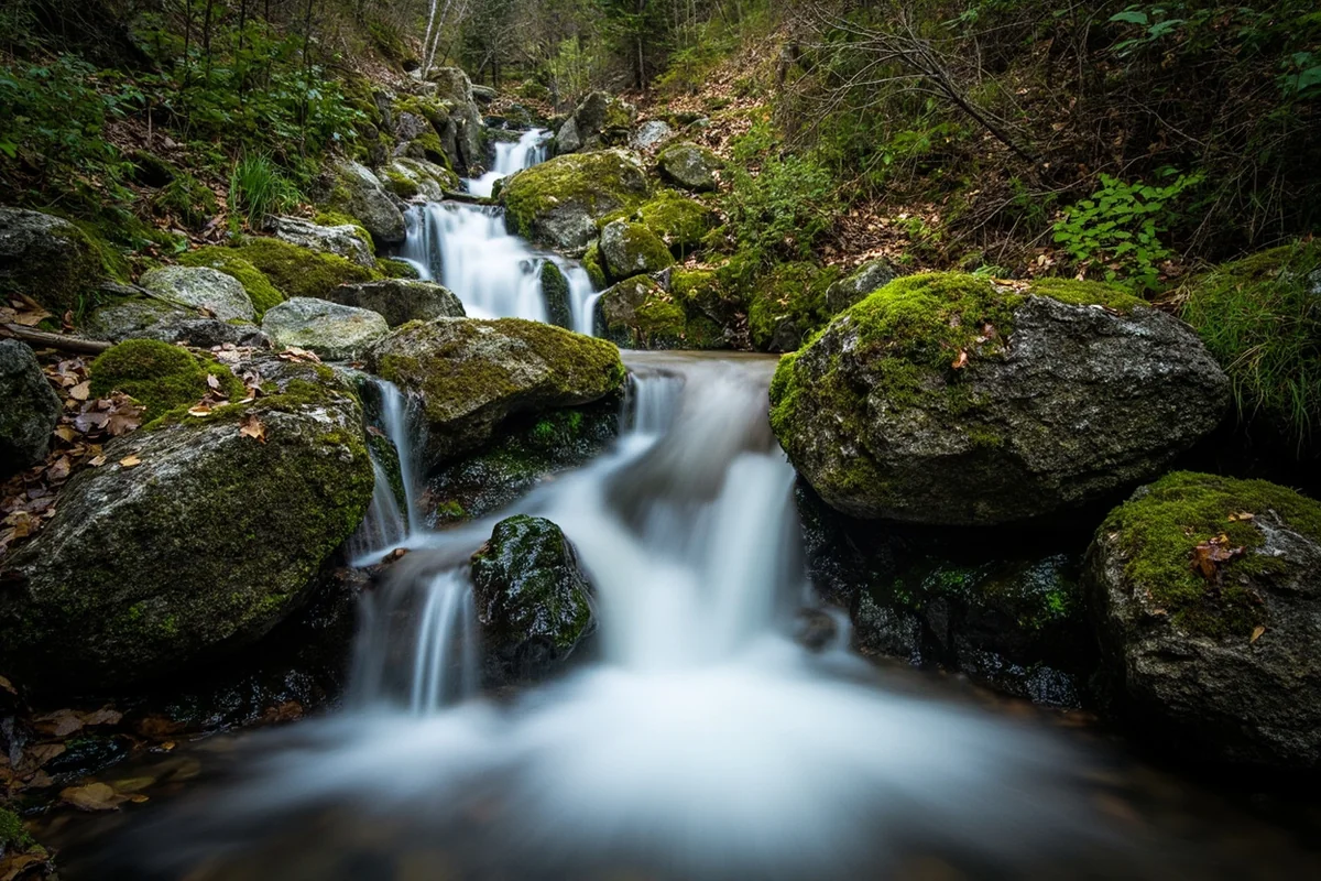
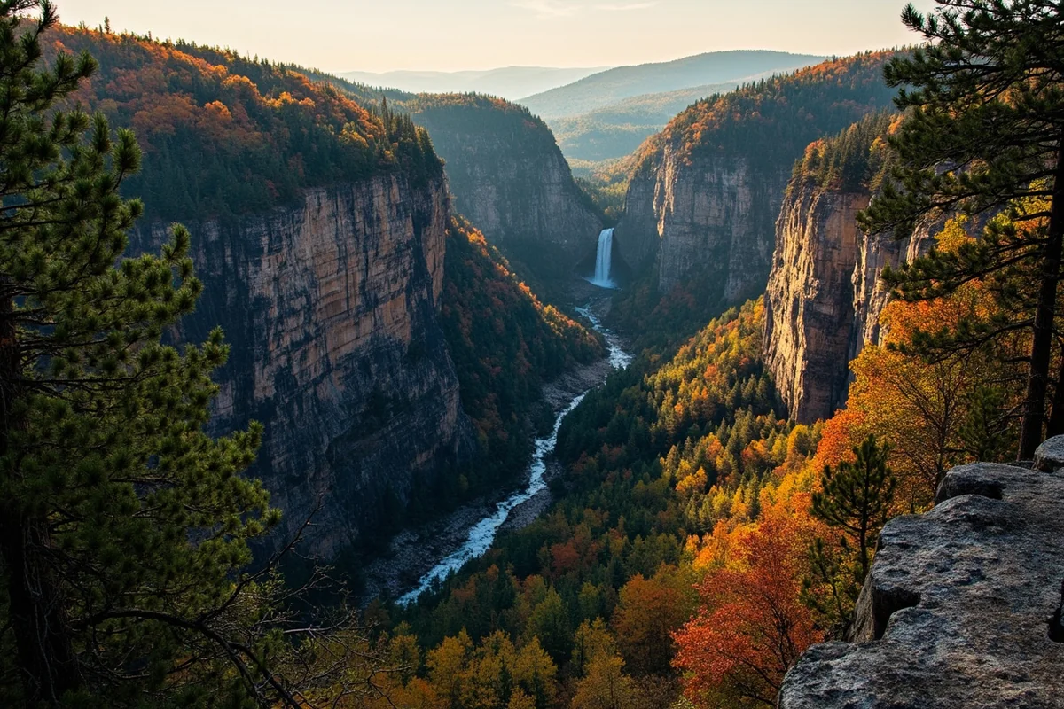
Little North Fork Falls Up Close
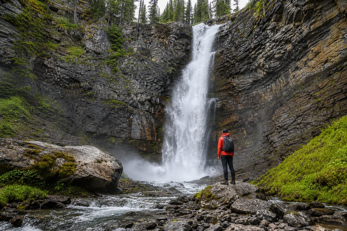
Nothing quite prepared me for that first unobstructed view. Little North Fork Falls drops approximately 65 feet in a series of cascades, the main plunge splitting around a massive boulder before reuniting in a churning pool below.
The setting creates something magical. Moss carpets every available surface, draping rocks in vibrant green that almost glows when sunlight filters through the canopy. Ferns cascade down the canyon walls, and the mist from the falls keeps everything perpetually damp.
I spent nearly an hour at the base, just absorbing the scene. The negative ions from the waterfall created that energizing, fresh sensation that people try to bottle and sell in wellness stores. Here, it’s free and unlimited.

Photography Tips From My Experience
Early morning light doesn’t penetrate this canyon directly—the steep walls block direct sun until mid-morning. This actually works in photographers’ favor, as the diffused light prevents harsh shadows.
I shot with a circular polarizer, which cut the glare on wet rocks significantly and deepened the green tones in the surrounding vegetation. If you’re shooting waterfalls, this is essential gear.
For that silky water effect, I used a 6-stop ND filter and shot at f/11 for about 2 seconds. The results were exactly what I’d hoped for—the water transformed into flowing ribbons while the surrounding forest stayed tack-sharp.
A tripod is non-negotiable for serious photography here. The ground is uneven, but I found several flat rocks that provided stable platforms.
The Upper Cascade: Worth the Extra Effort
Most visitors turn around after viewing the main falls, but I encourage you to continue another quarter mile to reach the upper cascade viewpoint.
The trail climbs steeply along the canyon rim, offering aerial perspectives of the falls below. The upper cascade itself isn’t as dramatic—maybe 25 feet tall—but the overall view combining both features is spectacular.
This extension adds about 30 minutes to your hike but delivers outsized rewards. I actually preferred the lighting at the upper viewpoint, where morning sun created dramatic side lighting on the canyon walls.
Best Time to Visit Little North Fork Falls
Timing your visit correctly can mean the difference between a memorable experience and a disappointing trickle. I’ve gathered information from multiple visits and conversations with locals to help you plan optimally.
Late May Through Early July: Peak Flow
Snowmelt from the Cabinet Mountains peaks during this window, pushing maximum water volume through the falls. My late June visit hit the sweet spot—substantial flow without the challenging trail conditions of early spring.
The downside of this period is slightly higher mosquito activity. I applied bug spray liberally and still received several bites. Consider bringing a head net if you’re particularly sensitive.
Trail conditions during peak flow are generally good, though creek crossings run higher and faster. Water shoes or sandals for the crossing make sense during this time.
Mid-July Through September: Lower Water, Easier Access
Water volume decreases noticeably by mid-summer, but the falls remain photogenic. I’ve seen photos from August visitors that show more rock exposed, creating different compositional possibilities.
The advantages here include easier creek crossings, fewer bugs, and more reliable road conditions. The tradeoff is reduced drama in the falls themselves.
Fall colors arrive in late September, adding golden larch needles to the predominantly green palette. I haven’t personally witnessed this but it’s high on my return visit list.
Winter and Early Spring: Not Recommended
The access road closes to vehicles once snow accumulates, typically by late October. Some adventurous souls ski or snowshoe in, but this extends an already significant outing into a full-day expedition.
Avalanche danger exists in the canyon during winter months. Unless you have serious backcountry experience and proper safety gear, save this waterfall for warmer months.
Spring snowmelt (March through early May) renders the access road impassable and makes the trail potentially dangerous due to high water levels. The Libby Ranger Station can provide current conditions if you’re considering an early-season attempt.

What to Pack for This Hike
I’ve refined my packing list over multiple waterfall hikes in northwest Montana, and this trail has some specific requirements worth noting.
| Item | Why It Matters |
|---|---|
| Bear Spray | Active bear population in Cabinet Mountains—carry it accessible |
| Water Shoes/Sandals | Creek crossing is unavoidable during high water periods |
| Trekking Poles | Final descent to falls is steep and root-covered |
| Bug Spray/Head Net | Mosquitoes are aggressive near water, especially June |
| Rain Layer | Weather changes rapidly; also useful for waterfall mist |
| Extra Socks | Dry socks for the return hike improve morale significantly |
| Offline Maps/GPS | No cell service throughout this area |
I always pack more water than I think I’ll need. The 4.2-mile round trip distance doesn’t sound extreme, but the elevation gain and variable temperatures can increase hydration needs substantially.
Wildlife Considerations in the Cabinet Mountains
The Cabinet Mountains Wilderness supports healthy populations of both black bears and grizzly bears. During my hike, I didn’t encounter any bears directly, but the signs of their presence were unmistakable.
Make noise as you hike, especially approaching blind corners on the trail. I tend to talk to myself, which probably makes me seem unhinged but also alerts wildlife to my presence.
Bear spray should be immediately accessible—not buried in your pack. I wear mine in a chest holster that allows deployment within seconds.
If you’re hiking alone, as I was, extra caution is warranted. Bears are less likely to feel threatened by solo hikers, which can actually work in your favor, but you also lack the noise-making advantage of a group.
Moose occasionally wander through this drainage as well. Give them extremely wide berth—they’re actually more dangerous than bears in many situations due to their unpredictable temperament.
Nearby Attractions Worth Combining
If you’ve driven all the way to this corner of Montana, maximize your trip by exploring nearby attractions. I’ve visited several during various trips to the area.
Kootenai Falls
About 45 minutes north, Kootenai Falls offers a completely different waterfall experience. It’s one of the largest free-flowing falls in Montana and features an impressive swinging bridge that’s appeared in several films.
The accessibility couldn’t be more different—paved trails and parking lots make Kootenai Falls family-friendly. I often recommend visiting Kootenai in the afternoon after a morning at Little North Fork, creating a day of contrasts.
Ross Creek Cedars
This grove of ancient western red cedars sits about 20 miles from Little North Fork. Some trees here exceed 1,000 years old, and a easy loop trail winds through the cathedral-like forest.
I find the cedars almost more impressive than the falls themselves. The scale is difficult to comprehend until you’re standing at the base of a trunk wider than most rooms.
Libby Dam
For a completely different vibe, Libby Dam provides views of Lake Koocanusa and offers free tours during summer months. The engineering is impressive, and the visitor center provides excellent context about the region’s hydroelectric history.
Comparison With Other Northwest Montana Waterfalls
Having visited dozens of Montana waterfalls, I can place Little North Fork Falls in context for your planning purposes.
If you’re seeking a similar remote, rewarding experience, Morrell Falls near Seeley Lake offers comparable solitude with a slightly longer approach. The falls themselves are taller but less intimate in their setting.
For those who love the lush, Pacific Northwest aesthetic of Little North Fork, Grotto Falls near Hyalite Reservoir delivers similar moss-draped beauty with easier access. It’s considerably more crowded, though.
Holland Lake Falls provides another moderate hike to a waterfall in a wilderness setting, though the Swan Valley location places it in different terrain. I’d call Holland Lake slightly easier overall but with comparable scenery.
The Cabinet Mountains drainage also contains several lesser-known cascades. Hidden Falls lives up to its name—even more remote than Little North Fork and requiring bushwhacking skills to reach.
Where to Stay Near Little North Fork Falls
Libby serves as the most practical base for exploring this waterfall. The small town offers several accommodation options that I’ve personally evaluated.
Hotels and Motels
The Sandman Motel in downtown Libby provided clean, no-frills lodging during my visit. Don’t expect luxury—expect functional rooms, friendly owners, and rates around $80 per night.
The Caboose Motel offers slightly more character with better beds in my experience. Their proximity to several good restaurants made dinner logistics easier after a long hiking day.
Camping Options
For those preferring to sleep under stars, several Forest Service campgrounds operate along Bull River Road. Howard Lake Campground sits closest to the trailhead, about 8 miles before you reach the turnoff for Forest Road 398.
Sites are first-come, first-served and rarely fill completely. I’ve never been unable to find a spot, though arriving by late afternoon is wise during peak summer weekends.
Dispersed camping is permitted throughout the national forest, and I’ve found several excellent unofficial sites along Forest Road 398. Practice Leave No Trace principles rigorously—these areas see light use, and I’d like to keep them pristine.
Planning Your Visit: Practical Logistics
Let me consolidate the key planning details that’ll help you execute this hike smoothly.
Trail Information Summary
The trailhead sits at approximately 3,800 feet elevation. The falls viewing area is around 4,600 feet, meaning you’ll gain roughly 800 feet over 2.1 miles each direction.
Allow 3-4 hours for the complete experience, including ample time at the falls for photography and lunch. Rushing this hike defeats the purpose of visiting such a special place.
The trail is open year-round technically, though practical access is limited to late May through October for most vehicles. Check current conditions at the Libby Ranger Station (406-293-7773) before making the drive.
Cell Service and Emergency Planning
Cell service disappears once you leave Highway 2. I had zero signal throughout the drive and hike, not regaining connection until returning to the main highway.
Given this reality, file a trip plan with someone before you go. Let them know your itinerary and expected return time. This is standard backcountry protocol that many day hikers neglect.
The nearest medical facilities are in Libby, about 45 minutes from the trailhead under normal driving conditions. For serious emergencies, helicopter evacuation would be required from the trail itself.
Leave No Trace Principles
The Cabinet Mountains Wilderness deserves exceptional stewardship. Pack out everything you pack in—including biodegradable items like banana peels and orange rinds that many hikers inexplicably leave behind.
Stay on established trails to prevent erosion. The moss at the falls is incredibly fragile and recovers slowly from trampling.
If nature calls, dig a cathole at least 200 feet from water sources and pack out toilet paper. Yes, it’s inconvenient. Yes, it matters.
Combining Falls Into a Multi-Day Northwest Montana Itinerary
For waterfall enthusiasts planning an extended trip, northwest Montana offers enough cascades to fill a week easily. Here’s how I’d structure a 4-day itinerary using Little North Fork Falls as a centerpiece.
- Day One: Drive to Libby, explore town, visit Kootenai Falls for an easy introduction to the region. Stay overnight in Libby.
- Day Two: Early start for Little North Fork Falls. Spend the morning on the trail, then drive to Thompson Falls in the afternoon. The drive passes beautiful Clark Fork River scenery.
- Day Three: Head south toward Missoula, stopping at Memorial Falls near Noxon and Mission Falls in the Mission Valley. Both offer shorter hikes with impressive payoffs.
- Day Four: Explore the Seeley-Swan corridor, with Morrell Falls and Holland Lake Falls as primary targets. Return to Missoula for departure.
This route covers significant ground but showcases the diversity of Montana’s waterfall offerings. You’ll experience everything from roadside pullouts to moderate backcountry hikes.
For those with additional time, consider adding Skalkaho Falls near Hamilton or venturing east toward Glacier National Park, where Running Eagle Falls and Saint Mary Falls await.
My Honest Assessment: Is Little North Fork Falls Worth It?
After all this information, you probably want my bottom line. Here it is: Little North Fork Falls rewards effort disproportionately well.
This isn’t a waterfall for everyone. If you want easy access, there are better options—Palisade Falls near Bozeman or Ousel Falls in Big Sky deliver stunning scenery with paved or well-maintained trails.
But if you value solitude, if you want to earn your waterfall, if the journey matters as much as the destination—Little North Fork Falls should be on your list.
The drive keeps casual visitors away. The moderate hike filters out those unwilling to work for beauty. What remains is a pristine wilderness waterfall that has changed little since the first people witnessed it generations ago.
I’ve returned to many waterfalls over the years, but Little North Fork Falls occupies special space in my memory. That moment of rounding the final corner, of hearing thunder before seeing its source, of standing alone in mist while ancient cedars watched over me—that’s what Montana wilderness offers to those willing to seek it.
Plan your visit thoughtfully. Pack properly. Leave the trail better than you found it. And when you finally stand before those cascading waters, take a moment to simply be present before reaching for your camera.
The Cabinet Mountains hold many secrets. Little North Fork Falls is one worth discovering for yourself.
Frequently Asked Questions
Where is Little North Fork Falls located in Montana?
Little North Fork Falls is located in the Kootenai National Forest in northwestern Montana, near the town of Libby. The falls sit along the Little North Fork of the Bull River, and you’ll need to take Forest Road 68 to reach the trailhead, which is about 25 miles south of Libby.
How difficult is the hike to Little North Fork Falls Montana?
The hike to Little North Fork Falls is relatively easy and suitable for most fitness levels, covering roughly 0.5 miles one way with minimal elevation gain. I found the trail well-maintained but rocky in spots, so sturdy footwear is recommended. The short distance makes it a great quick stop if you’re exploring the Bull River Valley area.
What is the best time of year to visit Little North Fork Falls?
The best time to visit Little North Fork Falls is late spring through early summer (May-June) when snowmelt creates the most impressive water flow. I recommend avoiding early spring when forest roads may still be muddy or closed, and note that by late August the falls can slow to a trickle during dry years.
Is there an entrance fee to see Little North Fork Falls in Montana?
No, there is no entrance fee to visit Little North Fork Falls since it’s located on Kootenai National Forest land. You won’t need a Northwest Forest Pass for this particular trailhead either, making it a completely free attraction for budget-conscious travelers exploring Montana waterfalls.
What should I bring when hiking to Little North Fork Falls?
Bring sturdy hiking shoes with good traction since the trail and rocks near the falls can be slippery, plus layers as temperatures in the forest can be cooler than expected. I always pack bug spray for Montana summers, plenty of water, and a camera since the falls photograph beautifully. There are no facilities at the trailhead, so plan accordingly.
Can you swim at Little North Fork Falls Montana?
Swimming at Little North Fork Falls isn’t really practical due to the cold water temperatures and rocky terrain around the base of the falls. The pool area is shallow and the water comes straight from mountain snowmelt, so it’s quite frigid even in summer. Most visitors enjoy the falls for photography and the peaceful forest atmosphere instead.
How tall is Little North Fork Falls and what does it look like?
Little North Fork Falls drops approximately 30-40 feet in a beautiful cascading pattern over mossy rocks surrounded by dense evergreen forest. The falls split into multiple streams as they descend, creating a picturesque scene that feels like a hidden gem in Montana’s backcountry. During peak flow, the roar of the water echoing through the forest canyon is impressive for its size.
Sources