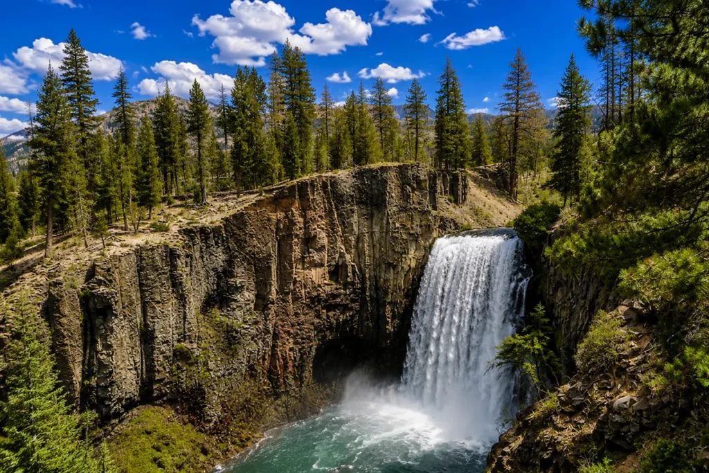
On June 14, 1805, Meriwether Lewis crested a rise along the Missouri River, heard a tremendous roaring, walked several hundred yards further — and stopped dead. He later wrote in his journal that he had just witnessed one of the most beautiful objects in nature: a waterfall stretching a quarter mile across the river, its water descending in one unbroken, even sheet over a perfectly straight ledge of sandstone. He named it “Handsome Falls.” It has been officially called Rainbow Falls for 150 years, and it still stops people dead.
Check our Montana waterfalls guide.
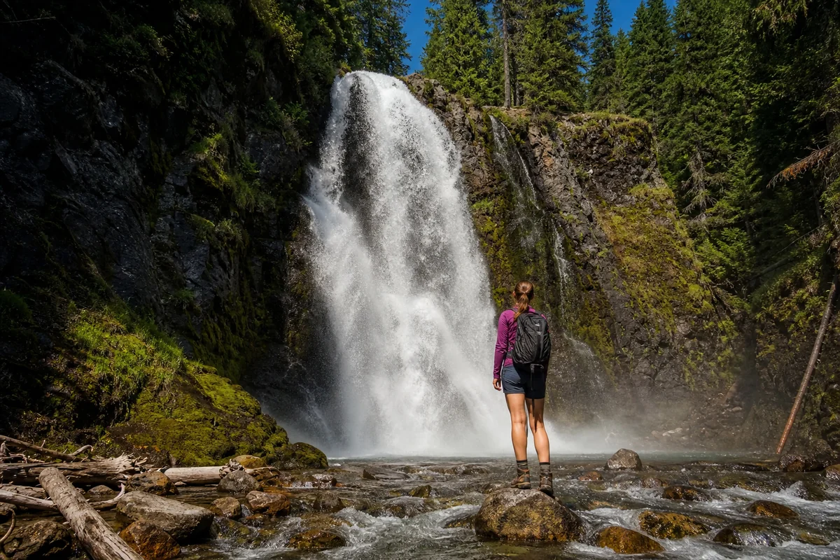
- Rainbow Falls is a 47-foot-high, 1,320-foot-wide (quarter mile) waterfall on the Missouri River in Great Falls, Montana — the waterfall that gives the city its name and one of the five historic Great Falls of the Missouri.
- It was discovered by Meriwether Lewis on June 14, 1805, and is a High Potential Historic Site on the Lewis & Clark National Historic Trail — the original name was “Handsome Falls.”
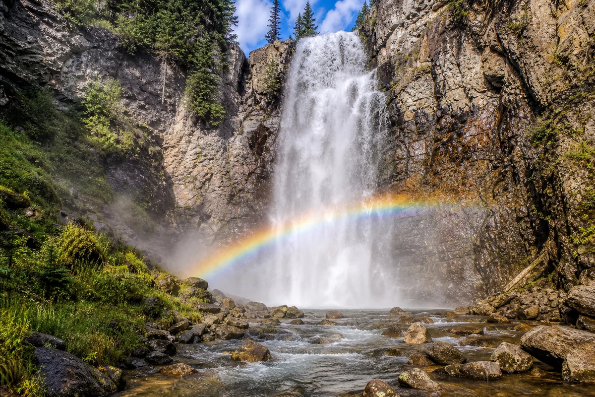
- The name “Rainbow Falls” came from the frequent rainbows visible in the mist before the Rainbow Dam (built 1914) diverted much of the river’s flow. Water levels today vary dramatically by season — spring has the most impressive flow; late summer can be nearly dry.
- Access is via the River’s Edge Trail and the Lewis & Clark Overlook near Giant Springs State Park — a short, mostly paved walk from the parking area.
- Combine with nearby Giant Springs, Crooked Falls, the Lewis & Clark Interpretive Center, and the Ryan Dam viewpoint for a full Great Falls waterfall day.
Searching for a different Rainbow Falls? Montana has three waterfalls with this name. If you’re looking for the Rainbow Falls in Glacier National Park (Goat Haunt region, boat access from Waterton Lake), skip to the disambiguation section near the bottom. The smaller Rainbow Falls in Hyalite Canyon near Bozeman (on Hyalite Creek) is unrelated to this guide. This post covers the famous Missouri River waterfall in Great Falls.
Rainbow Falls at a Glance
| Location | Missouri River, Great Falls, Cascade County, Montana |
|---|---|
| Height | 47 feet (14 m) |
| Width | 1,320 feet (402 m) — approximately one quarter mile |
| Type | Block waterfall (pitches over a sheer sandstone ledge) |
| Geology | Kootenai Formation sandstone |
| Discovery | June 14, 1805 — Meriwether Lewis, Lewis & Clark Expedition |
| Original Name | “Beautiful Cascade” / “Handsome Falls” (Lewis, 1805) |
| Current Name Given | 1872, by Thomas Paschall Roberts, Northern Pacific Railroad |
| River | Missouri River |
| Upstream dam | Rainbow Dam (1914, hydroelectric) — affects water levels |
| Access | River’s Edge Trail / Lewis & Clark Overlook, Giant Springs area |
| Distance from GF | ~3 miles east of downtown Great Falls on River Drive North |
| Trail to overlook | Short walk (~0.25 mile paved) from Giant Springs parking area |
| Best season | April–June (peak spring flow) |
| Entry fee | [Verify current Giant Springs State Park fees] |
| Dogs allowed | Yes, on leash (River’s Edge Trail) |
How Rainbow Falls Got Its Name — and Why It Can Fool You Today
Here is the most important thing to know before you visit Rainbow Falls: the waterfall you see today is not the one Lewis and Clark saw. And depending on when you visit, you might see almost nothing at all.
In 1805, all five of the Great Falls of the Missouri ran at full, undammed force. Lewis described Rainbow Falls spanning the full quarter-mile width of the river in an unbroken sheet of white water — a cascade of such scale and precision that he wrote it looked as though a skilled painter had designed it.
The spray from that volume of falling water created rainbows so frequently and reliably that when railroad engineer Thomas Paschall Roberts renamed the waterfall in 1872, “Rainbow Falls” was the obvious choice.
Then in 1914, the Rainbow Dam was built directly upstream. The dam forms a run-of-river reservoir and diverts the majority of the Missouri’s flow through penstocks (large pipes) around the right side of the falls to generate hydroelectric power — feeding eight turbines that exploit the combined drop of Rainbow Falls and the downstream Crooked Falls. The results:
- Spring (April–June): Snowmelt overwhelms the dam’s diversion capacity. The spillways overflow. Rainbow Falls runs close to its original force — wide, powerful, and mist-heavy. This is when you might see an actual rainbow.
- Summer (July–August): Flow decreases as snowmelt subsides. The falls split into two main sections, hugging both banks, with the center running at reduced volume.
- Late Summer–Fall (August–October): The dam diverts almost all flow. The falls can reduce to a trickle or narrow strips down the face. Visiting in September without knowing this can be a genuine disappointment.
- Winter: Partially frozen, dramatic in a different way. Accessible, but cold and sometimes icy on the trail.
The practical takeaway: visit in May or June. That is when Rainbow Falls earns its name.
June 14, 1805: The Discovery of Rainbow Falls
Lewis and Clark’s expedition had been struggling upriver along the Missouri for weeks when Lewis, scouting ahead on foot on June 14, 1805, first heard the roaring of what he had been told was “the Great Falls.” He expected one major waterfall. What he found was an entirely different scale of wonder.
Lewis’s journal entry for that day is one of the most vivid in the entire expedition record. He described hearing a tremendous roaring, following the sound for several hundred yards, and being presented with a cascade stretching perpendicular across the river for at least a quarter mile.
He wrote that the water descended in one even, uninterrupted sheet over a ledge as straight and regular as if formed by art, and that the spray rose to fifty feet and moved downstream hissing and sparkling. His conclusion: if a skilled painter had been asked to create the most beautiful waterfall imaginable, this would be the precise image he would produce.
Lewis originally named the falls “Beautiful Cascade,” then settled on “Handsome Falls” — a name that appears in various forms across his journal entries.
He could not have known then that this was only one of five major falls he would discover along this stretch of the Missouri, and that the portage around all five would consume nearly an entire month of the expedition’s schedule — one of the most physically grueling chapters of the entire journey.
The name “Rainbow Falls” was assigned in 1872 by Thomas Paschall Roberts, a railroad engineer working on the Northern Pacific Railroad’s survey of the region.
The name reflected what he observed on his visit: the near-constant presence of rainbows in the mist thrown up by the falls. That phenomenon still occurs today under the right conditions, though far less reliably than before the dam.
Rainbow Falls is now designated a High Potential Historic Site on the Lewis & Clark National Historic Trail, managed by the National Park Service. It is one of the most historically significant waterfalls in North America — not for its size alone, but for what Lewis wrote about it and what it meant to the expedition.
For more on the Lewis and Clark story in Montana, see my Montana history guide.
The Five Great Falls of the Missouri
Rainbow Falls does not stand alone. It is one of five historic waterfalls that collectively give the city of Great Falls its name and gave the Lewis and Clark Expedition one of its most difficult months. Understanding all five puts Rainbow Falls in context:
| Waterfall | Height | Current Status |
|---|---|---|
| Black Eagle Falls | ~26 ft | Dammed; powerhouse on right side |
| Colter Falls | ~6 ft | Submerged under Rainbow Dam reservoir |
| Rainbow Falls | 47 ft | Virtually unaltered; open to visitors |
| Crooked Falls | ~19 ft | Mostly natural; downstream from Rainbow |
| The Great Falls (Ryan Dam) | ~87 ft | Half-occupied by Ryan Dam powerhouse |
Rainbow Falls and Crooked Falls are the only two of the five that remain in an almost-natural condition. The other three have been significantly altered by dam construction and power canal development.
This makes Rainbow Falls historically and visually irreplaceable — it is the closest thing still surviving to what Lewis experienced in 1805.
Great Falls, Montana earned its nickname as the “Electric City” precisely because of these five falls: the hydroelectric dams built on each one (Rainbow Dam, Ryan Dam, Cochrane Dam, Morony Dam, and Black Eagle Dam) made the city a major power generation center for the region.
How to Get to Rainbow Falls
Rainbow Falls is reached via the River’s Edge Trail and the Lewis & Clark Overlook near Giant Springs State Park, approximately 3 miles east of downtown Great Falls.
From downtown Great Falls: Take River Drive North east from downtown. Follow signs for Giant Springs State Park / Giant Springs Road. The main visitor parking area for Giant Springs State Park is the most convenient starting point. From there, the Lewis & Clark Rainbow Falls Overlook is a short, mostly paved walk eastward along the River’s Edge Trail — approximately a quarter mile.
[Verify current Giant Springs State Park entrance fees before visiting; Montana resident and non-resident rates apply.]
Parking: The Giant Springs State Park parking area accommodates standard vehicles well. Overflow areas are available on summer weekends.
GPS coordinates: 47°32’00″N, 111°12’20″W (Rainbow Falls overlook area)
From I-15: Take exit 278 toward Great Falls downtown. Follow Central Avenue or 10th Avenue South toward Giant Springs State Park. Approximately 5 miles from the interstate.
The initial 300 yards of the River’s Edge Trail near the falls has been upgraded to meet ADA accessibility standards. The overlook itself is accessible from the main paved path. Visitors wanting views from lower angles may encounter moderate inclines and uneven terrain on side paths.
Cell service: Limited along parts of the River’s Edge Trail. Download offline maps before you go.
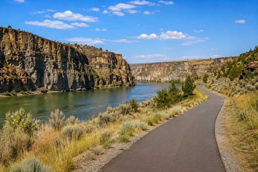
The River’s Edge Trail: Rainbow Falls in Context
The River’s Edge Trail is one of Montana’s great urban trail systems — more than 50 miles of paved and unpaved path on both sides of the Missouri River through and east of Great Falls. It connects virtually every significant waterfall and Lewis & Clark site in the region:
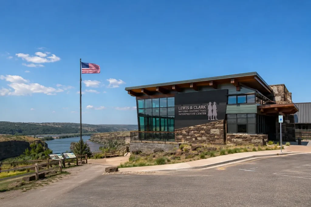
- Lewis & Clark National Historic Trail Interpretive Center (western end)
- West End Park
- Black Eagle Falls viewpoint
- Giant Springs State Park
- Rainbow Falls Overlook (Lewis & Clark Overlook)
- Rainbow Dam crossing (seasonally open for trail crossing)
- North Shore Trail — hugs rugged canyon walls between Rainbow Dam and Morony Dam
- Crooked Falls viewpoint (South Shore trail)
- Ryan Dam / Big Falls viewpoint — several miles east, the most dramatic overlook of the largest of the Great Falls
- South Shore single-track (“Mayhem” trails) — mountain biking destination
- Morony Dam
- Box Elder Creek canyon (eastern turnaround for most visitors)
The trail is free, open year-round during daylight hours, and maintained by the Great Falls Park & Recreation Department and Montana State Parks. Printed and digital maps available at Giant Springs, the Lewis & Clark Interpretive Center, and the Great Falls Visitor Center. Trailheads on both north and south shores have parking areas.
For the Rainbow Falls overlook specifically: enter via the Giant Springs parking area on the south shore and walk east along the paved path. For multiple waterfall views, plan a 4–6 mile out-and-back on the south shore to include Crooked Falls and the Ryan Dam overlook.
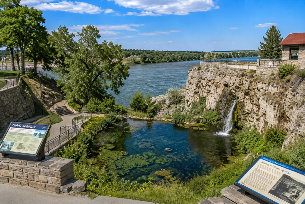
Giant Springs: The Other Great Falls Attraction
Giant Springs State Park, where you’ll park for the Rainbow Falls overlook, is worth substantial time in its own right. Giant Springs is one of the largest freshwater springs in the United States, flowing at approximately 156,000 gallons per minute from an opening in the canyon wall above the Missouri River. The water temperature holds steady year-round at approximately 54°F.
Lewis and Clark documented Giant Springs during their portage in 1805, finding it remarkable enough to describe in detail in their journals.
The spring’s source is Rocky Mountain snowmelt that seeps into the Madison limestone formation along the Rocky Mountain Front and travels underground for an estimated 2,800 years before emerging at Giant Springs — one of the longer groundwater journeys documented in North America.
The park includes the Giant Springs Fish Hatchery (Montana’s largest fish hatchery, open to visitors), the spring itself with interpretive exhibits, picnic areas, and the Giant Springs Visitor Center. Allow 1–2 hours to walk the grounds before or after your Rainbow Falls overlook visit.
[Verify current Giant Springs State Park entrance fees.]
Best Time to See Rainbow Falls (and the Rainbow)
The seasonal water flow is the single most important planning variable for a Rainbow Falls visit. Here’s the honest breakdown:
April–June (Best): Spring snowmelt drives the Missouri’s flow above what Rainbow Dam can fully divert. The spillways overflow and the falls approach their historic character — wide, powerful, and mist-heavy. May is typically the single best month. This is when actual rainbow conditions occur in the afternoon mist.
July–August (Good, but declining): Water flow decreases as snowmelt subsides. The falls are still impressive, especially on the left and right sides where the dam’s outlet works and spillways continue to discharge. Crowds are higher. The rainbow effect becomes harder to achieve.
September–October (Diminished): The dam diverts the majority of the river through penstocks. In a drought year, the falls can reduce dramatically. If fall foliage is your goal, the cottonwoods along the river canyon are beautiful — but manage your expectations for the waterfall itself.
November–March (Winter/Ice): The partial freezing of the falls creates dramatic ice formations. The trail remains accessible on milder days. Dress for cold and wind.
For rainbow sightings specifically: Sunny afternoons (1–4 PM) in May or June, when the falls are at high volume and the sun hits the mist at the right angle. The spray needs to be substantial. This happens reliably in spring; intermittently in summer; rarely in fall.
For Montana’s broader seasonal planning, see my best time to visit Montana guide.
Photography Tips for Rainbow Falls
Best position: The Lewis & Clark Overlook on the south shore gives the clearest straight-on view of the full width of the falls. For drama and depth, walk the River’s Edge Trail eastward past the overlook — downstream angles show the falls receding into the canyon.
Best time of day: Morning light is clean and soft, with fewer visitors. Afternoon (1–4 PM) is ideal for rainbow photography in spring. Avoid midday in summer — the light is flat and harsh on the white water.
Lens recommendation: Wide-angle (16–24mm equivalent) to capture the full 1,320-foot span of the falls. For compressed telephoto shots emphasizing a specific section, a 70–200mm works well.
Long exposure: A 1–3 second exposure at f/11 or f/16 creates the silky water effect on the cascade. Bring a small tripod or use the rail at the overlook as a stabilizer. A neutral density filter (6-stop) helps in bright spring afternoon light.
Mist protection: In May and June at high flow, mist from the falls reaches the overlook. Keep a microfiber cloth accessible for the lens. Front elements fog up quickly.
Rainbow composition: Position the sun at your back (facing the falls). The rainbow arc, when present, spans the lower section of the mist cloud at the base of the falls. Give yourself 30+ minutes and wait for cloud gaps.
Winter ice: The partial freezing creates striking abstract forms. A macro or 100mm lens captures the ice crystal detail well.
The Full Rainbow Falls Day: What to See and When
A well-planned Rainbow Falls visit can anchor a complete Great Falls day trip. Here’s how I’d structure it:
Morning (9–11 AM): Park at Giant Springs State Park. Walk to Rainbow Falls overlook via the paved River’s Edge Trail. Spend 30–45 minutes at the overlook — photograph the falls, read the Lewis & Clark interpretive signage, watch the river. Walk back through Giant Springs and tour the fish hatchery and spring overlook.
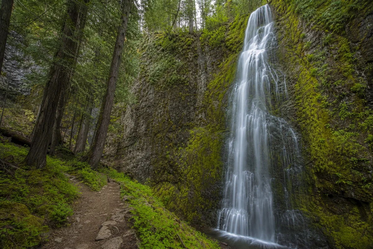
Late Morning (11 AM–noon): Drive or bike east on the south shore trail to the Crooked Falls viewpoint. Crooked Falls is smaller (about 19 feet) but retains much of its natural condition — one of only two falls on the entire Missouri-Mississippi system still in essentially-natural state. It’s a short, easy hike from a trailhead on the south shore.
Afternoon (1–4 PM): Drive to the Ryan Dam viewpoint (southeast of Giant Springs along Giant Springs Road). Ryan Dam impounds the Great Falls of the Missouri — at 87 feet, the original was the tallest and most powerful of the five. While the dam has altered it significantly, the canyon overlook is spectacular and the hydroelectric infrastructure is impressive in its own industrial way. This is also a good position for a longer River’s Edge Trail ride if you have bikes.
Late Afternoon: Return to Great Falls proper. Grab coffee on Central Avenue (see my Great Falls coffee guide) or tour the C.M. Russell Museum — the largest collection of Charles Marion Russell’s Western art in the world. Then the Lewis & Clark National Historic Trail Interpretive Center (1-2 hours) provides the full expedition context for everything you’ve seen along the river.
See my complete Great Falls, Montana guide for lodging, dining, and further city coverage. For RV travelers, see the Great Falls RV parks guide.
Nearby Waterfalls Worth Combining
Rainbow Falls sits at the center of the densest cluster of significant waterfalls in central Montana. If you’re building a waterfall itinerary, here’s what’s within range:
Crooked Falls — 19 ft, downstream from Rainbow Falls on the south shore trail. Mostly natural condition. Easy 30-minute detour.
Ryan Dam / Great Falls — The largest of the five original Great Falls. Dammed but the canyon views are dramatic. 10 minutes by car from Giant Springs.
Black Eagle Falls — Dammed and controlled, but the canyon setting is interesting. Visible from the north shore trail.
For longer waterfall trips from Great Falls, Kootenai Falls in Lincoln County (northwest Montana) and Morrell Falls near Seeley Lake are both worthy additions to a week-long Montana waterfall circuit. For the full statewide list, see my Montana waterfalls guide.
Where to Stay Near Rainbow Falls
In Great Falls: The falls are 3 miles from downtown. Major chain hotels (Holiday Inn, Hampton Inn, Best Western) are clustered downtown and along 10th Avenue South. Mid-range rates ($100–180/night) are typical. See my Great Falls guide for current recommendations.
RV travelers: Multiple RV parks serve the Great Falls area along the Missouri River corridor. See my Great Falls RV parks guide for sites with hookups, dump stations, and river access.
Camping: Primitive camping is not available at the Rainbow Falls overlook area. Giant Springs State Park does not have overnight camping. The nearest developed camping options are at Ackley Lake State Park (south) or public land camping east of the city.
What I Wish I’d Known Before Visiting
The timing issue is real. I’ve met visitors who drove hours to see Rainbow Falls in late September, found a trickle, and left frustrated. The Rainbow Dam is upstream; the dam operators’ decisions about power generation directly determine how much water comes over those falls on any given day. Spring is not optional if you want the full experience.
The Lewis & Clark Interpretive Center deserves as much time as the falls. Most visitors do the overlook first (right — do that), but then skip the Interpretive Center because they’re tired. Don’t. The center reframes everything you saw at the falls — the portage maps, the physical scale of what the expedition endured, the timeline of 26 days moving boats and equipment around these five waterfalls in summer heat. It costs the experience context that transforms “nice waterfall” into “genuinely significant place.”
The River’s Edge Trail is underrated as a biking destination. If you’re spending a full day in Great Falls, rent bikes and do the full south shore run from the Interpretive Center to the Ryan Dam overlook. It’s one of the best flat river-canyon bike rides in central Montana, with all five waterfall sites along the way.
The rainbow doesn’t happen every day. It’s not a permanent feature — it requires the right combination of water volume, sunlight angle, and timing. If you visit in spring on a partly cloudy afternoon, you’ve given yourself the best odds. Accept that it may or may not appear and let the waterfall’s intrinsic scale do the work.
The Glacier NP Rainbow Falls requires serious planning. See the disambiguation section below if that’s actually where you wanted to go.
Disambiguation: Montana’s Three Rainbow Falls
Montana has three separate waterfalls called Rainbow Falls. They are completely unrelated and require completely different approaches:
1. Rainbow Falls — Great Falls, Montana (This Guide)
What it is: A 47-foot-high, quarter-mile-wide block waterfall on the Missouri River. Historically one of the most significant waterfalls in North America — the Lewis & Clark “Handsome Falls.” Part of the Five Great Falls of the Missouri.
How to access: River’s Edge Trail via Giant Springs State Park, ~3 miles east of downtown Great Falls. Short paved walk from parking. No significant hiking required.
Best for: History enthusiasts, Lewis & Clark travelers, families, photographers, and anyone combining with a Great Falls city visit.
2. Rainbow Falls — Glacier National Park (Goat Haunt Region)
What it is: A smaller waterfall deep in the Goat Haunt region of Glacier National Park, in the backcountry near the Canadian border. 1.9 miles round trip, 111 feet elevation gain. A pleasant hike through wildflower meadows with American Dippers at the base.
How to access: Primarily by boat across Waterton Lake from Waterton Lakes National Park in Alberta, Canada. The approach on foot is much longer. Requires pre-planning for U.S. Customs and Border Protection regulations (for return to the U.S. crossing). No dogs allowed.
Best for: Serious hikers with backcountry Glacier plans who are already in the Waterton/Goat Haunt area.
Important: This waterfall has very limited reviews and is not the dominant search result for “rainbow falls montana.”
3. Rainbow Falls — Hyalite Canyon, near Bozeman
What it is: A small, intimate waterfall on Hyalite Creek in the Gallatin National Forest south of Bozeman. Approximately 30 feet. Part of the Hyalite Canyon Recreation Area which contains multiple other named waterfalls. Easy 1.2-mile round-trip hike.
Best for: Bozeman-area hikers looking for a short local waterfall walk. Often combined with Grotto Falls and Palisade Falls nearby. This is not the waterfall that appears in top SERP results for “rainbow falls montana.”
Practical Information Summary
| Detail | Information |
|---|---|
| Location | Missouri River, Great Falls, Cascade County, MT |
| Coordinates | 47°32’00″N 111°12’20″W |
| Distance from downtown GF | ~3 miles east via River Drive North |
| Trail to overlook | ~0.25 mile paved from Giant Springs parking |
| Waterfall height | 47 feet |
| Waterfall width | 1,320 feet (~quarter mile) |
| Managed by | Helena-Lewis and Clark National Forest / Montana State Parks |
| Entry | Giant Springs State Park fee [verify current rates] |
| Dogs | Yes, on leash (River’s Edge Trail) |
| ADA accessibility | First 300 yards of River’s Edge Trail near falls is ADA-compliant |
| Best months | April–June (peak flow); July–August (moderate) |
| Cell service | Limited; download offline maps |
| Restrooms | Giant Springs Visitor Center |
| Nearest fuel/food | Great Falls downtown (~15 min) |
Conclusion
Rainbow Falls earns its place on any serious Montana waterfall itinerary — not for its height (there are taller falls in the state) but for what it represents.
This is the waterfall that Meriwether Lewis called one of the most beautiful objects in nature. It still is. The Rainbow Dam changed the water volume; nothing changed the sandstone ledge, the canyon walls, or the Missouri River stretching away below.
Visit in May or June. Walk out to the Lewis & Clark Overlook in the afternoon sun. Wait for the mist to catch the light. If the rainbow appears, you’re standing roughly where Lewis stood in 1805, watching the same falling water he said looked like a painting. That’s a worthwhile Montana moment.
Questions about visiting Rainbow Falls or Great Falls? Drop them in the comments.
Frequently Asked Questions
Where exactly is Rainbow Falls in Montana?
Rainbow Falls is located on the Missouri River in Great Falls, Montana, approximately 3 miles east of downtown via River Drive North. It is accessible from the Lewis & Clark Overlook near Giant Springs State Park via the River’s Edge Trail — a short (~0.25 mile) paved walk from the Giant Springs parking area. GPS coordinates: 47°32’00″N, 111°12’20″W.
What is the history of Rainbow Falls Montana?
Rainbow Falls was discovered on June 14, 1805, by Meriwether Lewis during the Lewis & Clark Expedition. Lewis named it “Beautiful Cascade” and “Handsome Falls” in his journal. The current name was given in 1872 by railroad engineer Thomas Paschall Roberts, who named it for the frequent rainbows visible in the spray before the dams were built. Rainbow Falls is now a High Potential Historic Site on the Lewis & Clark National Historic Trail, managed by the National Park Service.
How big is Rainbow Falls Montana?
Rainbow Falls is 47 feet high and approximately 1,320 feet wide — about a quarter mile across. It is a block-type waterfall where the Missouri River pitches over a straight, nearly unbroken ledge of Kootenai Formation sandstone. By width, it is one of the most expansive waterfalls in Montana.
Why is Rainbow Falls sometimes barely flowing?
The Rainbow Dam, built in 1914 directly upstream of Rainbow Falls, diverts most of the Missouri River’s flow through penstocks (pipes) around the falls to generate hydroelectric power. In late summer and fall, the majority of the river bypasses the falls entirely, reducing it to a trickle or narrow strips. Spring snowmelt (April–June) overwhelms the dam’s diversion capacity, pushing water over the spillways and restoring the falls close to their historic volume. Always visit in spring for the best experience.
Is Rainbow Falls Montana the same as the one in Glacier National Park?
No — these are two completely different waterfalls. Rainbow Falls in Great Falls is a 47-foot-wide waterfall on the Missouri River with Lewis & Clark historical significance. Rainbow Falls in Glacier National Park is a smaller backcountry waterfall in the Goat Haunt region, accessible primarily by boat across Waterton Lake from Canada. A third Rainbow Falls exists in Hyalite Canyon near Bozeman on Hyalite Creek. This guide covers the Great Falls, Missouri River version, which dominates search results for “rainbow falls montana.”
Can you see an actual rainbow at Rainbow Falls?
Yes — under the right conditions. The rainbow effect requires substantial water volume (spring/early summer), direct afternoon sunlight hitting the mist at the right angle (typically 1–4 PM), and some luck with cloud cover. Rainbows were reportedly visible almost daily before the Rainbow Dam was built. Today they occur during spring peak flow on sunny afternoons. Don’t plan your visit specifically around seeing a rainbow — the falls are worth the trip regardless.
How do I access the Rainbow Falls overlook?
Park at the Giant Springs State Park parking area on River Drive North, about 3 miles east of downtown Great Falls. Walk east on the paved River’s Edge Trail for approximately 0.25 miles to the Lewis & Clark Rainbow Falls Overlook. The first 300 yards of trail from this area meets ADA accessibility standards. The overlook itself is accessible. [Verify current parking fees at Giant Springs State Park before visiting.]
What else is near Rainbow Falls in Great Falls?
Giant Springs (one of the largest freshwater springs in the United States) is adjacent to the Rainbow Falls parking area. The Lewis & Clark National Historic Trail Interpretive Center is approximately 2 miles west. Crooked Falls (another mostly-natural Missouri River waterfall) is downstream along the south shore River’s Edge Trail. The Ryan Dam overlook (Big Falls viewpoint) is further east. The C.M. Russell Museum and downtown Great Falls restaurants are about 15–20 minutes by car. See my complete Great Falls, Montana guide for the full city overview.
What are the Five Great Falls of the Missouri?
The Five Great Falls of the Missouri are the series of waterfalls that Lewis and Clark portaged around in June–July 1805: Black Eagle Falls, Colter Falls, Rainbow Falls, Crooked Falls, and the Great Falls (at Ryan Dam). Rainbow Falls and Crooked Falls are the only two that remain in an almost-natural condition. The others have been significantly altered by dam construction and power canal development. The city of Great Falls, Montana is named for this series of falls.
Is the River’s Edge Trail suitable for biking to Rainbow Falls?
Yes — the River’s Edge Trail is Montana’s premier urban trail network and excellent for biking. The south shore paved path from the Lewis & Clark Interpretive Center to the Rainbow Falls overlook is flat, smooth, and family-friendly. Extending further east to the Ryan Dam overlook adds several more miles. The north shore and south shore single-track trails (“Mayhem” and “Chaos”) are for experienced mountain bikers. Trail maps are available free at the Giant Springs Visitor Center, Lewis & Clark Interpretive Center, and at thetrail.org.
How do I get to the Rainbow Falls in Glacier National Park (Goat Haunt)?
The Glacier National Park Rainbow Falls is a completely separate waterfall from the Great Falls version. It is located in the Goat Haunt region of Glacier National Park and is primarily accessible by boat across Waterton Lake from Waterton Lakes National Park in Alberta, Canada. The trail is 1.9 miles round trip with 111 feet of elevation gain. No dogs are allowed. Entry into Glacier at Goat Haunt requires compliance with U.S. Customs and Border Protection regulations for the Canadian crossing. Verify current boat schedules with Waterton Shoreline Cruises before planning this trip.
Sources