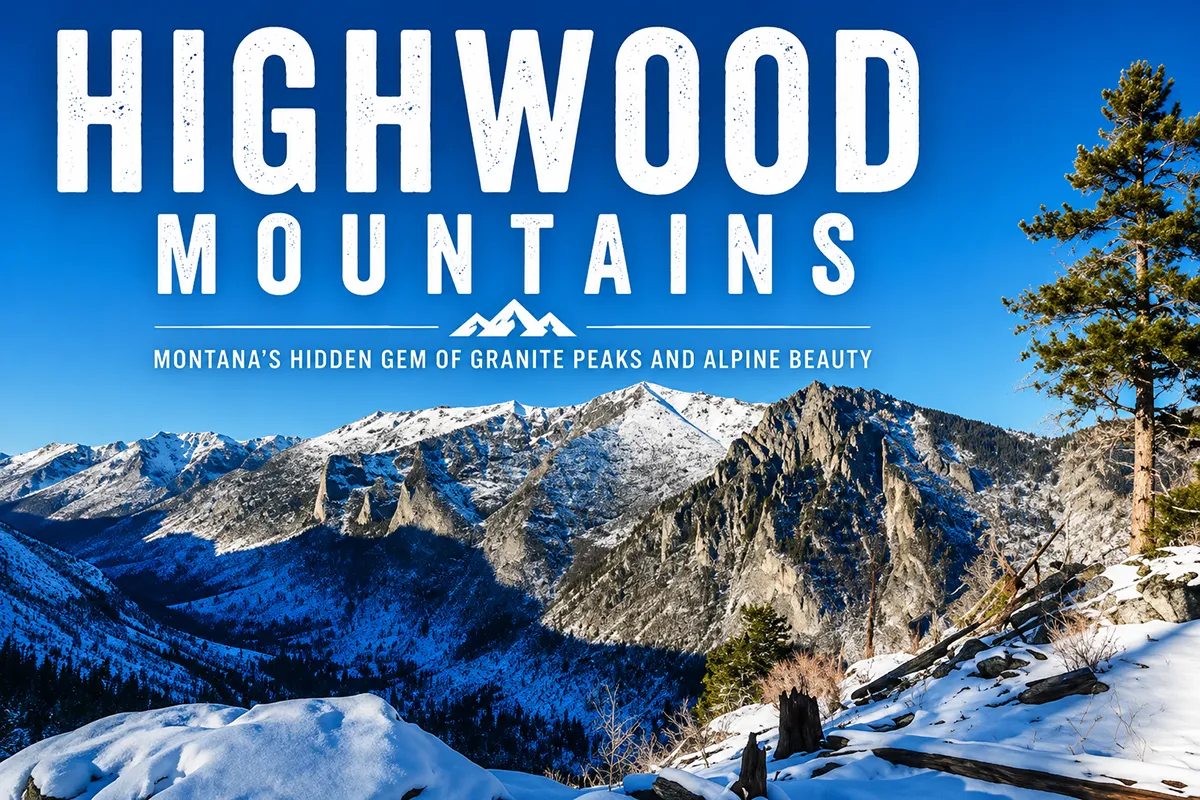
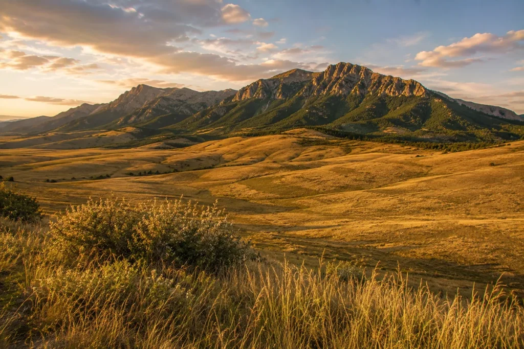
The Highwood Mountains are easy to miss. They sit east of Great Falls, rising about 4,300 feet above the surrounding prairie, and most people driving US-87 between Great Falls and Lewistown barely register them.
The Highwoods don’t have the dramatic vertical relief of the Crazies, the glacier-cut alpine basins of the Beartooths, or the tourism infrastructure of Glacier.
What they have is something different: a 50-million-year-old volcanic field with rocks so unusual that a tiny community in the range gave its name to a rock type used in geology textbooks worldwide. The Highwoods are quiet, weird, and underrated.
The Highwood Mountains are a small island range east of Great Falls, anchored by Highwood Baldy (7,670 ft). The range is volcanic in origin — part of the Central Montana Alkalic Province, a chain of Eocene-age (54–50 million years) intrusions that includes the Bears Paw Mountains. The Highwoods are the type locality for shonkinite, a specific dark potassium-rich igneous rock named after the community of Shonkin, Montana. The range covers about 1,800 square miles and is managed by the Helena-Lewis and Clark National Forest. Thain Creek Campground is the main trailhead access, 40 miles east of Great Falls. Best window: May through October, with limited high-country snow concerns due to the modest elevations.
Liked this article?
Add Roaming Montana as a preferred source so you see more of our articles and guides on Google.
Why the Highwoods Are Different
The Highwoods are an island range — a discrete mountain mass surrounded entirely by prairie, with no ridgeline connection to any other range. Like the Crazy Mountains, the Bears Paw, and the Sweet Grass Hills, they rise out of the Great Plains as a singular geographic event.
But the Highwoods are distinct from those other island ranges in two ways:
- They’re built from unusual rock. Most Montana mountain ranges are granite, gneiss, sedimentary limestone/sandstone, or igneous intrusions of relatively conventional composition. The Highwoods are composed primarily of alkaline igneous rocks — phonolites, latites, minettes, trachytes, and shonkinites — that are petrologically rare and geochemically distinctive. The same Eocene volcanic episode that built the Absaroka Range farther south built the Highwoods, but with different chemistry.
- They’re an ecological intersection. The Highwoods rise from the confluence of four different prairie ecosystems: foothill grasslands, semi-arid prairie, Missouri Breaks, and unglaciated high plains. The wildlife and vegetation transitions in the Highwoods reflect this unusual ecological setting.
For broader context, see my full Montana mountain ranges guide and the related Big Belt Mountains and Bears Paw Mountains guides.
Where the Highwoods Are
The Highwood Mountains sit in north-central Montana, about 40 miles east of Great Falls. The range covers approximately 1,800 square miles in three counties: Cascade, Chouteau, and Judith Basin. The closest National Forest land to Great Falls.
The range is bordered:
- West: Highwood Creek valley and the small town of Belt, Montana
- North: The Missouri River valley near Fort Benton
- East: Square Butte and the open prairie of Judith Basin County
- South: The Judith River drainage and the prairie around Geyser
Gateway access is via US-87 from Great Falls to Belt, then either the Highwood Highway (county road) into the western part of the range, or various ranch roads into the southern and eastern portions.
The Geology: Shonkin and the Central Montana Alkalic Province
This is where the Highwoods become genuinely unique.
About 54 to 50 million years ago, during the early Eocene, a chain of volcanic eruptions occurred along a northeast-trending line in central Montana.
The volcanoes have long since eroded away, but their underlying intrusive cores — the magma chambers that once fed the volcanoes — are still here.
The exposed remnants form the Central Montana Alkalic Province, which includes:
- The Highwood Mountains
- The Bears Paw Mountains to the north
- Eagle Buttes to the northeast
- The Sweet Grass Hills (related but distinct chain to the north)
These ranges are all composed of unusual alkaline igneous rocks — rocks unusually rich in potassium and sodium, with relatively low silica content. They’re petrologically rare.
Most volcanic rock on Earth is calc-alkaline (the typical andesite-rhyolite chemistry of the Cascade volcanoes or the Andes).
Alkaline volcanic rocks are a much smaller fraction of global volcanism, and the Central Montana Alkalic Province contains some of the best-exposed examples in North America.
Shonkinite: The Rock Named After Shonkin
The tiny community of Shonkin, Montana sits in the western Highwoods. Population is approximately 30. It’s the kind of place most travelers drive past without noticing.
But Shonkin gave its name to shonkinite — a specific dark alkaline igneous rock, named after the type locality (Shonkin Sag, just outside town) where the rock was first scientifically described.
Geologists worldwide use the term “shonkinite” to describe this specific rock composition. The Shonkin Sag laccolith — a roughly tabular igneous intrusion — is one of the most-studied alkaline igneous bodies in North America.
If you’re interested in geology, the Shonkin Sag area is worth a stop. The exposed rock shows classic differentiation: dark mafic shonkinite at the base, transitioning upward into lighter, more silica-rich syenite at the top — a textbook example of magmatic differentiation in a sill.
Other Highwoods Geology
The range also contains mafic phonolite flows and dikes, minette dikes, and trachyte dikes — all unusual alkaline rock types.
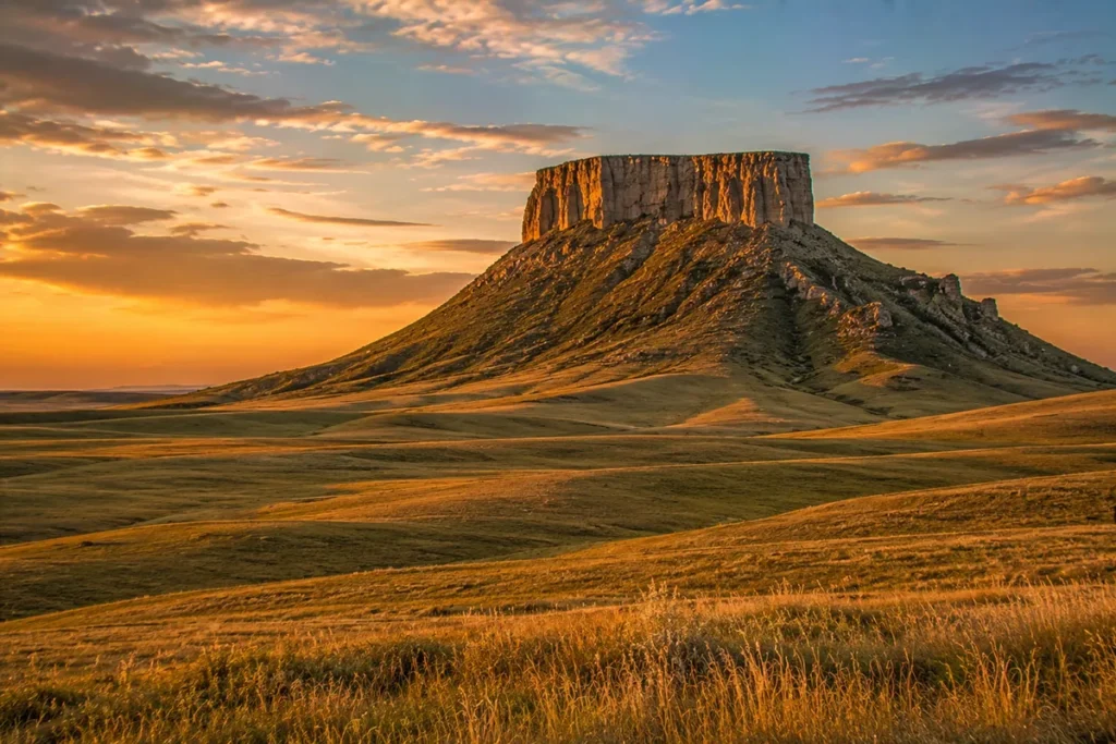
The famous Square Butte, visible to the east of the Highwoods, is a separate but geologically related Eocene intrusion that erodes out as a distinctive flat-topped landform.
The painter Charlie Russell painted Square Butte repeatedly; it’s part of his iconic Montana landscapes.
Highwood Baldy and the High Country
Highwood Baldy, at 7,670 feet, is the highest peak in the range. The summit is accessible by Forest Service road and is topped by communication towers and equipment — not exactly aesthetically pleasing, but the views are unmatched in central Montana. From the summit, you can see:
- West: Great Falls and the Missouri River valley
- North: The Sweet Grass Hills and Bears Paw Mountains
- East: Square Butte, the Judith Mountains, and the open central Montana prairie
- South: The Little Belt Mountains and Big Belts beyond
A useful note: cell service is generally available from Highwood Baldy’s summit (it’s a transmission site), making it one of the only Montana mountain summits where you can reliably check messages. This is genuinely useful for backcountry travelers.
Other notable peaks in the range include North Peak and Windy Mountain, both with established trail access.
The Best Hikes in the Highwoods
The Highwoods don’t have the dramatic alpine country of higher Montana ranges, but they have a surprisingly good trail network for their size — and the trails are almost always uncrowded.
Highwood Mountains Loop Trail
The classic Highwoods hike. A 14.9-mile loop from Thain Creek Campground with about 2,979 feet of elevation gain.
Takes 7.5–8.5 hours. The trail follows ridgelines and creek bottoms through pine and spruce forest with prairie views. AllTrails rates it as hard but it’s hard primarily because of length, not technical difficulty.
North Fork Highwood Creek Trail
A roughly 16-mile out-and-back along the North Fork of Highwood Creek from Thain Creek Campground. Good for intermediate hikers — gradual elevation gain, few steep sections, multiple stream crossings. Best done as a long day hike or easy overnight.
Windy Mountain Loop
A pleasant 7.1-mile loop maintained by the Charlie Russell Back Country Horsemen of Great Falls. Easier than the main Highwoods Loop. Good for families and intermediate hikers.
Highwood Baldy Summit
You can drive most of the way up Highwood Baldy on Forest Service roads, then walk the final stretch to the summit. The ridge hike from North Peak to Highwood Baldy is one of the more accessible Montana summit experiences.
Thain Creek Loops
Several shorter loops branch off from Thain Creek Campground, ranging from 2 to 6 miles. Good options for casual hikers and families.
Mountain Biking and Dirt Biking
This is something the Highwoods are quietly known for. Many of the designated trails are multi-use, allowing mountain bikes, dirt bikes, and motorcycles in addition to hikers and horseback riders.
The North Fork Highwood Creek trail is the marquee mountain bike route — about 11 km of singletrack with reasonable difficulty.
This is one of the few national forest trail systems near Great Falls that supports motorized recreation, which makes it popular with dirt bikers and ATV users.
If you’re hiking, plan for the possibility of meeting motorized users on shared trails — particularly on summer weekends.
Cow Camp History and Cattle Country
The Highwoods have a long history of cattle grazing. The combination of reliable water (Highwood Creek and its tributaries) and abundant native grass made the range ideal cattle country from the late 1800s onward. Two historic sites preserve this heritage:
- Highwood Cow Camp — a historic ranching site at the northern edge of the range
- Shonkin Cow Camp — historic structures associated with the early ranching operations in Shonkin Sag
The Highwood Guard Station, still standing at the entrance to the forest at the North Fork of Highwood Creek, is a Forest Service structure dating to the early ranger-station era. It’s a useful landmark for orienting yourself in the range.
For broader Montana ranching history, see our Montana history overview.
Wildlife in the Highwoods
The Highwoods support a transitional wildlife community reflecting their position at the boundary of prairie and forest.
- Elk and mule deer — both common, particularly in the central forested areas
- White-tailed deer — abundant in the creek bottoms and edges
- Black bears — present, generally low-density
- Grizzly bears — not established as resident, but occasional sightings as dispersing bears expand from the Rocky Mountain Front to the west. Carry bear spray. See our Montana bear guide.
- Mountain lions — present, rarely seen
- Wild turkeys — abundant
- Sharp-tailed grouse and sage grouse — at the prairie edges
- Bald eagles and golden eagles — both common, nesting in the area
- Coyotes, badgers, foxes, beaver — the small-mammal community is rich
The Highwoods are popular hunting country in fall — elk and deer seasons bring significant traffic to the area. If you’re hiking from mid-September through November, wear orange and be aware of hunters.
Where to Base Yourself
Great Falls — Main Base
Best for: Most travelers. The largest city in north-central Montana (population ~58,000), with full-service amenities, restaurants, lodging, and Great Falls International Airport (GTF). About 40 miles to Thain Creek Campground and the Highwoods trailheads.
Great Falls has its own attractions worth a day — the Charles M. Russell Museum (named for the cowboy artist who painted this country), Giant Springs State Park, the Lewis and Clark Interpretive Center, and the Missouri River. Combined Great Falls + Highwoods trip is a strong itinerary.
Belt, Montana — Foothill Town
Best for: Travelers who want to be at the foot of the range and combine with a small-town Montana experience.
Belt is a small community (population ~600) about 25 miles east of Great Falls, sitting at the western foot of the Highwoods. The town is also the namesake of the Belt Supergroup — the geological formation found across northwest Montana — making it a meaningful place for geology travelers.
Belt also has the Harvest Moon Brewery, an excellent small brewery in a historic building. Worth a stop for a beer and conversation with the brewmaster on your way back from the trails.
Fort Benton — Historic Missouri River Town
Best for: Travelers combining the Highwoods with Missouri River heritage tourism.
Fort Benton is the historic Missouri River port town north of the Highwoods. The Upper Missouri River Breaks National Monument starts here. Strong heritage tourism, lodging, and the historic Fort Benton site.
Thain Creek Campground
For the genuine in-the-mountains experience, Thain Creek Campground is the main developed camping area in the Highwoods, accessible from Belt via the Highwood Highway. First-come, first-served. Picnic tables, vault toilets, water (seasonal).
Smaller Communities
Geyser (south side), Highwood (small community in the western range), and Shonkin (the geological type locality) are all tiny communities with minimal services but interesting character.
Best Time to Visit
The Highwoods’ modest elevations mean a much longer usable season than higher Montana ranges.
May through June — wildflowers, green grass, and accessible high country. Some early-season mud on trails. Mosquitoes start mid-May.
July through August — prime hiking and biking. The range can get hot — temperatures in the high 80s and low 90s are common at lower elevations. The summit ridges are cooler.
September through October — my favorite season. Aspen color in the creek drainages, cooler temperatures, fewer bugs, and reliable weather. This is also peak hunting season — wear orange.
November through April — the Highwoods get snow but not as much as higher ranges. The lower trails are accessible for snowshoeing and cross-country skiing. The Forest Service roads close in winter.
For seasonal Montana context, see Montana in June, Montana in September, and Montana in October.
Personal Tips: What I Wish I Knew About the Highwoods
Don’t compare them to Glacier or the Beartooths. The Highwoods are a small, modest, accessible island range. Going in expecting alpine drama will disappoint. Going in expecting a quiet, geologically fascinating, lightly-used National Forest will satisfy.
The geology is worth a stop even if you don’t hike. Drive the Highwood Highway from Belt, pull off at Shonkin Sag, walk around the exposed shonkinite-syenite contact. Read a basic field guide to alkaline igneous rocks. This is one of the more geologically educational drives in central Montana.
Square Butte is worth a side trip. Drive east on US-87 from Great Falls to the small town of Square Butte (population ~25), then up to the base of the butte itself. The butte is on private land but the view from the road is one of the great Montana landscapes — and it’s the view Charlie Russell painted dozens of times.
Combine your trip with Great Falls. The Charles M. Russell Museum and the Lewis and Clark Interpretive Center are two of the best cultural attractions in Montana. A day in Great Falls + a day in the Highwoods is a strong central Montana itinerary.
Cell service is unusually good at the summit of Highwood Baldy. If you need to be reachable, plan to summit and check messages. Below the ridge, service drops off quickly.
Bring water. The Highwoods can be dry, particularly on the south-facing slopes in late summer. The creek bottoms have water, but the ridges don’t.
Multi-use trails mean motorized traffic. Be prepared to share trails with mountain bikers, dirt bikers, and ATVs in the summer. On weekdays it’s usually quiet; weekends can be busy.
Local people will talk. The Highwoods are quietly visited country. If you meet someone at Thain Creek Campground or at the Harvest Moon Brewery in Belt, they’ll often know the range intimately. Local knowledge is generously shared if you’re willing to listen.
Practical Info Box
| Item | Detail |
|---|---|
| Highest peak | Highwood Baldy, 7,670 ft |
| Range area | ~1,800 sq mi |
| Type | Island range, volcanic origin (Eocene, 54–50 Ma) |
| Geological province | Central Montana Alkalic Province |
| Type locality | Shonkin, MT — namesake for shonkinite rock |
| National Forest | Helena-Lewis and Clark National Forest |
| Counties | Cascade, Chouteau, Judith Basin |
| Closest city | Great Falls (~40 mi west) |
| Main trailhead | Thain Creek Campground |
| Best basecamp | Great Falls; Belt for foothill experience |
| Best hiking season | May through October |
| Multi-use trails | Mountain bikes, dirt bikes, ATVs allowed on many trails |
| Cell service | Available at Highwood Baldy summit; spotty elsewhere |
| Bear spray | Recommended (low-density bear country) |
| Nearest airport | Great Falls International (GTF) |
Final Thoughts
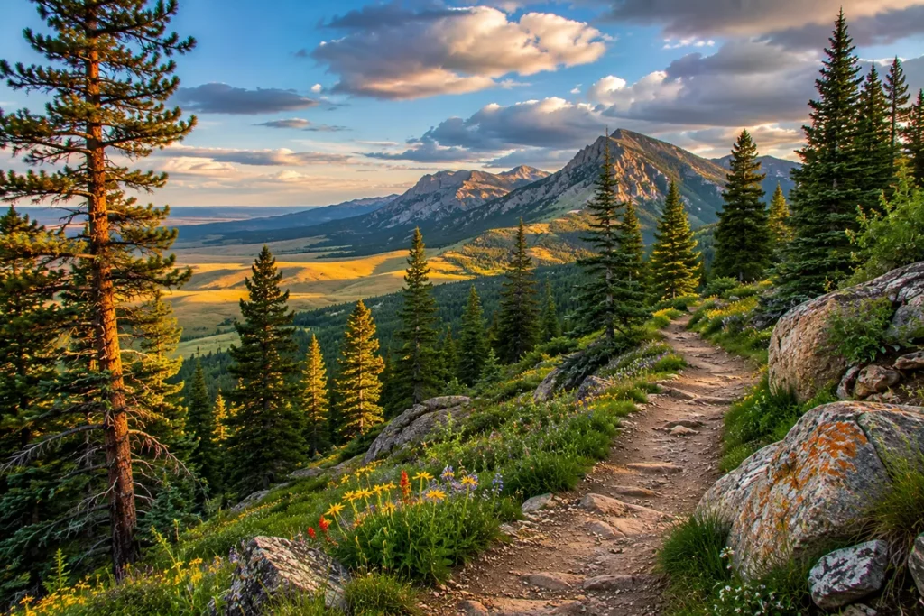
The Highwoods are a range you visit because you want a quiet hike, an interesting geology lesson, and a real central Montana experience without the crowds and infrastructure of the more famous ranges.
They’re not Glacier. They’re not the Beartooths. They’re a small volcanic island range with unique alkaline rocks, a historic ranching heritage, and a useful proximity to Great Falls and Charlie Russell country.
If you’ve never been: drive out from Great Falls on a clear day, hike one of the Thain Creek loops, stop at Square Butte on the way back, and have a beer at the Harvest Moon Brewery in Belt.
If you’ve been once: do the full Highwood Mountains Loop Trail. If you’re a geology traveler: spend a day exploring the Shonkin Sag area and the alkaline rock exposures.
For broader context on how the Highwoods fit alongside Montana’s other ranges, see the full Montana mountain ranges guide.
Frequently Asked Questions
Where are the Highwood Mountains?
The Highwood Mountains are an island range in north-central Montana, approximately 40 miles east of Great Falls in Cascade, Chouteau, and Judith Basin counties. They’re the closest National Forest range to Great Falls.
What’s the highest peak in the Highwood Mountains?
Highwood Baldy at 7,670 feet. Note that some travel sites incorrectly list “Mount Baldy” at 8,914 feet — this is confused with Mount Baldy in the Big Belt Mountains. The Highwood Baldy is the correct name and elevation for the Highwood Mountains high point.
Are the Highwood Mountains volcanic?
Yes. The Highwoods are an eroded remnant of an Eocene volcanic and intrusive complex active 54 to 50 million years ago. They’re part of the Central Montana Alkalic Province, a chain of unusual potassium-rich volcanic intrusions that also includes the Bears Paw Mountains and Eagle Buttes.
What is shonkinite?
Shonkinite is a specific type of dark alkaline igneous rock (essentially a mafic syenite) named after Shonkin, Montana, a tiny community in the western Highwood Mountains. The Shonkin Sag laccolith near the town is the type locality where the rock was first scientifically described and named.
How do you get to the Highwood Mountains?
The most common access is via Belt, Montana (25 miles east of Great Falls on US-87), then north on the Highwood Highway to Thain Creek Campground, which is the main trailhead.
Are the Highwood Mountains good for hiking?
Yes, particularly for moderate-difficulty trails. The Highwood Mountains Loop Trail (14.9 miles), the North Fork Highwood Creek trail (~16 miles round-trip), and the Windy Mountain Loop (7.1 miles) are the main established hiking trails.
Can you mountain bike in the Highwood Mountains?
Yes — the Highwoods have one of the more developed multi-use trail systems near Great Falls, with mountain bikes, dirt bikes, motorcycles, and ATVs allowed on many trails. The North Fork Highwood Creek trail is the marquee mountain bike route.
Are there grizzly bears in the Highwood Mountains?
A resident grizzly population is not established. Black bears are present at low density. Carry bear spray as a general precaution.
Are the Highwood Mountains part of the Rocky Mountains?
Yes — they’re classified as a sub-range of the Northern Rocky Mountains, though as an island range surrounded by prairie, they’re geographically isolated from the main Rocky Mountain chain.
Where do you stay near the Highwood Mountains?
Great Falls is the main base, with full-service amenities about 40 miles west. Belt is the smaller foothill town. Fort Benton is the historic Missouri River town to the north. Thain Creek Campground is the developed in-the-mountains option.