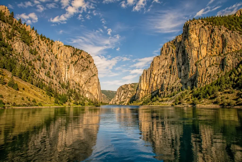
The first time I really understood the Big Belts, I was sitting on the deck of the Sacajawea tour boat heading up the Missouri River from Holter Lake, looking up at 1,200-foot limestone cliffs rising straight out of the water on both sides.
Meriwether Lewis stood on a boat almost exactly there in July 1805 and wrote that the cliffs “seem to scarcely yet have time to settle.”
Two centuries later, they still don’t. The Big Belts are Helena’s range, and they’re packed with more history per square mile than any other mountains in Montana.
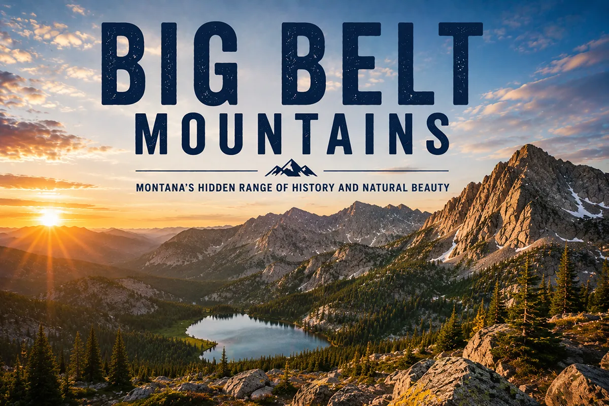
The Big Belt Mountains run about 75 miles in a northwest-to-southeast arc east of Helena and Canyon Ferry Reservoir, anchored by the Gates of the Mountains Wilderness — Montana’s smallest designated wilderness at 28,562 acres. The range contains some of the most historically dense ground in the state: the spot where Lewis & Clark named the Gates of the Mountains in July 1805; Mann Gulch, where 13 smokejumpers died in 1949 in a fire that fundamentally changed American wildland firefighting; and Confederate Gulch, site of one of the largest placer gold strikes in Montana history. Best hiking window: late May through October.
Liked this article?
Add Roaming Montana as a preferred source so you see more of our articles and guides on Google.
Why the Big Belts Are Different
Most Montana ranges are about the mountains themselves — the peaks, the lakes, the alpine country. The Big Belts are about the history embedded in them.
The range runs in a long northwest-to-southeast arc — that “belt-like” shape is where the name comes from — between Helena and Townsend on the west, and the rolling Smith River and Belt Creek country on the east.
The geology is mostly Belt Supergroup sedimentary rock: limestone, sandstone, and argillite layers deposited 1.4 to 1.6 billion years ago when this country was a shallow inland sea. (The Belt Supergroup is named after this range — and after the small town of Belt north of the range.)
Pockets of metamorphic and igneous rock punch through, particularly on the western slope, and that intrusive rock is what made the Big Belts one of Montana’s great gold-mining ranges.
The terrain is less dramatic than the granitic ranges to the west. The Big Belts don’t have alpine plateau or jagged ridges. They have rolling forested mountains, sage parks, deep gulches, and — most distinctively — vertical limestone cliffs where the Missouri River and several tributaries have cut through.
The Gates of the Mountains is the most famous example, but the entire range has these “limestone gates” where rivers carved canyons through the resistant carbonate rock.
For broader context, see my full Montana mountain ranges guide.
Where the Big Belts Are
The Big Belt Mountains stretch roughly 75 to 80 miles in a northwest-to-southeast direction, with their footprint covering parts of five counties: Broadwater, Lewis and Clark, Meagher, Cascade, and a small slice of Gallatin.
The western boundary runs along Canyon Ferry Reservoir and the Missouri River. The eastern boundary fades into the Smith River and Castle Mountain country.
The closest major city is Helena, Montana’s state capital, which sits at the foot of the range to the west — the entire eastern skyline from downtown Helena is Big Belts horizon. Townsend sits on the southwestern foot of the range along US-287.
White Sulphur Springs sits on the southeastern foot along US-89.
The range is almost entirely contained within the Helena-Lewis and Clark National Forest.
The Sleeping Giant: Helena’s Skyline Mountain
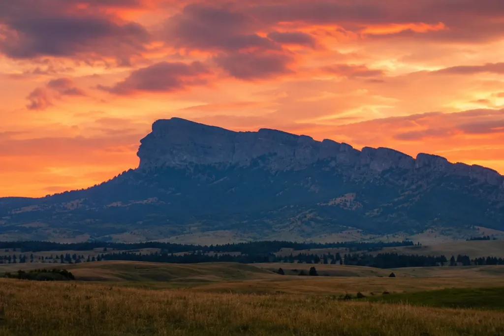
Step out anywhere in Helena and look northeast across the Prickly Pear Valley — you’ll see a distinctive horizon formation called the Sleeping Giant.
The profile genuinely looks like a reclining man with arms folded across the chest, and it’s been part of Helena’s identity for as long as the city has existed.
Geologically, the formation is a series of high ridges in the western Big Belts; the “head” of the Giant is Beartooth Mountain at about 7,800 feet. The whole formation is visible for about 60 miles along the Prickly Pear and Missouri valleys.
A short trail accesses the Sleeping Giant from the south, climbing through limestone bluffs to viewpoints over the Missouri River. It’s one of the most popular short hikes from Helena.
The High Country
Here’s something I have to clear up. The competitor most commonly cited for Big Belts information lists “Sacagawea Peak (9,656 ft)” as the high point.
That’s incorrect — Sacagawea Peak is actually in the Bridger Range near Bozeman, a completely different mountain range. The Big Belts don’t have a Sacagawea Peak.
The actual highest points in the Big Belts are clustered in the southern half of the range:
- Mount Baldy (~9,500 ft) — the highest peak in the range
- Hardscrabble Peak
- Ross Peak
- Mount Edith (9,491 ft) — one of the most prominent and most-climbed peaks
The range has roughly 48 named peaks, though most are sub-9,000-foot forested summits rather than alpine peaks. The Big Belts feel more like a backcountry forest range with occasional limestone outcrops than like the dramatic granitic country to the west.
The Gates of the Mountains: Lewis & Clark’s Naming
The single most famous feature of the Big Belts is the Gates of the Mountains — a stretch where the Missouri River cuts a 5-mile canyon through 1,200-foot vertical limestone cliffs.
The geology is the resistant Madison Limestone (later sources call it Mission Canyon Limestone), the most prominent carbonate formation in this part of Montana.
On the evening of July 19, 1805, Meriwether Lewis was traveling up the Missouri with the Corps of Discovery and entered this canyon. He wrote in his journal:
“This evening we entered much the most remarkable cliffs that we have yet seen. These cliffs rise from the water’s edge on either side perpendicularly to the height of about 1,200 feet… I shall call this place the Gates of the Rocky Mountains.”
The name stuck. Today, the Gates of the Mountains boat tour operates from a marina off Interstate 15 north of Helena from about Memorial Day through late September.
The two-hour tour runs upriver through the canyon, with a stop at Meriwether Picnic Area near where Lewis camped that night.
It’s one of the most popular Lewis & Clark heritage experiences in Montana — and frankly, even without the history, the canyon itself is one of the most striking landscape features in the state.
For broader Lewis & Clark and Montana history context, see our key historical events in Montana overview.
The Gates of the Mountains Wilderness
In 1964, with the original passage of the Wilderness Act, Congress designated the Gates of the Mountains Wilderness — 28,562 acres along both sides of the Missouri River canyon. It’s Montana’s smallest designated wilderness, which is a real fact that nobody seems to emphasize enough.
What it lacks in size, it makes up for in character. The wilderness includes:
- The Missouri River canyon itself (the “Gates”)
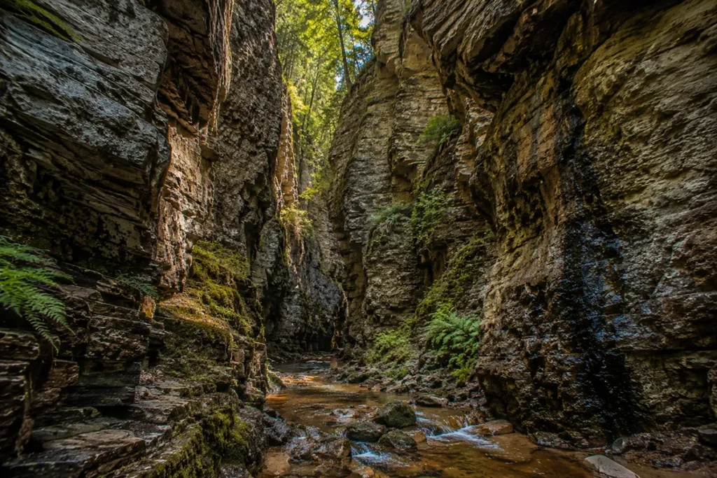
- Refrigerator Canyon — a narrow slot canyon that stays cold and shaded even in midsummer (worth the hike just for the temperature drop)
- Mann Gulch (more below)
- Meriwether Canyon — where the Corps of Discovery camped
- Bear Prairie — a popular backpacking destination
- Candle Mountain — an easy summit from Bear Prairie with valley-spanning views
- 53 miles of maintained trails
The wilderness is unusually dry for western Montana — the limestone country drains fast, water sources are scarce, and you have to plan trips with that in mind. Don’t assume you’ll find water along the trail.
Moors Mountain (7,979 ft) is the highest peak entirely inside the wilderness.
The Mann Gulch Fire: August 5, 1949
Most of the Mann Gulch story isn’t told well in travel guides because travel guides aren’t built for tragedy. But the Mann Gulch Fire happened in the Big Belts, it fundamentally changed American firefighting, and it’s part of any honest understanding of this range.
On the afternoon of August 5, 1949, a small lightning-caused fire was reported in Mann Gulch — a steep, V-shaped drainage running about two miles down to the Missouri River within what’s now the Gates of the Mountains Wilderness. It was 97°F in Helena.
A C-47 from the Missoula smokejumper base flew in with 16 jumpers under foreman Wagner “Wag” Dodge. They landed in the gulch and met fire guard James Harrison from the nearby Meriwether Campground. Sixteen men total.
Within roughly 90 minutes of landing, the fire blew up. Wind picked up embers and dropped them downhill below the crew, cutting off their escape route to the river. The fire began running uphill toward them at over 30 miles per hour through cured grass on a 76-percent slope.
Dodge — recognizing the situation was catastrophic — did something no one had ever done: he lit a small “escape fire” in front of the advancing flame front, burning out a circle of grass, and lay down in the burned-over patch. He yelled for his crew to join him.
They didn’t understand, and they kept running. Dodge survived. Two younger jumpers, Walter Rumsey and Robert Sallee, crested the ridge and crawled into a rock crevice and survived. Thirteen men died — 12 smokejumpers and Harrison.
The Mann Gulch Fire became the deadliest day in smokejumper history. It’s the subject of Norman Maclean’s masterpiece Young Men and Fire (1992), one of the great works of American nonfiction.
It led directly to the creation of modern wildland fire science — the systematic study of fire behavior, fuel models, and slope-and-wind interactions that now underlies every Forest Service firefighter’s training.
The “Standard Fire Orders” and the “18 Watchout Situations” that all American wildland firefighters learn today exist in large part because of what happened in Mann Gulch.
The gulch is accessible today by boat — the Gates of the Mountains tour will drop you at Meriwether Landing, and the hike up Mann Gulch follows the route the smokejumpers took.
White concrete crosses mark where each of the 13 men died. The Mann Gulch site has been a National Historic Landmark since 1999.
If you go: treat it as the memorial it is. Don’t make noise. Don’t disturb the markers.
For more on Montana’s fire history, see our fire history overview and our Montana wildfires guide.
Confederate Gulch and the Big Belts Gold Rush
The other defining historical story of the Big Belts is the gold rush of 1864–1870.
In December 1864, three former Confederate soldiers on parole found gold in a steep narrow canyon on the east side of the range. They named it Confederate Gulch.
A few months later, the Montana Bar — a placer deposit at the gulch’s confluence with Cement Gulch — turned out to be one of the richest placer gold strikes ever found in the American West.
Estimates of total gold extracted from Confederate Gulch between 1864 and 1870 range from $19 million to $30 million, in 1860s dollars — equivalent to roughly $400 million to $600 million today.
The boomtown that emerged was called Diamond City, supposedly because the first four cabins formed a diamond pattern in the snow.
By 1867, Diamond City had a population of about 10,000 people — making it briefly one of the largest cities in the Northern Rockies.
By 1870, the gold played out. By the early 1880s, the town was abandoned. Today there’s essentially nothing left at the site — just some interpretive markers and the impressively scarred hillsides showing where placer mining tore through the gulch.
The Big Belts also produced silver and other metals from hard-rock mining operations through the late 19th century. Several smaller ghost towns dot the range. For broader context, see our Roaming Montanald Rush overview.
The Best Hikes in the Big Belts
The Big Belts have a more varied trail system than most Montana ranges — short historical hikes, classic alpine summits, and serious wilderness backpacks all coexist.
Refrigerator Canyon
Probably the most unique short hike in the range. A trail from York winds through a narrow slot canyon — the “refrigerator” effect refers to how cool the canyon stays in summer due to its narrow walls and shade. About 4 miles round-trip. Great for families.
The canyon eventually connects to the longer Meriwether Canyon route into the wilderness.
Bear Prairie and Candle Mountain
The classic Gates of the Mountains backpack. From the southwest trailhead, hike about 8 miles into Bear Prairie, a large meadow that’s the standard overnight basecamp inside the wilderness.
From Bear Prairie, an easy summit of Candle Mountain gives panoramic views over the canyon and the Missouri River country. Plan two or three days.
Meriwether Canyon to the Missouri
A 16-mile trail from the southwest wilderness boundary down through Refrigerator Canyon to Meriwether Landing on the Missouri.
Hearty day-hikers do it round-trip; most people overnight in Bear Prairie. The boat tour will pick you up at Meriwether Landing and ferry you to Upper Holter Lake for a fee.
Mount Baldy
The high-point summit of the range. About 6 miles round-trip with significant gain. Steep, exposed near the top, but a non-technical hike. The summit views cover most of central Montana.
Mount Edith
Another classic summit hike, accessed from the eastern (Smith River) side. Mount Edith has multiple route options.
The Sleeping Giant
Short hike from south of Wolf Creek up onto the Sleeping Giant ridge. Spectacular views down to the Missouri and across to Helena.
Trout Creek Canyon
A scenic limestone canyon hike from York, with good fall color and frequent wildlife sightings.
Wildlife in the Big Belts
The Big Belts support a diverse but lower-density wildlife community compared to the western ranges.
Elk and mule deer are abundant throughout. The Big Belts are popular elk hunting country in fall.
Mountain lions are present in good numbers — the limestone country with its rimrocks and cliffs is excellent cougar habitat.
Black bears are common. Grizzly bears are not yet established as residents in the Big Belts, but occasional dispersing grizzlies have been documented as the regional grizzly population expands. Carry bear spray. See our Montana bear guide.
Bighorn sheep — a significant herd inhabits the cliffs along the Missouri River canyon. Look for them from the Gates of the Mountains boat tour.
Mountain goats are limited but present on the highest peaks.
Bird life: Bald eagles, golden eagles, peregrine falcons, and prairie falcons all nest in the limestone cliffs. The Gates of the Mountains is one of the easier places in Montana to see peregrines.
Where to Base Yourself
Helena — The Best All-Around Base
Best for: Most travelers. Direct access to the western Big Belts, the Sleeping Giant, the Gates of the Mountains boat tour, and a real city’s worth of restaurants, history, and lodging.
Helena is Montana’s state capital — population about 33,000 — with a strong historic downtown, the Montana State Capitol, the Cathedral of St. Helena, and the Last Chance Gulch pedestrian mall. Helena is where I’d base for almost any Big Belts trip. See our things to do in Helena guide for more.
Townsend — Southern Big Belts Gateway
Best for: Mount Baldy, Confederate Gulch country, and Canyon Ferry Reservoir recreation.
Townsend is a smaller town (population ~2,000) sitting between Helena and Three Forks, with direct access to the southern Big Belts and the Canyon Ferry Reservoir.
White Sulphur Springs — Eastern Big Belts Gateway
Best for: Mount Edith, Smith River access, and the lesser-traveled eastern slope.
White Sulphur Springs is a quiet ranch town (population ~950) on the east side of the range, with hot springs (it’s named after them) and direct access to the Smith River — Montana’s most famous river permit float trip.
Wolf Creek and Craig
Small communities along Interstate 15 between Helena and Great Falls that put you closest to the Gates of the Mountains marina and the Mann Gulch area.
Best Time to Visit
The Big Belts are lower in elevation than most western Montana ranges, which means a longer usable hiking season.
Late May through June is excellent for the lower-elevation hikes — the Sleeping Giant, Refrigerator Canyon, and Gates of the Mountains boat tour. Wildflowers peak in early June.
July and August are prime for the high country and the wilderness backpacks. Watch for fire activity — the Big Belts burn regularly in late summer, and the Mann Gulch terrain is a sobering reminder of why.
September and October are my favorite. Aspens turn gold, crowds thin, weather is stable. The Gates of the Mountains boat tour typically runs through late September.
Winter the range is good for cross-country skiing and snowshoeing on the lower trails, with snowmobile use allowed on Forest Service roads. The Gates of the Mountains canyon itself is sometimes accessible by ice from the river, but ice conditions vary year to year.
For seasonal context, see Montana in May, Montana in June, and Montana in September.
Personal Tips: What I Wish I Knew About the Big Belts
Take the Gates of the Mountains boat tour. Yes, it’s a tourist boat. Yes, you’ll be surrounded by retirees with sun hats. Do it anyway. The canyon is more dramatic from the water than from any trail, and the historical narration is genuinely good.
Plan water carefully in the wilderness. The Gates of the Mountains Wilderness is dry. Most “creeks” on the map are seasonal and bone-dry by August. Pack more water than you think.
Mann Gulch is hard ground. If you visit, be aware that 13 men died here. The site is a memorial, not a destination. The white concrete crosses marking where each man fell are still there. Hike quietly.
Helena is underrated as a Montana basecamp. Most tourists pass through Helena en route to Glacier or Yellowstone. The city has the State Capitol, the Holter Museum of Art, the Helena Cathedral, a brewery scene, and direct trailhead access to the Big Belts. It’s worth a multi-day visit on its own.
Confederate Gulch is essentially gone. Don’t expect a ghost town tour. The site is mostly overgrown placer-mined slopes with a few interpretive signs. The history is more interesting than what’s visible on the ground.
The Smith River permit is one of Montana’s hardest tickets. If you want to float the Smith River — which runs along the east side of the Big Belts — you need a permit, awarded by lottery in late winter for the following summer. The Smith River float is one of the great American river trips, and the Big Belts form half of the corridor.
Fall hunting changes the range. From mid-September through mid-November, the Big Belts are heavily hunted for elk and deer. If you’re hiking during hunting season, wear orange and check Montana FWP for current season dates. Most trails remain accessible.
Practical Info Box
| Item | Detail |
|---|---|
| Highest peak | Mount Baldy [~9,500 ft] |
| Most prominent named peak | Mount Edith, 9,491 ft |
| Range length | ~75–80 miles, NW-to-SE arc |
| Wilderness | Gates of the Mountains Wilderness, 28,562 acres — Montana’s smallest |
| Wilderness trail miles | 53 maintained |
| National Forest | Helena-Lewis and Clark National Forest |
| Counties | Broadwater, Lewis and Clark, Meagher, Cascade, Gallatin |
| Lewis & Clark naming | July 19, 1805 (Gates of the Mountains) |
| Mann Gulch Fire | August 5, 1949 — 13 smokejumpers killed |
| Confederate Gulch gold rush | 1864–1870, $19–30 million extracted |
| Diamond City peak population | ~10,000 (1867) |
| Boat tour season | Memorial Day to late September |
| Smith River permit | Lottery (late winter) |
| Best basecamp | Helena |
| Nearest airport | Helena Regional (HLN) |
| Bear spray | Recommended |
Final Thoughts
The Big Belts are the most historically dense mountain range in Montana. You can hike up Mann Gulch in the morning and stand where 13 firefighters died in 1949, take the boat tour through the cliffs Lewis named on July 19, 1805, in the afternoon, and have dinner in Helena six miles from where the largest gold strike of the Montana Rush played out 160 years ago.
Few mountain ranges anywhere combine that much American history with this much accessibility.
If you only have a day, take the Gates of the Mountains boat tour and add the Refrigerator Canyon hike. If you have a weekend, base in Helena, do the boat tour with the Mann Gulch hike one day, and the Sleeping Giant trail another.
If you have a week, plan the Bear Prairie backpack and tack on the Smith River float if you’ve got a permit.
For broader context on how the Big Belts fit alongside Montana’s other ranges, see the full Montana mountain ranges guide.
Frequently Asked Questions
Where are the Big Belt Mountains?
The Big Belt Mountains run about 75 miles in a northwest-to-southeast arc east of Helena and Canyon Ferry Reservoir, in west-central Montana. Helena, Townsend, and White Sulphur Springs are the gateway towns.
Why are they called the Big Belt Mountains?
The name refers to the range’s belt-like arc shape. The Belt Supergroup geological formation — a sequence of billion-year-old sedimentary rocks that makes up much of northwest Montana — is named after this range and after the small town of Belt north of the mountains.
What’s the highest peak in the Big Belts?
Mount Baldy is generally considered the highest peak at approximately 9,500 feet, though sources disagree slightly. Mount Edith (9,491 ft) is the most prominent named peak. Note: Sacagawea Peak, sometimes incorrectly listed as the Big Belts’ high point, is actually in the Bridger Range near Bozeman.
Where is the Gates of the Mountains?
The Gates of the Mountains is a 5-mile stretch where the Missouri River cuts through 1,200-foot vertical limestone cliffs in the northern Big Belts, about 20 miles north of Helena. It’s named by Meriwether Lewis on July 19, 1805. The Gates of the Mountains Wilderness (28,562 acres) protects the area.
Can you take a boat through the Gates of the Mountains?
Yes. The Gates of the Mountains tour boat operates from a marina off Interstate 15 north of Helena, running two-hour tours through the canyon from Memorial Day through late September.
What happened at Mann Gulch?
On August 5, 1949, a wildland fire in Mann Gulch — within the Gates of the Mountains Wilderness — killed 13 men, including 12 smokejumpers and one fire guard. The Mann Gulch Fire became the deadliest day in smokejumper history and is widely credited with prompting the development of modern wildland fire science. Norman Maclean’s book Young Men and Fire documents the event in depth.
What was Confederate Gulch?
Confederate Gulch was the site of a major gold strike on the east side of the Big Belt Mountains beginning in December 1864. The boomtown of Diamond City peaked at about 10,000 residents in 1867, and the gulch produced an estimated $19–30 million in gold before the deposits played out around 1870. The site is now abandoned.
Are there grizzly bears in the Big Belts?
Resident grizzlies are not established in the Big Belts. Dispersing grizzlies from the Northern Continental Divide and Greater Yellowstone Ecosystems have been documented occasionally. Carry bear spray as a general precaution.
What’s the best hike in the Big Belt Mountains?
For history + scenery: hike Mann Gulch from Meriwether Landing (accessed via boat tour). For families: Refrigerator Canyon. For backpacking: Bear Prairie and Candle Mountain. For summit baggers: Mount Baldy or Mount Edith. For valley views: the Sleeping Giant trail.
Where do you stay near the Big Belt Mountains?
Helena is the best all-around base, with full services and direct trail access. Townsend serves the southern range. White Sulphur Springs serves the eastern range. Wolf Creek and Craig are the closest small communities to the Gates of the Mountains marina.