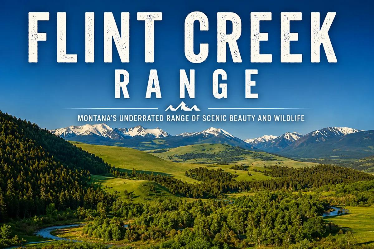
The Flint Creek Range looks small on a Montana map. It’s not. It’s compact — about 25 miles north to south — but packed inside that small footprint is a 10,168-foot peak, a 60,000-acre roadless area, the highest silver-producing town in late-1800s Montana, an Indigenous flint quarry that gave the range its name, a state park with 1,200-foot limestone cliffs, and one of the only Montana ski areas where you can spend a day skiing without joining a line.
Most travelers drive I-90 between Drummond and Deer Lodge looking at the Flint Creeks as a roadside silhouette, never stopping. They should..
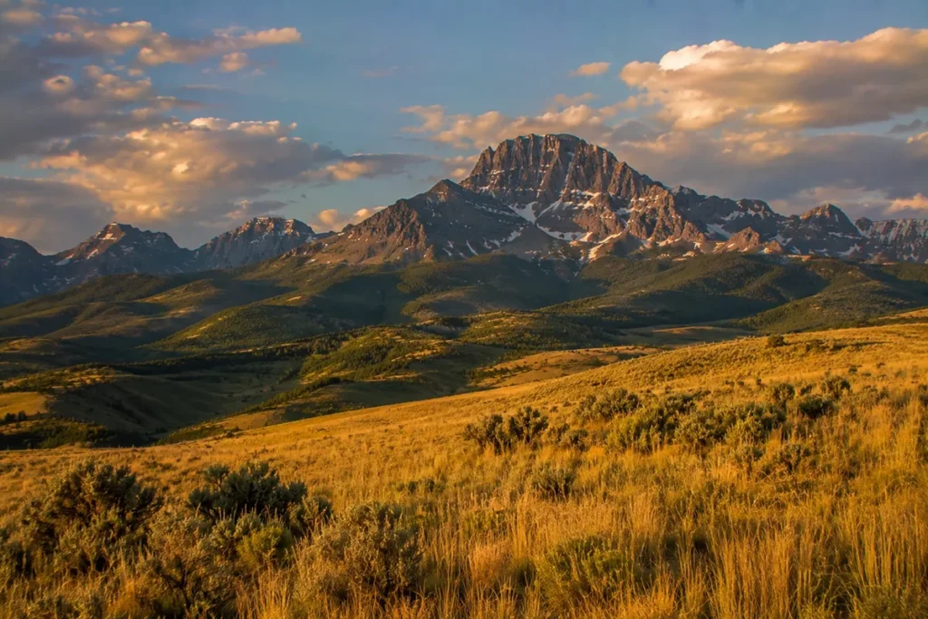
The Flint Creek Range sits between Philipsburg, Deer Lodge, and Anaconda in southwest Montana, with Mount Powell (10,168 ft) — named for explorer John Wesley Powell — as the high point. The range covers about 60,000 acres of roadless terrain in the Beaverhead-Deerlodge National Forest. The name comes from Eyebrow Quarry, the largest of several pre-contact Indigenous flint extraction sites in the area. The east side of the range produced $20 million in silver between 1885 and 1893, anchored by Montana’s first silver mill (the Hope Mill in Philipsburg). Discovery Ski Area sits on the southwest flank; Lost Creek State Park anchors the southeast corner. Best window: mid-July through September.
Liked this article?
Add Roaming Montana as a preferred source so you see more of our articles and guides on Google.
Why the Flint Creek Range Is Different
The Flint Creeks are a smaller-by-footprint range in a state full of larger ones. What they lack in size they make up for in concentrated character:
- Vertical relief. Mount Powell rises 5,600 feet above the Deer Lodge Valley. That’s more vertical relief than most of the major Montana ranges’ state highpoint peaks.
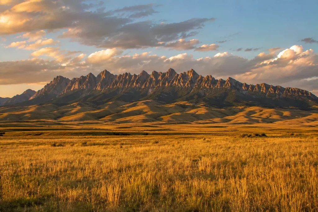
- The “dinosaur backbone.” The ridge connecting Mount Powell to Deer Lodge Mountain (9,765 ft) is one of the most visually distinctive ridgelines visible from Interstate 90. Locals describe it as looking like the backbone of a dinosaur — long, level, vertebrae-textured.
- Concentrated mining history. The eastern side of the range was one of the most productive silver districts in 1880s Montana, and Philipsburg was the hub.
- Real solitude. The 60,000-acre roadless area in the center of the range is some of the quietest country in southwest Montana. Trails are maintained by a volunteer group, condition varies, and you’ll often see no one.
For broader context, see my full Montana mountain ranges guide and the related Tobacco Root Mountains guide.
Where the Flint Creek Range Is
The Flint Creek Range sits in southwest Montana, with three gateway towns at its base and one major highway running past:
- East: Deer Lodge along Interstate 90. The range is the dominant western skyline from town.
- West: Philipsburg along Montana Highway 1. The Flint Creek Valley runs north-south at the western foot.
- South: Anaconda along Montana Highway 1. The Anaconda-Pintler Range begins just south of the Flint Creeks.
- North: Drummond where I-90 makes a turn westward toward Missoula.
The range is sometimes described as a northern offshoot of the Anaconda-Pintler Range, with the two separated by a narrow valley along Montana Highway 1.
The entire range falls within the Beaverhead-Deerlodge National Forest (Montana’s largest National Forest), primarily in Granite and Powell counties.
The Name: Eyebrow Quarry and Indigenous Flint Quarrying
This is the most interesting fact about the Flint Creek Range, and it’s one that travel writers consistently miss.
The range takes its name from flint extraction sites in the area — specifically the Eyebrow Quarry, the largest such site in the range. Long before European contact, Indigenous peoples (likely Salish and other Plateau peoples) extracted flint from outcrops in these mountains for tool-making.
Flint and chert from this area was knapped into projectile points, scrapers, and cutting tools, and traded across hundreds of miles of the Northern Rockies and the Northern Plains. The Eyebrow Quarry is one of the larger pre-contact tool-stone quarries in Montana.
The fact that a Montana range — and the creek that drains through Philipsburg, and the entire valley — takes its name from Indigenous tool-stone extraction is genuinely distinctive.
It tells you that the people who came through here for thousands of years before the silver miners named these mountains for the resource that mattered to them.
For broader Montana history context, see our Montana history overview.
Mount Powell: The High Point
Mount Powell, at 10,168 feet, is the highest peak in the range. The mountain is named for John Wesley Powell (1834–1902), the one-armed Civil War veteran and explorer who led the first scientific descent of the Colorado River through the Grand Canyon in 1869.
Powell later became the second director of the U.S. Geological Survey and the first director of the Smithsonian’s Bureau of Ethnology.
He never visited the Flint Creek Range, but the mountain bears his name — likely chosen during the late-1800s era of USGS surveying when Powell was a famous and admired figure.
Mount Powell is the county highpoint of Powell County (a Montana county also named after John Wesley Powell), and has a prominence of over 3,700 feet — meaning it rises significantly above its surrounding terrain.
Climbing Mount Powell
The standard route is approximately 14 miles round-trip with significant elevation gain and a “very precipitous final push” to the summit.
The route is non-technical (Class 2 boulder-scrambling near the top) but long and exposed. Most parties do it as a long day hike.
The route is mostly on south-facing slopes, which means it melts out earlier in the season than equivalent shaded routes — sometimes accessible by late June.
The summit views span outward to:
- South: The Anaconda-Pintlers and Pioneers
- West: The John Long Range
- North: The Scapegoat and Bob Marshall Wilderness peaks
- East: The Highland Mountains south of Butte
The Crater
Between Mount Powell and Deer Lodge Mountain (9,765 ft) sits a striking glacially carved cirque locally called “The Crater” — a massive bowl with vertical walls dropping hundreds of feet from the connecting ridge.
Strong scramblers do a Mount Powell + Deer Lodge Mountain loop, traversing along the rim of The Crater between summits. It’s one of the more impressive sustained ridge traverses in southwest Montana.
The Silver Mining History: Philipsburg and the Hope Mill
The eastern side of the Flint Creek Range was one of the most productive silver-mining districts in 1880s Montana.
Philipsburg was founded in 1867, named after Philip Deidesheimer, an early mine engineer in the area.
The town’s growth was fueled by silver claims in the surrounding hills, including the Stewart Gulch Mine (established 1866) and dozens of smaller operations.
Philipsburg’s economic centerpiece was the Hope Mill — Montana’s first silver mill, built to process the silver ore from the surrounding deposits.
Between 1885 and 1893, the eastern side of the Flint Creek Range produced approximately $20 million in silver (1880s dollars; equivalent to roughly $600 million today).
The economic boom transformed Philipsburg from a frontier camp into a substantial Victorian-era town, with a brick downtown, schools, an opera house, and a brick courthouse.
Much of that 1880s and 1890s streetscape still stands today, making Philipsburg one of the best-preserved historic mining towns in the West.
The silver boom ended with the Panic of 1893 and the U.S. shift away from silver coinage, but mining continued on a smaller scale into the 20th century.
The Flint Creeks also produced tungsten, molybdenum, manganese, and phosphate — strategic minerals that were mined during both World Wars.
The Sapphire-Bearing Gem Mountain area is technically in the adjacent Sapphire Mountains, but the proximity and shared mining culture mean Philipsburg’s gem stores still sell Montana sapphires today.
The town is also famous for the Sweet Palace candy store, a real institution worth a stop after a day on the trails. For more on the mining era, see our Roaming Montanald Rush overview.
Discovery Ski Area
Discovery Ski Area sits on the southwestern flank of the Flint Creek Range near Georgetown Lake. It’s a small ski area by Montana standards — about 2,200 skiable acres — but it’s one of the best uncrowded ski destinations in the state.
Discovery is the place to ski if you want short lift lines, friendly local culture, and reasonable prices. The terrain ranges from beginner-friendly groomers to genuinely challenging steep faces.
Even in summer, the access road to Discovery (off Montana Highway 1) is a useful entry point into the southern Flint Creek Range trail system.
Lost Creek State Park
At the southeastern edge of the Flint Creek Range, just north of Anaconda, sits Lost Creek State Park — one of Montana’s most underrated state parks.
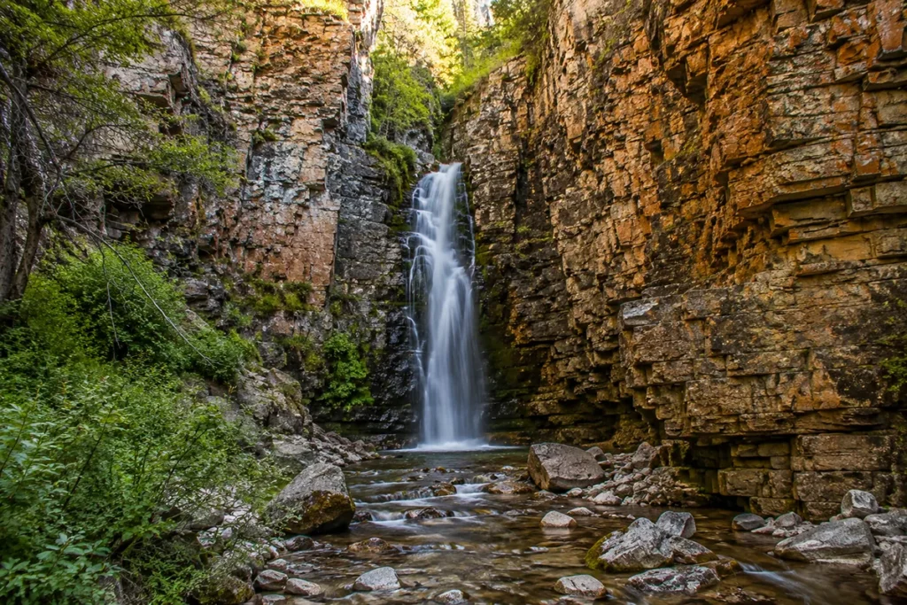
The park is built around Lost Creek Canyon, where 1,200-foot limestone cliffs rise above the canyon floor in striking multi-colored bands of orange, gray, and white.
A short hiking trail leads to Lost Creek Falls — a 50-foot waterfall plunging through the canyon. Mountain goats and bighorn sheep are reliably visible on the canyon walls, often within camera range.
Lost Creek State Park has a small campground, picnic areas, and a network of short trails. It’s an easy half-day visit and pairs well with a day in Philipsburg or Anaconda.
The Best Hikes in the Flint Creek Range
Mount Powell Summit
The 14-mile round-trip ascent of the range high point. Most of the route is on south-facing slopes, so the route is often clear of snow by late June. The final summit push is steep with boulder-scrambling. Typical time: 8–10 hours for a strong party.
Mount Powell to Deer Lodge Mountain Loop
The full ridge traverse from Mount Powell across The Crater to Deer Lodge Mountain (9,765 ft) and back. About 17–18 miles total. Real Class 2 ridge scrambling. Best for experienced parties.
Trail Creek / Trask Creek to Trask Lakes
A 15.8-mile out-and-back to the Trask Lakes — pristine alpine lakes with fly fishing for brook and rainbow trout. Some of the best alpine lake scenery in the range. Can be done as a long day or comfortable overnight backpack.
Pozega Lake Trail
The most rideable singletrack on the east side, accessed from Racetrack Creek Valley off I-90. Good for hikers wanting moderate effort.
Lost Creek Falls Trail
The short, family-friendly hike at Lost Creek State Park to the 50-foot falls. Wheelchair-accessible portions, plus longer extensions.
Twin Lakes
Multiple alpine lakes accessed from various trailheads. The Flint Creek Range has dozens of named alpine lakes, most of which hold trout.
Wildlife in the Flint Creek Range
The Flint Creeks support a healthy southwest Montana wildlife community:
Elk and mule deer — both abundant. The Flint Creeks are popular elk hunting country in fall.
Bighorn sheep and mountain goats — both species use the higher elevations, particularly around Lost Creek State Park and the Mount Powell area.
Black bears — common throughout.
Grizzly bears — not established as resident, but occasional dispersing grizzlies have been documented. Carry bear spray. See our Montana bear guide.
Mountain lions — present, rarely seen.
Wolves — recolonized from adjacent ranges; a small but established population.
Moose — present in the wet drainages.
Fish — dozens of alpine lakes hold brook, rainbow, brown, and cutthroat trout. Georgetown Lake on the southwest side is a major fishing destination with arctic grayling, kokanee salmon, and trout.
Where to Base Yourself
Philipsburg — Best All-Around Base
Best for: Most travelers. The historic mining town at the western foot of the range. Population about 850. Strong restaurants, lodging, the Sweet Palace candy store, the Sapphire Gallery, and direct access to the western Flint Creek Range trailheads. Philipsburg is also one of the most-photographed Montana towns for its preserved Victorian streetscape.
Deer Lodge — East Side Base
Best for: Mount Powell access from the east, the Old Montana Prison Museum, and travelers heading west on I-90.
Deer Lodge (population ~3,200) sits along I-90 at the eastern foot of Mount Powell. The town has motels, restaurants, and the Grant-Kohrs Ranch National Historic Site (a working 1850s-1900s cattle ranch managed by the National Park Service — well worth a visit for Montana ranching history).
Anaconda — South Side Base
Best for: Lost Creek State Park access, Discovery Ski Area, and the southern Flint Creek Range.
Anaconda (population ~9,000) is the historic copper-smelting city south of the range. The town’s signature feature is the 585-foot Anaconda Smelter Stack (the tallest masonry structure in the world), and the surrounding country has strong Butte-area mining history. Real services, lodging, and restaurants.
Drummond — North Side Base
Best for: Northern range access and travelers passing through on I-90.
Drummond is the small town at the north end of the range. Limited services. Best for travelers passing through rather than basing here.
Regional: Missoula or Butte
Missoula is about 75 miles west of Philipsburg. Butte is about 50 miles southeast. Both offer full-service regional bases with airports.
Best Time to Visit
The Flint Creeks have a relatively short high-country hiking season due to elevation and snow accumulation.
Late June through early July — Mount Powell’s south-facing route may melt out, but most other high routes still have snow. Lower trails accessible.
Mid-July through mid-September — prime hiking window. Wildflowers peak in late July. The high lakes are accessible.
Mid-September through October — fall colors in the aspens and larches, cooler temperatures, fewer crowds. Best photography window. Discovery Ski Area opens late November.
November through April — winter sports season. Discovery Ski Area is the main attraction. Cross-country skiing and snowmobiling on lower elevation Forest Service roads.
For seasonal Montana context, see Montana in July, Montana in September, and Montana ski resorts.
Personal Tips: What I Wish I Knew About the Flint Creeks
Philipsburg is worth a slow visit, not a drive-through. The downtown is one of the best-preserved historic streetscapes in Montana, and the candy store is a real thing. Allow at least half a day in town.
The trails are volunteer-maintained. Conditions vary widely. Bring a current Forest Service map (Beaverhead-Deerlodge National Forest), GPS, and don’t expect signage to match older trail descriptions. Some routes have been rerouted; some sections are overgrown.
Mount Powell is best in late June or July. The south-facing route melts out early in the season. By August, the route is dry and hot. Bring extra water.
Lost Creek State Park is a half-day worth doing. The limestone cliffs and the wildlife sighting reliability make it a strong addition to any Flint Creek visit. The campground is small and books fast in summer.
Discovery Ski Area is the un-Big-Sky. If you ski Montana in winter and want to skip the Big Sky crowds, Discovery is the answer. Cheap lift tickets, no lift lines, friendly locals.
Georgetown Lake is a real fishing destination. The lake on the southwest side has arctic grayling, kokanee salmon, brook trout, and rainbow trout. Ice fishing in winter, fly fishing in summer.
Cell service is patchy at best. Philipsburg has decent coverage; the wilderness has none. Plan for off-grid.
The Grant-Kohrs Ranch National Historic Site near Deer Lodge is excellent. A working 1850s-1900s cattle ranch run by the National Park Service. Some of the best Montana ranching-history context in the state.
Bear spray is recommended. Even though the Flint Creeks don’t have a resident grizzly population, the broader regional population is expanding. Carry spray.
Practical Info Box
| Item | Detail |
|---|---|
| Highest peak | Mount Powell, 10,168 ft |
| Range type | Northern offshoot of the Anaconda-Pintler Range |
| Roadless area | ~60,000 acres |
| Named for | Indigenous flint quarries (Eyebrow Quarry, largest) |
| Mount Powell named for | John Wesley Powell (1834–1902), Grand Canyon explorer |
| Mining era peak | 1885–1893; ~$20 million in silver from east side |
| Notable historic site | Hope Mill, Philipsburg — Montana’s first silver mill |
| National Forest | Beaverhead-Deerlodge National Forest |
| Counties | Granite, Powell, Deer Lodge |
| Best basecamp | Philipsburg |
| Major ski area | Discovery Ski Area (southwest flank) |
| State park | Lost Creek State Park (southeast edge) |
| Best hiking window | Mid-July through mid-September |
| Cell service | Patchy in towns, none in wilderness |
| Bear spray | Recommended |
| Nearest airport | Missoula (MSO, ~1.5 hours) or Butte (BTM, ~1 hour) |
Final Thoughts
The Flint Creeks are the kind of Montana range that quietly rewards travelers who stop. They’re not a destination range — they’re not advertised in glossy travel magazines or featured in Instagram feeds — but they have one of the better historic mining towns in the state (Philipsburg), a genuinely impressive 10,000-foot summit (Mount Powell), a quiet 60,000-acre roadless area, an underrated state park (Lost Creek), and an uncrowded ski area (Discovery).
For travelers who like discovering places before they become famous, the Flint Creeks are nearly perfect.
If you’ve never been: spend a day in Philipsburg, drive the Pintler Scenic Route through to Anaconda, stop at Lost Creek State Park. If you’ve been once: climb Mount Powell. If you ski in winter: do a day at Discovery.
For broader context on how the Flint Creeks fit alongside Montana’s other ranges, see the full Montana mountain ranges guide.
Frequently Asked Questions
Where is the Flint Creek Range?
The Flint Creek Range sits in southwest Montana between Philipsburg (west), Deer Lodge (east), Anaconda (south), and Drummond (north). The range is bordered by Interstate 90 to the north and Montana Highway 1 to the south.
What’s the highest peak in the Flint Creek Range?
Mount Powell at 10,168 feet — also the highest point in Powell County, Montana. It’s named after John Wesley Powell, the famous one-armed explorer who led the first scientific descent of the Colorado River through the Grand Canyon in 1869.
Why is the range called the Flint Creek Range?
The range, and the creek that drains through Philipsburg, takes its name from Indigenous pre-contact flint extraction sites in the area. The largest of these is Eyebrow Quarry, where flint and chert were extracted for tool-making and traded across hundreds of miles of the Northern Plains and Rockies.
Where is Mount Powell, Montana?
Mount Powell is on the eastern side of the Flint Creek Range, west of Deer Lodge, Montana. The summit is reached via a 14-mile round-trip hike from trailheads west of Deer Lodge. The peak is the county high point of Powell County.
What’s the best hike in the Flint Creek Range?
For summit baggers: Mount Powell. For alpine lake hikes: Trail Creek / Trask Creek to Trask Lakes (15.8 miles round-trip). For families: Lost Creek Falls at Lost Creek State Park. For experienced parties: the Powell-Deer Lodge Mountain ridge loop across “The Crater.”
Is the Flint Creek Range a ski destination?
Yes — Discovery Ski Area on the southwest flank near Georgetown Lake is a smaller-than-major-resort ski area with about 2,200 skiable acres, known for short lift lines, reasonable prices, and quality terrain.
What was the Hope Mill?
The Hope Mill in Philipsburg, built in the 1860s-1870s, was Montana’s first silver mill. It processed silver ore from the surrounding Flint Creek Range mining operations, helping establish Philipsburg as a major silver mining center.
Are there grizzly bears in the Flint Creek Range?
A resident grizzly population is not established. Dispersing grizzlies have been documented occasionally as the regional population expands. Black bears are common. Carry bear spray.
Are the Flint Creek Mountains part of the Rocky Mountains?
Yes. The Flint Creek Range is a sub-range of the Northern Rocky Mountains, often considered a northern offshoot of the Anaconda-Pintler Range to the south.
Where do you stay near the Flint Creek Range?
Philipsburg is the best all-around base with historic charm and direct access. Deer Lodge is the I-90-side base with the Grant-Kohrs Ranch nearby. Anaconda is the south base with Lost Creek State Park access. Missoula and Butte are the larger regional cities within easy driving distance.