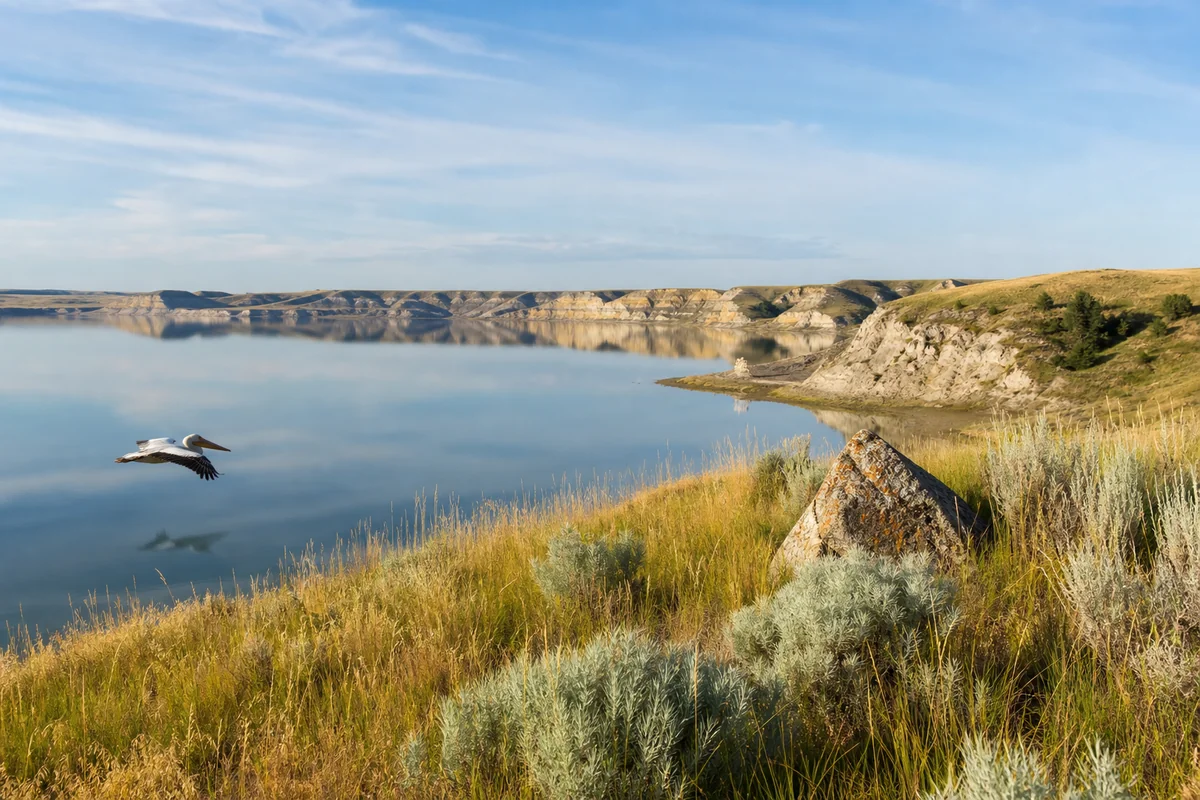
Standing at the edge of the Fort Peck Reservoir on a quiet Tuesday morning in early September, with nothing but a pelican gliding low over glassy water and the faintest smell of sage on the wind, it hit me — this is what Montana looked like before the crowds found it.
McCone County is one of those rare corners of the American West that still feels genuinely undiscovered, and if you’re the kind of traveler who gets more excited by space and silence than by Instagram queues, it belongs on your radar.
As part of our ongoing coverage of all 56 Montana Counties, this guide goes deep on what McCone County actually offers a real visitor.
- McCone County sits in northeastern Montana, centered on the small town of Circle — population under 700.
- The county borders the massive Fort Peck Reservoir, offering exceptional walleye and northern pike fishing.
- Wildlife watching here is world-class — pronghorn, mule deer, prairie dogs, and migratory birds are common sightings.
- This is remote, rugged country — fuel up, carry water, and don’t count on cell service.
- Best visited May through September; spring and fall offer outstanding birding and cooler temperatures.
- Accommodation is limited — plan ahead and consider camping at Fort Peck for the full experience.
Liked this article?
Add Roaming Montana as a preferred source so you see more of our articles and guides on Google.
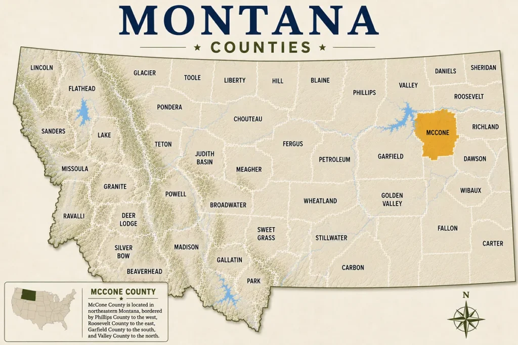
Where Is McCone County and Why Should You Care?
McCone County occupies a chunk of northeastern Montana that most road-trippers skip entirely in their rush between Billings and the Dakotas. The county seat, Circle, sits roughly 95 miles northwest of Glendive and about 185 miles northeast of Billings — distances that tell you something important about this place.
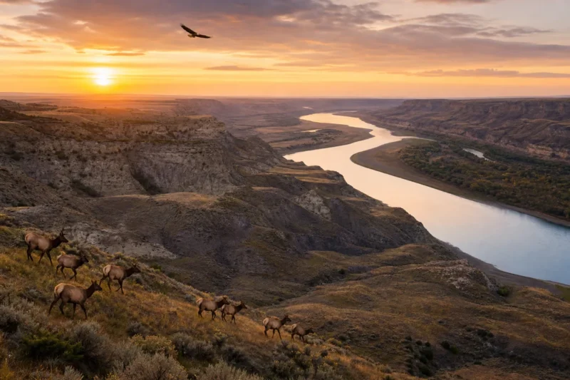
What most guides skip is just how dramatically the landscape shifts as you cross into McCone County from the west. The rolling wheat fields of central Montana give way to something rawer: eroded badland formations, wide coulees, and the enormous blue expanse of Fort Peck Reservoir cutting along the county’s southern edge.
The county covers roughly 2,643 square miles and holds a population of around 1,700 people — which works out to fewer than one person per square mile. For context, that’s genuinely frontier-level sparse, even by Montana standards.
A Brief History of McCone County
The county was created in 1919, carved out of Dawson and Garfield counties during the homestead boom years. It was named after George McCone, a member of the Montana State Board of Equalization.
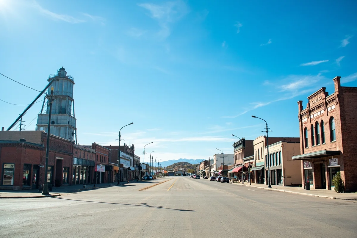
The homesteading era left visible marks on the landscape — abandoned farmsteads and old grain elevators dot the back roads, silent reminders of the families who tried and, in many cases, couldn’t make dryland farming work on the northern plains.
Circle itself grew as a cattle and sheep ranching hub, and that identity still holds. Drive through town on any given morning and you’ll see more ranch pickups than tourist rentals. That’s not a criticism — it’s what makes the place feel real.
Getting to McCone County
Montana Highway 13 runs north-south through Circle and connects to US Highway 2 in the north (near Wolf Point) and US Highway 12 to the south. The drive from Billings takes roughly two and a half to three hours under normal conditions.
One thing that caught me off guard on my first visit: Google Maps shows the route as simple, but some county roads become impassable after rain. If you’re planning to access Fort Peck shoreline access points or remote wildlife management areas, check road conditions with the McCone County road department before you go.
The nearest commercial airports are in Glendive (Dawson Community Airport, with limited service) and Billings Logan International. Most visitors drive, and that’s fine — the approach itself, through open prairie and badlands, is part of the experience.
| Route From | Approximate Drive Time | Road Condition Notes |
|---|---|---|
| Billings, MT | ~2.5–3 hours | Mostly paved highway, reliable year-round |
| Glendive, MT | ~1.5 hours | US-16 then MT-13, paved and straightforward |
| Great Falls, MT | ~3.5–4 hours | US-87 east then MT-200, some remote stretches |
| Missoula, MT | ~5.5–6 hours | Long haul across central Montana — break the trip up |
| Wolf Point, MT | ~1 hour | US-2 south to MT-13, easy drive |
Top Things to Do in McCone County
Fishing Fort Peck Reservoir
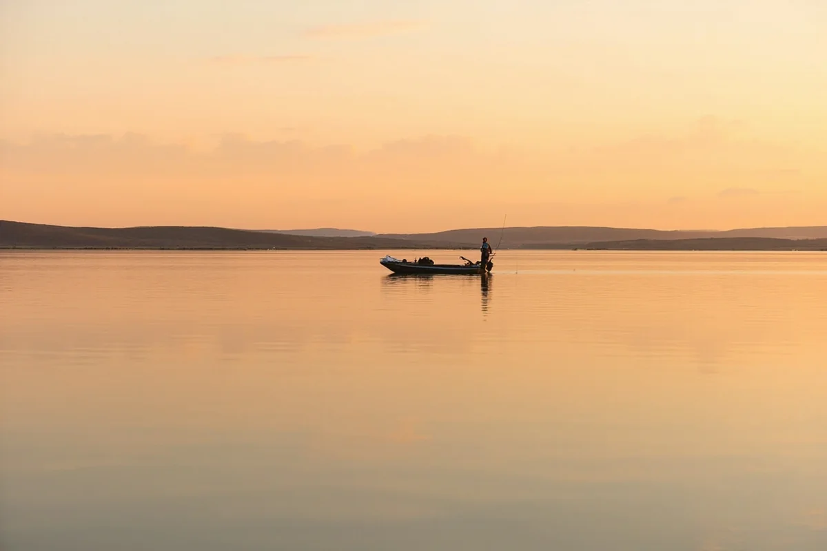
The southern edge of Fort Peck Reservoir — one of the largest reservoirs in the United States — runs along McCone County’s border, and the fishing here is genuinely exceptional. Walleye are the headline act, but northern pike, sauger, smallmouth bass, and paddlefish (in the Missouri River arm) round out a list that keeps serious anglers coming back year after year.
According to Montana Fish, Wildlife & Parks, Fort Peck regularly ranks among the top walleye fisheries in the state. During my visit in early September, a local guide mentioned that the walleye bite in McCone County’s section of the reservoir — particularly around the Flat Lake and Seven Sisters areas — tends to be strongest in late May through June and again in September after summer heat subsides.
Licenses are required and available online through Montana Fish, Wildlife & Parks. Expect to pay roughly $15–$25 for a non-resident fishing license depending on duration, at the time of writing. Guided fishing trips out of nearby communities typically run anywhere from $200–$400 per person for a full day, though rates vary by season and operator.
Wildlife Watching on the Prairie
McCone County is one of those places where the wildlife watching sneaks up on you. Pronghorn — North America’s fastest land animal — are practically roadside companions on the county’s back roads. Mule deer are common around dawn and dusk, and coyotes are almost guaranteed if you spend a night camping.
What genuinely surprised me during my last visit was a prairie dog town just off a gravel road south of Circle. It wasn’t marked on any map I had, and I nearly drove past it. Hundreds of black-tailed prairie dogs, burrowing owls perched on mounds, and a ferruginous hawk circling overhead — the whole scene felt like a private wildlife documentary.
Birding is seriously underrated here. The county sits along migratory flyways, and spring and fall bring exceptional diversity. Sandhill cranes, white pelicans, sharp-tailed grouse, and the occasional whooping crane (yes, really) have all been documented in the area by local birders.
Exploring the Badlands and Fossil Country
The badlands formations in and around McCone County don’t get the same press as those in Garfield County or Fallon County, but they’re no less dramatic. Eroded gullies, hoodoos, and layered clay hillsides in shades of rust, grey, and cream make for striking photography, especially in the late afternoon light.
The region sits within fossil-rich formations, and while casual fossil collecting on private land requires landowner permission and federal land rules apply strictly on BLM parcels, the geology alone is worth exploring. Stop by the McCone County Museum in Circle for context on the paleontological history of the area.
McCone County Museum
The museum in Circle is a genuine community treasure — the kind of small-town institution that punches well above its weight. It houses a solid collection of homesteader artifacts, ranching equipment, Native American history materials, and natural history displays including fossil specimens found locally.
Hours can be seasonal and irregular, so calling ahead before you drive to Circle specifically for the museum is smart. Admission is typically a modest suggested donation. What I appreciated most was the personal way the exhibits are presented — this isn’t a sterile institution, it’s a place where local families have donated objects with stories attached.
Scenic Driving and Photography
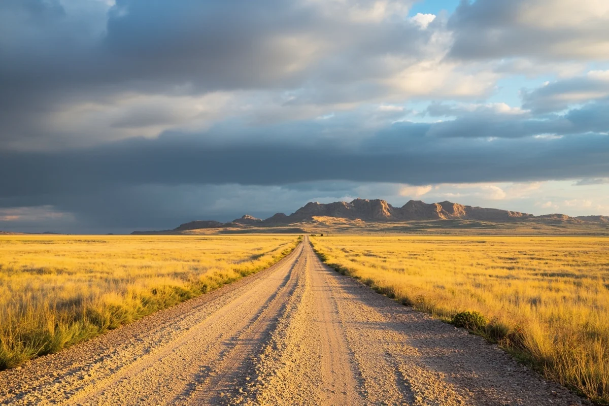
There’s no official scenic byway through McCone County, which is actually part of the appeal — the drives here feel like discoveries rather than packaged experiences. Montana Highway 13 between Circle and Brockway offers open grassland and badland views with almost no traffic.
The road south toward the Fort Peck Reservoir access areas winds through increasingly dramatic terrain. One morning on that drive, a golden eagle sat on a fence post close enough to the road that I could see its talons. Those moments don’t happen in places with tour buses.
Circle, Montana — The County Seat
Circle is a small ranch town with a genuine, unpretentious character. The name comes from the old Circle C Ranch brand that was prominent in the region’s early cattle days — a piece of local history that feels entirely appropriate for a place that still runs on ranching culture.
The town has the basics a traveler needs: a gas station, a couple of eating spots, and enough friendliness from locals to make you feel like a welcome visitor rather than an intrusion. Expect very limited restaurant variety — this is not a culinary destination — but the portions are honest and the coffee is always hot.
Brockway, another small community in the county, has a functioning post office and some services, but Circle is the hub. If you’re passing through on a Sunday, double-check that anything you need is actually open.
Where to Stay in McCone County
Accommodation options are limited, and that’s worth knowing before you finalize plans. Circle has a small motel with basic rooms — adequate, clean, and nothing fancy. Expect rates in the range of $80–$120 per night for a standard room, though availability can be tight during hunting season in October and November.
Camping is the better option for many visitors, particularly those coming to fish or watch wildlife. Fort Peck Lake’s surrounding campgrounds — managed partly by the Army Corps of Engineers and partly by Montana Fish, Wildlife & Parks — offer sites with varying levels of hookups. Some visitors base themselves at Fort Peck town (just across the county line in Valley County) and day-trip into McCone County, which works well.
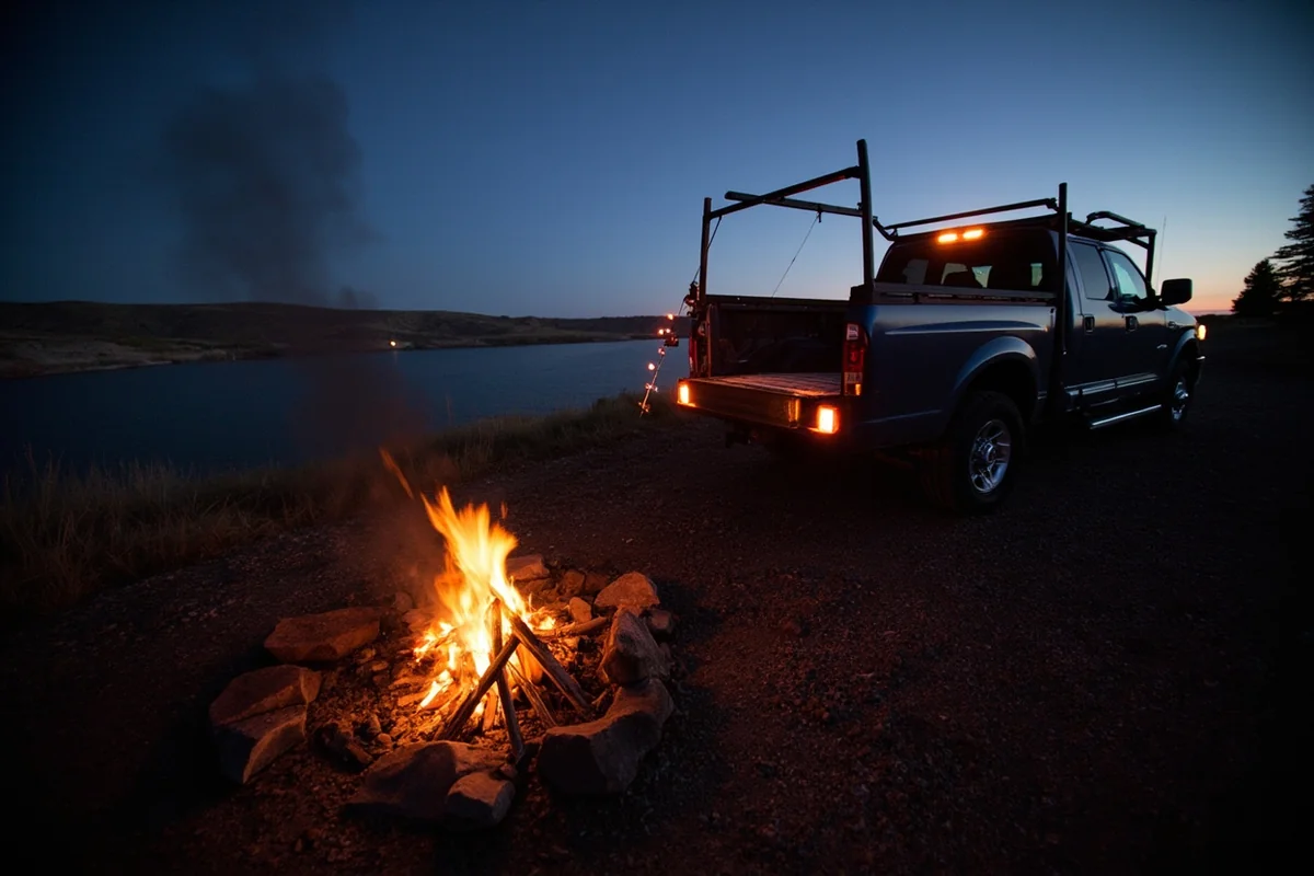
For travelers willing to rough it, dispersed camping on BLM land in the county is an option with no fees, but you need to know what you’re doing. Bring more water than you think you need, a paper map, and a plan if your vehicle gets stuck on a gumbo clay road after rain. Trust me on the clay roads — that’s a personal lesson learned the muddy way.
Suggested Itinerary
Day 1: Arriving and Getting Oriented
Drive into Circle and check in wherever you’re staying. If you’re arriving from Billings or Glendive, plan to arrive by mid-afternoon so you still have light to explore.
Stop at the McCone County Museum before it closes — it’ll give you context for everything else you see. Then drive south on MT-13 toward the Fort Peck Reservoir access area, even just to scout locations for the next morning’s fishing or birding. The evening light on the badlands along this stretch is excellent for photography.
Have dinner in Circle. Options are limited but the locals are friendly, and conversations at the counter of a small-town diner tend to yield the best fishing tips and road advice money can’t buy.
Day 2: Fishing, Wildlife, and the Reservoir
Get up early. Seriously — dawn at Fort Peck Reservoir is something you need to experience once. If you’ve hired a guide, you’ll be on the water before the sun is fully up.
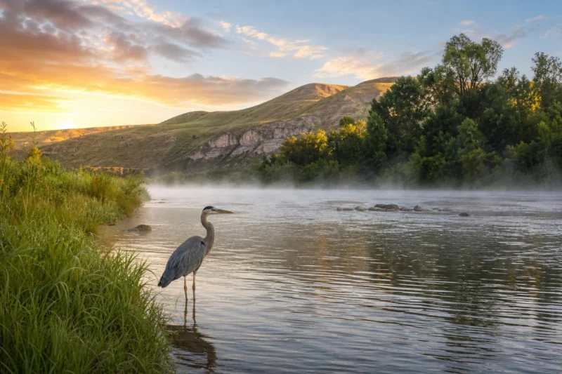
Spend the morning fishing or exploring the shoreline on foot. The bird activity at dawn is worth the early alarm: white pelicans, great blue herons, and various duck species are usually active before the wind picks up.
After lunch back in Circle (or a packed lunch, which is smarter), drive the back roads east of town looking for prairie dog towns and pronghorn. Late afternoon is the sweet spot for wildlife movement. If you’re still energized, the drive toward Brockway offers a different landscape perspective and very little traffic.
Day 3: Deep Prairie and Heading Out
Use the morning to explore any BLM access areas or badland formations you identified on arrival. Early light on the eroded clay formations is dramatically different from midday — the colors are richer and the shadows more defined.
Fuel up before you leave Circle (don’t assume the next town will have gas), and take the slow road out rather than rushing back to the interstate. The drive itself is part of what makes McCone County worthwhile.
Best Time to Visit McCone County
Spring (May–June) is outstanding for wildflowers, bird migration, and moderate temperatures before summer heat arrives. This is arguably the most underrated window to visit.
Summer (July–August) brings heat — daytime temperatures regularly push into the high 80s and occasionally top 100°F. Fishing can slow during the hottest weeks as water temperatures rise, but evening wildlife activity compensates. The sunsets in July are extraordinary.
Fall (September–October) is the local favorite for good reason. Temperatures ease, migratory birds return, fishing picks back up, and the prairie grasses turn gold. Hunting season brings the biggest influx of visitors the county sees all year — primarily upland bird hunters and deer hunters.
Winter is genuinely harsh and most services contract significantly. Unless you’re a serious cold-weather enthusiast or ice fisherman, plan your visit between May and October.
What Most Visitors Get Wrong About McCone County
Underestimating the Distances
The county looks manageable on a map until you realize that “nearby” access points on Fort Peck Reservoir can be 25 miles of unpaved road apart. Build buffer time into every day and never run your fuel tank below half.
Relying on Cell Service
Coverage across McCone County is genuinely patchy — there are stretches of the county where no carrier has signal. Download offline maps before you arrive (Google Maps and Maps.me both allow this), carry a printed state map as backup, and let someone know your rough itinerary.
Showing Up Without a Fishing License
The nearest place to buy a Montana fishing license in person may involve a significant drive. Buy yours online through Montana Fish, Wildlife & Parks before you arrive. It takes five minutes and saves a lot of frustration.
Assuming the Museum Is Always Open
The McCone County Museum operates on seasonal and sometimes volunteer-dependent hours. A quick phone call before arriving in Circle specifically for the museum will save disappointment.
Not Talking to Locals
This is the mistake that costs visitors the most in terms of experience. The ranchers, the guys at the gas station, the woman working the motel front desk — these are people who know exactly where the walleye are biting, which roads are passable after rain, and where the prairie dog town is that isn’t on any map. Ask questions. Listen. That’s how McCone County reveals itself.
McCone County Compared to Neighboring Counties
Travelers planning a broader northeastern Montana trip often combine McCone County with visits to neighboring areas. Dawson County to the southeast offers Glendive as a more developed base with Makoshika State Park’s dramatic badlands. Garfield County to the southwest goes even more remote and is worth the detour for serious solitude seekers.
For those interested in how population trends are shaping eastern Montana communities, the contrast with Montana’s fastest-growing cities and counties is striking — McCone County is moving in the opposite direction from Gallatin or Flathead, and that’s precisely its appeal.
Daniels County further north offers a similar frontier character if you’re doing a multi-county sweep of the Hi-Line region.
Practical Information for Visitors
| Category | Details |
|---|---|
| County Seat | Circle, MT |
| County Population | Approximately 1,700 |
| Area | ~2,643 square miles |
| Nearest Large City | Billings (~185 miles SW) |
| Cell Coverage | Patchy — download offline maps |
| Gas Stations | Circle, Brockway — fuel up before heading out |
| Hospital / Medical | McCone County Health Center in Circle; nearest major hospital in Glendive |
| Fishing License | Required — buy online at Montana FWP before arrival |
| Best Seasons | May–June and September–October |
| Camping | Fort Peck campgrounds, dispersed BLM camping |
Final Thoughts
McCone County won’t suit every traveler, and that’s part of what makes it special. If your idea of a great trip involves crowds, curated experiences, and reliable Wi-Fi, this is not your place. But if you’re after something more honest — space without performance, wildlife without a viewing platform, and a landscape that still carries genuine wildness — McCone County delivers in a way that’s increasingly hard to find anywhere in the American West.
What surprised me most across multiple visits was how the county grows on you. The first day can feel almost too quiet, almost too empty. By the third day, the rhythm of it — the big sky, the antelope on the horizon, the pelicans on the reservoir — starts to feel like the right pace for everything.
Come prepared, come curious, and come ready to be slightly uncomfortable in the best possible way. McCone County asks something of its visitors, and what it gives back is entirely worth the effort.
How We Researched This Guide
This guide is based on multiple visits to McCone County across different seasons, including spring and early fall trips that allowed direct comparison of wildlife activity, road conditions, and fishing patterns.
We explored the Fort Peck Reservoir shoreline, drove the major county roads, visited the McCone County Museum in Circle, and spoke with local ranchers, anglers, and business owners to verify current conditions and access details.
Fishing regulations and license information were verified directly with Montana Fish, Wildlife & Parks (fwp.mt.gov), and land access information was cross-checked with the Bureau of Land Management’s Montana/Dakotas state office.
Frequently Asked Questions
What is there to do in McCone County, Montana for outdoor enthusiasts?
McCone County is a paradise for outdoor lovers, offering world-class fishing and hunting along the Milk River and Fort Peck Lake, which is one of the largest reservoirs in the US. You can also explore the Charles M. Russell National Wildlife Refuge, which spans over a million acres and is home to elk, pronghorn, and migratory birds. Hiking, boating, and wildlife photography are among the most popular activities for visitors making the trip out here.
When is the best time to visit McCone County, Montana?
The best time to visit McCone County is late spring through early fall, roughly May through September, when roads are accessible and wildlife is most active. Summer temperatures typically range from the mid-70s to low 90s°F, making it ideal for fishing, boating on Fort Peck Lake, and exploring the CMR Wildlife Refuge. If you’re an elk or deer hunter, fall is absolutely the time to plan your trip, with peak hunting season running October through November.
How far is McCone County, Montana from major US cities?
McCone County sits in northeastern Montana, with its county seat of Circle located about 230 miles northeast of Billings and roughly 330 miles from Missoula. If you’re driving from out of state, Great Falls is approximately 200 miles to the west and makes a convenient stopping point. Most visitors fly into Billings Logan International Airport and then drive northeast on US-200, which cuts right through the county.
What should I pack for a trip to McCone County, Montana?
Pack in layers no matter what season you visit, because northeastern Montana weather can swing dramatically within a single day. Sturdy hiking boots, sunscreen, and insect repellent are must-haves for summer visits, while hunters and fall travelers should bring blaze orange gear and cold-weather layers. If you plan to fish Fort Peck Lake or the Milk River, make sure you have a valid Montana fishing license, which you can purchase online before you arrive for around $15-$50 depending on your residency status.
Are there places to stay in McCone County, Montana, or should I book accommodations nearby?
Accommodation options in McCone County are limited but charming — the small town of Circle has a handful of locally owned motels and a few vacation rental options that give you an authentic eastern Montana experience. If you prefer more amenities, Glasgow (about 60 miles north) and Miles City (about 90 miles south) offer additional hotel chains and dining options. I’d strongly recommend booking as far in advance as possible, especially during hunting season in October and November when rooms fill up fast.
Is McCone County, Montana worth visiting if I’ve never been to rural Montana before?
Absolutely — McCone County offers some of the most unspoiled, crowd-free scenery in the entire state, which is a refreshing contrast to the more touristy areas of Glacier or Yellowstone. The wide-open prairie, badlands terrain, and access to Fort Peck Lake give first-time visitors a genuine sense of just how vast and wild Montana really is. If you appreciate solitude, big skies, and the kind of fishing or hunting that doesn’t require fighting for space, this corner of Montana is genuinely worth the drive.
What are the costs involved in a McCone County, Montana road trip?
A trip to McCone County can be surprisingly affordable compared to other Montana destinations — expect to spend roughly $80-$130 per night on lodging in or near Circle, and daily meals at local diners typically run $15-$30 per person. Gas is a real consideration since services are sparse across eastern Montana, so budget accordingly and never pass a gas station without topping off your tank. Fishing licenses run $15-$111 depending on whether you’re a Montana resident or out-of-state visitor, and hunting licenses vary by species but are available through Montana Fish, Wildlife & Parks.