Most travelers on I-94 see the Makoshika State Park exit sign and keep driving.
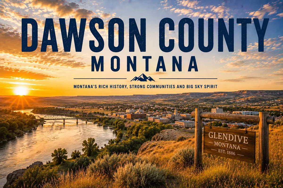
The ones who turn off find Montana’s largest state park tucked directly behind the town of Glendive — 11,538 acres of badlands, dinosaur fossils, and some of the most visually arresting landscape in the American West sitting 2.5 miles from a Subway and a Best Western.
The contrast is part of what makes it work.
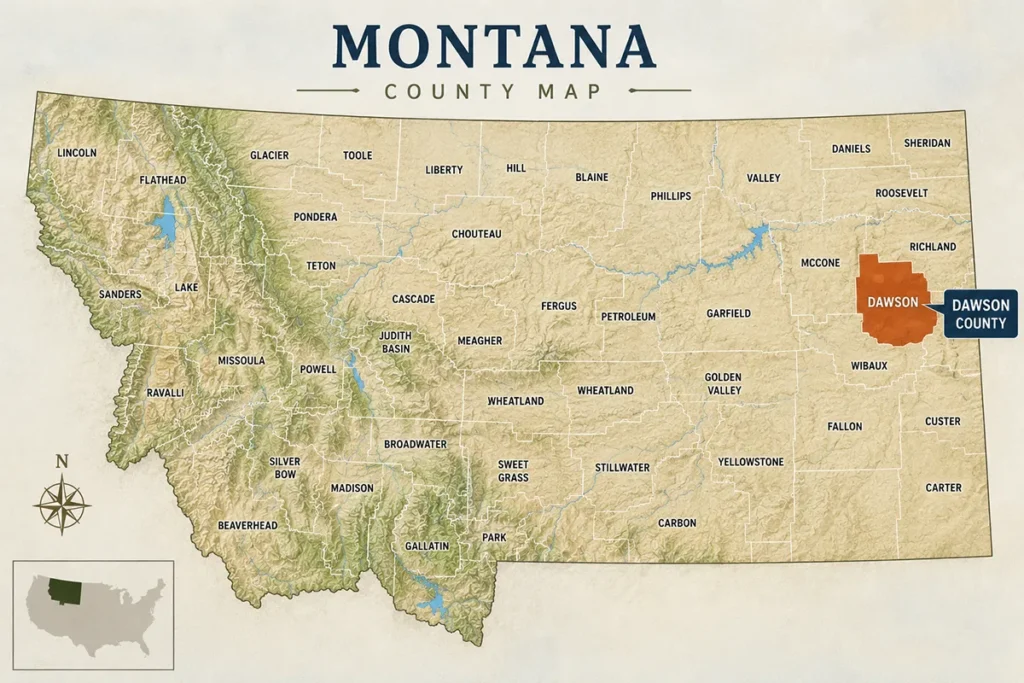
- Dawson County covers 2,373 square miles in eastern Montana along the Yellowstone River, at the junction of I-94 and the North Dakota state line corridor
- The county seat is Glendive (~5,000) — a practical I-94 city with a genuine paleontology heritage
- Makoshika State Park is Montana’s largest state park at 11,538 acres — one of the world’s premier Hell Creek Formation fossil sites, with 10+ dinosaur species discovered including T. rex and Triceratops
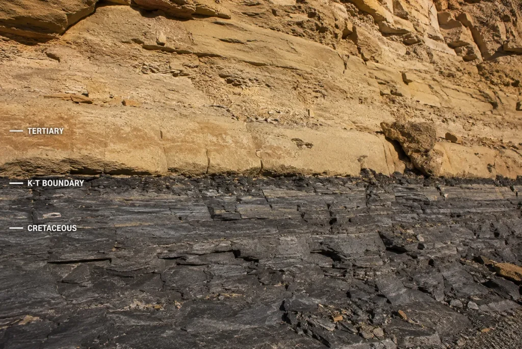
- The park’s K-T boundary line — the geological marker of the mass extinction event 66 million years ago — is visibly exposed in the badlands walls and is one of the most accessible places in North America to see it in person
- The Diane Gabriel Trail has an actual hadrosaur vertebra imprint fossilized in the exposed rock — a literal on-trail fossil
- The Buzzard Day festival (second Saturday in June) is one of Montana’s most entertaining state park events: races, disc golf, food, and turkey vultures returning to roost
- The Frontier Gateway Museum is Dawson County’s official history museum, covering Lewis & Clark, Native American heritage, and the Hell Creek Formation — distinct from the Glendive Dinosaur Museum (see the important note in that section)
- Hollecker Lake north of Glendive is an underrated swimming, paddleboarding, and stargazing spot
- The Short Pine OHV Area offers 2,800 acres of off-road terrain 7 miles south of Glendive
- ⚠️ RVs and campers over 20 feet are restricted to the first 2 miles of Makoshika — cannot go beyond the switchbacks
Liked this article?
Add Roaming Montana as a preferred source so you see more of our articles and guides on Google.
Dawson County at a Glance
Dawson County was established in 1865 as one of Montana Territory’s original counties.
It’s named for Andrew Dawson — a Scottish-born fur trader who spent decades at Fort Union and Fort Benton and was one of the most knowledgeable figures in early Montana’s trading economy.
The county covers 2,373 square miles of eastern Montana. The Yellowstone River flows east-west through the northern portion before crossing into North Dakota. The Redwater River drains the county from the north.
The terrain is eastern Montana badlands, coulees, and rangeland — flat on the agricultural plateaus, dramatically eroded in the river drainage zones.
Population is around 8,830. Glendive is the only city of any size, anchored by I-94 and the I-94/US-12 interchange.
The county’s geological claim to fame is significant: the badlands around Glendive sit directly in the Hell Creek Formation — one of the most productive dinosaur fossil beds in the world. Institutions from across North America run active dig expeditions here every summer.
For broader Montana context, see the complete guide to all 56 Montana counties.
Makoshika State Park
Makoshika is pronounced “ma-KO-shi-ka.”
The name comes from a Lakota phrase — Mako sica — meaning “bad land” or “bad earth.” The name fits. The badlands here are not hospitable terrain. But they’re extraordinary.
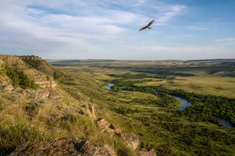
Montana’s largest state park encompasses 11,538 acres of eroded sandstone formations: hoodoos, caprocks, natural bridges, and coulees carved by millions of years of water and wind cutting through the Hell Creek Formation.
The park entrance is 1/4 mile southeast of downtown Glendive — follow the signs 2.5 miles through town from I-94. You’ll know you’re there when the city streets end and the badlands begin, abruptly, like a geological curtain drop.
The paleontology: Over ten dinosaur species have been discovered in the park. Notable finds include a complete Triceratops horridus skull (unearthed 1991, weighing 600 pounds, measuring 5.5 feet) displayed in the visitor center, plus remains of Tyrannosaurus rex and Edmontosaurus hadrosaurs.
In 1997, an expedition led by Jack Horner and Bob Harmon found what was then the largest and most complete Thescelosaurus skeleton ever discovered.
Scientific expeditions from the Museum of the Rockies, Burpee Museum, University of Wisconsin, Notre Dame, and other institutions return to Makoshika every summer.
You cannot dig or remove fossils. No metal detectors are permitted. The park takes enforcement seriously.
The visitor center at the park entrance has the Triceratops skull, fossil displays, geological exhibits, and staff who can orient you to current trail conditions and ongoing research.
Day use: $8 for non-resident vehicles. Montana residents who pay the $9 annual state parks fee with vehicle registration have no day-use fee.
Camping: 28 sites at $4–$34 per night depending on season and amenities. [Reserve at stateparks.mt.gov]
[Verify current hours and fees at fwp.mt.gov/makoshika]
The Hell Creek Formation and the K-T Boundary
The badlands of Makoshika are part of the Hell Creek Formation — a geological layer laid down in the final years of the Cretaceous period, roughly 66–68 million years ago.
The Hell Creek Formation is globally famous. It’s one of the few places on Earth where you can study the final chapter of the Age of Dinosaurs in rich fossil detail.
What makes Makoshika especially significant is the K-T boundary line — visible in the exposed rock walls of the badlands.
The K-T boundary (now formally called the K-Pg boundary) is the geological marker of the mass extinction event 66 million years ago, when an asteroid impact wiped out roughly three-quarters of Earth’s species including all non-avian dinosaurs.
Below the line: Hell Creek Formation sediments rich in dinosaur fossils.
Above the line: Paleocene sediments. Dinosaurs absent. Mammals proliferating.
You can stand in Makoshika State Park and see this geological dividing line — the literal boundary between the world before and after the mass extinction — exposed in the badlands walls.
That’s not a metaphor. It’s a visible stripe in the rock.
The visitor center staff can point you to the best viewing locations for the K-T boundary on your visit.
Makoshika’s Trails and Activities
The park has 11 designated trails ranging from short nature walks to longer backcountry routes.
Diane Gabriel Trail is the park’s signature hiking trail. At the top, fossilized hadrosaur vertebra impressions are preserved in the exposed rock surface — an actual on-trail fossil you can examine up close without going near an active dig site. The trail received a new pedestrian bridge recently, improving access to this section.
Cap Rock Nature Trail is the most popular short hike — accessible, visually rewarding, and a good first walk for families. The caprock formations along the route give the trail its name and character.
Caprocks Trail provides an up-close view of Makoshika’s most striking badland formations.
Paramount Trail runs from the visitor center and connects to the Diane Gabriel Trail — a longer route for full-park exploration.
Disc golf: Two courses. Makoshika Buccaneer Flats (9 holes) near the lower group use shelter is ranked the #1 disc golf course in Montana by UDisc users. Makoshika Ponderosa Pines starts near the Cap Rock Trail trailhead above the switchbacks — more challenging terrain.
Archery range: Two courses, 14 shooting stations each, at varying distances and difficulty. Free to use. Open May 1 through weather permits.
Wildlife: Turkey vultures are the park’s most visible wildlife — the Buzzard Day festival (see below) marks their annual return. Prairie falcons and golden eagles nest in the park. Mountain bluebirds, bald eagles, and mule deer are also present. Mountain lions inhabit the park and are occasionally tracked, though sightings are rare.
RV note: Vehicles over 20 feet are restricted to the first 2 miles of the park road. The switchbacks above that point are not navigable for longer rigs. Plan accordingly — tent campers and shorter vehicles have full park access.
Buzzard Day
The second Saturday of June brings Buzzard Day to Makoshika — one of the most specific and enjoyable annual events at any Montana state park.
The festival marks the return of the turkey vultures that nest in the park’s badlands formations each spring. The birds are back by June, and Buzzard Day celebrates their arrival with:
- A 10K and 5K race through the badlands
- A family fun run
- A disc golf tournament
- Food vendors
- Kids’ activities including a jumping house
- Guided hikes
- Evening campfire programs
It’s a genuinely fun event with a specific, local character — not a generic outdoor festival but a park celebration that only makes sense in Makoshika’s particular context.
The outdoor amphitheater also hosts events throughout summer: Montana Shakespeare in the Park, Friday night campfire programs, and youth programs. [Verify current Buzzard Day dates and schedules at fwp.mt.gov/makoshika]
Frontier Gateway Museum
The Frontier Gateway Museum is Dawson County’s official history museum and one of the most complete county museums in eastern Montana.
It’s located in downtown Glendive, next door to the Glendive Dinosaur Museum (see the important note below).
The collection covers the full arc of Dawson County and Yellowstone River valley history:
- Lewis & Clark on the Yellowstone — Clark camped near present-day Glendive on the return journey in 1806 and described the badlands in his journal as “birnt hills”
- Native American history and artifacts from the region
- Fur trade and frontier settlement
- The homestead era and agricultural development
- Paleontology exhibits including “Margie” — a full-size skeleton cast of a Struthiomimus (ostrich-like dinosaur) found near Glendive in the early 1990s
- Additional fossil specimens: Stegoceras, Triceratops, Thescelosaurus, hadrosaurs, aquatic and plant fossils
The Frontier Gateway Museum is rated among the best county museums in Montana by multiple travel sources. It’s an essential complement to the Makoshika visit — the park shows you the landscape; the museum explains the full human and natural history context.
[Verify current hours at frontiergatewaymuseum.org]
A Note on the Glendive Dinosaur Museum
The Glendive Dinosaur and Fossil Museum is adjacent to the Frontier Gateway Museum downtown.
It displays an impressive collection of dinosaur fossils and casts. However, travelers should know that this museum presents paleontology through a Young Earth Creationist framework — it interprets dinosaur fossils as evidence consistent with a 6,000-year-old Earth and a biblical timeline.
This is not mainstream scientific paleontology.
If you want conventional scientific interpretation of the Hell Creek Formation fossils, visit the Frontier Gateway Museum and the Makoshika State Park visitor center instead.
If you’re curious about Young Earth Creationist interpretations of paleontology, the Glendive Dinosaur Museum offers that perspective clearly and extensively.
Neither choice is wrong — but knowing what each institution represents before you walk in makes for a more informed visit.
Glendive: The County Seat
Glendive (~5,000) sits where I-94 crosses the Yellowstone River, at one of eastern Montana’s most significant highway junctions.
It’s a practical I-94 city — good motel inventory, gas, food, and the logistics needed for exploring a large surrounding county. But it has more cultural texture than a typical interstate stop.
The Glendive Dinosaur Trail is a self-guided scavenger hunt through the city — find all the dinosaur statues and installations scattered through downtown and along the riverfront. Pick up a map at the Chamber of Commerce at 808 N. Merrill Ave.
The Bell Street Bridge is a historic structure that illuminates at night — a genuinely attractive downtown focal point on the Yellowstone River.
The mural and bronze sculpture trail through downtown highlights local history and artists.
Hell Creek Music — an independent music store in Glendive — has been recognized as one of the top music stores in the nation. Worth a stop for musicians and music-curious travelers.
For the full Glendive guide, see Glendive, Montana.
The Yellowstone River and Hollecker Lake
The Yellowstone River flows through the northern part of Dawson County before crossing into North Dakota.
Fishing near Glendive: catfish, walleye, sauger, and seasonal paddlefish. The Yellowstone near Glendive is accessible at several fishing access sites. Check current paddlefish season dates at fwp.mt.gov before targeting them — it’s a regulated fishery with specific season windows.
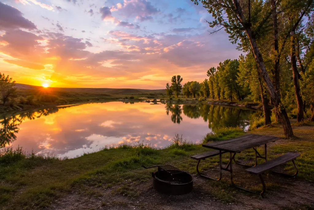
Hollecker Lake is one of Glendive’s best-kept local secrets. Located just 1 mile north of town on Highway 16 (exit 213 off I-94), it’s a small lake with a beach and picnic area that gets very little attention from out-of-state visitors.
Activities at Hollecker: swimming, paddleboarding, kayaking, canoeing, fishing, and floating. The sunsets over the lake are excellent. On clear nights it’s a reliable stargazing spot — and the Northern Lights are occasionally visible from here when the aurora is active. See Montana night sky for broader stargazing context.
Short Pine OHV Area
About 7 miles south of Glendive on Road 335 (Marsh Road), the Short Pine OHV Area provides 2,800 acres of off-road terrain managed by the BLM.
The area has trails for motorcycles, ATVs, four-wheelers, and 4WD trucks and SUVs. Terrain ranges from easy cruising tracks to steep technical challenges.
All vehicles must be legally registered — either with a license plate or an off-road sticker — and must have an unmodified spark arrestor.
This is a legitimate destination for off-road enthusiasts and not well-known outside the immediate region.
[Verify current access and conditions at the Glendive BLM field office or blm.gov]
Lewis & Clark in Dawson County
William Clark and his party traveled down the Yellowstone River on the return journey in the summer of 1806, passing through what is now Dawson County.
Clark camped near present-day Glendive and recorded the distinctive eroded formations visible from the river — referring to them in his journal as the “birnt hills.”
Those same formations are what is now Makoshika State Park. The view Clark described from the river in 1806 remains largely recognizable from the badlands ridge trails today.
The Frontier Gateway Museum has a dedicated Lewis & Clark exhibit covering the 1806 return journey along the Yellowstone.
What I Wish I Knew Before Visiting Dawson County
Makoshika is bigger than it looks from the entrance. The visitor center and first mile feel like a standard state park. Then the road climbs past the switchbacks and the scale becomes clear. Budget half a day minimum. A full day with hiking is not excessive.
The K-T boundary line is worth asking about specifically. Mention it to visitor center staff and they’ll direct you to the best viewing spots. Don’t assume it’s immediately obvious — the boundary line looks like a color change in the rock and context makes it meaningful.
The Diane Gabriel Trail has an actual in-situ fossil. The hadrosaur vertebra imprint near the trail summit is embedded in the exposed rock surface. It’s marked — you don’t need to hunt for it — but knowing it’s there gives the hike a specific goal beyond scenery.
RVs over 20 feet cannot go past the switchbacks. This is a hard park restriction, not a suggestion. The road geometry doesn’t allow it. Longer rigs need to camp and explore the lower section on foot or by shuttle.
Know which dinosaur museum is which. The Frontier Gateway Museum presents mainstream scientific paleontology. The Glendive Dinosaur Museum presents Young Earth Creationism. Both are downtown; they’re adjacent. Make an informed choice about which one fits your interests.
Hollecker Lake is worth the one-mile detour. Most I-94 travelers stopping in Glendive don’t know it exists. It’s 10 minutes from the interstate and completely different in character from the badlands.
Summer temperatures in the badlands run hot. Makoshika’s eroded terrain reflects and concentrates heat. Early morning and late afternoon hiking is significantly more comfortable than midday. Bring more water than you expect to need.
Practical Info
| County seat | Glendive |
| Area | 2,373 sq mi |
| Population | ~8,830 (2022 est.) |
| Tourism region | Southeast Montana / Missouri River Country |
| Formed | 1865 |
| Main highways | I-94 (east-west), US-12 |
| Makoshika location | 2.5 miles from I-94 via Glendive city streets |
| Makoshika size | 11,538 acres — Montana’s largest state park |
| Day use fee | $8 non-resident vehicles [verify at stateparks.mt.gov] |
| Camping | 28 sites, $4–$34/night [reserve at stateparks.mt.gov] |
| Buzzard Day | Second Saturday in June |
| Frontier Gateway Museum | Downtown Glendive [frontiergatewaymuseum.org] |
| Hollecker Lake | 1 mile north on Hwy 16, Exit 213 off I-94 |
| Short Pine OHV | 7 miles south on Road 335 (Marsh Road) |
| Nearest major airport | Billings Logan International (BIL) — ~220 miles west |
| Local airport | Dawson Community Airport (GDV) — Glendive |
| Cell service | Good in Glendive; variable in Makoshika backcountry |
Getting to Dawson County
From Billings: I-94 east — about 220 miles, roughly 2.5 to 3 hours.
From Miles City: I-94 east — about 70 miles, roughly 1 hour.
From Dickinson, ND: I-94 west — about 100 miles, roughly 1.25 hours.
By air: Dawson Community Airport (GDV) in Glendive has limited scheduled service. Billings Logan International (BIL) is the nearest major airport with full commercial service.
See Montana airports and Montana transportation guide.
Towns in Dawson County
- Glendive — county seat; Makoshika State Park gateway, full I-94 services
- Richey — small community in northern Dawson County; agricultural
- Lindsay — tiny farming community
Adjacent Counties
- Custer County to the west — Miles City, Yellowstone River corridor
- Prairie County to the northwest — Terry
- Wibaux County to the east — Wibaux, North Dakota border
- Fallon County to the south — Baker
- Richland County to the northeast — Sidney, Bakken oil country
Plan Your Dawson County Trip
Dawson County is an excellent I-94 stop that most drivers underestimate.
A strong two-day trip: Day one — arrive Glendive, Hollecker Lake in the afternoon, Frontier Gateway Museum close to closing time, dinner downtown. Day two — full morning at Makoshika (visitor center, Diane Gabriel Trail, Cap Rock trail, disc golf if time), afternoon at the park overlooks before driving on.
Timed to Buzzard Day in June, add the morning race and disc golf tournament before the afternoon Makoshika trails.
For planning help, see Montana trip planning guide and best time to visit Montana.
For Lewis & Clark context, see key historical events in Montana and Montana history. Back to the complete Montana counties guide.