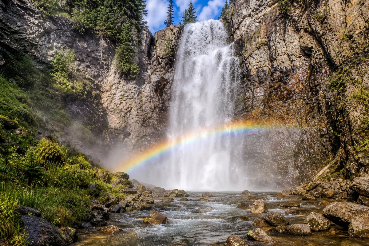
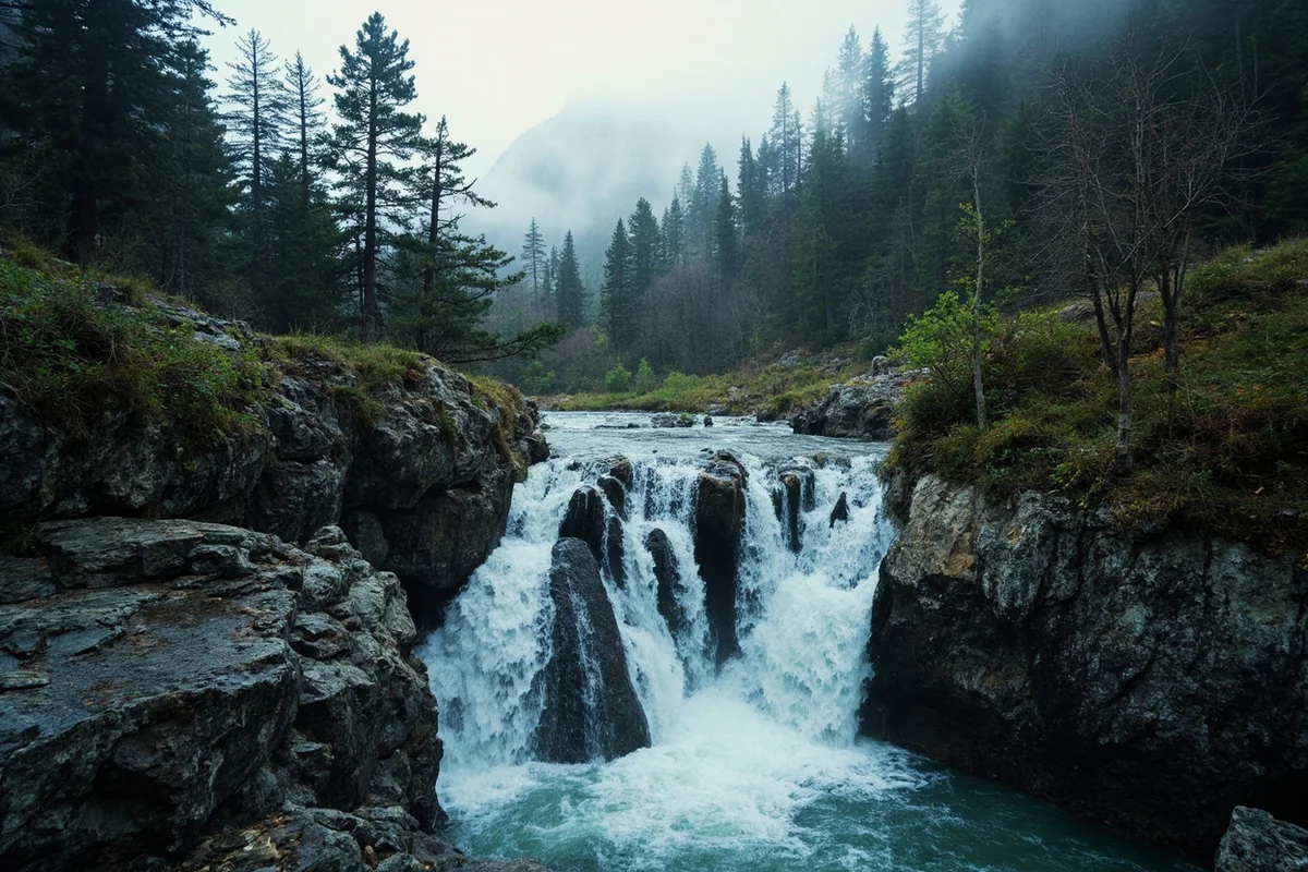
Standing at the base of Mokowanis Cascade last August, with glacial mist cooling my sunburned face and the thunderous roar drowning out every worry I’d carried into the backcountry, I understood why some Montana waterfalls remain secrets only shared among serious hikers.
This 100-foot tiered cascade, tucked deep in Glacier National Park’s remote northeast corner, isn’t on most tourist itineraries—and that’s precisely what makes reaching it feel like discovering something extraordinary.
- Mokowanis Cascade is a remote 100-foot waterfall in Glacier National Park’s Belly River drainage
- Requires a 13+ mile round trip hike from Chief Mountain Customs trailhead
- Best visited July through early September when snow has cleared
- Backcountry camping permit required for overnight trips (highly recommended)
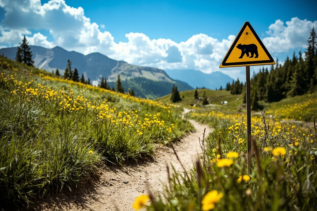
- Expect wildlife encounters—this is prime grizzly bear habitat
- No crowds—I saw only 4 other hikers during my entire 2-day trip
Why Mokowanis Cascade Deserves Your Attention
Let me be honest with you: Mokowanis Cascade isn’t for everyone. If you’re looking for a quick waterfall stop between Going-to-the-Sun Road viewpoints, this isn’t it. But if you’ve been chasing remote wilderness experiences and want a waterfall that feels genuinely earned, keep reading.
Unlike popular destinations like McDonald Falls or Running Eagle Falls, which you can reach in minutes from a parking lot, Mokowanis Cascade demands commitment. The journey takes you through some of Glacier’s most pristine wilderness—the Belly River Valley—where you’re more likely to encounter a moose than another hiker.
During my visit last summer, I passed through meadows so thick with wildflowers that I had to stop every few hundred yards just to take it all in. That’s the trade-off here: effort for exclusivity.
Understanding the Geography
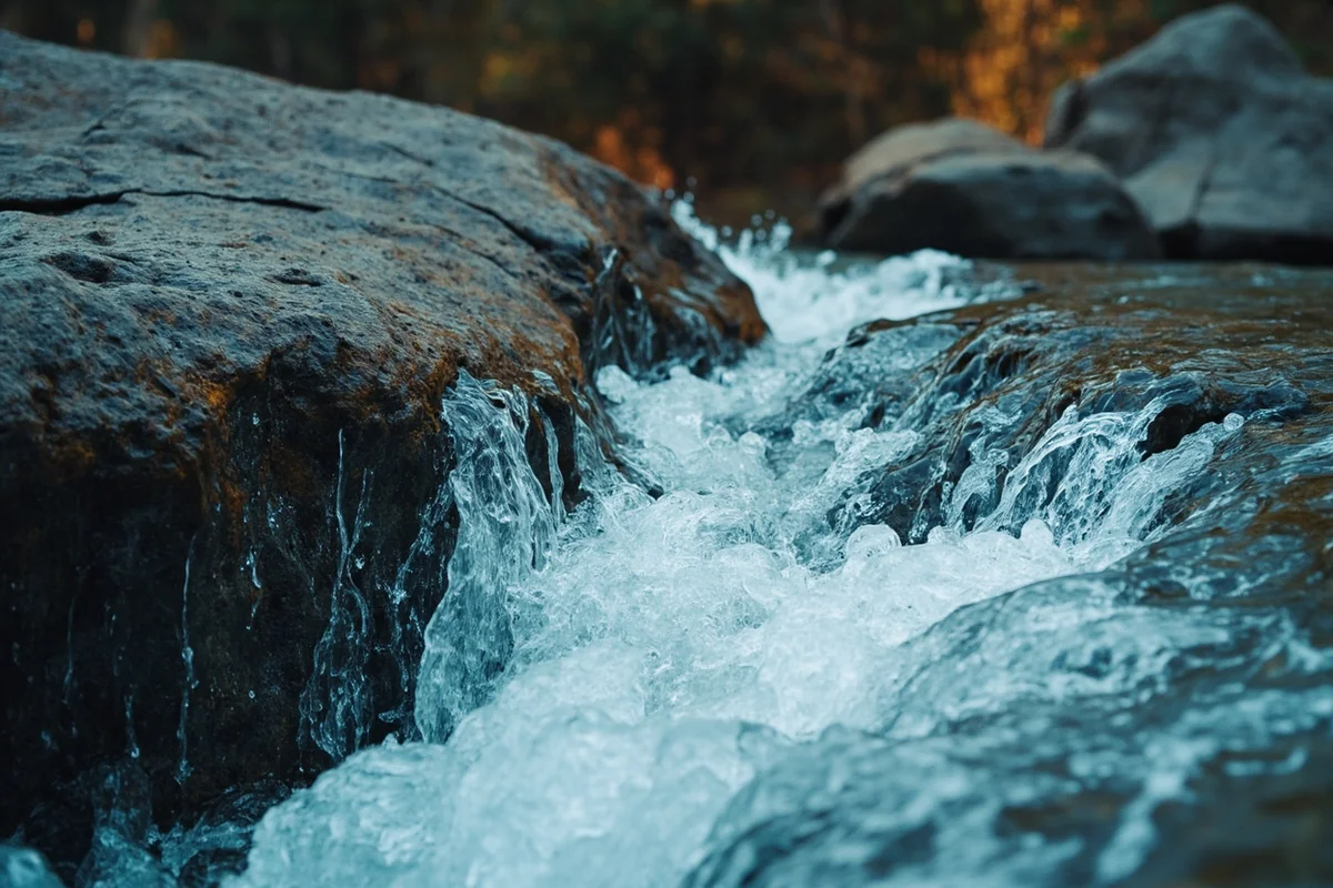
Mokowanis Cascade sits in the Mokowanis Valley, a tributary of the larger Belly River drainage in Glacier National Park’s northeastern section. The waterfall forms where Mokowanis Creek plunges over a series of rock ledges before joining the Belly River system.
The name “Mokowanis” comes from the Blackfoot language, though the exact translation is debated. Some sources suggest it relates to the shape of the valley or the character of the creek. What’s not debated is the waterfall’s dramatic presence in this remote glacial valley.
The cascade itself drops approximately 100 feet in multiple tiers. When I was there in mid-August, the main drop was still carrying significant volume from late-season snowmelt higher in the mountains. The sound reached us nearly a quarter-mile before we could see the falls through the forest.
Getting to the Trailhead
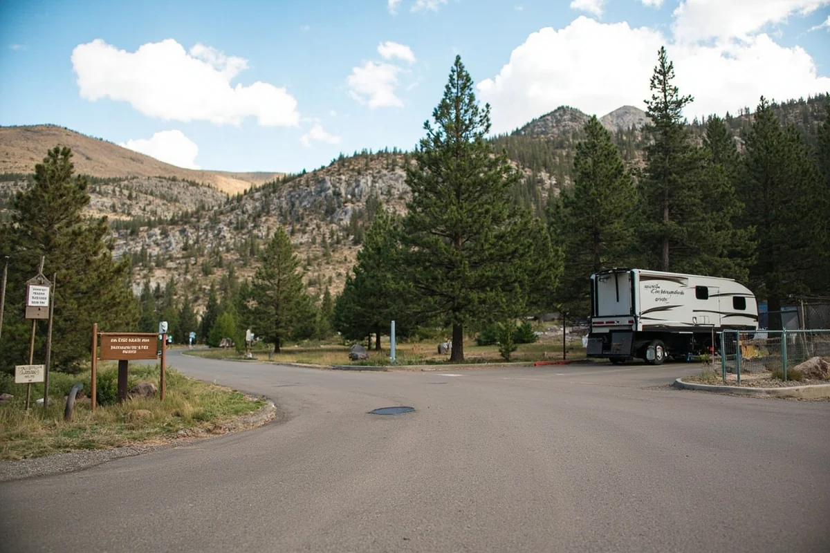
Here’s where logistics get interesting. The primary access point is the Chief Mountain Customs trailhead, located near the Chief Mountain border crossing with Canada. This trailhead puts you on the Belly River Trail, which eventually connects to the Mokowanis Lake Trail.
Driving Directions
From Babb, Montana, drive north on Highway 17 (Chief Mountain Highway) for approximately 9 miles. The trailhead parking area is on your left, just before you reach the Canadian border crossing.
Important note: Chief Mountain Highway is a seasonal road, typically open from late May through mid-September, weather dependent. I recommend calling the park service before making the drive, especially early or late in the season.
From Glacier Park Lodge in East Glacier, expect about a 45-minute drive to the trailhead. From St. Mary, it’s roughly 30 minutes.
Parking Considerations
The Chief Mountain trailhead has a decent-sized parking lot, but during my recent trip, I was surprised to find it only about one-third full on a Saturday morning in August. This area simply doesn’t get the traffic that trailheads on the park’s west side receive.
That said, arrive early anyway. The hike is long, and you’ll want daylight working in your favor.
The Trail: What to Expect Mile by Mile
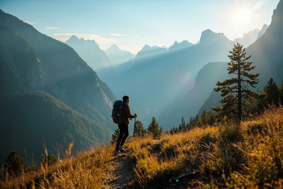
I want to break this down in detail because the hike to Mokowanis Cascade is an all-day commitment (or better yet, an overnight adventure). Understanding what each section demands will help you plan appropriately.
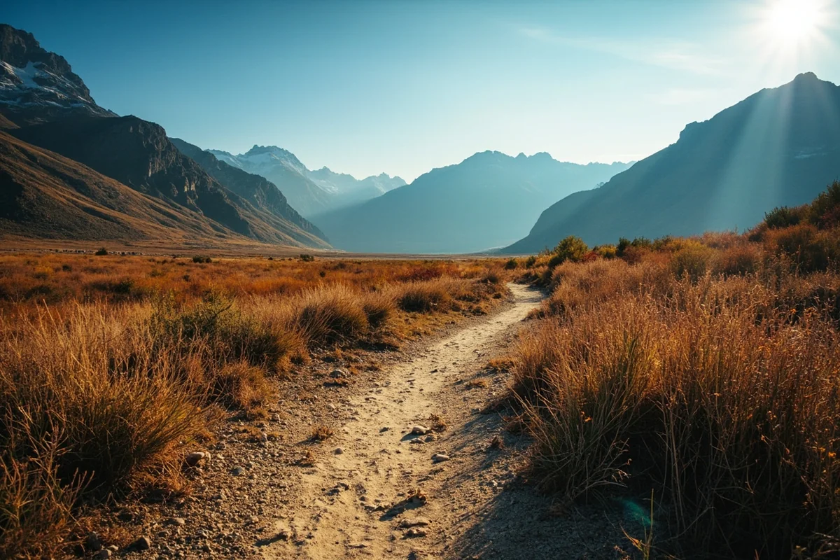
Miles 0-3: Belly River Valley Floor
The trail begins with a steady descent into the Belly River Valley. You’ll drop about 600 feet over the first couple of miles—elevation you’ll regain on the return trip when you’re tired.
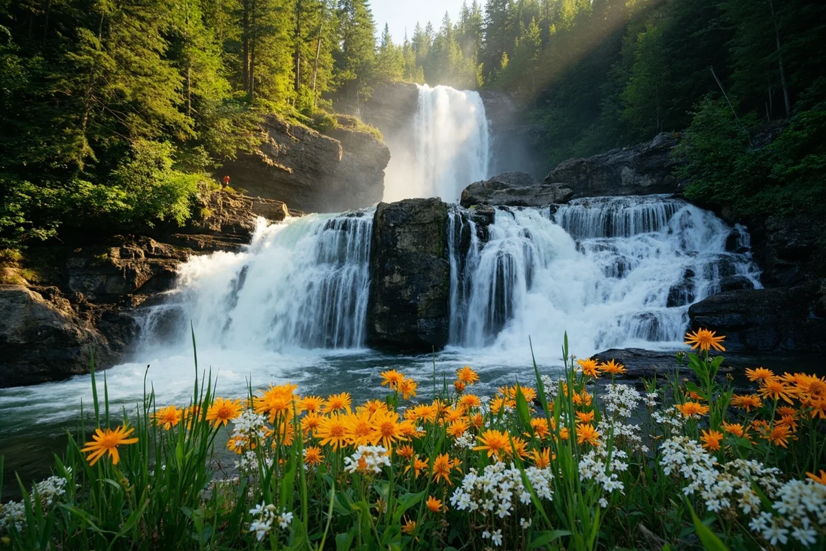
This section travels through mixed forest and open meadows. During my August hike, the wildflowers were still going strong: fireweed, asters, and late-blooming arnica dotted the trail edges.
The Belly River itself comes into view around mile 2. It’s a beautiful glacial stream, milky with rock flour in the morning but often clearing slightly by afternoon as upstream snowmelt slows.
Miles 3-5: Following Belly River
This stretch is my favorite part of the approach. The trail parallels the Belly River through ancient forest, crossing several tributary streams via log bridges. I stopped for lunch around mile 4, sitting on a massive downed spruce beside the river.
Watch for wildlife along here. I spotted a cow moose with twin calves feeding in a willow flat around mile 4.5. We gave them wide berth—moose with calves can be more dangerous than bears.
Miles 5-6.5: Climbing Toward Mokowanis
The trail forks near the Belly River Ranger Station (a historic patrol cabin). You’ll head left toward Mokowanis Lake, gaining elevation more steadily now.
The forest transitions to more subalpine character here. Spruce and fir dominate, with occasional openings offering views back down the valley. The first glimpses of peaks surrounding Mokowanis Valley appear through the trees.
Miles 6.5-7+: The Final Approach
The cascade comes into earshot before it comes into view. I first heard the rushing water around mile 6.5, though the forest was too dense to see anything yet.
A short spur trail leads to the best viewpoint of Mokowanis Cascade. This isn’t an official maintained trail, so be prepared for rough footing and potential deadfall. The effort pays off—the view opens dramatically to reveal the full cascade dropping through a rocky chute.
Trail Difficulty and Physical Demands
Let me give you my honest assessment of this hike’s difficulty, based on doing it as a two-day backpacking trip.
| Factor | Assessment |
|---|---|
| Round Trip Distance | 13-15 miles (depending on route variations) |
| Elevation Gain | ~1,400 feet total (undulating terrain) |
| Trail Conditions | Well-maintained to Belly River; rougher beyond |
| Technical Difficulty | Moderate—stream crossings, uneven terrain |
| Time Required | 8-10 hours day hike; overnight recommended |
| Fitness Level Needed | Above average; long distance stamina essential |
I’m in decent hiking shape, and doing this as a day hike would have been exhausting. The distance alone is manageable, but the undulating terrain adds up. You descend into the valley, climb out toward Mokowanis, then reverse it all on the return.
If you’re comparing difficulty, this is significantly harder than trails like Ousel Falls or Palisade Falls, both of which are quick day trips. Mokowanis is more comparable to reaching remote cascades like Ipasha Falls or Ptarmigan Falls in terms of commitment.
Best Time to Visit
Timing your trip to Mokowanis Cascade matters more than with easily accessible waterfalls. Here’s what I’ve learned from personal experience and conversations with park rangers.
Seasonal Accessibility
The trail is typically snow-free from early July through mid-September. Snow can linger in the higher sections well into July some years, so check current conditions before committing to an early-season trip.
During my August visit, trail conditions were excellent—dry, well-defined, and easy to follow. The creek crossings were manageable with careful rock-hopping, though earlier in summer you might face deeper water.
Water Volume Considerations
Mokowanis Cascade is fed by snowmelt and precipitation, so water volume varies significantly throughout the season. Late June through mid-July typically sees peak flow, making the cascade most impressive but also making creek crossings more challenging.
By late August, water volume decreases. The cascade was still dramatic during my visit, but I could see from high-water marks that it had been significantly more powerful earlier in the season.
Weather Patterns
Afternoon thunderstorms are common in Glacier’s high country during July and August. I always plan to be at my destination (or heading back) by early afternoon. Lightning above treeline is no joke.
The Mokowanis Valley, being somewhat sheltered, can feel humid and still on hot summer days. Bugs were manageable during my August trip, but earlier in summer, mosquitoes and no-see-ums can be fierce. Bring bug spray regardless.
Backcountry Camping: My Strong Recommendation
While technically possible as a day hike, I strongly encourage planning Mokowanis Cascade as an overnight backpacking trip. Here’s why my approach worked so well.
Permit Requirements
Overnight camping anywhere in Glacier’s backcountry requires a permit. You can apply for advance reservations starting in mid-March each year through the park’s online system. Same-day walk-up permits are available but unreliable during peak season.
For Mokowanis, I secured a permit for the Mokowanis Lake campground, located about a mile beyond the cascade viewpoint. This allowed me to hike in, set up camp, then explore the cascade area without my full pack.
Campground Details
Mokowanis Lake campground has several designated sites with bear poles for food storage. The sites are well-separated, offering privacy that’s increasingly rare in popular backcountry areas.
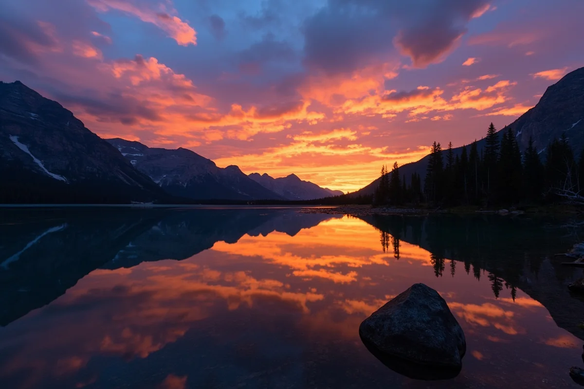
My campsite overlooked the lake with peaks rising dramatically on three sides. That evening, I watched the sunset paint the mountains pink and orange while heating my freeze-dried dinner. Worth every mile of the approach.
Why Overnight Makes Sense
Beyond reducing daily mileage, staying overnight let me experience the cascade at different times of day. I visited the viewpoint in late afternoon when first arriving, then returned at dawn before hiking out.
The morning light hitting the cascade was spectacular—something I’d have missed entirely on a rushed day hike. The solitude was also more profound; I had the entire area to myself both times.
Wildlife Considerations
Let’s talk honestly about wildlife in the Belly River drainage, because it’s something you must take seriously.
Grizzly Bear Country
The Belly River area is prime grizzly bear habitat. During my two-day trip, I saw fresh bear scat on the trail three times and encountered what appeared to be fresh digging activity in a meadow near the river.
I carried bear spray accessible on my hip (not buried in my pack), made noise on blind corners, and traveled during daylight hours. These aren’t optional precautions—they’re basic wilderness protocols in Glacier.
The park requires bear spray for all backcountry travelers. I use Counter Assault, which meets the EPA standard for capsaicin concentration. Make sure you know how to use it; a tense encounter isn’t the time to read instructions.
Other Wildlife
Beyond bears, the Belly River corridor supports moose, mountain goats, mule deer, and wolves. The moose encounter I mentioned earlier reminded me that every large animal deserves respect and distance.
I also spotted pikas in the rocky areas near the cascade—those adorable little rock rabbits whose squeaky calls echo off cliff faces. They’re always entertaining to watch.
What to Pack
Having done this trip, I can tell you exactly what I was glad I brought and what I wished I’d left behind.
Essential Gear
- Bear spray: Absolutely non-negotiable
- Water filter or purification: I use a Sawyer Squeeze; the river water is cold and delicious once filtered
- Layered clothing: Temperatures swing dramatically between valley floor and higher elevation
- Rain gear: Afternoon storms can appear quickly
- Trekking poles: Saved my knees on the descent and helped with creek crossings
- Headlamp: Even for day hikes—this trail is long enough that getting caught after dark is possible
- First aid kit: Including blister treatment; my feet thanked me
- Detailed map: Cell service is nonexistent; don’t rely on phone navigation
For Overnight Trips
If you’re camping, add:
- Lightweight backpacking tent (I used my Nemo Hornet 2P)
- Sleeping bag rated to 30°F minimum—nights get cold
- Sleeping pad with good R-value
- Bear-resistant food storage (or plan to use campground bear poles)
- Camp stove and fuel
- Enough food plus emergency extra
What I Left Behind Next Time
I overpacked on clothing changes and could have saved 2 pounds. One extra shirt and one pair of socks would have sufficed for my 2-day trip. I also brought a heavy camera lens I never used—next time, I’ll stick with just my lightweight setup.
Practical Information Table
| Category | Details |
|---|---|
| Park Entrance Fee | $35 per vehicle (7-day pass); $80 annual |
| Backcountry Permit Fee | $7 per person per night |
| Trail Season | Early July through mid-September |
| Nearest Services | Babb, MT (limited); St. Mary, MT (more options) |
| Cell Coverage | None on trail; limited at trailhead |
| Water Availability | Abundant from streams (filter required) |
| Restrooms | Vault toilet at trailhead; pit toilets at backcountry camps |
| Dogs Allowed | No—trails are closed to pets in Glacier NP |
Photography Tips from the Trail
As someone who photographs waterfalls regularly across Montana—from Morrell Falls to Kootenai Falls—I found Mokowanis Cascade presented unique opportunities and challenges.
Best Angles
The main viewpoint offers a head-on perspective of the cascade’s full drop. It’s dramatic but somewhat one-dimensional. I spent time scrambling (carefully) to alternative positions that showed the cascade in profile against the surrounding peaks.
A telephoto lens proved useful for isolating individual tiers of the cascade. The tiered structure means you can capture three or four distinct compositions from a single position.
Timing and Light
Morning light was hands-down better for photography. The cascade faces roughly east, catching early sun beautifully while the surrounding forest remains in shadow. This contrast creates a natural spotlight effect.
By afternoon, harsh overhead light flattened the scene. If you can only visit once, go in the morning.
Technical Considerations
I brought a lightweight tripod and was glad I did. Long exposures smoothing the water required stability I couldn’t achieve handheld. That said, I kept exposures shorter than usual (1/8 to 1/4 second) to preserve some texture in the water—full smoothing looked artificial with this cascade’s structure.
Comparing Mokowanis to Other Glacier Waterfalls
If you’re planning a Glacier National Park trip focused on waterfalls, understanding how Mokowanis fits into the bigger picture helps prioritize your time.
Easier Alternatives
For visitors wanting waterfall experiences without the backcountry commitment, Glacier offers several accessible options. Saint Mary Falls requires only a 3-mile round trip and delivers impressive rewards. Sacred Dancing Cascade can be viewed from the road.
McDonald Falls and Running Eagle Falls also offer easy access. These are perfect for families or visitors with limited hiking time.
Similar Difficulty Level
If you’re ready for a challenge comparable to Mokowanis, consider Rockwell Falls via the Two Medicine area or the journey to Piegan Falls. Both require significant effort but reward with spectacular scenery and relative solitude.
Redrock Falls offers another multi-mile option in the Many Glacier area, though it sees more traffic than Mokowanis due to its popular trailhead.
Even More Remote
For those who tackle Mokowanis and want something even more isolated, Hole in the Wall Falls and Passage Creek Falls require multi-day expeditions into Glacier’s deepest wilderness. These are for experienced backcountry travelers only.
Extending Your Trip
If Mokowanis Cascade whet your appetite for more exploration, the surrounding area offers additional destinations worth considering.
Mokowanis Lake
Just beyond the cascade, Mokowanis Lake sits in a stunning alpine cirque. During my overnight trip, I spent an hour at the lake watching mountain goats pick their way across the cliffs above. The lake itself is too cold for comfortable swimming but gorgeous for photographs.
Glenns Lake and Cosley Lake
The Belly River trail system connects to additional lakes farther into the backcountry. With proper permits and time, you could build a loop trip of several days exploring this remote drainage.
Dawn Mist Falls
Another waterfall option in the area, Dawn Mist Falls requires extending your route but adds another impressive cascade to your trip list. I didn’t reach it on this particular trip but plan to on a future visit.
Common Mistakes to Avoid
Based on my experience and conversations with other hikers I met on the trail, here are pitfalls to sidestep:
Underestimating Distance
The mileage looks moderate on paper, but undulating terrain makes this feel longer than flat miles would. Start early and pace yourself.
Insufficient Water Planning
You’ll cross numerous water sources, so you don’t need to carry huge volumes from the start. But you absolutely need a reliable filtration system. I met one couple who’d brought only water bottles and were nervously rationing by mile 6.
Ignoring Weather Forecasts
I cannot stress this enough: check the forecast and respect what it tells you. Thunderstorms in Glacier can turn deadly fast, and there’s minimal shelter along much of this route.
Skipping the Permit Process
Rangers do patrol this area, and getting caught without a permit for overnight stays means serious fines. More importantly, the permit system exists to protect the wilderness character that makes Mokowanis special.
Nearby Lodging and Amenities
Planning where to stay before and after your Mokowanis adventure requires some advance thought, as options are limited.
Closest Accommodations
St. Mary, located about 20 miles from the trailhead, offers the nearest lodging options including St. Mary Lodge and several smaller motels. During peak season, book well in advance—availability fills quickly.
The town of Babb, slightly closer to the trailhead, has very limited options but may have availability when St. Mary is full.
Camping Alternatives
If you can’t secure a backcountry permit for Mokowanis, St. Mary Campground within the park offers a base for exploring the east side. It’s first-come, first-served and fills by midday during summer.
Services to Know About
Stock up on supplies in St. Mary before heading to the trailhead. There’s a small grocery store, gas station, and a few restaurants. Don’t count on finding anything at the Chief Mountain trailhead itself.
I grabbed breakfast at the Park Cafe in St. Mary before my hike—their famous pie isn’t available until later in the day, but the breakfast portions fueled me well for the trail ahead.
My Final Thoughts
After spending two days exploring Mokowanis Cascade and its surrounding wilderness, I came away with renewed appreciation for what makes Glacier National Park extraordinary. This isn’t the waterfall experience you’ll find at roadside pullouts. This is earned beauty, the kind that rewards those willing to put in miles and carry their weight on their backs.
The cascade itself exceeded my expectations—powerful, dramatic, and set against the kind of mountain scenery that reminds you why they call Montana “Big Sky Country.” But equally memorable was everything else: the morning mist rising off Belly River, the evening light on distant peaks, the profound silence of a valley where you might be the only human for miles.
If you’re considering Mokowanis Cascade, go. Plan carefully, respect the wilderness, and give yourself enough time to truly experience the journey, not just the destination. And maybe explore some of Montana’s other incredible waterfalls along the way—places like Grotto Falls, Hidden Falls, or Holland Lake Falls each offer their own unique character.
Montana has dozens of waterfalls worth visiting—I’ve been steadily working through them for years. But Mokowanis holds a special place in my memory now, not because it’s the tallest or most powerful, but because reaching it felt like a real adventure. In an age of geo-tagged Instagram spots and crowded overlooks, that’s increasingly rare.
Go find your own adventure at Mokowanis Cascade. Just be ready to work for it.
Frequently Asked Questions
Where is Mokowanis Cascade Waterfall located in Montana?
Mokowanis Cascade Waterfall is located in the remote northern section of Glacier National Park, near the Canadian border. You’ll find it along the Belly River drainage, accessible via the Ptarmigan Tunnel Trail or the longer Belly River Trail system starting from the Chief Mountain Highway area.
How long is the hike to Mokowanis Cascade Waterfall?
The hike to Mokowanis Cascade is approximately 10-12 miles one way depending on your route, making it a challenging day hike or better suited as an overnight backpacking trip. I’d recommend planning for the Belly River Trail route, which passes through stunning alpine meadows and offers backcountry camping options near the falls.
What is the best time of year to visit Mokowanis Cascade Waterfall?
The best time to visit Mokowanis Cascade is mid-July through early September when trails are typically snow-free and the waterfall flows strong from snowmelt. I’ve found late July offers the perfect combination of peak water flow and accessible trail conditions, though you’ll want to check current trail status with Glacier National Park rangers.
Do I need a permit to hike to Mokowanis Cascade in Glacier National Park?
If you’re doing a day hike, you only need the standard Glacier National Park entrance fee of $35 per vehicle. For overnight backpacking trips, you’ll need a wilderness camping permit which costs $7 per person per night, and I strongly recommend reserving these months in advance as backcountry sites fill up quickly during summer.
What should I bring on the Mokowanis Cascade Waterfall hike?
Pack bear spray (mandatory in Glacier), plenty of water, layers for unpredictable mountain weather, sturdy hiking boots, and a detailed topographic map since cell service is nonexistent. I always carry trekking poles for the creek crossings and a water filter since the hike is long and refilling from streams is essential.
Is Mokowanis Cascade Waterfall crowded compared to other Glacier waterfalls?
Mokowanis Cascade sees far fewer visitors than popular Glacier waterfalls like Virginia Falls or St. Mary Falls due to its remote location and strenuous access. During my visits, I’ve encountered only a handful of other hikers, making it one of the most peaceful waterfall experiences in Montana for those willing to put in the miles.
Can beginners hike to Mokowanis Cascade Waterfall in Montana?
This hike is not recommended for beginners due to its 20+ mile round-trip distance, significant elevation changes, and remote wilderness setting with grizzly bear activity. If you’re new to backcountry hiking, I’d suggest building up your endurance on shorter Glacier trails first and gaining experience with bear safety before attempting this challenging but rewarding trek.