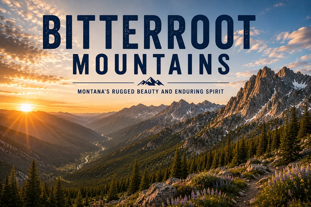
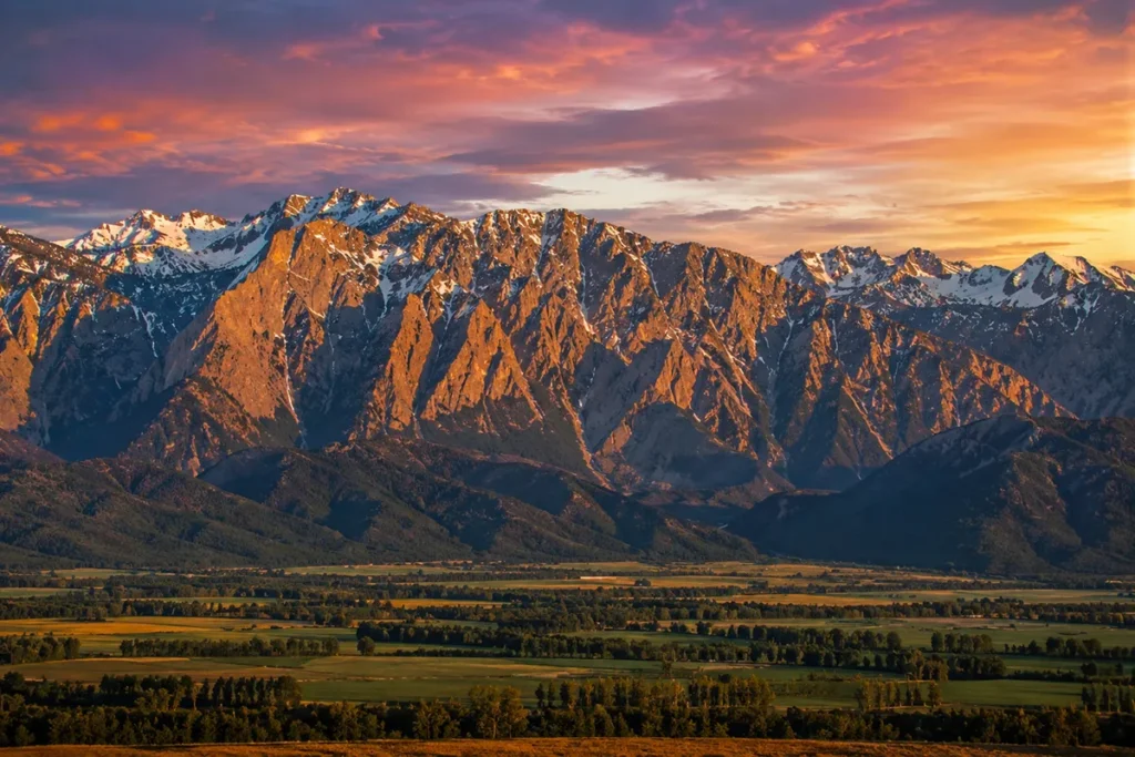
If you stand in the middle of the Bitterroot Valley on a clear summer evening and look west, you see a 90-mile wall of granite cut by a new canyon roughly every fifteen miles. Each canyon has its own creek, its own lakes, its own personality, and its own hike.
The pattern repeats from Lolo down to Lost Trail Pass — thirty-plus drainages, all flowing east out of the same range.
I’ve hiked maybe twelve of them, and the Bitterroots still feel like a range you could explore for the rest of your life and never finish.
The Bitterroot Mountains form the entire west side of the Bitterroot Valley along the Montana–Idaho border, anchored by Trapper Peak at 10,157 feet. The range’s defining feature is its 30+ glacial canyons cutting east into the valley — Blodgett, Bass, Sweathouse, Mill, Lost Horse, Bear, Boulder, Como — each one a separate hiking destination. The 1.3-million-acre Selway-Bitterroot Wilderness protects the heart of the range and was the largest area designated in the original 1964 Wilderness Act. The Bitterroots are Lewis and Clark’s most punishing Montana crossing, the traditional homeland of the Salish people, and the namesake of Montana’s state flower. Best hiking window: late June through September.
Liked this article?
Add Roaming Montana as a preferred source so you see more of our articles and guides on Google.
What Makes the Bitterroots Different
Most Montana ranges have a high spine and ridges that fan out in multiple directions. The Bitterroots don’t. They run as one continuous wall, north–south, with the Bitterroot Valley on the east side, the Selway and Lochsa drainages on the west side, and the Continental Divide forming the ridgeline that doubles as the Montana–Idaho border.
From the air, the range looks like a long granite roof tilted east, with deep parallel canyons cut into the eastern slope by Pleistocene glaciers.
This canyon pattern is the defining feature. Every 10 to 15 miles down the valley, another deep U-shaped drainage opens westward into the range. Each one was carved by a glacier flowing east during the last ice age.
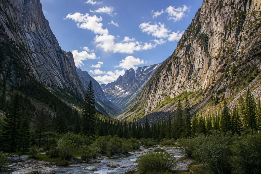
Each one has a creek running out of it, granite walls rising 2,000+ feet on both sides, and one or more alpine lakes near its head.
Together they make the Bitterroots one of the most legible mountain ranges in Montana — you don’t need a map to understand the structure once you see it. Pick a canyon, walk west into the range, climb to a lake.
For broader Montana context, see my full Montana mountain ranges guide.
Where the Bitterroots Are
The Bitterroot Mountains form the entire western boundary of the Bitterroot Valley, running roughly 90 miles north–south from Lolo Pass in the north (US-12, the Montana–Idaho border) down to Lost Trail Pass in the south (US-93, also the Montana–Idaho border).
The range is part of the larger Bitterroot Range, which extends north into the Panhandle of Idaho and south into the Salmon River country — but when most people say “the Bitterroots” in Montana, they mean specifically the east-facing wall on the Bitterroot Valley side.
The Bitterroot Valley itself is one of Montana’s most populated and agricultural valleys, with US-93 running its length. The towns along the valley — Florence, Stevensville, Victor, Corvallis, Hamilton, and Darby — all sit at the foot of the range and serve as basecamps for the canyons directly behind them.
The county is Ravalli. The forest is the Bitterroot National Forest. The drive from Missoula to Hamilton is about an hour; Missoula to Darby is roughly 90 minutes.
Trapper Peak: The Montana High Point
Trapper Peak, at 10,157 feet, is the highest point in the Bitterroot Mountains on the Montana side and the highest peak in the entire Selway-Bitterroot Wilderness.
It’s also the highest peak in southwestern Montana outside the Greater Yellowstone ranges. The peak rises over 6,000 feet above the Bitterroot Valley floor — the kind of vertical relief that makes most other mountains look modest.
Trapper Peak is also one of the few Bitterroot high summits that’s reachable as a long day hike. The trail starts from a Forest Service road off the West Fork Road south of Darby and climbs about 3,800 feet over four miles to the summit.
It’s steep, exposed near the top, and weather-prone — but it’s a non-technical hike, not a climb. From the summit you can see most of southwestern Montana, into Idaho, and down into the Selway River drainage. It’s one of the great single-day summit hikes in the state.
Note on the competing claim: Some sources list the highest point of the entire Bitterroot Range as Scott Peak (11,394 ft) in Idaho. That’s true if you’re counting the Bitterroot Range broadly, including the southern Idaho portion. But on the Montana side of the range — which is what most travelers mean by “the Bitterroot Mountains” — Trapper Peak is the high point.
The Geology: The Idaho Batholith
The Bitterroots are built from one enormous body of granite called the Idaho Batholith — a 200-mile-long mass of igneous rock that intruded into the existing sedimentary layers between roughly 100 and 70 million years ago.
The Idaho Batholith is part of the same family of granitic intrusions that built the High Sierra of California, and at the surface, the Bitterroot granite has the same coarse, light-colored, weather-resistant character.
The mountains got their current shape much more recently — during the Pleistocene ice ages, ending about 10,000 years ago. Glaciers cut the east-facing canyons.
Hanging valleys, U-shaped cross-sections, moraines at the canyon mouths, polished granite walls inside the canyons — all of it is glacial signature. When you walk into Blodgett Canyon or Bear Creek Canyon, you’re walking up a glacial valley with vertical 2,000-foot walls on both sides.
The country around Como Peaks at the south end of the range, with its serrated alpine ridges and east-facing couloirs, looks more like the European Alps than anywhere else in Montana.
Lewis and Clark in the Bitterroots: The Most Punishing Crossing
If you want to understand how serious the Bitterroots are as mountains, read the Corps of Discovery’s journals from September 1805.
Meriwether Lewis and William Clark, along with about thirty members of the expedition, crossed the Bitterroots over a route now called the Lolo Trail in September 1805 — westbound, headed for the Columbia River. They’d been told by the Salish that the crossing would take six days. It took eleven.
They ran out of food. They butchered a colt to survive. They got lost. They hit early snow that obscured the trail. They emerged at the Weippe Prairie in Idaho starving, hypothermic, and barely functional. Clark wrote that the crossing was “the worst day we have experienced.”
They re-crossed eastbound in June 1806, and that crossing was easier — but only because the Nez Perce sent guides to lead them. Without those guides, they would not have made it.
The Lolo Trail today is a National Historic Landmark, and the modern Highway 12 follows roughly the same corridor over Lolo Pass.
The full Lolo Trail proper — the original Indigenous and Lewis & Clark route — runs as a dirt-and-gravel route along the Bitterroot Divide and is still navigable by high-clearance vehicle in summer.
It’s one of the most historically dense drives in the American West. For Montana history context, see our Montana history overview.
The Salish Homeland
Long before the Corps of Discovery came through, the Bitterroots were the traditional homeland of the Bitterroot Salish — the easternmost band of the Salish-speaking peoples, who occupied the Bitterroot Valley year-round.
The valley was their summer camp, their berry-gathering ground, and the source of one of their most important food plants: the bitterroot.
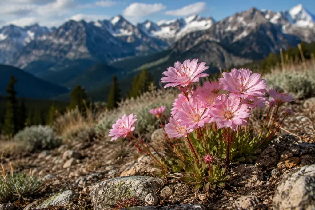
The bitterroot plant (Lewisia rediviva) is a small, ground-hugging perennial with a pink flower that blooms briefly in May and June.
The Salish dug its starchy roots in spring before the flower bloomed, peeled them, dried them, and used them as a staple winter food.
Trade in dried bitterroot extended from the Salish hundreds of miles in every direction. The plant gave its name to the river, the valley, the range, and eventually — in 1895 — to Montana’s state flower.
See our dedicated post on the bitterroot, Montana’s state flower for more on its botany and cultural history.
The Salish were forced onto the Flathead Indian Reservation north of Missoula by the Hellgate Treaty of 1855, and the last Salish village in the Bitterroot Valley was at St. Mary’s Mission in present-day Stevensville — which is also the oldest permanent non-Indigenous settlement in Montana, founded by Jesuit missionaries in 1841.
The Selway-Bitterroot Wilderness
The heart of the range is protected within the Selway-Bitterroot Wilderness — 1.34 million acres straddling the Montana–Idaho border, jointly managed by the Bitterroot, Clearwater, Nez Perce, and Lolo National Forests.
When the Wilderness Act passed in 1964, the Selway-Bitterroot was the largest area included in the original designation.
Together with the adjacent Frank Church-River of No Return Wilderness on the Idaho side, this complex forms the second-largest contiguous wilderness in the Lower 48 (behind only the Bob Marshall–Glacier complex in northern Montana).
The combined Selway-Bitterroot/Frank Church wilderness covers nearly 4 million acres with no roads, no structures, and no motorized access.
What this means in practice: the Bitterroots contain some of the most remote terrain in the contiguous United States. Inside the wilderness, you can hike for days without seeing another person.
The Selway River drainage on the Idaho side is one of the most pristine river canyons in America.
The Bitterroots are also one of the gray wolf reintroduction sites from the 1990s — wolves recolonized this country quickly and now form one of the densest populations outside Yellowstone.
The wilderness has roughly 1,490 miles of maintained trails plus hundreds more miles of unmaintained routes.
The Canyon-by-Canyon Guide
The Bitterroots have a canyon every 10–15 miles down the valley. Here are the ones I’d send hikers to, in order from north to south. Each one is its own day trip or overnight from a different valley town.
Bass Creek (near Florence/Stevensville)
The Bass Creek trail follows a U-shaped glacial valley to Bass Lake at the head of the canyon, about 8 miles in. Granite walls, cascades, meadow stretches. Trailhead is just west of Florence. Good for backpackers wanting a quintessential Bitterroot canyon experience.
Sweeney Ridge (near Florence/Stevensville)
For elevation gain and views rather than canyon walking, the Sweeney Ridge / Sweeney Peak trail climbs roughly 3,300 feet over about 4.5 miles to a ridge with valley-spanning views. This is the trail Bitterroot Backpacking and other local guide services use as a benchmark.
Sweathouse Falls (near Victor)
A short, accessible canyon hike to a multi-tiered waterfall, suitable for families. The trail follows Sweathouse Creek up into a tight granite canyon. Trailhead is west of Victor.
Blodgett Canyon (near Hamilton)
Blodgett Canyon is the most iconic and most accessible Bitterroot canyon. The Blodgett Canyon Overlook trail is a short, three-mile-round-trip hike to a stunning view point — easy enough for most travelers. The longer Blodgett Creek trail follows the canyon floor for 10+ miles back to Blodgett Lake. The granite walls here are some of the tallest in the range — 2,000+ feet of vertical rock on both sides. This is also one of the most popular rock climbing destinations in Montana.
Trailhead access from Hamilton.
Canyon Creek (near Hamilton)
Connects to Canyon Lake at the head — about 9 miles in. Spectacular alpine setting, larch in fall.
Mill Creek (near Hamilton)
Mill Creek climbs to a lake at the head of the canyon, with strong fishing and pretty wildflower meadows along the lower trail.
Lost Horse Canyon (near Hamilton/Darby)
A long, drivable Forest Service road (Lost Horse Road) penetrates 18+ miles into the range — one of the few canyons with significant vehicle access. From its end you can reach Twin Lakes (different from the Crazy Mountains’ Twin Lakes), Bear Lake, and other high lakes via shorter hikes. Best for travelers wanting alpine country without a long backpack.
Bear Creek Canyon (near Victor)
Less crowded than Blodgett, similar character. Trail to Bear Creek Falls about a mile in; longer route continues to Bear Lake.
Como Lake and Como Peaks (near Darby)
Lake Como is the largest natural lake on the Montana side of the Bitterroots, accessible by road, with a campground, boat launch, and beach. From there, trails climb west into the spectacular Como Peaks — the most Alps-like portion of the range, with serrated granite, hanging couloirs that hold snow into summer, and tight alpine lakes. The Como Peaks area is the closest thing to European-alpine terrain anywhere in Montana.
Trapper Peak (near Darby)
Already covered above. Trailhead access via West Fork Road south of Darby.
Wildlife in the Bitterroots
The Bitterroots support the full Northern Rocky Mountain mammal community.
Elk are abundant — the Selway-Bitterroot complex has been described as supporting one of the largest elk herds in the United States. Bitterroot elk are heavily hunted on the Montana side; the wilderness areas are managed primarily as elk and big-game habitat.
Mule deer and white-tailed deer are common throughout. Mountain goats occupy the high alpine ridges, particularly around Trapper Peak and the Como Peaks. Bighorn sheep are present but scattered.
Black bears are common; grizzlies are confirmed in the northern part of the range and the population is expanding south. Carry bear spray and review our Montana bear guide.
Wolves recolonized the Bitterroots quickly after the 1995–96 reintroduction in adjacent areas. The Bitterroot wolf population is now well-established. Mountain lions are present and occasionally seen.
Moose are common in the wet drainages, particularly in the northern canyons.
Where to Base Yourself in the Bitterroot Valley
The Bitterroot Valley is roughly 60 miles long, with US-93 running its length. Where you base depends on which canyons you want to access.
Hamilton — The Best All-Around Base
Best for: Most travelers. Direct access to Blodgett Canyon, Canyon Creek, Mill Creek, and the Lost Horse drainage. Hamilton is the county seat and the largest town in the valley (population ~4,800), with strong restaurants, lodging options, and a historic downtown. The Bitterroot River runs right past town for fly fishing. This is where I’d base for most Bitterroot trips.
Stevensville — Historic North Valley
Best for: Bass Creek, Sweeney Ridge, the north end of the range. Stevensville is the oldest permanent non-Indigenous settlement in Montana (founded 1841), with St. Mary’s Mission still standing. Smaller and quieter than Hamilton, with a tighter old-town feel.
Darby — South Valley Gateway
Best for: Trapper Peak, Lake Como, the West Fork country, and the Lost Trail Pass area. Darby is the small town at the southern end of the valley (population ~750), with limited services but the closest access to the southern Bitterroots. The famous Yellowstone TV show was filmed in and around Darby.
Florence, Victor, Corvallis — Smaller Bases
Each of these small Bitterroot Valley communities sits at the foot of a specific canyon system: Florence for Sweeney Ridge and Bass Creek, Victor for Sweathouse and Bear Creek, Corvallis for Mill Creek and Skalkaho. Limited lodging but quick trailhead access.
Missoula — Day-Trip Base
Missoula is about an hour north of Hamilton and serves as a good full-service base if you want a larger city’s restaurants and amenities. You can day-trip into most Bitterroot canyons from Missoula.
Best Time to Visit
The Bitterroots have a long usable season for low- and mid-elevation hiking, and a shorter window for high-country travel.
Spring (April–May) is excellent in the lower canyons. Wildflowers — including the bitterroot itself — bloom in May. The high lakes are still snow-bound. The Bitterroot Valley is famous for its arrowleaf balsamroot display in late April, when the foothills turn yellow.
Summer (June–August) is prime hiking season. The high country opens up in late June for snow-clear approaches, and the alpine lakes are accessible. Mosquitoes are bad in the high country in early July; manageable by August.
Fall (September–early October) is my favorite. The valley aspens and cottonwoods turn gold, the western larches (a deciduous conifer unique to this region) turn brilliant yellow in late September into mid-October, and the crowds thin out. See our Montana in October and Montana in September guides.
Winter the canyons are accessible for snowshoeing and cross-country skiing. Lolo Pass has a Nordic ski center. Lost Trail Powder Mountain ski area sits at the south end of the range. Backcountry skiing on Lolo Peak (9,096 ft) and Trapper Peak is for advanced backcountry travelers only.
Personal Tips: What I Wish I Knew About the Bitterroots
Each canyon is its own trip. Don’t try to “see the Bitterroots” generically. Pick one canyon — start with Blodgett if it’s your first time — and go deep on it. The range rewards depth over breadth.
The east face gets hot. All those canyons face east, which means morning sun and afternoon shade — but in summer, the lower canyon floors can be 90+°F by noon. Start early.
Cell service is reliable in the valley, gone in the canyons. The Bitterroot Valley itself has good coverage along US-93. The moment you turn west into a canyon, signal disappears. Plan accordingly.
Lake Como is a real lake town in summer. Lake Como has a swimming beach, campground, and boat launch — and on a summer weekend it’s busy with families. If you want quiet, go midweek.
The Bitterroot fly fishing is some of the best in the state. The Bitterroot River, fed by all these canyons, holds wild westslope cutthroat trout, rainbow trout, and brown trout. Hamilton is the fly fishing hub. The salmonfly hatch in late May / early June is one of Montana’s great fly fishing events.
The road over Skalkaho Pass is unmaintained for the season. Skalkaho Pass (Highway 38) connects the Bitterroot Valley to the upper Rock Creek drainage — a beautiful gravel route over the southern shoulder of the range. The pass closes in winter and is rough year-round. Worth doing in summer for the Skalkaho Falls.
Pre-2024 fire scars are visible across much of the range. The Bitterroots have burned heavily over the last two decades — the Saddle Complex Fire (2007), the Lolo Peak Fire (2017), and other major burns have reshaped the forest. Some canyons (particularly in the north) show extensive burn scars. This is part of the western fire ecology, and the regrowth is its own kind of beautiful, but plan visually for it. See Montana’s fire history.
The southern Bitterroots have grizzly recovery. The northern Bitterroots have established grizzlies; the southern portion is part of an active grizzly recovery zone. Carry spray throughout the range.
Practical Info Box
| Item | Detail |
|---|---|
| Highest peak (Montana side) | Trapper Peak, 10,157 ft |
| Range length (Montana side) | ~90 miles N–S |
| Border | Forms the Montana–Idaho state line |
| National Forest | Bitterroot National Forest (Montana side) |
| Wilderness area | Selway-Bitterroot Wilderness, 1.34 million acres |
| Trail miles in wilderness | ~1,490 maintained |
| Counties | Ravalli (Montana side) |
| Major canyons | 30+ glacial canyons, including Blodgett, Bass, Sweathouse, Mill, Lost Horse, Bear, Boulder, Como |
| Geological substrate | Idaho Batholith granite |
| Lewis & Clark crossing | Lolo Trail, September 1805 |
| State flower connection | Range named for Lewisia rediviva (bitterroot), Montana’s state flower |
| Best basecamp | Hamilton (central) |
| Nearest airport | Missoula International (MSO), ~1 hour to Hamilton |
| Bear spray | Required gear |
Final Thoughts
The Bitterroots are the range I’d send a serious hiker to if they had one Montana trip.
Glacier is more famous, the Beartooths are higher, the Crazies are more dramatic from a distance — but for sheer concentration of accessible alpine country, canyon depth, historical density, and pure granitic mountain character, the Bitterroots are hard to beat.
And the range’s east face, visible from anywhere in the Bitterroot Valley, is one of the great visual experiences in Montana — especially at sunset, when the granite glows orange and the canyons fall into deep blue shadow.
Pick a canyon. Walk west into the range. Most of what I’ve described above is still wild enough that you’ll have it largely to yourself if you’re willing to walk past the first lake.
For more on how the Bitterroots fit into the rest of the state’s mountain geography, see the Montana mountain ranges guide. And if your favorite Bitterroot canyon isn’t in my list, drop it in the comments — I’m always looking for one more drainage to walk.
Frequently Asked Questions
How tall are the Bitterroot Mountains?
Trapper Peak at 10,157 feet is the highest peak in the Bitterroot Mountains on the Montana side. Many peaks in the range exceed 9,000 feet. The range rises over 6,000 feet above the Bitterroot Valley floor.
Where are the Bitterroot Mountains?
The Bitterroot Mountains form the western boundary of the Bitterroot Valley in western Montana, running roughly 90 miles north–south from Lolo Pass to Lost Trail Pass along the Montana–Idaho border.
Why are they called the Bitterroot Mountains?
The range, the river, and the valley are all named after Lewisia rediviva — the bitterroot plant — a small pink-flowered perennial whose starchy root was a staple food of the Salish people. The plant became Montana’s state flower in 1895.
Are the Bitterroots part of the Rocky Mountains?
Yes. The Bitterroots are a sub-range of the Northern Rocky Mountains, built from the Idaho Batholith granitic intrusion.
Did Lewis and Clark cross the Bitterroots?
Yes. The Corps of Discovery crossed the Bitterroots westbound in September 1805 along what’s now called the Lolo Trail. The crossing took eleven days, depleted their food supply, and was described by Clark as the worst experience of the expedition. They recrossed eastbound in June 1806.
What’s the best hike in the Bitterroot Mountains?
For most travelers: Blodgett Canyon Overlook is the easy classic; Trapper Peak is the iconic summit hike; the Como Peaks area is the most alpine. Each canyon has its own merits.
Is there a national park in the Bitterroots?
No national park, but the Selway-Bitterroot Wilderness — 1.34 million acres — protects the heart of the range. It was the largest area included in the original 1964 Wilderness Act.
Are there grizzly bears in the Bitterroots?
Yes, particularly in the northern part of the range, with an expanding population. The southern Bitterroots are part of an active grizzly recovery zone. Carry bear spray.
Where do you stay near the Bitterroot Mountains?
Hamilton is the best central base. Stevensville for the north valley, Darby for the south valley. Missoula serves as a larger full-service basecamp about an hour to the north.
Can you drive into the Bitterroot Mountains?
Most canyons are roadless and require hiking. The notable exceptions are Lost Horse Road (drivable 18+ miles into the range), the road to Lake Como, and Skalkaho Pass (Highway 38) over the southern flank.