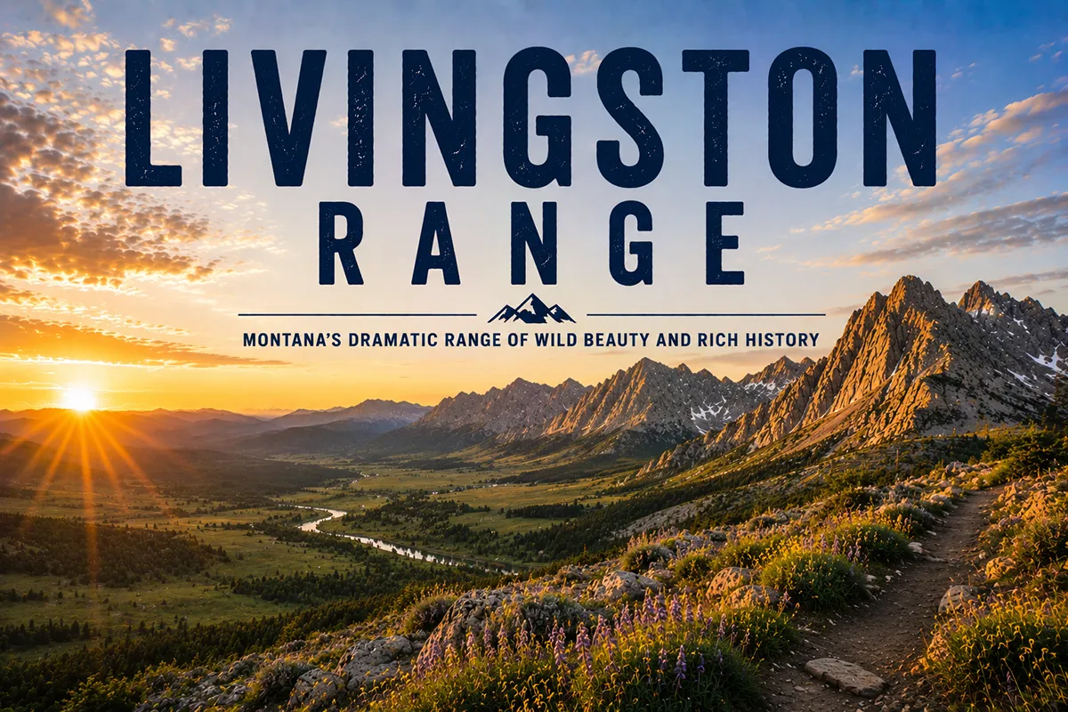
The Livingston Range is the half of Glacier National Park that most visitors never see. Going-to-the-Sun Road, the Highline Trail, Many Glacier, Logan Pass — all of that famous Glacier country is on the eastern spine of the park, the Lewis Range.
The Livingston Range is the parallel ridge to the west, anchored by Kintla Peak (10,106 ft) — the most northerly 10,000-foot peak in the contiguous United States.
To get to the base of Kintla Peak requires a 15-mile hike from the nearest road. To get to the nearest road requires driving out to Polebridge, which has no cell service and a famous bakery. This is the wild half of Glacier, and most travelers will never see it.
The Livingston Range is Glacier National Park’s western spine, running about 36 miles north to south and extending across the Canadian border into British Columbia. Kintla Peak (10,106 ft) is the high point and the most northerly peak above 10,000 feet in the Lower 48. The range is accessed from the North Fork sector of Glacier — the least-visited corner of the park — via the Inside or Outside North Fork Roads from the unincorporated community of Polebridge. The country is built from 1.6-billion-year-old Belt Supergroup rock pushed into place by the Lewis Overthrust 170 million years ago. Best window: mid-July through September; spectacular larch color in October.
Liked this article?
Add Roaming Montana as a preferred source so you see more of our articles and guides on Google.
The Livingston Range vs the Lewis Range
This is the first thing most travelers get wrong: Glacier National Park has two mountain ranges, not one. They run parallel to each other on either side of the Continental Divide:
- The Lewis Range — the eastern spine — contains Mount Cleveland (10,479 ft, the park high point), the country along Going-to-the-Sun Road and around Many Glacier, Logan Pass, the Highline Trail, and most of the iconic photographed Glacier scenery.
- The Livingston Range — the western spine — contains Kintla Peak (10,106 ft), the North Fork sector of the park, Bowman Lake, Kintla Lake, and Polebridge as its gateway. This is the wild, less-developed half.
Both ranges were created by the same geological event — the Lewis Overthrust, beginning around 170 million years ago — and both are built from the same Belt Supergroup rock.
They’re geologically twins. What separates them visually and experientially is access. The Lewis Range has Going-to-the-Sun Road and full park infrastructure.
The Livingston Range has Polebridge, a gravel road, and no cell service. That difference is everything.
For broader context, see my full Montana mountain ranges guide and the Lewis Range guide.
Where the Livingston Range Is
The Livingston Range runs 36 miles north to south and is 28 miles wide. The southern end terminates at the Camas Creek area of Glacier near West Glacier; the northern end crosses the Canadian border into British Columbia and continues into Akamina-Kishinena Provincial Park.
Counties: Flathead (Montana) and the Regional District of East Kootenay (British Columbia).
Major access:
- South: West Glacier — the main park entrance, then north up either the Inside or Outside North Fork Road
- Central: Polebridge, Montana — the unincorporated community at the heart of the North Fork
- North: The road ends at Kintla Lake — beyond that, you walk
Nearest larger towns: Columbia Falls, Whitefish, and Kalispell are 1–1.5 hours south, depending on road conditions.
Inside vs Outside North Fork Road: Critical Planning
There are two roads that get you up the North Fork, and which one you choose determines your trip.
Outside North Fork Road
The “Outside” road runs outside the park boundary, on the west side of the North Fork of the Flathead River. It’s a wider, smoother gravel-and-paved route that takes you to Polebridge faster — roughly 90 minutes from Columbia Falls.
This is the route I’d take for most trips, unless you’re going deep into the park first. You’ll see meadows, prairie-grass clearings, vintage cabins, and dramatic views of the Livingston Range to the east.
Inside North Fork Road
The “Inside” road runs inside Glacier National Park, on the east side of the North Fork of the Flathead River. It’s a rougher, narrower dirt road that hugs the Livingston Range and provides closer access to Polebridge and Bowman Lake. Slower (figure two hours from Columbia Falls), much more dramatic.
The Inside Road is closed to vehicles north of Polebridge Ranger Station at certain times of year, and stretches can be impassable in spring or after heavy rain. Check current status with Glacier National Park before you go.
Most travelers do Outside on the way in, Inside on the way out — or vice versa — to see both perspectives.
Polebridge: The Last Real Mountain Town
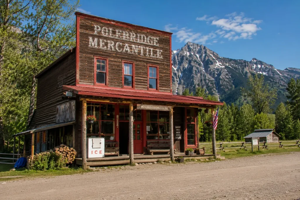
Polebridge, Montana is an unincorporated community of fewer than 100 year-round residents at the gateway to the North Fork sector of Glacier. There is no cell service. There is no power grid — the entire community runs on solar and generators. There is no paved road in or out.
What Polebridge does have:
- The Polebridge Mercantile — built in 1914, still operating as a general store and famous for its baked goods (the huckleberry bear claws have become iconic).
- The Northern Lights Saloon — a tiny restaurant and bar attached to the Mercantile.
- The Polebridge Ranger Station — Glacier’s NPS presence in the North Fork.
- A handful of cabins, a school for the local kids, and not much else.
That’s the entire town. The lack of infrastructure is the point. Polebridge attracts a specific kind of traveler — those willing to disconnect for the experience of being somewhere that hasn’t been smoothed over.
For full coverage of what’s actually there, see our things to do in Polebridge guide.
The Peaks: Kintla and Kinnerly
Kintla Peak (10,106 ft)
The high point of the range. Pyramidal, glacier-flanked, and impossibly remote — even by Glacier National Park standards. The peak is the most northerly point of land above 10,000 feet in the contiguous United States, sitting almost on the Canadian border.
The standard climbing route is the Southeast Ridge, accessed from the Agassiz Glacier basin. From the nearest road (Kintla Lake), the approach is roughly 15 miles just to reach the base of the mountain.
The climb itself involves Class 3 and Class 4 scrambling, plus snow travel depending on the season. The total trip is typically 4–6 days.
Kintla Peak is considered “the most arduous climb in the northwest section of the park” — and given the difficulty of Glacier climbing generally, that’s saying something.
The name “Kintla” comes from the Kootenai word for “sack.” According to Kootenai oral tradition, a man drowned in one of the Kintla Lakes and the lake was likened to a sack: “once you got in, you couldn’t get out.” The name passed from the lake to the peak.
Kinnerly Peak (9,949 ft)
Kintla’s northern neighbor — slightly lower, even more dramatic. Kinnerly’s north face rises 5,573 vertical feet from Upper Kintla Lake in just one horizontal mile.
That’s a steeper sustained vertical relief than almost anywhere in the Lower 48. From the lake, looking up at the peak, the visual experience is like looking up at the Eiger from Grindelwald.
The first recorded ascent was by Norman Clyde and a Sierra Club party in 1937. The standard route is Class 4 to easy Class 5, with the climb starting from the south shore of Upper Kintla Lake.
Other Notable Peaks
- Rainbow Peak (9,891 ft) — northeast of Bowman Lake
- Vulture Peak (9,638 ft)
- Numa Peak (8,994 ft) — accessible via the Numa Ridge Lookout trail
- Chapman Peak (9,411 ft) — sits along the Continental Divide
- Reuter Peak — on the BC border
Over 15 summits in the range exceed 9,000 feet.
The Geology: Lewis Overthrust and Belt Supergroup
The Livingston Range and the Lewis Range share an unusual geological origin: they’re both pieces of an enormous slab of ancient rock that was pushed eastward over much younger rock during the Lewis Overthrust, beginning around 170 million years ago.
The story is genuinely strange. A slab of Precambrian (1.4–1.6-billion-year-old) Belt Supergroup sedimentary rock — roughly 3 miles thick, 50 miles wide, and 160 miles long — slid 50+ miles eastward over much younger Cretaceous-period rocks during the Laramide Orogeny.
The result is that in Glacier National Park, billion-year-old rock now sits on top of 100-million-year-old rock — younger rock literally underneath older rock.
You can see the contact line — the “Lewis Overthrust fault” — at several places in the park. The most famous viewpoint is Chief Mountain on the east side of the Lewis Range, but the same overthrust runs through the Livingston Range too.
The rust-and-cream-colored cliff bands you see all over the western face of the range are the same Belt Supergroup sedimentary layers, deposited when this region was a shallow inland sea more than a billion years ago.
The range was finished off by Pleistocene glaciation. The U-shaped canyons, hanging valleys, cirques, and tarns are all glacial signatures.
A handful of small active glaciers still cling to the highest peaks — most notably the Agassiz Glacier below Kintla Peak and Rainbow Glacier below Rainbow Peak — but they’re shrinking rapidly and are projected to disappear within decades.
The Best Hikes in the Livingston Range
Bowman Lake Trail
The shoreline trail along Bowman Lake (7 miles long, snowmelt-fed, surrounded by Livingston Range peaks) is the classic North Fork hike. You can do as much or as little as you want — even a one-mile out-and-back along the shore gives you the lake-and-peaks experience. The full trail extends 6.5 miles to the head of the lake.
Numa Ridge Lookout
A 5.6-mile climb from the Bowman Lake campground with about 3,000 feet of gain, ending at the historic Numa Ridge Lookout tower. Panoramic views of the Livingston Range and the North Fork country. One of the best moderate-difficulty hikes in the North Fork sector.
Kintla Lake Head
A 6.6-mile out-and-back from the Kintla Lake campground along the shore to the head of the lake. Easy terrain, gentle elevation. Best for travelers who want the Kintla Lake experience without committing to a backpack.
Akokala Lake
A 5.8-mile (one-way) hike from the Bowman Lake area to a quieter alpine lake. Less crowded than Bowman or Kintla. Good day hike or easy overnight.
Hole-in-the-Wall (Boulder Pass Trail)
A serious multi-day backpack that crosses from the Goat Haunt area on the east into the Livingston Range via Boulder Pass, descending into the Hole-in-the-Wall basin. One of the great Glacier traverses — three to five days, multiple high passes, and views back into both spines of the park.
For broader Glacier hiking context, see our best hikes in Glacier National Park guide.
Wildlife in the Livingston Range
The North Fork sector and the Livingston Range support one of the densest grizzly bear populations in the contiguous United States, plus the full Northern Rocky Mountain mammal community.
Grizzly bears — high density, particularly around Bowman and Kintla Lakes. Carry bear spray. See our Montana bear guide.
Black bears — common.
Gray wolves — the North Fork has its own resident wolf packs. Big Sky Journal notes the North Fork has “a fair number of gray wolves” though they’re rarely seen.
Mountain lions, lynx, wolverines — all present, rarely seen.
Moose, elk, mule deer, white-tailed deer — abundant.
Mountain goats — alpine ridges.
Bald eagles, common loons, harlequin ducks — birdlife along the lakes and rivers.
Western Larches and Fall Color
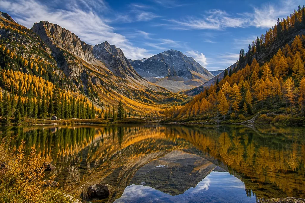
If there’s one thing you need to know about visiting the Livingston Range, it’s that western larch trees turn brilliant gold in October.
The western larch (Larix occidentalis) is one of the world’s few deciduous conifers — a needle-bearing tree that loses its needles each fall. Before they drop, the needles turn an intense yellow-gold that lights up entire mountainsides.
The North Fork sector of Glacier, with its mixed conifer forest and the Livingston Range as the backdrop, is one of the best places in Montana to see this phenomenon. Peak larch color is typically late September through mid-October, depending on elevation and year.
This is one of the few times the North Fork sees significant visitation. Local photographers and Montana residents make pilgrimage trips during peak larch week. For seasonal timing, see Montana in October.
Where to Base Yourself
Polebridge — In the North Fork
Best for: Maximum North Fork immersion, Bowman Lake, Kintla Lake, Numa Lookout, and the genuine off-grid experience.
Limited lodging — a few cabin rentals, some camping at Bowman Lake and Kintla Lake campgrounds (no reservations; first-come first-served). No cell service. Bring everything you need.
Columbia Falls — Drive-In Base
Best for: Most travelers. Roughly 1 hour from Polebridge via the Outside North Fork Road. Real lodging, restaurants, full services. Day-trip into the North Fork.
Whitefish — Larger Tourist Base
Best for: Travelers combining the North Fork with skiing at Whitefish Mountain Resort or wanting more upscale lodging. About 1.5 hours from Polebridge.
West Glacier — South Park Entrance
Best for: Travelers combining the North Fork with the rest of Glacier via Going-to-the-Sun Road. About 1.5 hours from Polebridge via the Outside Road.
Best Time to Visit
The Livingston Range has a relatively short alpine season due to high elevation, deep snow, and the road conditions.
Late June through mid-July is fine for lower-elevation access, but the high country is still snowbound and many trails are impassable.
Mid-July through mid-September is prime. Wildflowers peak in late July. The lakes are warm enough for swimming (briefly). Mosquitoes are intense in July and largely gone by mid-August.
Mid-September through mid-October is the larch season — my favorite time. Crowds thin out, weather is generally stable, and the gold-needled larches transform the forest. The Polebridge Mercantile reduces hours in October but typically stays open.
Late October through April the area is mostly inaccessible. Roads close, snow accumulates, and the North Fork becomes effectively wilderness. Some experienced cross-country skiers and snowshoers access lower trails, but it’s a serious undertaking.
For seasonal context, see Montana in July, Montana in August, and Montana in October.
Personal Tips: What I Wish I Knew About the Livingston Range
Plan for no cell service. Polebridge has no cell coverage. The North Fork roads have no coverage. If you need to be reachable, you can’t be here. I bring a Garmin inReach for emergency communication.
The roads are slow. Both the Inside and Outside North Fork Roads are gravel/dirt and significantly slower than they look on a map. Plan 90 minutes from Columbia Falls minimum.
Polebridge Mercantile huckleberry bear claws are worth the drive. I know this sounds like marketing. It’s not. They make them fresh in the morning, they sell out by midday, and they’re genuinely one of the best baked goods in Montana.
Bowman and Kintla Lake campgrounds fill up fast. Both are first-come, first-served (no reservations). On summer weekends, arrive by mid-morning Friday at the latest. Midweek is much easier.
Larch peak is short. The peak gold color lasts about 2 weeks, varying by year. Watch local photographer blogs in mid-September for status updates. Once it starts, it goes fast.
Don’t try to climb Kintla Peak unless you’re a real mountaineer. The 15-mile approach plus Class 4 climbing plus weather exposure has turned back many parties. Most people who plan it don’t actually summit. The lake hikes are more than enough for most travelers.
Wolves are here. You probably won’t see them, but you’ll likely hear them at night if you camp at Bowman or Kintla in summer. The howling is one of the great Montana experiences.
Bring bear spray and use it correctly. This is some of the densest grizzly habitat in the Lower 48. Spray on the hip, not in the pack. Group hiking and noise. See the bear guide.
Fish are accessible. Bowman and Kintla Lakes both hold cutthroat trout, bull trout, and kokanee salmon. Montana fishing license required. The bull trout are catch-and-release only.
Practical Info Box
| Item | Detail |
|---|---|
| Highest peak | Kintla Peak, 10,106 ft (most northerly 10,000+ peak in contiguous U.S.) |
| Range length | 36 miles N–S |
| Range width | 28 miles E–W |
| Number of 9,000+ ft peaks | 15+ |
| Geology | Belt Supergroup (1.4–1.6 billion years), emplaced by Lewis Overthrust |
| National Park | Glacier National Park (Livingston Range is the western spine) |
| Active glaciers | Agassiz, Rainbow, others (shrinking) |
| Gateway community | Polebridge, MT (no cell service, no power grid) |
| Major access roads | Inside North Fork Road, Outside North Fork Road |
| Major lakes | Bowman Lake (7 mi long), Kintla Lake |
| Northern terminus | British Columbia (Akamina-Kishinena Provincial Park) |
| Best basecamps | Polebridge (in-park), Columbia Falls / Whitefish / West Glacier (regional) |
| Best months | Mid-July through September; spectacular October larch color |
| Cell service | None |
| Bear spray | Required gear |
Final Thoughts
The Livingston Range is Glacier National Park’s quiet half. It doesn’t have the tourist infrastructure of Going-to-the-Sun Road, it doesn’t have the famous photographs from the Highline Trail, it doesn’t have the lodge culture of Many Glacier.
What it has is the most remote 10,000-foot peak in the contiguous United States, a community without cell service, a 7-mile-long alpine lake with no road around it, and the most reliable larch color in Montana.
If you’ve already done Glacier the conventional way and want to come back: the Livingston Range is the answer.
If you’re a first-time Glacier visitor with five-plus days: split your time between the Lewis Range (Going-to-the-Sun Road, Many Glacier) and the Livingston Range (Polebridge, Bowman Lake, Kintla Lake).
The contrast between the two halves of the park is genuinely the best way to understand Glacier.
For broader context on how the Livingston Range fits alongside Montana’s other ranges, see the full Montana mountain ranges guide.
Frequently Asked Questions
Where is the Livingston Range?
The Livingston Range is the western spine of Glacier National Park in northwestern Montana, running about 36 miles north to south and extending across the Canadian border into British Columbia. It’s accessed from the North Fork sector of Glacier via Polebridge.
What’s the highest peak in the Livingston Range?
Kintla Peak at 10,106 feet — the most northerly peak above 10,000 feet in the contiguous United States and the third-tallest peak in Glacier National Park.
What does “Kintla” mean?
“Kintla” comes from the Kootenai word for “sack.” According to Kootenai tradition, a man drowned in one of the Kintla Lakes, and the lake was likened to a sack — “once you got in, you couldn’t get out.”
What’s the difference between the Livingston Range and the Lewis Range?
Both are within Glacier National Park, but they’re parallel ranges. The Lewis Range is the eastern spine, containing Going-to-the-Sun Road and Many Glacier. The Livingston Range is the western spine, accessed via the North Fork and Polebridge. Both share the same geological origin (Lewis Overthrust).
How do you get to the Livingston Range?
From Polebridge, Montana — accessed via the Inside or Outside North Fork Road from West Glacier or Columbia Falls. The drive is roughly 1–1.5 hours of gravel road from Columbia Falls.
Is Polebridge worth the drive?
Yes — but only if you accept it for what it is: a tiny, off-grid community without cell service or modern amenities. The Polebridge Mercantile, the Northern Lights Saloon, and the gateway to one of the wildest sectors of the Lower 48 are the rewards.
What’s the best hike in the Livingston Range?
For families: the Bowman Lake shoreline trail. For day hikers: Numa Ridge Lookout (5.6 miles, big views). For backpackers: the Hole-in-the-Wall traverse via Boulder Pass. For mountaineers: Kintla Peak via the Southeast Ridge.
Are there grizzly bears in the Livingston Range?
Yes — some of the densest grizzly habitat in the contiguous United States. The North Fork sector of Glacier is particularly active grizzly country. Carry bear spray.
When do the larches turn gold?
Western larch peak color typically falls in late September through mid-October in the North Fork sector. The exact window varies by year and elevation.
Are the Livingston Range glaciers still active?
A few are. The Agassiz Glacier and Rainbow Glacier still meet the technical definition of glaciers, but like all Glacier National Park glaciers, they’re shrinking rapidly and projected to mostly disappear in coming decades.