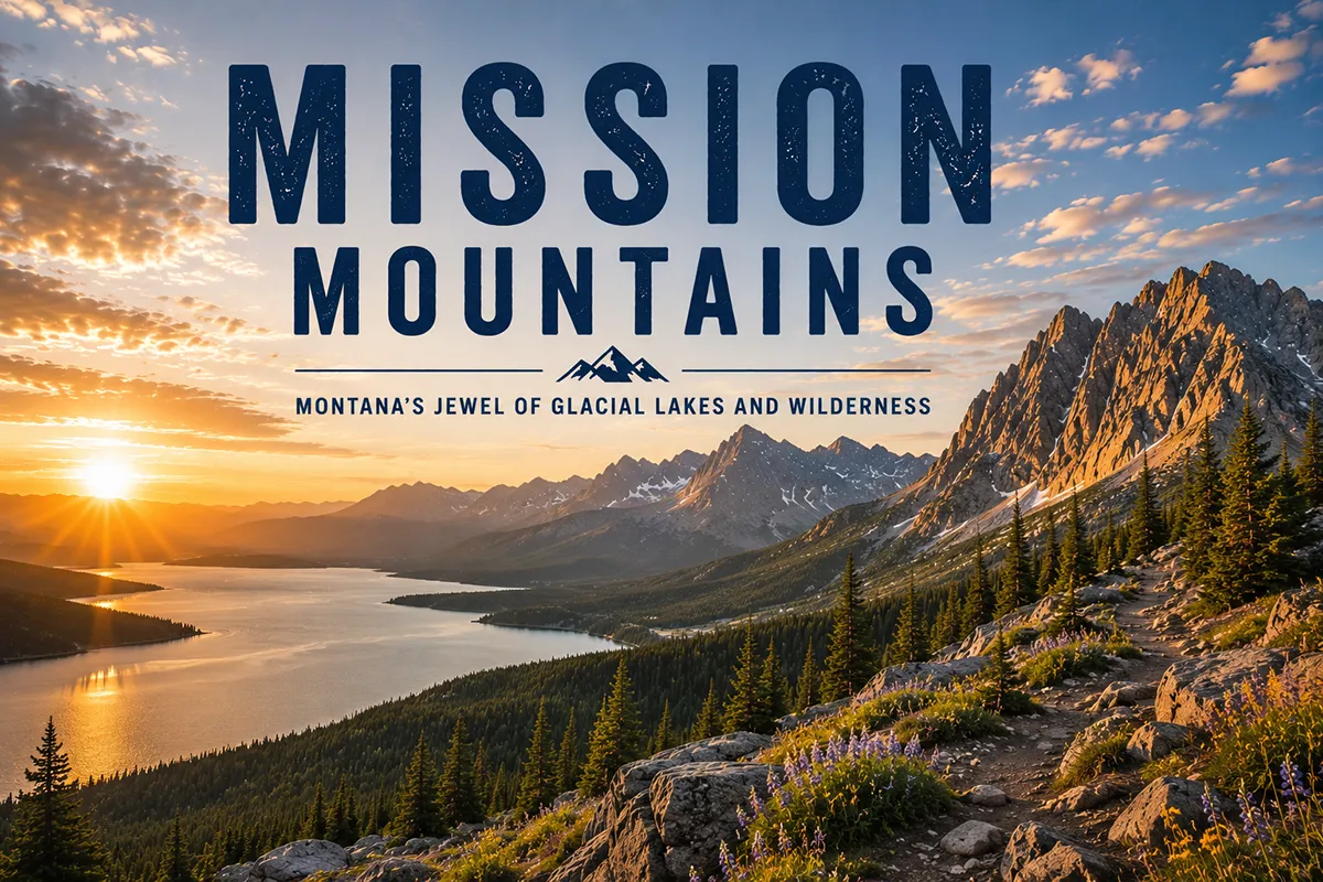
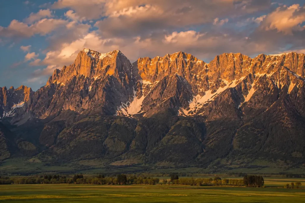
Drive south on US-93 from Polson toward Missoula on a clear afternoon and the Mission Mountains hit you like a wall.
There’s about forty miles of nearly vertical granite-and-Belt-rock peaks rising 7,000 feet off the Mission Valley floor — no foothills, just prairie one second and a row of 9,000-foot summits the next.
Locals call them the American Alps, and the comparison isn’t marketing. I drove this stretch once on a September evening with the western face lit gold by the setting sun and pulled over twice because I genuinely couldn’t keep my eyes on the road.
The Mission Mountains run roughly 50 miles between Missoula and Flathead Lake, with McDonald Peak (9,820 ft) as the high point. Their west face is the most dramatic mountain wall in Montana outside Glacier. The range is split into two wilderness areas — the federal Mission Mountains Wilderness (73,877 acres) on the east side, and the Mission Mountains Tribal Wilderness (89,500 acres) on the west side, which in 1982 became the first tribally-designated wilderness in the United States. The west side closes every July 15 through October 1 to protect grizzlies feeding on army cutworm moths. A Tribal Conservation Permit is required for the west side. Best window: late June through mid-September.
Liked this article?
Add Roaming Montana as a preferred source so you see more of our articles and guides on Google.
Why the Missions Are Called the American Alps
Most Montana mountain ranges build gradually — you drive through foothills, into forested ridges, up toward an alpine zone. The Missions skip the gradient.
On their west face, the transition from grassland prairie at 3,000 feet to vertical granite at 9,000 feet happens in about two horizontal miles.
The result is the most dramatic mountains-meet-plains profile in Montana outside the Rocky Mountain Front.
The comparison to the European Alps is more than visual. The Missions are built almost entirely of Belt Supergroup rock — a 1.4-to-1.6-billion-year-old sequence of sedimentary layers (mudstone, sandstone, argillite, limestone) deposited when this region was a shallow inland sea.
The same rock that forms Glacier National Park’s signature cliff-and-ledge architecture forms the Missions.
The vertical layering, combined with classic Pleistocene glaciation, produces the kind of serrated alpine ridgelines, hanging valleys, and U-shaped glacial canyons that look almost identical to the Bernese Alps.
For broader context on Montana’s mountain systems, see Montana’s full mountain ranges guide.
Where the Missions Are
The Mission Mountains run roughly 50 miles north–south between Missoula and Flathead Lake, with a relatively narrow width of 2 to 6 miles.
They sit between the Mission Valley (and the Flathead Reservation) on the west, and the Swan Valley on the east. The Swan River and the Swan Range form their eastern boundary; Flathead Lake forms their northern terminus near Bigfork.
The range crosses Lake and Missoula counties, with the crest forming the eastern boundary of the Flathead Indian Reservation. The Confederated Salish and Kootenai Tribes (CSKT) manage the entire western slope; the Flathead National Forest manages the eastern slope.
US-93 runs the length of the Mission Valley along the west side of the range — and the entire drive between Polson and Arlee is one of the most consistently beautiful highway stretches in the state.
McDonald Peak and the High Country
McDonald Peak, at 9,820 feet, is the highest point in the Mission Mountains. A dozen other peaks in the range exceed 9,000 feet, all clustered in the southern half. The northern half of the range tapers steadily down toward Flathead Lake, ending in lower forested ridges near Bigfork.
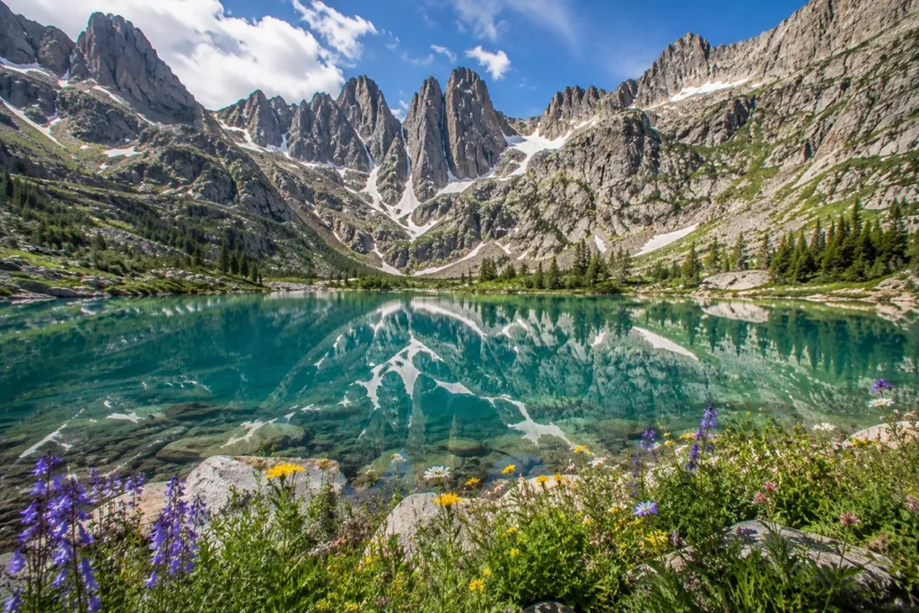
The high country is studded with what visitors call “tarns” — small glacial lakes formed in cirques and basins. Visit Montana’s tourism office calls the Missions one of the highest densities of alpine lakes in the Northern Rockies, and they’re not exaggerating.
From any high ridge in the range, you can see ten to twenty lakes at once. Several small remnant glaciers — true active glaciers, not just permanent snowfields — still cling to the highest north-facing slopes.
I have to be straight here: most of McDonald Peak itself is closed to the public during the summer, more on that below.
Two Wilderness Areas: A Critical Distinction
The Mission Mountains contain two separately managed wilderness areas. Getting them confused will get you ticketed at best, or in serious trouble at worst. Here’s the breakdown.
Mission Mountains Wilderness (East Side / Federal)
- Acres: 73,877
- Managed by: Flathead National Forest (USFS)
- Established: 1975 (under the Wilderness Act of 1964)
- Access: From the Swan Valley side (east), via Highway 83 / Forest Service roads from Seeley Lake, Condon, and Swan Lake
- Permit: No specific permit required, just standard wilderness regulations (no motors, no bikes, no group sizes over 15)
- Maintained trails: Roughly 45 miles
- Best access points: Glacier Creek trailhead (Glacier Lake), Piper Lake trailhead, Cold Lakes trailhead, Crystal Lake trailhead
Mission Mountains Tribal Wilderness (West Side / Tribal)
- Acres: 89,500
- Managed by: Confederated Salish and Kootenai Tribes (CSKT)
- Established: 1979 (designated), formal protection 1982
- Significance: The first tribally-designated wilderness in the United States — no other tribe had ever set aside its own land as designated wilderness before
- Access: From the Mission Valley side (west) via the Flathead Reservation
- Permit required: A Tribal Conservation Permit is required for all non-tribal visitors. Available from CSKT offices in Pablo, online, or from local outfitters
- Group size: Maximum 8 people, 8 head of livestock
- Special closure: McDonald Peak Grizzly Bear Management Zone — closed July 15 to October 1 annually
The boundary between the two wilderness areas runs along the crest of the range — generally the highest ridgeline. You can hike from one into the other, but you need the permit before crossing onto tribal land.
For trip planning purposes: the federal east side is what most non-tribal visitors hike. The west side is more restricted, requires the permit, and has the seasonal closures. Both are spectacular. Both are grizzly country.
The Grizzly Bear Closure: What’s Actually Happening on McDonald Peak
This deserves a dedicated section because the ecology is genuinely fascinating and most travelers don’t understand why the closure exists.
Every summer, army cutworm moths (Euxoa auxiliaris) migrate from the eastern Montana plains where they hatch and feed on agricultural crops, up to the high-elevation talus fields of the Rocky Mountains.
They concentrate by the millions in the rockslides above 9,000 feet, where they hibernate (“aestivate”) through the hot summer months. The moths are extraordinarily nutritious — pound for pound, they have more fat content than elk meat.
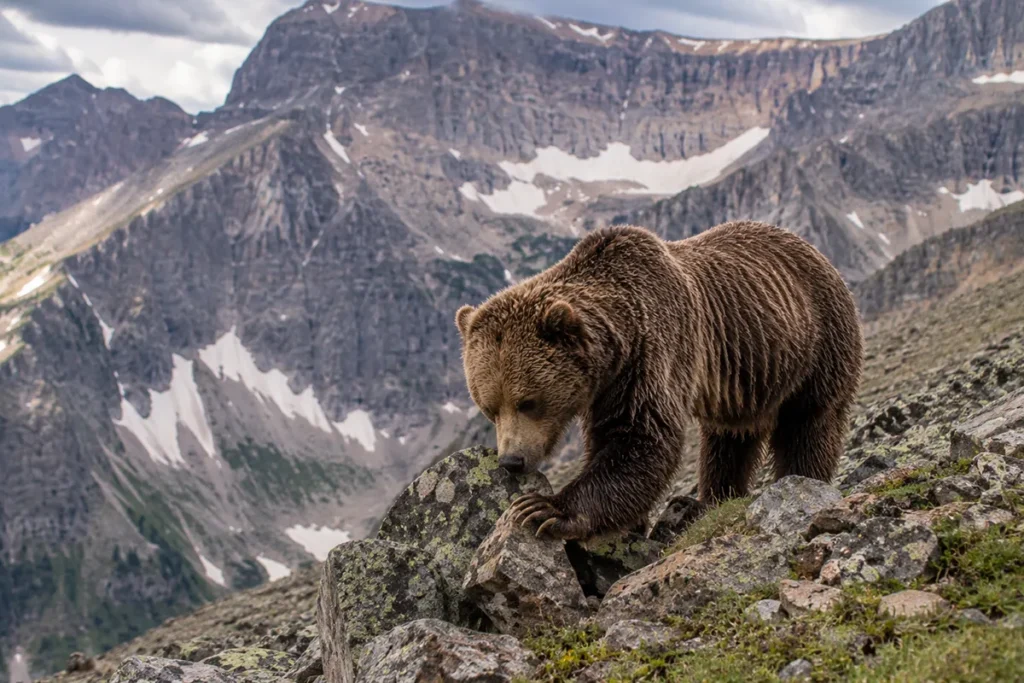
Grizzly bears know this. Every July through September, grizzlies congregate on McDonald Peak and surrounding talus fields, flipping rocks and gorging on moths.
A grizzly can eat tens of thousands of moths per day. This intensive feeding period puts on critical pre-hibernation weight, and it’s one of the most concentrated grizzly feeding events anywhere in the Lower 48.
In 1982, the CSKT recognized that human disturbance in this zone was disrupting the bears and creating safety risks for hikers.
They established the Special Grizzly Bear Management Zone — roughly 10,000 to 12,000 acres covering McDonald Peak, Ashley Lakes, and the adjacent drainages — and closed it to all human use from July 15 to October 1.
The closure has been a model conservation success, and it’s one of the reasons the Mission Mountains grizzly population is so healthy.
What this means practically:
- You cannot hike McDonald Peak in summer
- You cannot camp at Ashley, Duncan, Cliff, Disappointment, or First Lake (all inside the closure) during summer
- The closure is patrolled by Tribal Fish & Game officers
- McDonald Lake (lower elevation), Summit Lake, and Eagle Pass remain accessible
- For the rest of the year (October 1 through July 14), access opens up
If you want to climb McDonald Peak, plan an early summer trip in late June or early July before the closure — though you’ll still be in active grizzly habitat.
The Salish and Kootenai Homeland
The Mission Mountains are the ancestral homeland of the Bitterroot Salish, Pend d’Oreille (Upper Kalispel), and Kootenai peoples — the three tribes that today form the Confederated Salish and Kootenai Tribes (CSKT).
For thousands of years before contact, the range and the valley below were used for hunting, fishing, root and berry gathering, and ceremonial purposes.
The CSKT statement on the Tribal Wilderness designation captures what the range means to the tribes:
“These mountains belong to our children, and when our children grow old they will belong to their children. In this way and for this reason these mountains are sacred.”
The 1855 Hellgate Treaty established the Flathead Reservation, which today covers most of the Mission Valley and the western slope of the Missions. The town names of the valley — St. Ignatius, Pablo, Ronan, Charlo — all reflect tribal history, with several named for tribal leaders.
The name “Mission Mountains” itself comes from St. Ignatius Mission, a Jesuit mission established in 1854 at the foot of the range.
The mission church still stands, with frescoes painted by Brother Joseph Carignano in the 1890s — one of the most striking interior spaces in Montana. Worth a stop on any Missions trip.
The Best Hikes in the Mission Mountains
Most Missions hikes are short-ish in distance but steep. The west face’s brutal verticality means you gain elevation fast. Plan for slow miles.
Glacier Lake (East Side, Federal Wilderness)
The most popular hike in the Mission Mountains Wilderness — and the best introductory trail. 3.3 miles round-trip, ~420 feet of elevation gain, ending at a stunning alpine lake set against vertical walls.
Trailhead is the Glacier Creek trailhead, accessed from Highway 83 between Seeley Lake and Condon. Suitable for families with reasonably fit kids. No tribal permit required.
Cold Lakes (East Side, Federal Wilderness)
A longer, harder trail to a series of high alpine lakes. Roughly 8 miles round-trip with substantial gain. Excellent overnight option. The Cold Lakes area has camping restrictions; check current regulations.
Turquoise Lake (East Side, Federal Wilderness)
About 12 miles round-trip to one of the most spectacular lakes in the range — Turquoise gets its name honestly. This is a serious day hike or a good overnight. ~2,500 feet of elevation gain.
Piper Lake (East Side, Federal Wilderness)
One of the longest trails in the federal wilderness — about 12.7 miles round-trip with 2,500+ feet of gain. Less crowded than Glacier Lake. Worth it for the solitude.
Mission Reservoir / Mission Falls (West Side, Tribal Wilderness)
A 3.6-mile out-and-back to Mission Reservoir, passing the dramatic Mission Falls cascade. Trailhead is from the Mission Valley side. Requires a Tribal Conservation Permit. One of the more accessible west-side hikes.
Lucifer Lake (West Side, Tribal Wilderness)
A steep, demanding 6.3-mile climb with nearly 3,000 feet of gain, passing Mission Falls on the way up. Spectacular high lake setting. Tribal permit required.
McDonald Lake (West Side, Tribal Wilderness — Outside Closure Zone)
McDonald Lake at the foot of McDonald Peak is accessible by road and is one of the most photographed spots in the range. Quick canoe paddles, easy lakeside walks, and views straight up at McDonald Peak. Tribal permit required, but the lake itself stays open during the summer grizzly closure.
Wildlife in the Missions
The Mission Mountains support some of the densest grizzly bear habitat in the Lower 48 outside Glacier National Park.
Grizzly bears — significant resident population, concentrated on the west side. Carry spray at all times. Review our Montana bear guide.
Black bears are common throughout.
Mountain goats — the Missions support a healthy alpine goat population, particularly on the cliff faces of McDonald Peak and Mountaineer Peak.
Mountain lions are present but rarely seen.
Wolves have recolonized the range — a small but established population, with packs ranging between the Missions and the adjacent Bob Marshall Wilderness Complex.
Wolverines — confirmed in the high country, but extremely rare.
Elk, mule deer, white-tailed deer, and moose are all abundant in their respective habitat zones.
Bird life: Common loons nest on several of the alpine lakes — one of the few breeding loon populations this far south in the Lower 48. Bald eagles and ospreys are common in the lower drainages.
Where to Base Yourself
The Missions can be approached from either the west (Mission Valley / Flathead Reservation) or the east (Swan Valley). Your choice depends on which trails you’re targeting.
West Side: St. Ignatius, Ronan, Pablo, Polson
Best for: Tribal Wilderness access, McDonald Lake, the dramatic west face, Mission Falls, and combining your trip with Bison Range and Flathead Lake.
St. Ignatius sits directly at the foot of the range and is the closest base for Mission Falls and the west-side trails. Population around 850. Limited but adequate lodging. The St. Ignatius Mission church is worth a visit.
Pablo is the CSKT tribal headquarters — this is where you pick up your Tribal Conservation Permit if you didn’t get it online.
Polson sits at the south end of Flathead Lake. Population around 5,200, larger services. Best for travelers combining the Missions with lake recreation.
Ronan and Charlo are smaller agricultural communities along US-93 between St. Ignatius and Polson.
East Side: Seeley Lake and Condon
Best for: Federal wilderness access, Glacier Lake, the Cold Lakes, Turquoise Lake, and combining your trip with the Swan Valley and Bob Marshall Wilderness.
Seeley Lake is the larger of the two east-side communities, with lodging, restaurants, gear shops, and direct Forest Service road access to several wilderness trailheads. Roughly 50 miles north of Missoula on Highway 83.
Condon is smaller and quieter, sitting in the heart of the Swan Valley, with access to northern wilderness trailheads.
Northern: Bigfork
For travelers focused on the northern Missions and Flathead Lake — Bigfork is the established tourist town at the southeast corner of Flathead Lake.
Regional: Missoula or Kalispell
Missoula (south) and Kalispell (north) are the full-service regional cities. Both within 60-90 minutes of Mission trailheads.
Best Time to Visit
The Missions have a relatively short and weather-dependent hiking season due to elevation, exposure, and the grizzly closure.
Late June through mid-July is excellent for the east-side wilderness. The lakes are mostly ice-free, snow has cleared from most approaches, and wildflowers are peaking. You can still attempt McDonald Peak in early July before the July 15 closure.
Mid-July through October 1 is the closure period for the west-side Grizzly Bear Management Zone. East-side hiking remains excellent. Mosquitoes are bad in early July but generally over by August.
Mid-August through early September is my sweet spot. Mosquitoes are gone, weather is stable, the lakes are warmest for swimming.
Mid-September through mid-October is fall hiking — the larches in the Swan Valley turn gold, crowds are minimal, but weather risk increases. The closure ends October 1, so west-side access reopens.
Winter the range is the domain of backcountry skiers and snowmobilers. Snowmobiling is allowed in some areas of the federal wilderness boundary zones and prohibited inside the wilderness. The Tribal Wilderness has its own restrictions.
For seasonal Montana context, see Montana in July and Montana in September.
Personal Tips: What I Wish I Knew
Get the Tribal Conservation Permit before you go. If you’re planning any west-side hiking on the Flathead Reservation — whether in the Tribal Wilderness or just on tribal land — you need a Tribal Conservation Permit. They’re available from the CSKT Tribal Natural Resources Department in Pablo, online, or from many local outfitters and convenience stores in the Mission Valley. They’re cheap and they’re required. Tribal officers do enforce.
The west face is best photographed from the Mission Valley in evening light. Pull-offs along US-93 near St. Ignatius and Ronan give the best views, particularly in late afternoon when the sun lights up the granite. The Bison Range, just south, is also an underrated viewing point.
Don’t underestimate the verticality. A 6-mile hike in the Missions is not the same as a 6-mile hike in the Beartooths. You gain elevation faster here than in almost any other Montana range. Plan accordingly.
Bear spray is non-negotiable. I cannot emphasize this enough. The Missions have some of the densest grizzly populations in the Lower 48 per square mile. Even on short, popular trails like Glacier Lake, carry spray on your hip.
The Bison Range is right next door. The Bison Range — once the National Bison Range, now restored to CSKT management in 2020 — sits at the southern edge of the Mission Valley. Combine a Missions trip with a Bison Range driving tour for one of the best one-day wildlife experiences in Montana.
St. Ignatius Mission is worth twenty minutes. The 1890s frescoes inside the church are extraordinary and the building itself, dating to 1854, is the oldest standing Mission building in Montana.
Cell service is poor everywhere. US-93 has spotty coverage. The wilderness areas have zero. Plan accordingly.
Common loons nest on several Missions lakes. If you camp at a wilderness lake in summer, you may hear them calling at dusk — one of the most haunting sounds in nature.
Practical Info Box
| Item | Detail |
|---|---|
| Highest peak | McDonald Peak, 9,820 ft |
| Range length | ~50 miles N–S |
| Range width | 2–6 miles E–W |
| Federal wilderness | Mission Mountains Wilderness, 73,877 acres (est. 1975) |
| Tribal wilderness | Mission Mountains Tribal Wilderness, 89,500 acres (est. 1982) — first tribal wilderness in the U.S. |
| Combined protected acreage | ~163,000 acres |
| Geology | Belt Supergroup sedimentary rock |
| Major grizzly closure | McDonald Peak Grizzly Bear Management Zone, July 15–October 1 |
| Tribal permit required for west side | Yes — CSKT Tribal Conservation Permit |
| Maintained trails (federal) | ~45 miles |
| National Forest (east) | Flathead National Forest |
| Tribal nation (west) | Confederated Salish and Kootenai Tribes (CSKT) |
| Counties | Lake, Missoula |
| Best basecamp (west) | St. Ignatius |
| Best basecamp (east) | Seeley Lake |
| Bear spray | Required gear |
Final Thoughts
I think the Mission Mountains are the most underrated range in Montana. Glacier gets the crowds, the Beartooths get the prominence, the Bitterroots get the canyons — and the Missions sit there with the most dramatic west face in the state, the highest density of alpine lakes in the Northern Rockies, the first tribal wilderness in America, and one of the most fascinating grizzly bear feeding ecosystems on the continent, and most travelers never set foot in them.
If it’s your first trip, do Glacier Lake on the east side as a day hike, then drive the Mission Valley loop on US-93 between Polson and St. Ignatius with sunset over the west face.
Combine it with a stop at the Bison Range. If you’ve been once, get the Tribal Conservation Permit and explore the west side — Mission Falls and McDonald Lake are accessible even during the closure period.
If you’re committed, plan a multi-night backpack to Turquoise Lake or the Cold Lakes.
And whatever you do, respect the closure and respect the permit system. Both exist for good reasons.
For broader context on how the Missions fit into the state’s mountain geography, see the full Montana mountain ranges guide.
Frequently Asked Questions
Where are the Mission Mountains?
The Mission Mountains run between Missoula and Flathead Lake in northwestern Montana, forming the western boundary of the Swan Valley and the eastern boundary of the Mission Valley.
Why are they called the American Alps?
The Mission Mountains’ western face rises nearly 7,000 feet abruptly from the Mission Valley floor with serrated, glacially carved peaks and a high density of alpine lakes — visually and geologically similar to the European Alps.
How tall are the Mission Mountains?
McDonald Peak at 9,820 feet is the highest point. A dozen peaks in the range exceed 9,000 feet.
What’s the Mission Mountains Tribal Wilderness?
The 89,500-acre Mission Mountains Tribal Wilderness, designated by the Confederated Salish and Kootenai Tribes (CSKT) in 1979 and formalized in 1982, was the first tribally-designated wilderness area in the United States. It covers the entire western slope of the range.
Do you need a permit to hike the Mission Mountains?
For the federal Mission Mountains Wilderness on the east side, no specific permit is required. For the Mission Mountains Tribal Wilderness on the west side, a Tribal Conservation Permit from the Confederated Salish and Kootenai Tribes is required.
Why is McDonald Peak closed in summer?
Each summer (July 15 to October 1), grizzly bears gather on the high talus fields of McDonald Peak to feed on aestivating army cutworm moths — an extraordinary concentration of food. The CSKT closes a roughly 10,000-acre Grizzly Bear Management Zone to all human use during this period to protect both the bears and visitors.
Are there grizzly bears in the Mission Mountains?
Yes. The Mission Mountains support one of the densest grizzly bear populations in the contiguous United States outside Glacier National Park. Carry bear spray at all times.
What’s the best hike in the Mission Mountains?
For most visitors: the Glacier Lake trail (3.3 miles, federal wilderness) is the easy classic. For overnighters: Turquoise Lake or Cold Lakes. For tribal side: Mission Falls or Lucifer Lake with a tribal permit.
Where do you stay near the Mission Mountains?
West side: St. Ignatius, Ronan, Pablo, or Polson on the Flathead Reservation. East side: Seeley Lake or Condon in the Swan Valley. Regional bases: Missoula or Kalispell.
Are the Mission Mountains part of the Rocky Mountains?
Yes. The Missions are a sub-range of the Northern Rocky Mountains, geologically related to the Glacier National Park ranges through shared Belt Supergroup bedrock.