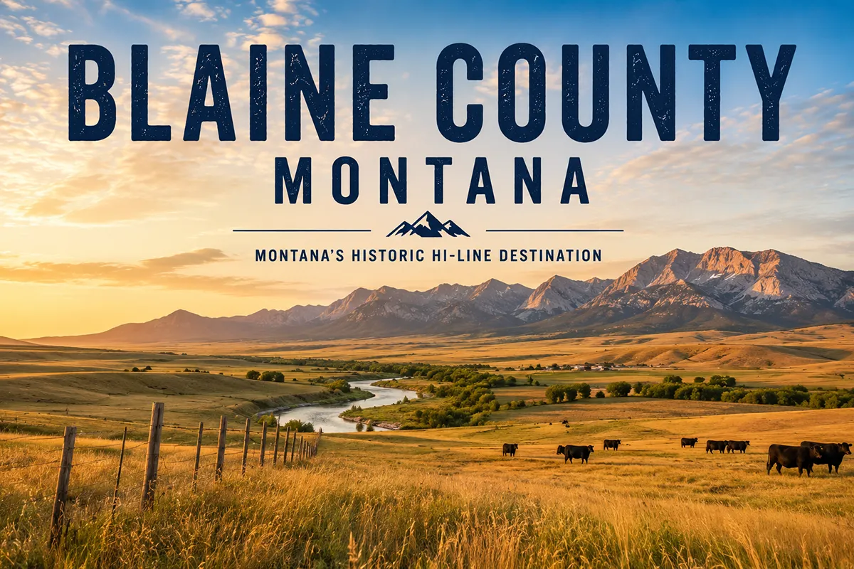
Most people driving US Highway 2 through northern Montana treat Chinook as a fuel stop.
I was one of them for years — pull off, fill up, keep moving west toward Havre or east toward Malta without ever turning south toward the battlefield that sits 16 miles away on a quiet county road.
The day I finally drove to Bear Paw changed how I think about the whole Hi-Line. This county has layers.
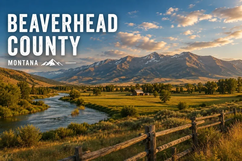
- Blaine County sits on Montana’s Hi-Line, bordering Saskatchewan to the north and the Missouri River to the south
- The county seat is Chinook (pop. ~1,200), on US Highway 2
- The Bear Paw Battlefield is the final site of the 1877 Nez Perce War — where Chief Joseph surrendered just 40 miles from the Canadian border
- The Fort Belknap Reservation covers much of the county and is home to two tribes: the Aaniiih (Gros Ventre) and Nakoda (Assiniboine)
- The Little Rocky Mountains in the south hold two historic gold-rush towns — Zortman and Landusky
- The Blaine County Museum in Chinook is a Montana Dinosaur Trail member with a standout multimedia presentation on the Nez Perce War
- The McClelland Ferry provides a rare seasonal Missouri River crossing into the Upper Missouri River Breaks
- Best visited May–October; fuel up in Chinook before heading south — services are minimal once you leave the Hi-Line
Blaine County at a Glance
Blaine County was established in 1912 and covers 4,226 square miles in north-central Montana.
It’s named for James G. Blaine, a U.S. Secretary of State and two-time presidential candidate. The county’s geography is more varied than it looks from the highway.
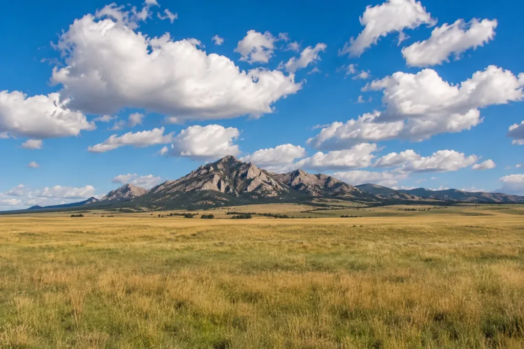
The Hi-Line (US Highway 2) slices east-west across the northern half, through flat wheat and barley country. Drop south and the landscape shifts: the Bear Paw Mountains rise as an isolated island range from the prairie, then give way to the Missouri River breaks along the county’s southern edge.
The Milk River runs through Chinook and Harlem, and the Missouri River forms the entire southern boundary. The Fort Belknap Reservation covers a significant portion of the county.
Population is around 6,936, spread thin across a large area. The county borders Saskatchewan to the north — with a port of entry near Turner for cross-border traffic.
For context alongside the rest of the state, see all 56 Montana counties.
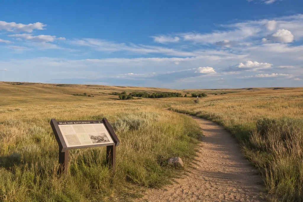
Bear Paw Battlefield
If you’ve read anything about the Nez Perce War of 1877, you know how it ends — but standing at Bear Paw still hits differently than reading about it.
Chief Joseph’s band had been fleeing U.S. Army forces for nearly four months and over 1,100 miles — from their homeland in Oregon’s Wallowa Valley, through Idaho, across Montana’s Bitterroot Range, through Yellowstone, and then north toward Canada.
They were 40 miles from the border when Colonel Nelson Miles caught them here on October 1, 1877.
A five-day siege followed in October snow and cold. The Nez Perce held off the Army longer than anyone expected. When Joseph finally surrendered on October 5, he reportedly said: “From where the sun now stands, I will fight no more forever.”
Around 430 Nez Perce people were captured here. Many who escaped the siege made it to Canada. Those who surrendered were sent first to Kansas, then to Oklahoma — not to their homeland in the Pacific Northwest. Chief Joseph never returned to the Wallowa Valley.
Visiting the battlefield:
The site is 16 miles south of Chinook on County Highway 240. It’s part of the Nez Perce National Historical Park system — the same network as Big Hole Battlefield in Beaverhead County.
A 1.25-mile interpretive trail loops through the battlefield with numbered markers explaining troop positions, tipi locations, and key moments of the siege. The trail is flat and walkable in about 45 minutes at a thoughtful pace.
There is no entrance fee. Picnic tables and restrooms are available. Summer ranger tours can be arranged in advance — contact the local NPS staff at 406-357-3130.
The battlefield is often quiet. I visited on a Saturday in September and had the trail to myself for the first hour. That solitude is part of the experience — this is a place that asks you to slow down.
[Verify current seasonal tour schedules at nps.gov/nepe]
Blaine County Museum
Before driving to the battlefield, stop at the Blaine County Museum in Chinook first.
It’s the designated interim visitor center for Bear Paw Battlefield, and its multimedia presentation — “Forty Miles from Freedom” — is the best preparation for the site.
The 20-minute program, built around a series of paintings by artist Lorenzo Ghiglieri commissioned by the museum in 1985, walks through the events leading up to and during the siege.
I’ve been to plenty of small county museums where the presentations feel like an afterthought. This isn’t one of them. The film is genuinely moving and adds context that makes the battlefield markers much more legible.
The museum also covers:
- Blaine County paleontology — dinosaur fossils found in the region, as part of the Montana Dinosaur Trail
- Native American cultural artifacts from both the Aaniiih and Nakoda peoples
- Pioneer homestead history dating to the early 1900s
- Local agricultural and ranching history
The museum provides NPS Passport cancellation stamps for Bear Paw Battlefield — worth knowing if you collect those.
Address: 501 Indiana Avenue, Chinook. Phone: 406-357-2590. [Verify current hours and admission fees before your visit.]
Fort Belknap Reservation: Aaniiih and Nakoda
The Fort Belknap Reservation covers 705,067 acres in Blaine and Phillips counties.
Two tribal nations share the reservation: the Aaniiih (also called Gros Ventre) and the Nakoda (also called Assiniboine). They were historically enemies — the Aaniiih are an Algonquian-speaking people related to the Arapaho, while the Nakoda are Siouan-speaking. The reservation system placed them together in 1888.
Today, the Fort Belknap Indian Community governs the reservation jointly, and both tribes maintain distinct cultural identities within a shared land base.
The reservation headquarters is at the community of Fort Belknap Agency, about 30 miles east of Chinook on US Highway 2.
What visitors can see on the reservation:
Snake Butte is an imposing sandstone formation that rises above the reservation’s bison range. It holds petroglyphs, tipi rings, and centuries of cultural significance for both tribes. Access is managed by the tribe — check current visitor policies before going.
Mission Canyon and Bear Gulch are canyon formations on the reservation with scenic and wildlife value.
St. Paul’s Mission near Hays is a historic Catholic mission church that has served the reservation community since the late 1800s.
The reservation’s genetically pure Yellowstone bison herd is one of the most significant in North America — a conservation success story that deserves more attention than it gets. [Verify current public viewing access with Fort Belknap tribal offices.]
Fort Belknap Cultural Events
Two annual powwows on the Fort Belknap Reservation are open to the public and worth planning a trip around.
Milk River Indian Days, held in July in Harlem, combines traditional singing, dancing, and drumming in a multi-day gathering that also includes film screenings, workshops, and a grand banquet.
Hays Pow Wow, held in August at the Hays community on the reservation, is a drumming and dancing competition that draws participants and spectators from across the region.
Both events celebrate Aaniiih and Nakoda culture and are genuinely welcoming to respectful outside visitors.
If you plan to attend either event, follow the same protocols as any tribal gathering: no photography without permission, follow all posted rules, and approach with genuine curiosity rather than a tourist checklist mentality.
[Verify current event dates and any entry requirements at fortbelknapnations.com]
The Little Rocky Mountains: Zortman and Landusky
The Little Rocky Mountains rise from the plains in the south-central part of Blaine County — another of Montana’s isolated “island” ranges, surrounded entirely by shortgrass prairie.
They’re not dramatic in the way the Rockies are. But they’re beautiful in their own way, and they carry a turbulent history.
In the 1880s and 1890s, gold was discovered in the Little Rockies and the towns of Zortman and Landusky appeared almost overnight.
Landusky was named for “Pike” Landusky — a prospector killed in 1894 by Kid Curry (Harvey Logan), an associate of Butch Cassidy, in a saloon fight over a longstanding personal grudge. Kid Curry went on to become one of the most wanted outlaws in the West.
Both towns still exist — barely. Zortman has a small number of year-round residents, a bar and café (seasonally open), and basic camping nearby. Landusky is smaller still.
The mountains themselves offer hiking, elk hunting, and dispersed camping on BLM land. Ponderosa pine grows across the higher slopes — a striking contrast to the surrounding prairie.
The mining history here also has an environmental footnote. The Zortman-Landusky gold mine — one of the first large-scale cyanide heap-leach operations in the U.S. — operated through the 1990s and created significant water contamination issues.
The site is now a Superfund-adjacent cleanup area. It’s honest Montana history: resource extraction with consequences that outlasted the boom.
Getting there: From Chinook, head south on US Highway 2 to Harlem, then south on Route 66 (about 50 miles total). The roads are paved to Zortman; some access roads beyond are gravel. High-clearance vehicles are helpful for deeper exploration.
The Upper Missouri River Breaks
The southern edge of Blaine County borders one of the most extraordinary landscapes in the American West — the Upper Missouri River Breaks National Monument.
The Missouri River cuts through ancient formations of white and tan sandstone here, creating badland formations, steep coulees, and canyon country that looks nothing like the rest of Montana. Lewis and Clark traveled this stretch of the Missouri in 1805 and wrote about it extensively in their journals.
The monument itself spans several counties. The Blaine County access point is via the McClelland Ferry in the south part of the county — a seasonal, free, vehicle-carrying cable ferry that crosses the Missouri River.
The McClelland Ferry is one of only three operational ferries left on the Missouri in Montana. It runs seasonally when river conditions allow — typically late spring through fall. The ferry connects the Hi-Line road system to the south-side breaks country and provides access to BLM dispersed camping and hiking along the river.
It’s a short crossing but a genuinely fun experience — especially if you’ve never ridden a river ferry. The views of the Missouri breaks from the south bank are some of the best in the county.
[Verify current ferry operating schedule and seasonal dates with Blaine County Road Department before planning your visit.]
Chinook: The County Seat
Chinook (population ~1,200) is named after the warm winter winds that periodically blow across the Hi-Line and can raise temperatures 30–40°F in hours.
It sits on the Milk River and US Highway 2, and it’s the main service hub for the county. The downtown has a few restaurants, motels, gas stations, and the Blaine County Museum.
The community still carries visible traces of its sugar beet past — the high school teams are still called the Sugarbeeters, and the annual Sugar Beet Festival in late September celebrates the crop that once supported a processing factory here.
The festival includes vendors, a parade, kids’ activities, and a barbecue. The factory itself is long closed, but the name stuck.
The Bear Paw Roundup Rodeo in late June is another strong local event — a PRCA-sanctioned rodeo with standard western events.
Chinook is a pleasant town to spend a night. I stayed at a small local motel and walked to dinner without a car — a rarity in rural Montana. The people are welcoming and the pace is slow in the way that Hi-Line towns tend to be: unhurried without being unfriendly.
Harlem
Harlem (population ~800) sits about 30 miles east of Chinook on US Highway 2 and serves as the main gateway community to the Fort Belknap Reservation.
It has basic services — gas, a small grocery, and a few food options. The town is named after the New York neighborhood, reportedly chosen by railroad surveyors who were running out of original names as they built the Hi-Line tracks westward.
Harlem is the starting point for drives south into the reservation toward Fort Belknap Agency, Hays, and the Little Rocky Mountains beyond.
What I Wish I Knew Before Visiting Blaine County
Start with the museum, not the battlefield. The Blaine County Museum’s “Forty Miles from Freedom” presentation is short (20 minutes) and genuinely changes how you read the landscape at Bear Paw. Don’t skip it.
The battlefield requires no reservation or fee. Just drive south from Chinook on County Highway 240 — the battlefield is clearly signed at 16 miles. The road is paved the whole way. There’s no ticket booth, no timed entry system, no crowds. You just show up and walk the trail.
Fill the tank in Chinook or Harlem. Once you head south toward the Little Rockies or the Missouri Breaks, services disappear. Zortman has no guaranteed fuel. Plan accordingly.
The McClelland Ferry doesn’t run in winter or high water. Check current operating status before routing your trip around it. It’s a free seasonal crossing that can close unexpectedly with river conditions.
Fort Belknap events are worth the trip but need advance research. Powwow dates shift year to year. Verify before you drive 2+ hours specifically for an event.
The Little Rockies are worth a full day. I treated them as a quick side trip on my first visit and regretted it. The combination of mining history, ponderosa pine hiking, and the sheer strangeness of a forested range rising from flat prairie deserves more time.
Cell service along the Hi-Line is decent; south of Chinook it drops fast. Download offline maps before heading into the breaks or the Little Rockies.
Practical Info
| County seat | Chinook |
| Area | 4,226 sq mi |
| Population | ~6,936 (2022 est.) |
| Tourism region | Central Montana |
| Formed | 1912 |
| Main highway | US Highway 2 (Hi-Line) |
| Bear Paw Battlefield | 16 miles south of Chinook on County Hwy 240 |
| Blaine County Museum | 501 Indiana Avenue, Chinook — 406-357-2590 |
| Fort Belknap Agency | ~30 miles east of Chinook via US-2 |
| Little Rocky Mountains | ~50 miles south of Chinook via Harlem |
| McClelland Ferry | Southern Blaine County — seasonal, free |
| Nearest airport | Havre City-County Airport (~50 miles west) |
| Best season | May–October |
| Battlefield entry | Free (NPS unit) |
| Cell service | Good on US-2; limited to none south of Chinook |
| Gas/services | Chinook, Harlem; none in south county |
| Canada border crossing | North of Turner on County Road |
Getting to Blaine County
By car: US Highway 2 (the Hi-Line) runs east-west directly through the county. Chinook is approximately 110 miles east of Havre and 75 miles west of Malta.
From Great Falls, take US-87 north to US-2 east — about 2.5 hours to Chinook.
From Billings, take I-90 east to US-87 north through Roundup and Lewistown, or I-90 west and US-87 north — about 3.5 hours.
By air: Havre City-County Airport (HVR) has limited regional service. Billings Logan International (BIL) is the closest major airport at roughly 3.5 hours.
See Montana transportation guide and Montana airports.
Towns in Blaine County
- Chinook — county seat, main services, Blaine County Museum
- Harlem — gateway to Fort Belknap Reservation, basic services
- Turner — small Hi-Line community; Canada border crossing nearby
- Zortman — former gold-rush town in the Little Rocky Mountains; seasonal café and camping
- Landusky — very small former mining community, Little Rocky Mountains
Adjacent Counties
- Hill County to the west — Havre, Rocky Boy’s Reservation
- Phillips County to the east — Malta, American Prairie Reserve, Missouri Breaks
- Chouteau County to the south — Fort Benton, Missouri River
- Saskatchewan, Canada to the north
Plan Your Blaine County Trip
Blaine County is the kind of place that rewards visitors who are willing to leave the highway.
The Hi-Line itself is fine — a long straight road through wheat country with a few decent towns. But the county’s real draws are all south of US-2: the battlefield, the reservation, the Little Rockies, and the Missouri Breaks canyon country.
A good minimum trip is two days. Day one: Blaine County Museum in the morning, Bear Paw Battlefield in the afternoon, overnight in Chinook. Day two: drive south to Zortman and the Little Rockies, return via Harlem and the Fort Belknap communities.
If you’re timing around a cultural event, build a long weekend around Milk River Indian Days in July or the Hays Pow Wow in August.
For historical context, see Montana history and key historical events in Montana.
For broader Hi-Line planning, see Montana trip planning guide and best time to visit Montana. Back to the complete Montana counties guide.