I’ve driven through Big Horn County three times in my life before I actually stopped.
The first two times, I was doing what most travelers do on I-90 through southeast Montana — pushing toward Billings or rushing toward Wyoming, watching the county flash past at 80 miles an hour without registering what was out there.
The third time, I got off at the Crow Agency exit and spent four days. What I found was one of the most historically layered, culturally rich, and geographically stunning counties in the entire state.
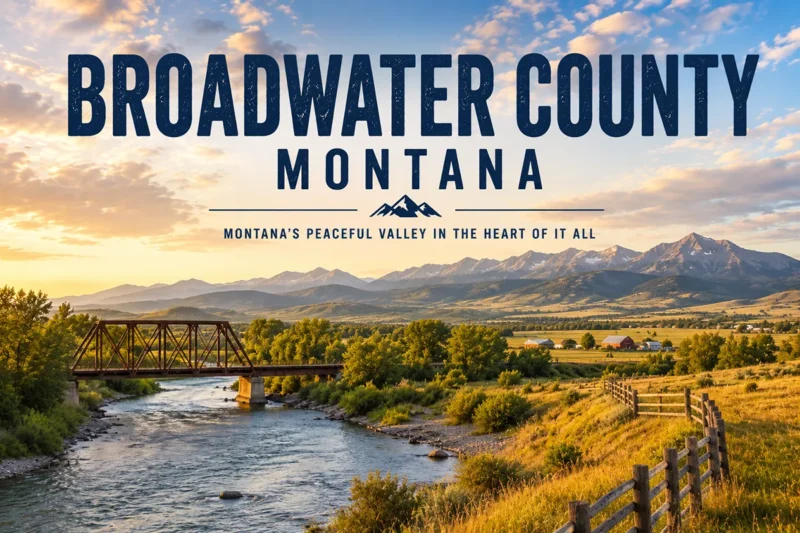
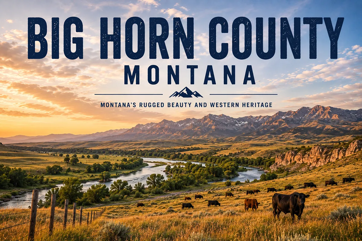
Big Horn County covers 4,995 square miles of southeast Montana and is home to the Crow Nation (Apsáalooke) — the largest tribal reservation in Montana. The county’s major draws include the Little Bighorn Battlefield National Monument, the Bighorn Canyon National Recreation Area, the Pryor Mountain Wild Horse Range, Chief Plenty Coups State Park, and the annual Crow Fair. The county seat is Hardin. This guide covers every major attraction with honest visitor logistics and the cultural context that most travel sites skip entirely.
Big Horn County at a Glance
Big Horn County was established in 1913 from parts of Yellowstone and Rosebud counties.
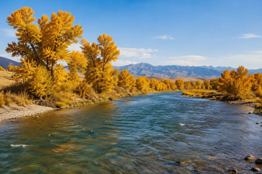
It covers 4,995 square miles and sits in the extreme southeast corner of Montana, bordering Wyoming to the south. The county includes three river systems — the Bighorn, Little Bighorn, and Tongue — all of which flow roughly north toward the Yellowstone River.
Roughly 60 percent of the county falls within the Crow Indian Reservation. The Crow Nation calls themselves Apsáalooke, which means “people of the large-beaked bird.” They are Montana’s largest tribe by reservation land area, with approximately 2.3 million acres.
The county’s population is around 12,850, and it consistently ranks as one of Montana’s lowest-income counties. That economic reality is part of the honest picture of Big Horn County — and it coexists with a cultural heritage, landscape, and set of attractions that deserve far more attention than they typically get.
The county seat is Hardin, a small city of about 3,500 on the Bighorn River. It’s a practical base with motels, gas, and restaurants. For full Big Horn County trip context alongside the rest of Montana, see all 56 Montana counties.
Little Bighorn Battlefield National Monument
This is the site most people associate with Big Horn County, and for good reason.
On June 25 and 26, 1876, Lt. Col. George Armstrong Custer led the U.S. Army’s 7th Cavalry in an attack on a large encampment of Lakota Sioux, Northern Cheyenne, and Arapaho warriors along the Little Bighorn River. The battle ended in a decisive defeat for Custer’s forces — 263 U.S. soldiers were killed, including Custer himself.
It was the most significant military victory of the Plains Indian Wars.
The site is located on the Crow Reservation, 15 miles south of Hardin via I-90 and US-87, near the community of Crow Agency. The monument is administered by the National Park Service.
What to know before you go:
The visitor center museum contains detailed exhibits on the battle, the weapons used, and the broader context of the Plains Indian Wars. A 17-minute documentary film provides orientation — worth watching even if you already know the history.
A 4.5-mile self-guided tour road connects the main battlefield with the Reno-Benteen Battlefield, where the battle actually began.
Ranger programs run throughout the summer and are among the best interpretive programs I’ve encountered at any NPS site. They consistently present multiple perspectives, including Lakota and Cheyenne accounts alongside the cavalry narrative.
A note on the name: The site was originally called Custer Battlefield National Monument. President George H.W. Bush renamed it to Little Bighorn Battlefield National Monument in 1991 to acknowledge both sides of the conflict. The Indian Memorial — a circular sandstone monument with bronze Spirit Warriors figures — was dedicated in 2003 and is worth as much of your time as Last Stand Hill.
The adjacent Custer National Cemetery contains interments from abandoned frontier military posts plus veterans of every major American conflict through Vietnam.
[Verify current entry fees and seasonal hours at nps.gov/libi]
Apsaalooke Tours: See the Battlefield Through Crow Eyes
Most visitors do the self-guided drive and move on.
The better choice — and one that almost no general travel guide emphasizes — is to book a tour with Apsaalooke Tours in Crow Agency. The guides are mostly members of the Crow Nation, and the interpretation is genuinely different from the NPS default.
The Crow were allies of the U.S. Army during the 1876 campaign — several Crow scouts rode with Custer’s column. Understanding why the Crow aligned with the U.S. military against the Lakota (who had long contested Crow territory) completely reframes the battle.
A one-hour guided tour includes stops at Reno-Benteen Battlefield, where the battle began, and Last Stand Hill. [Verify current tour availability and pricing directly with Apsaalooke Tours.]
The Crow Nation: Visiting with Respect
Big Horn County is Crow Country. Understanding what that means makes the visit better.
The Crow Indian Reservation is a sovereign nation. It has its own government, its own tribal law enforcement, and its own social and cultural protocols. Visitors are welcome, but certain places and ceremonies are not open to the public — and photography rules vary by location.
In Crow Agency, the small community at the center of the reservation, there are few tourist services. Visitors should get gas and supplies in Hardin before driving south on the reservation.
The Crow language is still widely spoken, and the tribe actively works to preserve it. Public signage in Crow Agency is often in both English and Apsáalooke.
When visiting any tribal site or attending any cultural event, follow posted rules and don’t photograph people without asking.
Don’t enter areas that are clearly marked as private or ceremonial. The Crow people have been extraordinarily generous in sharing their homeland with visitors — reciprocate that with respect and attentiveness.
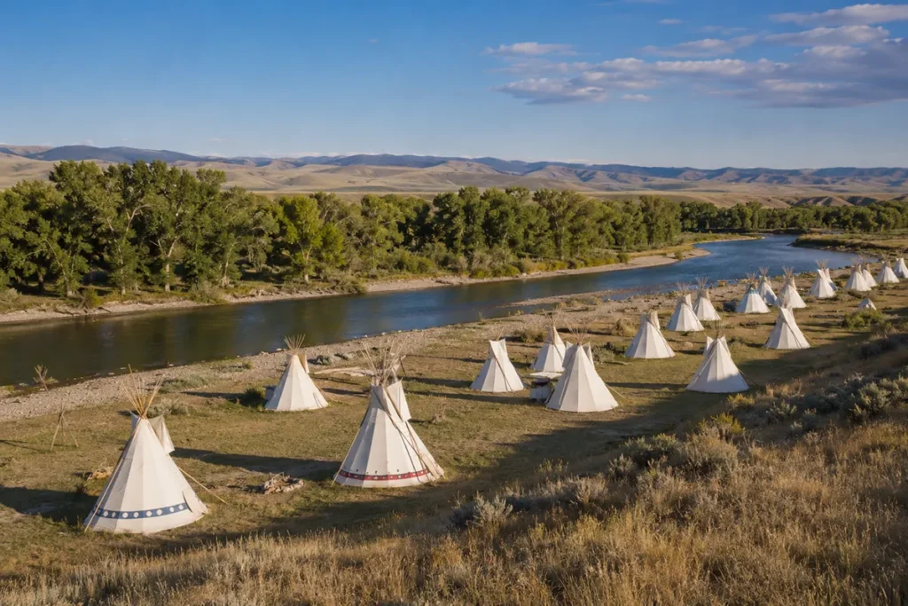
Crow Fair: The World’s Largest Outdoor Powwow
If there is a single event in Big Horn County that deserves its own trip, it’s Crow Fair.
Held each August in Crow Agency, Crow Fair has been running continuously since 1904 — making it one of the oldest powwow celebrations in North America. The Crow call it the “Teepee Capital of the World” and that’s not an exaggeration: up to 1,500 white teepees are erected along the Little Bighorn River for the week.
The event includes powwow dancing competitions, parade processions, rodeo events, arts and crafts, traditional foods, and drumming and singing that continues through the night.
Attendance runs into the thousands, with Crow members returning from across the country. It’s one of the most significant annual cultural events in Montana — and one of the most consistently overlooked by mainstream travel content.
Visitor logistics:
- Crow Fair runs for five days in mid-to-late August each year. [Verify exact dates at crow-nsn.gov]
- The event is open to the public, but commercial photography and filming require tribal permission
- Camping on the fairgrounds is available and frequently used by families
- Hardin’s motels book up well in advance during Crow Fair week — reserve early
- Cell service in Crow Agency can be intermittent during peak attendance days
Chief Plenty Coups State Park
Chief Plenty Coups was the last traditional chief of the Apsáalooke Nation. He was born around 1848 and died in 1932 — and in his lifetime he witnessed the end of the buffalo era, the creation of the reservation system, and the dramatic forced transformation of Crow society.
He adapted strategically, learning English and engaging with U.S. government structures. He traveled to Washington D.C. multiple times to advocate for his people.
Before he died, he donated his home, farm, and medicine spring to the people of the United States — not as a monument to himself, but as a place for all cultures to come together in peace.
The result is Chief Plenty Coups State Park near the small town of Pryor, about 35 miles south of Billings via Pryor Road.
It’s one of only three state parks in the United States located on a Native American reservation. The park’s museum tells the full story of Plenty Coups’ life with care and nuance. The farmstead and log home are preserved and interpretive. The medicine spring is still on the property.
This is not a heavily trafficked site. I’ve been there twice and both times had the museum and grounds nearly to myself. The quiet makes it more affecting, not less.
[Verify current park hours and admission at stateparks.mt.gov]
Pryor Mountain Wild Horse Range
The wild horses of the Pryor Mountains are not like most Bureau of Land Management horse herds.
The Pryor Mountain herd carries a distinct genetic heritage traced to Spanish colonial horses — likely descendants of animals brought to the Americas in the 1500s. DNA testing has confirmed their Spanish colonial lineage, making them genetically unlike any other wild horse population in North America.
The herd runs in the Pryor Mountains along the Montana-Wyoming border in the south part of Big Horn County. Numbers fluctuate but typically range from 120 to 170 horses.
How to see them:
The best access is via Pryor Mountain Road from the town of Pryor — a high-clearance road that climbs into the range and provides good viewing pullouts. The horses are not guaranteed to be visible from any specific spot, but open meadows along the ridgeline are productive, especially early morning and late afternoon.
The Bureau of Land Management maintains a small Wild Mustang Center near Lovell, Wyoming at the south end of the range. [Verify current BLM visitor access points and road conditions before making the drive — some sections require 4WD.]
The best time to see horses is spring through fall. Winter access is limited by snow and road conditions.
No other wild horse herd in the U.S. gets as little attention relative to how remarkable it is.
Bighorn Canyon National Recreation Area
Bighorn Canyon is one of the most dramatic landscapes in southeast Montana — and one of the most undervisited.
The Bighorn River is dammed by Yellowtail Dam near Fort Smith. The resulting Bighorn Lake stretches 71 miles through a canyon with walls rising up to 2,000 feet in places. It’s legitimately one of the deeper canyon systems in the Northern Rockies.
The Northern Entrance near Fort Smith, Montana provides boat launches, campgrounds, and the Yellowtail Dam Visitor Center. The Southern Entrance near Lovell, Wyoming provides access to the lower canyon, additional campgrounds, and the Bighorn Canyon Visitor Center.
Camping throughout the recreation area is free and available on a first-come, first-served basis. Campgrounds are open year-round, though some facilities are seasonal.
The Bad Pass Trail along the canyon edge follows a route estimated to be 12,000–15,000 years old — originally used by Paleo-Indian hunters, later by the Crow, and then by fur traders and mountain men including Jim Bridger.
Getting there from Hardin: Take I-90 to the Hardin exit, then south on US-313 approximately 40 miles to Fort Smith and the northern entrance. The drive through the Little Bighorn Valley is excellent.
[Verify seasonal road closures and current facility status at nps.gov/bica]
The Bighorn River: World-Class Trout Fishing
The Bighorn River below Yellowtail Dam is routinely listed among the top trout fisheries in the United States — and it earns that ranking.
The dam releases cold, clear water year-round, creating a tailwater fishery that supports enormous populations of rainbow and brown trout. The fish here grow large because of the insect-rich water, and the river has been carefully managed for decades. Fish in the 18–22 inch range are realistic targets on a good day.
The most productive stretch runs roughly 13 miles from the dam downstream to the town of St. Xavier. Guided float trips out of Fort Smith are the standard approach. Most outfitters run half-day and full-day floats.
Walk-and-wade fishing is also excellent, with several public access points marked along the river.
The Bighorn is productive year-round, but the prime windows are early spring (March-April) and fall (September-November). Summer fishing remains good in the early morning and evening when water temperatures are cooler.
For fishing conditions and reports, check with the outfitters based in Fort Smith — they update conditions daily during the season.
Big Horn County Museum
Most travelers know the battlefield and skip the museum in Hardin. That’s a mistake.
The Big Horn County Historical Museum sits on 35 acres on the east side of Hardin and contains 26 original historic structures moved from across the county.
The collection includes a railroad depot, a homestead farmhouse, a one-room schoolhouse, a church, and agricultural equipment — spread across a campus you walk through rather than view behind glass.
The exhibits inside cover the full arc of Big Horn County history — from the Crow and Lakota conflicts through the homestead era, the railroad, and the agricultural economy that followed. It puts the Little Bighorn Battlefield in broader context.
[Verify current hours and admission at bighorncountymuseum.org]
Pryor: The Quiet Side of Big Horn County
The small town of Pryor (population ~600) sits about 35 miles south of Billings on the Crow Reservation.
It’s the heart of the Crow community and the access point for both Chief Plenty Coups State Park and the Pryor Mountain Wild Horse Range. Pryor has limited visitor services — gas, a small store, and not much else. Plan accordingly.
The drive to Pryor from Billings via Edgar and Pryor Road passes through rolling shortgrass prairie and then into the Pryor Creek valley — some of the most classic southeastern Montana scenery anywhere.
Hardin: County Seat and Visitor Base
Hardin (population ~3,500) sits at the intersection of I-90 and the Bighorn River, about 15 miles north of Crow Agency.
It’s the most practical base for visiting Big Horn County — with a full range of motels, a handful of restaurants, gas stations, and proximity to both the Little Bighorn Battlefield and Bighorn Canyon’s northern entrance.
The annual Hardin Extreme Days festival in mid-September is one of the county’s bigger community events, alongside a rodeo and fair complex.
For dining, Hardin has options ranging from basic fast food to a few locally-owned western-style restaurants. Breakfast and lunch are easy to find; dinner options are more limited, especially on weekdays.
What I Wish I Knew Before Visiting Big Horn County
The battlefield is on Crow land. The Little Bighorn Battlefield National Monument sits within the Crow Reservation. This isn’t just an administrative detail — it shapes the entire interpretive context of the site. The Crow were Army allies in 1876. Understanding that relationship changes how you read the battlefield.
Apsaalooke Tours > self-guided. I’ve done both. The guided tour is considerably better, especially if you want to understand the Crow perspective on 1876 and why they made the strategic decisions they did.
Gas up in Hardin. There are very few fuel stops once you leave town heading south toward Crow Agency, Fort Smith, or Pryor. Fill up before every significant drive.
Crow Fair requires advance planning. Motel rooms in Hardin sell out weeks ahead of time during Crow Fair week. If you want to attend, book accommodations in Billings (65 miles northwest) and drive in daily. Or camp at the fairgrounds.
The canyon is not that far. I assumed Bighorn Canyon was a major detour. From Hardin it’s about 40 miles to Fort Smith and the northern entrance — under an hour’s drive on a good road. It’s a reasonable half-day add-on to a battlefield visit.
Summer heat is real. Big Horn County in July and August gets genuinely hot — highs in the 90s°F are common in Hardin and the canyon area. Early morning or late afternoon visits to open-air sites are more comfortable. The Bighorn Canyon is especially hot in summer with canyon walls trapping heat.
The wild horses are worth a dedicated trip. Don’t plan to see horses “on the way” to somewhere else. The Pryor Mountain access road takes time and the horses require patience to find. Plan a half-day minimum and consider it a primary destination.
Practical Info
| County seat | Hardin |
| Area | 4,995 sq mi |
| Population | ~12,851 (2022 est.) |
| Tourism region | Southeast Montana |
| Nearest city | Billings (~65 miles northwest via I-90) |
| Main highways | I-90 (east-west), US-212, US-313 |
| Little Bighorn Battlefield | Near Crow Agency, 15 miles south of Hardin |
| Bighorn Canyon entrance | Fort Smith (~40 miles south of Hardin via US-313) |
| Crow Fair | Mid-to-late August, Crow Agency |
| Best season | May–October for most activities |
| Fishing peak | March–April and September–November |
| Entry fees | [Verify Little Bighorn and Bighorn Canyon at nps.gov] |
| Cell service | Good in Hardin; variable on Crow Reservation |
| Gas/services | Hardin main hub; very limited south on reservation |
Getting to Big Horn County
By car: I-90 runs east-west through the northern part of the county. Hardin is approximately 45 miles east of Billings via I-90. From Billings, allow 45 minutes. From Bozeman, allow approximately 2.5 hours east on I-90.
By air: Billings Logan International Airport (BIL) is the closest major airport at about 65 miles northwest of Hardin. It has regular service from Denver, Salt Lake City, Seattle, and other hubs.
See Montana airports and Montana transportation guide for broader logistics.
Towns in Big Horn County
- Hardin — county seat, main service hub, gateway to the battlefield
- Crow Agency — headquarters of the Crow Nation, site of the Little Bighorn Battlefield
- Fort Smith — small community at Bighorn Canyon’s northern entrance; fishing outfitter base
- St. Xavier — small community along the Bighorn River corridor
- Pryor — Crow community, access point for Chief Plenty Coups State Park and wild horses
- Lodge Grass — Crow community on the Little Bighorn River
Adjacent Counties
- Yellowstone County to the northwest — Billings, Montana’s largest city
- Carbon County to the west — Red Lodge, Beartooth Highway
- Stillwater County to the northwest
- Treasure County to the northeast
- Rosebud County to the east — Northern Cheyenne Reservation
- Sheridan County and Big Horn County, Wyoming to the south
Plan Your Big Horn County Trip
Big Horn County rewards patience and genuine curiosity.
A visitor who speeds through the Little Bighorn Battlefield in two hours and moves on to Yellowstone has technically visited. But they’ve missed Crow Fair, the Pryor horses, the Bighorn Canyon, the river fishing, and the Crow cultural landscape that gives everything else its meaning.
Two days is a workable minimum for the battlefield, Bighorn Canyon, and Hardin. A week — timed around Crow Fair — lets you see all of it and then some.
For broader southeast Montana context, see Montana history and key historical events in Montana.
For trip planning across the region, see best time to visit Montana and Montana trip planning guide. Back to the complete Montana counties guide.