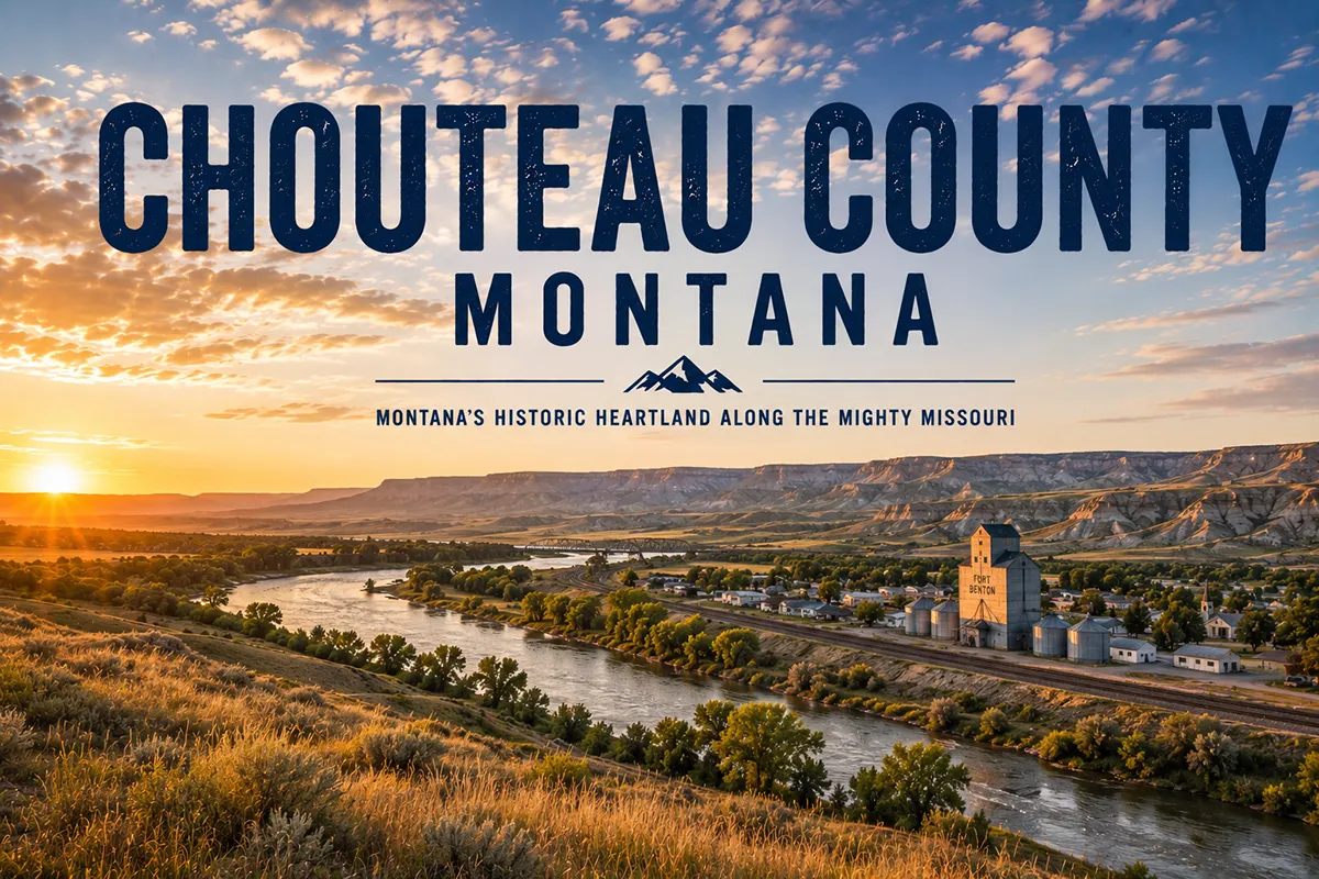
Fort Benton is the kind of town that makes you stop in the middle of the levee walk and just look around.
The bluffs rise above the river. The brick storefronts haven’t changed much in a century. The Missouri — the same river that Lewis and Clark paddled upriver in dugout canoes in June 1805 — is right there, moving past at the same pace it always has.
I’ve been here three times. Each visit, I stay longer than I planned.
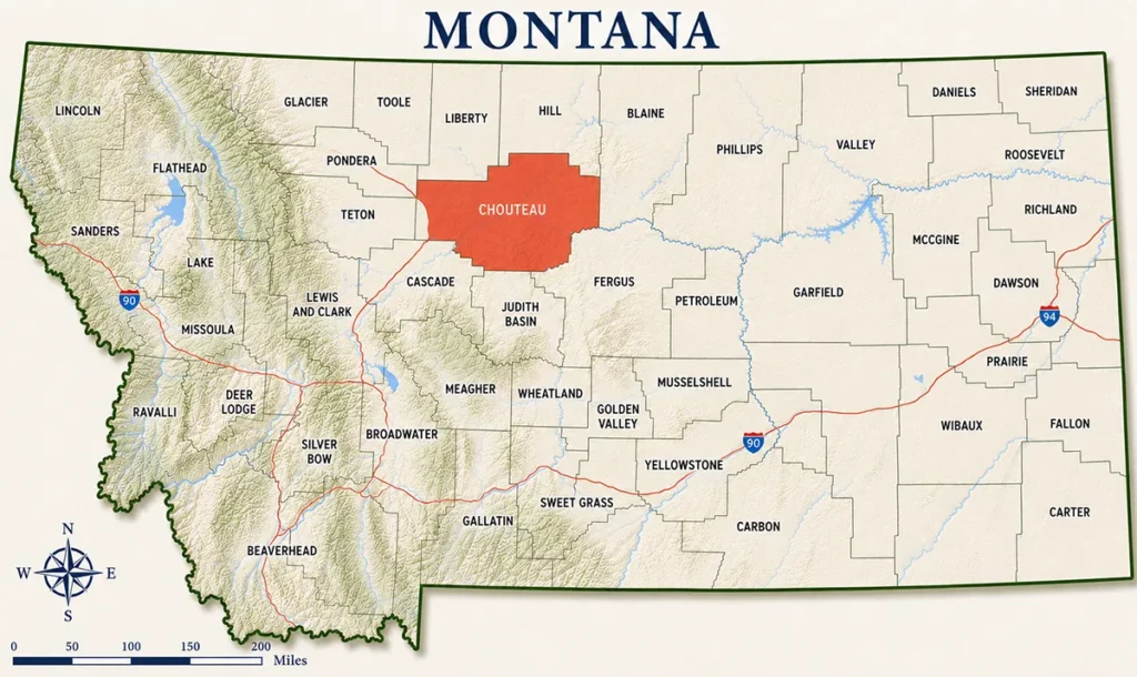
- Chouteau County covers 3,973 square miles in north-central Montana — NOT on the Canadian border, despite what one competitor claims; Hill County separates it from the border
- The county seat is Fort Benton (~1,400) — nicknamed “The Birthplace of Montana” and the former “World’s Most Inland Port”
- Fort Benton is Montana’s oldest continuously occupied settlement, established 1846 as a fur trading post
- The Fort Benton Heritage Complex includes six museums and interpretive sites covering the full arc of upper Missouri River history
- The Grand Union Hotel (1882) is Montana’s oldest continuously operating hotel
- Shep the Dog — one of the most affecting animal loyalty stories in American history — is memorialized in bronze on the Fort Benton levee
- The Upper Missouri River Breaks National Monument begins at Fort Benton — 149 miles of Wild and Scenic River through some of the most unspoiled Lewis & Clark landscape in existence
- The White Cliffs — 46 miles of white sandstone formations — are accessible only by river and represent one of Montana’s most extraordinary landscapes
- Loma, 20 river miles downstream, is where Lewis and Clark made the most critical navigation decision of the entire expedition
- ⚠️ Summer river float trips book up quickly — contact outfitters months in advance for peak season
Liked this article?
Add Roaming Montana as a preferred source so you see more of our articles and guides on Google.
Chouteau County at a Glance
Chouteau County was established in 1865, one of Montana Territory’s original counties.
It’s named for Pierre Chouteau Jr. — the St. Louis fur trading magnate whose American Fur Company operated Fort Benton as a trading post beginning in 1846.
Pierre Chouteau Jr. never set foot in the county that bears his name. But his commercial empire made Fort Benton possible, and Fort Benton made Montana accessible to the outside world.
The county covers 3,973 square miles of north-central Montana between the Rocky Mountain Front to the west and the Missouri River Breaks to the east. Terrain ranges from high plains wheat country in the north and west to the spectacular eroded badlands and river canyon of the Missouri Breaks in the east and south.
Population is around 5,898 — spread across the county with Fort Benton as the only service center of any size.
For broader Montana context, see the complete guide to all 56 Montana counties.
Fort Benton: The Birthplace of Montana
Fort Benton’s nicknames tell the story efficiently.
“The Birthplace of Montana” captures its role as the oldest continuously occupied settlement in the state — and the commercial hub that made Montana Territory viable in its early years.
“The World’s Most Inland Port” captures its geography. Fort Benton sits at the head of navigation on the Missouri River — the farthest point that steamboats from St. Louis could reach.
That put it roughly 3,000 miles upstream from the river’s mouth — the commercial terminus of an entire continent.
From the 1860s through the 1880s, nearly every person entering Montana’s interior came through Fort Benton. Miners headed to the goldfields. Army units bound for frontier forts.
Settlers with household goods in steamboat holds. Whiskey traders running the illicit Canadian trade via the Whoop-Up Trail. Missionaries. Surveyors. Fortune seekers of every variety.
The steamboats unloaded here and turned around. Everything else moved overland.
Fort Benton was also the eastern terminus of the Mullan Road — the military wagon route constructed between 1859 and 1862, connecting Fort Benton to Walla Walla, Washington.
It was the first road across the northern Rockies and served as the primary overland corridor into the Northwest for a generation.
The steamboat era ended when the railroads arrived in the 1880s. Fort Benton never became a major city.
But it preserved what it was with unusual integrity — the riverfront, the brick storefronts, the levee walk, and a museum complex that is one of the most complete surveys of northern Great Plains history anywhere in the country.
Today Fort Benton’s population is around 1,400. It’s worth two full days of anyone’s time.
For the complete Fort Benton guide, see Fort Benton, Montana.
The Fort Benton Heritage Complex
The Fort Benton Heritage Complex is not one museum — it’s six interconnected institutions sharing a walkable campus along the riverfront.
Old Fort Benton is the reconstructed trading post — trade store, warehouse, blacksmith shop, and carpenter’s shop, all staged with period furnishings and trade goods. The Starr Gallery of Western Art is housed within the fort. Guided tours run daily in summer.
The Museum of the Upper Missouri covers the steamboat era in depth — the commerce, the violence, and the characters who moved through Fort Benton at the height of its commercial power.
The Museum of the Northern Great Plains addresses the homestead era that followed — the wave of settlers who came after the steamboats, broke the prairie, and built the wheat economy that still defines much of this county.
The Homestead Village is a collection of original pioneer structures assembled on the campus grounds.
The Hornaday Smithsonian Buffalo Gallery covers the near-extinction and partial recovery of the American bison — an ecological story with direct roots in this region.
The Upper Missouri River Breaks Interpretive Center — operated by the Bureau of Land Management in partnership with Fort Benton — is the official visitor center for the Upper Missouri River Breaks National Monument. Its exhibits cover the Lewis & Clark Expedition, the 1877 Nez Perce flight, steamboat history, the region’s geology, and native wildlife including paddlefish and sturgeon that still inhabit the river. This is the best place to plan your river trip before you put in.
[Verify current hours and combination ticket pricing at fortbenton.com]
The Grand Union Hotel
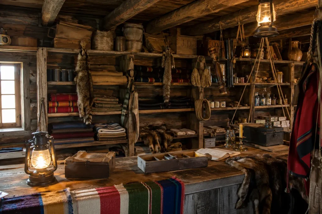
The Grand Union Hotel opened in 1882 on the Fort Benton riverfront.
When it opened, it was called the finest hotel between St. Louis and Seattle. The building cost $100,000 — a staggering sum for the Montana frontier.
Two years later, the railroads bypassed Fort Benton, steamboat traffic collapsed, and the Grand Union was sold at a sheriff’s auction.
It sat in various states of decline for over a century before a complete restoration returned it to something close to its original grandeur.
Today it operates as Montana’s oldest continuously operating hotel — a Victorian brick building with river views, restored guest rooms, and the Union Grille restaurant.
If you’re spending two days in Fort Benton, stay at the Grand Union.
The patio dinner with Missouri River views on a warm June evening is one of the better dining experiences in rural Montana.
[Verify current room rates and restaurant hours at grandunionhotel.com]
Shep the Dog
On the Fort Benton levee, there’s a bronze statue of a border collie looking toward the railroad tracks.
The statue is of Shep — and his story is one of the most affecting pieces of Montana history that most visitors to the state never encounter.
In the summer of 1936, a sheepherder was brought to Fort Benton seriously ill. He died at the local hospital and his body was shipped by train back east.
His dog — a border collie — followed the casket to the train station and watched the train leave.
Then he waited.
For five and a half years, Shep met every train that arrived at Fort Benton — four times a day — looking for his owner. The station workers fed him and gave him shelter. His story spread nationally through a 1939 Ripley’s Believe It or Not feature. Letters addressed simply to “Shep, Fort Benton, Montana” arrived from around the world.
In January 1942, Shep slipped on ice on the tracks and was struck by a train. He was buried on the bluff above the station with a formal ceremony.
The levee statue captures him at the moment of watching and waiting.
I’ve walked past that statue three times now. It gets me every time.
The Fort Benton Levee Walk
The Fort Benton levee walk runs along the Missouri River through the historic district — roughly a mile of paved path with interpretive signs, Shep’s statue, river access points, and views of the limestone bluffs rising across the water.
The cottonwoods along the river turn gold in late September and early October, making fall one of the best times to walk the levee.
The walk is free and connects most of Fort Benton’s main attractions within easy walking distance. The Chouteau County Health Department loans bicycles at no charge during business hours for exploring further afield — one of the more unusual visitor services in Montana. [Verify current availability before your visit.]
Upper Missouri River Breaks National Monument
The Upper Missouri River Breaks National Monument begins at Fort Benton and runs 149 miles downstream through 375,000 acres of BLM-managed public land.
The Wild and Scenic designation on this stretch is the oldest in Montana.
Lewis and Clark described the scenery in May 1805 as “scenes of visionary enchantment.” The landscape they paddled through — the coulees, the sandstone formations, the white cliffs, the cottonwood river bottoms — is essentially unchanged from what they saw.
No roads cross the monument’s core for most of its length. It is accessible only by river or by rough two-track roads from the edges. That inaccessibility is the point.
The monument holds elk, mule deer, bighorn sheep, mountain lions, black bears, eagles, prairie falcons, and the paddlefish and sturgeon that still swim the river.
The Upper Missouri River Breaks Interpretive Center in Fort Benton is the essential first stop before entering the monument. Staff can advise on current conditions, help with planning, and connect visitors with permitted outfitters.
Floating the Wild and Scenic Missouri
The upper Missouri float is one of the premier canoe trips in the United States.
The river is Class I from Fort Benton downstream — no rapids, no technical hazards. Paddlers of any experience level can run it. The current does most of the work.
Launch points and river miles:
- Fort Benton — River Mile 0 (Chouteau County Fairgrounds launch and Fort Benton boat launch)
- Loma — River Mile 20.2 (Wood Bottom Recreation Area)
- Coal Banks Landing — River Mile 41.5 (most popular launch point for the breaks section)
- Judith Landing — River Mile 88.5 (State Highway 236 east of Big Sandy)
- James Kipp Recreation Area — River Mile 149 (the monument terminus and main takeout)
Trip planning:
A full float from Fort Benton to James Kipp typically takes 5–7 days.
Shorter options: the Fort Benton to Loma segment (2–3 days, flat prairie scenery), Coal Banks to Judith Landing (3–4 days, White Cliffs and upper breaks), or Judith Landing to James Kipp (3–4 days, deep badlands country).
Commercial outfitters in Fort Benton offer everything from canoe rentals for self-guided trips to fully guided multi-day expeditions with meals and gear. Missouri River Outfitters is the primary operator with vehicle shuttles available.
Book well in advance for June through August — the best weather window fills up fast.
[Verify current outfitter availability and rates with Missouri River Outfitters and Upper Missouri River Canoe Guides]
The White Cliffs of the Missouri
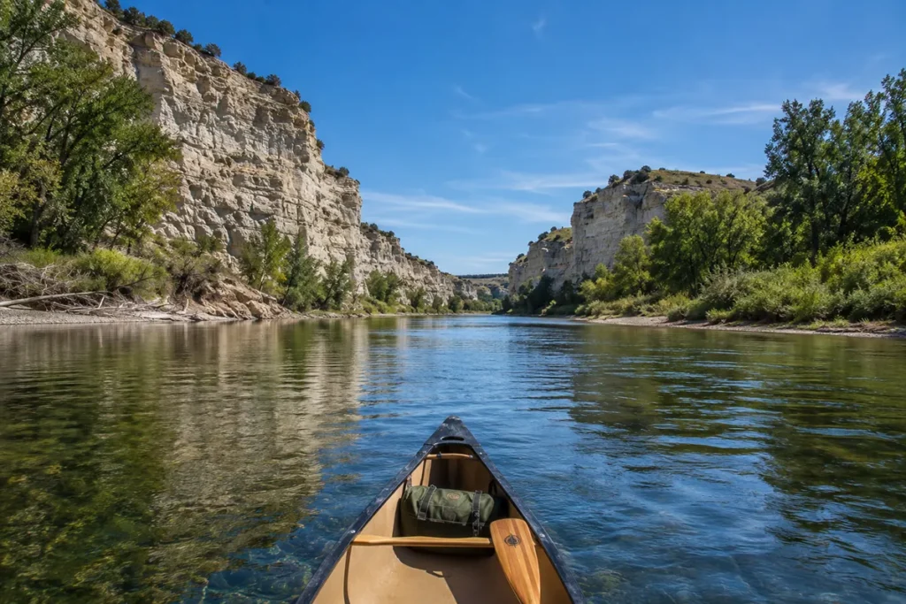
Between Virgelle and Judith Landing — roughly River Miles 45 to 91 — the Missouri River passes through the White Cliffs section.
White sandstone formations rise 30 to 50 feet directly from the river’s edge for 46 continuous miles.
Lewis and Clark wrote about this stretch at length. Clark described the formations as “seens of Visionary inchantment” — one of the most effusive passages in the entire Corps of Discovery journals. The shapes — spires, arches, castle-like formations — triggered comparisons to Gothic cathedrals, ruined cities, and dreamscapes.
They are accessible only from the river. There is no road into this section.
Floating through the White Cliffs for a full day — in silence, with no roads, no power lines, and no other boats in sight — is one of those experiences that recalibrates your sense of scale and time. I’ve floated this section twice and I’d go back tomorrow if I could.
The Loma Decision
The small community of Loma sits at the confluence of the Marias and Missouri rivers, about 20 river miles below Fort Benton.
On June 3, 1805, the Corps of Discovery arrived here and faced a decision that could have ended the expedition or redirected American western expansion onto a different trajectory.
Two rivers met here of apparently equal size. One (the Marias, flowing from the northwest) the men believed was the Missouri. The other (the actual Missouri, flowing from the southwest) seemed wrong to them by the look of the water.
Lewis and Clark disagreed with their entire crew. Every other member believed the northwest fork was the Missouri.
The captains believed the southwest fork was correct — and they were right. They followed their own judgment, sent scouting parties both ways, and confirmed the southwest fork was the true Missouri leading toward the Continental Divide.
Had they followed the Marias northwest, the expedition would have ended in the Canadian border region with no passage to the Pacific.
A BLM campground and canoe launch at Loma mark the confluence today. It’s worth driving out to stand at the point where the two rivers meet and understand the geography Lewis and Clark were reading in 1805.
The Highwood Mountains
The Highwood Mountains rise from the plains in the southern portion of Chouteau County as an isolated volcanic field.
Several hiking and mountain biking trails access the range from county roads. Maps are available through the Helena/Lewis & Clark National Forest Service office in Great Falls.
The Highwoods offer solitude, good wildlife viewing, and the disorienting experience of being in a forest that materializes from flat prairie. They’re shared with Cascade County to the south.
For most Chouteau County visitors, the Highwoods are a half-day add-on to a Fort Benton base. They deserve more attention than they typically get.
Big Sandy
Big Sandy (~600) sits on US Highway 87 in the northeastern corner of Chouteau County.
It’s the practical access point for approaching the Missouri Breaks from the north via State Highway 236 toward Judith Landing.
The Big Sandy Historical Museum holds the largest collection of early pioneer photographs in Chouteau County — an underrated stop for anyone interested in the homestead era of the Hi-Line.
Big Sandy is also the entry point for the breaks loop drive that follows Route 236 south and east through the White Cliffs country before crossing the Missouri at Judith Landing and continuing to Winifred.
What I Wish I Knew Before Visiting Chouteau County
The competitor calls it “just south of the Canadian border.” It isn’t. Hill County (Havre) lies immediately north of Chouteau County. The Canadian border is another full county north from that. Don’t let this error shape your geographic expectations — Chouteau County is solidly north-central Montana.
Fort Benton deserves two full days. Every time I’ve tried to do it in a day, I’ve left something out. The Heritage Complex alone needs four hours if you take it seriously. Add the levee walk, the Grand Union dinner, and Shep, and you need an overnight.
Book river float trips months in advance. The best June and July windows fill fast. If you want a guided multi-day float through the White Cliffs, contact outfitters in February or March for summer dates.
The White Cliffs are not accessible by road. This is a feature, not a bug — but travelers who haven’t done a canoe trip sometimes show up expecting a viewpoint drive. The only way in is the river.
The Loma Decision site is worth the 20-mile detour. Loma isn’t much of a town. But standing at the Marias/Missouri confluence and understanding the decision that was made there in 1805 adds a dimension to the whole Lewis & Clark story that no museum exhibit fully replicates.
Summer on the river means sun protection. The White Cliffs section has minimal shade. Bring a hat, long sleeves, strong sunscreen, and significantly more water than you think you need. See Montana bug season — mosquitoes along the river bottoms can be intense in June.
The Grand Union fills up. It has a limited number of rooms. If you’re planning a summer weekend in Fort Benton, book the Grand Union early or have a backup plan.
Practical Info
| County seat | Fort Benton |
| Area | 3,973 sq mi |
| Population | ~5,898 (2022 est.) |
| Tourism region | Central Montana |
| Formed | 1865 |
| Main highways | US-87 (north-south through Fort Benton) |
| Heritage Complex | Fort Benton riverfront [verify hours at fortbenton.com] |
| Grand Union Hotel | Front Street, Fort Benton [verify at grandunionhotel.com] |
| Missouri River float | River Mile 0 (Fort Benton) to 149 (James Kipp) |
| Coal Banks Landing | River Mile 41.5 — most popular upper breaks launch |
| Nearest city | Great Falls (~40 miles south via US-87) |
| Nearest airport | Great Falls International Airport (GTF) — ~40 miles south |
| Best season | May–October; June–August peak for river floats |
| Cell service | Good in Fort Benton; none on the river in the breaks |
| Gas/services | Fort Benton main hub; Big Sandy for northeast county |
Getting to Chouteau County
From Great Falls: US-87 north — 40 miles, about 40 minutes to Fort Benton. This is the main route.
From Havre: US-87 south through Box Elder — about 75 miles, roughly 1 hour to Fort Benton.
From Helena: I-15 north to Great Falls, then US-87 north — about 130 miles, 1.5 hours.
By air: Great Falls International Airport (GTF) is 40 miles south of Fort Benton with regular commercial service.
See Montana airports and Montana transportation guide.
Towns in Chouteau County
- Fort Benton — county seat; Heritage Complex, Grand Union Hotel, Missouri River access
- Big Sandy — northeastern county; Historical Museum, Judith Landing access point
- Loma — small community at Marias/Missouri confluence; BLM launch site, Lewis & Clark Decision Point
- Virgelle — tiny community with a canoe outfitter; White Cliffs access near Coal Banks Landing
Adjacent Counties
- Cascade County to the south — Great Falls, Lewis & Clark Center
- Teton County to the west — Choteau, Rocky Mountain Front
- Pondera County to the northwest — Conrad
- Hill County to the north — Havre
- Blaine County to the northeast — Chinook, Bear Paw Battlefield
- Phillips County to the east — Malta, American Prairie Reserve
- Fergus County to the southeast — Lewistown
- Judith Basin County to the south — Stanford
Plan Your Chouteau County Trip
Chouteau County anchors one of the most historically significant travel corridors in the American West.
Fort Benton alone justifies the trip. Add the White Cliffs float and you have one of the defining Montana experiences.
A strong three-day itinerary: Day one — arrive Fort Benton, Heritage Complex in the afternoon, Grand Union dinner.
Day two — levee walk in the morning, drive to Loma and the Marias confluence, Coal Banks Landing for an afternoon look at the upper breaks access.
Day three — either begin a multi-day float (if pre-planned) or drive the breaks loop north to Big Sandy and southeast toward Judith Landing for prairie and canyon views.
For planning context, see Montana trip planning guide and best time to visit Montana.
For historical context, see Montana history and key historical events in Montana. Back to the complete Montana counties guide.