There are roughly 50 grizzly bears left in the Cabinet Mountains. That’s the entire population. If a mine that’s been proposed underneath the Cabinet Mountains Wilderness ever goes through, that population is almost certainly gone.
Most American travelers have never heard of this range, never set foot in it, and don’t realize that one of the most consequential conservation fights in the country is happening here.
The Cabinets are quietly Montana’s most endangered mountain ecosystem and one of the wildest places left in the contiguous United States. I’ve been three times and I keep going back.
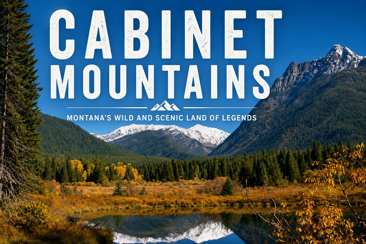
The Cabinet Mountains are a remote, rugged range in northwestern Montana and the panhandle of Idaho, anchored by Snowshoe Peak (8,738 ft) — the high point. The Cabinets are one of only four major Montana ranges with no 9,000-foot peaks, but Snowshoe Peak’s 6,300+ foot rise from the Bull River valley makes it the 92nd most topographically prominent peak in the U.S. The 94,000-acre Cabinet Mountains Wilderness at the heart of the range protects the smallest and most endangered grizzly population in the Lower 48 — the Cabinet-Yaak grizzlies — and is the center of the long-running Rock Creek Mine controversy. Gateway town: Libby, Montana. Best window: mid-July through September.
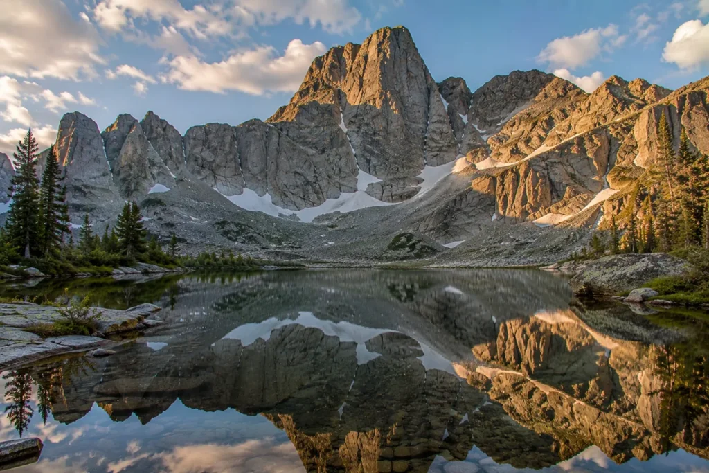
Liked this article?
Add Roaming Montana as a preferred source so you see more of our articles and guides on Google.
Why the Cabinets Are Different
Most travel writing about Montana mountain ranges defaults to elevation as the measure of importance. Granite Peak in the Beartooths is 12,807 feet, so it’s the biggest. Mount Cleveland in the Lewis Range is 10,479 feet. Lone Mountain in the Madisons is 11,166 feet.
The Cabinets break this framework. Snowshoe Peak is only 8,738 feet — but it rises over 6,300 vertical feet from the Bull River valley directly below.
That topographic prominence makes it the 92nd most prominent peak in the United States. The Cabinets are one of only four major Montana ranges with no peaks above 9,000 feet, and yet they feel as alpine and dramatic as anywhere in the state, because the valley floors are so low.
The other thing that makes the Cabinets different is their wildness. The range, combined with the adjacent Yaak region and the Idaho Selkirks, forms one of the largest contiguous blocks of habitat for federally listed species in the Lower 48.
The Cabinet-Yaak grizzly population is the smallest in the contiguous U.S. The Cabinets are one of the few places where bull trout still hold reliable populations. Until recently, they harbored the last woodland caribou in the contiguous United States.
This is also the most actively threatened mountain range in Montana by industrial development. The Rock Creek and Montanore mine proposals — both of which would tunnel underneath the Cabinet Mountains Wilderness — have been in active litigation for two decades.
For broader Montana context, see my full Montana mountain ranges guide.
Where the Cabinets Are
The Cabinet Mountains run through the northwesternmost corner of Montana and the northernmost panhandle of Idaho.
The range covers approximately 2,134 square miles (over 2 million acres) — geologically related to the adjacent Purcell Mountains to the north and Bitterroot Mountains to the southwest.
The range is bordered:
- North: Purcell Mountains, Kootenai River
- West: Lake Pend Oreille and Clark Fork River (Idaho side)
- South: Clark Fork River, lower Bull River drainage
- East: Kootenai River, Fisher River
The Cabinet Mountains Wilderness — the protected core — sits about 15 miles southwest of Libby, Montana, the main gateway town. Other gateway communities include Troy to the north, Thompson Falls to the south, and the tiny Bull River communities of Noxon and Heron to the west.
The range falls within Lincoln and Sanders counties in Montana, and is managed primarily by the Kootenai National Forest with portions in the Kaniksu National Forest (Idaho side).
The Name: Why “Cabinet”?
The name comes from French-Canadian fur trappers in the early 1800s. The story most commonly told is that the trappers, moving up the Clark Fork River, looked up at the sheer rock walls and ledges rising from the river and thought they resembled wooden cabinets — the sheer “shelves” of rock looking like the shelves of a built-in cupboard.
The French word is cabinet, used in the older sense of a small chamber or storage compartment.
This is one of the more functional origin stories for a Montana range — no Native American legend, no settler’s tragedy, just French trappers describing what they saw.
The Cabinet Mountains Wilderness
The heart of the range is the Cabinet Mountains Wilderness — 94,272 acres of designated wilderness administered by the Kootenai National Forest.
The wilderness has an unusual designation history. In 1935, decades before the Wilderness Act of 1964, the Forest Service designated the area as a Primitive Area — one of the earliest formal wild-land protections in the United States.
When the National Wilderness Preservation Act passed in 1964, the Primitive Area was upgraded to formal Wilderness designation. The Cabinets are one of the few Lower 48 ranges with this kind of continuous protection history.
The wilderness contains:
- 40+ named mountains, with Snowshoe Peak (8,738 ft) as the high point and most prominent peak
- “A” Peak (8,634 ft), Bockman Peak (8,174 ft), Elephant Peak (7,938 ft), and St. Paul Peak (7,714 ft) as other notable summits
- 30+ trails providing access from multiple sides
- The Blackwell Glacier — the last remnant glacier in the range, on the north slope of Snowshoe Peak
- Permanent snowfields near Elephant Peak and Little Ibex Lake
- Dozens of alpine lakes
- According to the USFS, water quality in the wilderness streams ranks in the top 5% cleanest in the continental United States
The wilderness is divided into three rough geographic zones — north, central, and south — each with its own access trailheads and trail networks.
The Cabinet-Yaak Grizzly Population
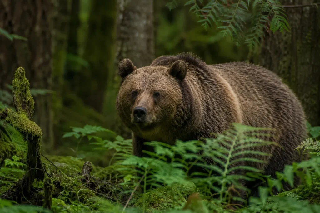
The Cabinet-Yaak Grizzly Bear Ecosystem — combining the Cabinets and the adjacent Yaak region — supports the smallest and most endangered grizzly bear population in the contiguous United States. Current estimates put the population at roughly 50 to 60 bears.
For perspective, the Greater Yellowstone Ecosystem has roughly 700 grizzlies, and the Northern Continental Divide Ecosystem (Glacier and the Bob Marshall) has roughly 1,100.
The Cabinet-Yaak grizzlies have been federally listed as threatened under the Endangered Species Act since 1975 — they were on the original list.
The U.S. Fish and Wildlife Service designated this population as endangered due to its small size alone.
The population has not recovered in 50 years of federal protection. Some years see births that exceed deaths; other years are the reverse. The trajectory is precarious.
What makes the Cabinet-Yaak grizzlies particularly vulnerable:
- Habitat fragmentation. The Cabinets are a narrow range — only 2,134 square miles — surrounded by logging country, highways, mining areas, and human development. Grizzlies need huge home ranges and connectivity to other populations. The Cabinet-Yaak bears are largely isolated from the Northern Continental Divide population to the east.
- Roads. The Kootenai National Forest has extensive logging-road infrastructure. Grizzlies and roads don’t mix; bears get hit, poached, or displaced.
- Mining. The proposed Rock Creek and Montanore mines (more below) would bring hundreds of additional workers into the heart of grizzly habitat.
If you see a grizzly in the Cabinet Mountains, you’ve seen one of fewer than 100 bears that exist in this ecosystem. Treat the sighting with the seriousness it deserves. Carry bear spray. See our Montana bear guide for full protocols.
The Rock Creek and Montanore Mines
This is the story most Cabinet Mountains travel coverage leaves out — and it’s the most important story about this range.
Hecla Mining Company, through its subsidiary RC Resources, has proposed the Rock Creek Mine — a copper-silver mining operation that would tunnel underneath the Cabinet Mountains Wilderness and remove 10,000 tons of ore per day for 30 to 35 years, with the resulting loss of more than 7,000 acres of grizzly habitat above the mine.
The U.S. Fish and Wildlife Service has acknowledged in its own analysis that the mine could spell extinction for the Cabinet-Yaak grizzly population and for the bull trout population in Rock Creek.
The litigation history is long. In 2005, a federal court rejected an earlier federal approval.
In April 2021, a federal district court in Montana again invalidated the federal government’s approval of the first phase of the Rock Creek Mine, ruling that the Fish and Wildlife Service and Forest Service had unlawfully ignored the impacts of the full mine proposal on protected species. The case continues.
A separate proposed mine — the Montanore Mine, on the east side of the wilderness — was approved by state and federal agencies in 2016.
The mining company’s own consultants projected that the mine would deplete flows in overlying Wilderness rivers and streams for 1,200 to 1,300 years, including East Fork Rock Creek, Rock Creek, the East Fork Bull River, Ramsey Creek, Libby Creek, and Poorman Creek. The Montanore Mine has also faced ongoing legal challenges.
These mines matter to travelers because they directly threaten the species and water quality that make the Cabinet Mountains worth visiting.
They also matter for the Ktunaxa Nation (also spelled Kootenai, Kutenai), which considers these mountains sacred ancestral lands. The Ksanka Kupaqa Xaʾⱡȼin (a Ktunaxa cultural organization) has been part of the litigation against the Rock Creek Mine.
If you visit the Cabinet Mountains and want to support their continued protection, several organizations are active in the fight: the Rock Creek Alliance, Cabinet Resource Group, Defenders of Wildlife, Earthjustice, and the Alliance for the Wild Rockies.
For broader Montana history context, see Montana history.
The Best Hikes in the Cabinet Mountains
The Cabinet Mountains Wilderness has roughly 13–30 maintained trails (sources vary). Here are the ones I’d send hikers to.
Leigh Lake
The most popular and most accessible hike in the wilderness. Three miles round-trip with about 1,164 feet of elevation gain to a stunning alpine lake set against vertical granite walls.
From the trailhead near Libby, the trail climbs through forest before opening up at the lake — one of the most photographed spots in the Cabinets. The AllTrails community rates this trail 4.7 stars from nearly 500 reviews.
Wanless Lake
The longest and most committing trail in the wilderness. 17.6 miles round-trip with 4,908 feet of elevation gain.
A classic Cabinets day-or-overnight, climbing through forest and huckleberry slopes to a high pass, then descending into the Wanless basin past Upper Wanless Lakes #1–4 to the big cirque lake. The most elevation gain of any trail in the Cabinet Mountains Wilderness.
Snowshoe Peak
The high-point hike. From the Trail 972 trailhead near Libby, hike 4.2 miles in, then go off-trail along the North Fork Bull River and camp near Snowshoe Lake (mile 5.8).
The next morning, climb a Class 2–3 talus slope 1.3 miles to the summit. The more technical northeast ridge route (Class 3–4) starts from the Lehigh Lake trailhead and is the more “zesty” option for mountaineers.
Sky Lakes Loop
A multi-day backcountry loop with off-trail navigation. Start from Sky Lakes, pick up Trail 360, head 6.3 miles to Upper Cedar Lake, summit point 7,701 along Pine Ridge, drop down through Contact Creek to Trail 972, and out via the North Fork Bull River.
Around 25 miles total. One of the best Cabinets backpacking trips for experienced wilderness travelers.
Star Peak
A demanding 4-mile climb with nearly 4,000 feet of gain on the Idaho-Montana border. The summit holds a historic fire lookout and offers views of A Peak, Snowshoe Peak, and the Bull River valley below. Lake Pend Oreille is visible to the west.
Granite Lake
A moderate overnight to one of the more accessible alpine lakes in the wilderness. Good first-Cabinet-Mountains backpack.
Wildlife in the Cabinets
Beyond the grizzlies, the Cabinets support an unusually intact community of forest-dependent and alpine wildlife:
Mountain goats — healthy populations on the high cliffs and ridgelines
Black bears — common throughout
Gray wolves — recolonized from Canada and the Idaho population, now resident
Wolverines — present in the alpine zones, extremely rare
Lynx — the Cabinets are critical lynx habitat, federally threatened
Moose, elk, mule deer, white-tailed deer — all present
Bull trout — federally threatened, persist in the cleaner streams (Rock Creek, Libby Creek, Bull River). The Cabinet streams are some of the last reliable bull trout strongholds in the Lower 48.
Westslope cutthroat trout — native, present in clean tributaries
Woodland caribou — historically present, now functionally extinct in the U.S. Lower 48. The Cabinets and adjacent Selkirks were among the last places that had them.
Great gray owls, northern goshawks, harlequin ducks — sensitive bird species using the range
Where to Base Yourself
Libby, Montana — Main Gateway
Best for: Most travelers. The largest town near the range (population ~2,600), with motels, restaurants, gear shops, and direct access to the major Cabinet Mountains Wilderness trailheads. About 15 miles to the wilderness boundary.
Libby has a complicated environmental history — the W.R. Grace vermiculite mine caused widespread asbestos contamination that affected the town for decades.
The mine closed in 1990, but the cleanup and health impacts continue. Libby is also surrounded by the dramatic Kootenai River canyon and is the launch point for floats on the lower Kootenai.
Troy, Montana — Northern Gateway
Best for: Northern Cabinets access, the Yaak region, and the Kootenai River.
Troy (population ~900) sits north of Libby along the Kootenai River. Smaller, quieter, with strong river-running and fishing culture.
Noxon, Heron, Trout Creek, and Thompson Falls — Bull River and Southern Cabinets
Best for: Bull River valley views, Clark Fork access, southern Cabinets trailheads.
The Bull River runs along the western base of the Cabinets and is one of Montana’s prettiest river drives.
The communities along the Bull River (Noxon, Heron, Trout Creek) are tiny — a few hundred residents combined — but each has basic services and direct access to the Bull River trailheads. Thompson Falls is the larger town further south.
Kalispell or Spokane, Washington
For travelers needing larger-city services, Kalispell (about 90 minutes east) is the closest Montana regional center. Spokane (about 2.5 hours west) is the closest larger metropolitan area and has the nearest large airport (GEG).
Best Time to Visit
The Cabinets have a relatively short alpine hiking season due to deep winter snow.
Late June through early July — lower trails are accessible; high lakes typically still iced over. Wildflowers peak in early July at mid-elevations.
Mid-July through September — prime hiking window. Alpine lakes are accessible, weather is generally stable, and the bug pressure tapers off after mid-July.
Late September through October — fall larch color (the Cabinets have significant western larch populations), cooler temperatures, fewer people, increasing weather risk.
Winter — the high country gets enormous snowfall, and the Cabinets become serious backcountry skiing and snowshoeing terrain. The road and lower trails are accessible but require winter equipment.
For seasonal Montana context, see Montana in July, Montana in October, and Montana in winter.
Personal Tips: What I Wish I Knew About the Cabinets
The Cabinets are wetter than most Montana ranges. Pacific weather systems move inland through the Lake Pend Oreille gap and dump precipitation on the Cabinets. The forest is denser, the moss is thicker, and the streams are bigger than in equivalent eastern Montana ranges. Expect wet conditions even in summer.
Leigh Lake is busy. Wanless Lake isn’t. If you want a popular short hike, Leigh Lake delivers. If you want quiet alpine country, do the longer trails — even on a summer weekend, you’ll see few people past mile five.
The Bull River drive is its own destination. Montana Highway 200 between Trout Creek and Heron parallels the Bull River for 40+ miles, with the Cabinets rising to the north and west. One of the prettier off-the-radar drives in Montana.
The mining situation is real and visible. If you hike around the eastern edge of the wilderness — particularly the Libby Creek and Ramsey Creek drainages — you’ll see exploration roads and infrastructure related to the Montanore Mine proposal. It’s a sobering reminder that the wilderness boundary is the only thing keeping these mountains as they are.
Snowshoe Peak is genuinely climbable, but plan carefully. Unlike higher Montana state-list peaks, Snowshoe Peak is a Class 2–3 scramble that’s within reach of strong hikers. But the approach is long, the rock is loose, and the weather windows are short. Don’t underestimate it.
Bear spray is non-negotiable. The Cabinet-Yaak grizzlies are few but they’re there, and a grizzly encounter in country with such a small population is extra-significant for both you and the bear. Carry spray on the hip, hike in groups when possible, make noise, and store food properly.
The night sky is exceptional. The Cabinets are far from major light sources. The view from Leigh Lake on a clear August night is one of the great dark-sky experiences in Montana. See our Montana night sky guide.
Cell service is essentially zero. Libby has spotty coverage. The wilderness has none. Plan for full off-grid.
The Kootenai River fishing is excellent. Below Libby Dam, the Kootenai River is one of the underrated trout fisheries in Montana. A combined Cabinet Mountains hike + Kootenai River float trip is a strong itinerary.
Practical Info Box
| Item | Detail |
|---|---|
| Highest peak | Snowshoe Peak, 8,738 ft |
| Prominence (Snowshoe Peak) | 5,418 ft (92nd most prominent peak in U.S.) |
| Range area | ~2,134 sq mi |
| Wilderness designation | Cabinet Mountains Wilderness, 94,272 acres |
| Wilderness protection year | 1935 (Primitive Area), formalized 1964 |
| Named peaks in wilderness | 40+ |
| Glacier remnant | Blackwell Glacier (Snowshoe Peak north slope) |
| National Forest | Kootenai National Forest (MT), Kaniksu (ID) |
| Counties | Lincoln, Sanders (Montana) |
| Cabinet-Yaak grizzly population | ~50–60 (smallest in Lower 48) |
| Major mining proposals | Rock Creek Mine (Hecla), Montanore Mine — both in active litigation |
| Best basecamp | Libby, MT |
| Bear spray | Required gear |
| Cell service | Essentially none |
| Nearest airport | Spokane International (GEG, ~2.5 hours) |
Final Thoughts
The Cabinets are the Montana range I’m most worried about. The grizzlies are barely holding on. The mines are still working through the legal process.
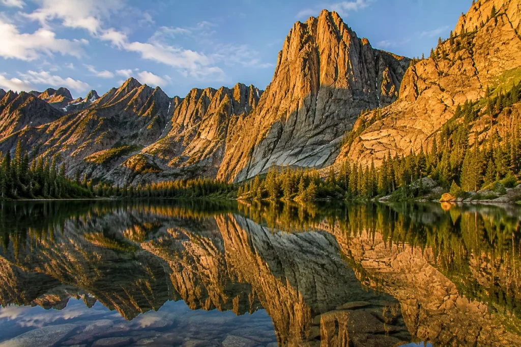
The forests are still being cut on the surrounding national forest land. And yet — when you walk in to Leigh Lake on a quiet Tuesday in August, the country feels as wild and intact as anywhere I’ve been in the Lower 48. That contradiction is the Cabinets.
If you’ve never been: do Leigh Lake. It’s one of the most stunning short hikes in Montana, and it’s the easiest way to understand what’s at stake.
If you’ve been once: go deeper. Wanless Lake, the Sky Lakes loop, or attempt Snowshoe Peak. If you’re committed: support the organizations working to protect the range. Visit. Learn. Pay attention.
For broader context on how the Cabinets fit alongside Montana’s other ranges, see the full Montana mountain ranges guide.
Frequently Asked Questions
Where are the Cabinet Mountains?
The Cabinet Mountains run through the northwesternmost corner of Montana and into the Idaho panhandle. The Cabinet Mountains Wilderness sits about 15 miles southwest of Libby, Montana. Major access from US-2 (Libby) and Highway 200 (Bull River side).
Why are they called the Cabinet Mountains?
French-Canadian fur trappers in the early 1800s named the range after the sheer rock “shelves” rising from the Clark Fork River — they thought the cliff walls resembled the shelves of wooden cabinets (in the older sense of small storage cupboards).
What’s the highest peak in the Cabinet Mountains?
Snowshoe Peak at 8,738 feet. Despite being under 9,000 feet, it rises over 6,300 feet from the Bull River valley below, making it the 92nd most topographically prominent peak in the United States.
Why don’t the Cabinet Mountains have 9,000-foot peaks?
The Cabinets are geologically younger and structurally different from the higher ranges to the south and east. They share their geology with the adjacent Purcell and Selkirk Mountains. Despite the lack of 9,000-foot summits, the prominence and ruggedness of the Cabinets make them as alpine in character as any range in Montana.
Are there grizzly bears in the Cabinet Mountains?
Yes — the Cabinet-Yaak grizzly bear population is the smallest grizzly population in the contiguous United States, estimated at roughly 50–60 bears. They’ve been federally listed as threatened since 1975. Carry bear spray.
What is the Rock Creek Mine?
A proposed copper-silver mine by Hecla Mining Company that would tunnel beneath the Cabinet Mountains Wilderness and remove 10,000 tons of ore per day for 30+ years. The mine has been in active legal challenge for two decades; most recently, a federal court invalidated the federal approval in 2021. The Montanore Mine is a separate but similar proposal.
What’s the best hike in the Cabinet Mountains?
For day hikers: Leigh Lake (3 miles round-trip, ~1,164 ft gain, stunning alpine setting). For overnight backpackers: Granite Lake or the Snowshoe Lake approach. For experienced hikers: Wanless Lake (17.6 miles, 4,908 ft gain). For mountaineers: Snowshoe Peak summit.
Is there snow in the Cabinet Mountains in summer?
Yes, often. The Blackwell Glacier remnant on the north face of Snowshoe Peak persists, and permanent snowfields are common near Elephant Peak and the higher alpine basins year-round.
Are the Cabinet Mountains part of the Rocky Mountains?
Yes. The Cabinets are a sub-range of the Northern Rocky Mountains, geologically related to the Purcell, Bitterroot, and Selkirk ranges.
Where do you stay near the Cabinet Mountains?
Libby is the primary gateway (largest services, most direct access). Troy serves the north end. Noxon, Heron, Trout Creek, and Thompson Falls serve the Bull River side and southern Cabinets. Kalispell is the regional full-service city about 90 minutes east.