The Absaroka Range gets confused with the Beartooths constantly. They share a wilderness area, they share a tourist corridor, and they both rise above Cooke City and Cody. But they’re completely different mountains. The Beartooths are granitic — old, hard, Archean rock pushed up into a high plateau.
The Absarokas are volcanic — eroded remnants of one of the largest eruption sequences in North American history, active 53 to 43 million years ago, producing enough material to bury an area the size of West Virginia under five-mile-deep ash.
The Absarokas also contain the most remote spot in the contiguous United States — the Thorofare region, more than 20 miles from any road in any direction. This is the eastern wall of Yellowstone, the range named for the Crow Nation, and one of the wildest mountain systems in the Lower 48.
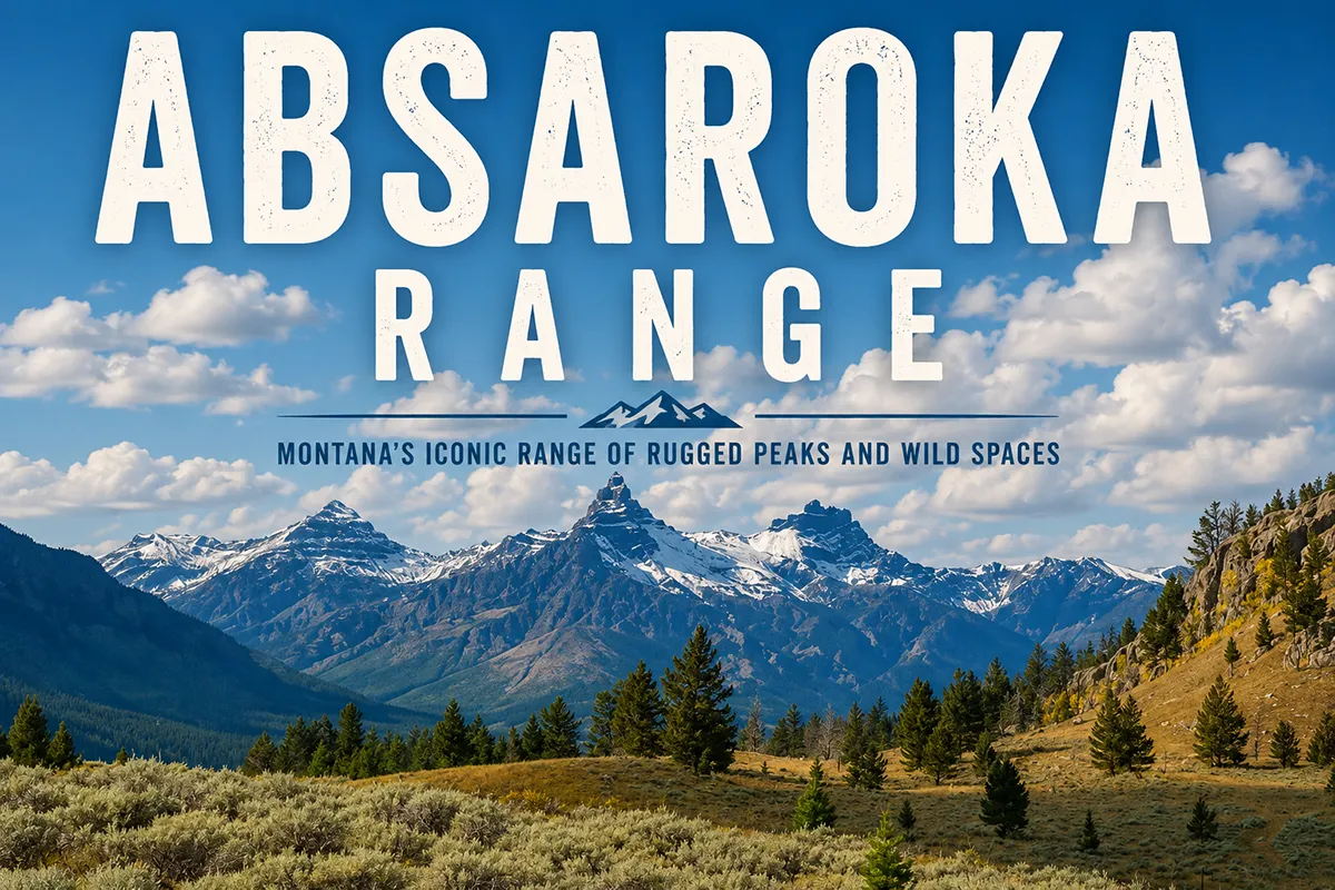
The Absaroka Range runs about 165 miles northwest to southeast from Livingston, Montana to Dubois, Wyoming, forming the eastern boundary of Yellowstone National Park. The range is named for the Apsáalooke (Crow) Nation — locally pronounced “Ab-sor-ka.” The Montana high point is Mount Cowen (11,212 ft); the overall range high point is Francs Peak (13,153 ft) in Wyoming. The Absarokas are entirely volcanic in origin — eroded remnants of the Absaroka Volcanic Supergroup, active 53–43 million years ago, which erupted approximately 29,000 cubic kilometers of material. The range contains 47 peaks over 12,000 feet. The remote Thorofare region in the southern Absarokas is the most isolated place in the contiguous U.S. Best window: mid-July through September.
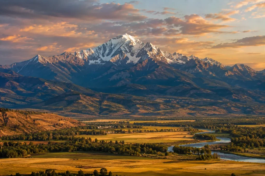
Liked this article?
Add Roaming Montana as a preferred source so you see more of our articles and guides on Google.
Why the Absarokas Are Different
The Absarokas are easy to confuse with the Beartooth Mountains — they share a wilderness area (the Absaroka-Beartooth Wilderness), they share gateway communities (Cooke City, Gardiner, Livingston), and they’re both spectacular alpine country in the Greater Yellowstone Ecosystem. But geologically and visually, they’re completely different ranges:
- Beartooths: Granitic, 2.8-billion-year-old Archean basement rock, high alpine plateau (the Beartooth Plateau itself), distinctive cirques and tarns from Pleistocene glaciation. Light gray rock, classic alpine “rock and ice” landscape.
- Absarokas: Volcanic, Eocene-age (53–43 million years old), characterized by dissected plateaus of dark breccia, andesite, and rhyolite. The peaks are shaped by erosion of layered volcanic rock — long cliff bands, turreted fins, dark angular ridgelines. Cap-rock summits, sometimes called the “Sierra Shoshonee” by early explorers.
If you’ve ever wondered why the country northeast of Yellowstone has those dark, sharp, fortress-like mountain skylines, you’re looking at the Absarokas.
The Eocene volcanism produced rock that doesn’t erode like the granite of the Beartooths — it erodes into the distinctive serrated ridgelines and steep talus slopes that define the range.
For broader context, see my full Montana mountain ranges guide and the related Beartooth Mountains guide.
Where the Absarokas Are
The Absaroka Range runs roughly 165 miles northwest to southeast, from near Livingston, Montana at its northern end, southward along the eastern boundary of Yellowstone National Park, and continuing south to near Dubois, Wyoming.
The range is 60 miles wide at its broadest. It crosses Park County in Montana and Park, Hot Springs, and Fremont counties in Wyoming.
The range is bordered:
- West: Yellowstone National Park (most of the eastern park boundary follows the Absaroka crest)
- East: Bighorn Basin (Wyoming) and the lower Yellowstone River drainage (Montana)
- North: Beartooth Mountains via the Clarks Fork and Stillwater drainages
- South: Wind River Range via Union Pass; Gros Ventre Range nearby
The defining valley is the Paradise Valley of the Yellowstone River, running between Livingston and Gardiner along US-89.
The west wall of Paradise Valley is the Absaroka Range. The east wall is the smaller Gallatin Range — a parallel sub-range separated by the Yellowstone River.
The Name: Apsáalooke and the Crow Nation
The Absarokas are named for the Apsáalooke, the Crow Nation’s name for themselves. The word translates roughly as “Children of the Large-Beaked Bird” — usually rendered in English as “Crow” or “People of the Crow.”
The Crow Nation has occupied this country for hundreds of years, and the range that bears their name remains traditional Crow homeland country. The mountains adjacent — the Big Horn Mountains, the Pryor Mountains — are also tied to Crow Nation history.
The English spelling “Absaroka” is anglicized from the Apsáalooke word. Locals — particularly in Montana — pronounce it “Ab-sor-ka” (three syllables, stress on the first).
Some other Montanans say “Ab-SAH-ro-ka” (four syllables, stress on the second). Both are acceptable; the three-syllable version is more common in everyday speech.
Captain William Jones, an Army Corps of Engineers officer, was the first non-Indigenous person to officially survey and document the range, in 1873.
He proposed naming it the “Sierra Shoshonee” — writing in his report, “I have named these mountains ‘The Sierra Shoshonee’ because the right to name them is clearly mine, as I have been the first to cross them and mark out their geographical position and extent.” The name didn’t stick. The Apsáalooke / Absaroka designation prevailed.
For broader context, see our Montana history overview.
The Volcanic Geology
The Absarokas are entirely volcanic, the eroded remnant of one of the largest continental volcanic provinces in North American history.
The Absaroka Volcanic Supergroup was active for roughly 10 million years, from 53 to 43 million years ago, during the Eocene Epoch. The eruptions produced approximately 29,000 cubic kilometers of andesite, dacite, rhyolite, and pyroclastic deposits.
To put that in perspective: that’s roughly 50 times the volume of all the lava erupted by Hawaii’s Kilauea volcano in its entire history.
The Absaroka eruptions buried much of what is now Wyoming and Montana under up to 5 miles of volcanic material. Breccia (broken-rock debris) from these eruptions has been found as far away as Arkansas — over 1,000 miles east of the source.
The Absaroka volcanism predates the Yellowstone caldera hotspot by tens of millions of years. The two volcanic systems are unrelated.
Today, the Yellowstone caldera is creeping eastward under the Absarokas at a few millimeters per year.
The hotspot has been moving across North America for at least 17 million years — leaving a trail of volcanic features across Idaho’s Snake River Plain — and is now passing under the Absarokas.
When the Absaroka eruptions ended, erosion went to work. The original volcanic landscape — which had been a relatively flat plateau covered in lava flows — was dissected by rivers and glaciers into the rugged terrain we see today.
The distinctive landforms of the Absarokas — Pilot and Index Peaks at the northeast Yellowstone entrance, Emigrant Peak in Paradise Valley, the Sunlight Volcano complex — are all eroded remnants of specific volcanic vents and the surrounding lava plateaus.
For more on Yellowstone’s geology, see our Yellowstone wolf watching guide which covers some of the related geological context.
The High Country: Mount Cowen and the Major Peaks
The Absarokas contain approximately 399 named mountains, with 47 peaks over 12,000 feet and 76 additional peaks over 11,500 feet.
Mount Cowen (11,212 ft) — The Montana High Point
Mount Cowen is the highest peak in the Montana portion of the Absaroka Range. It sits in the northern Absarokas, accessible via the East Fork Mill Creek drainage from Paradise Valley.
The peak is a moderately demanding technical scramble (Class 3) with significant exposure. Mount Cowen is the high point most Montana-focused travelers will encounter.
Francs Peak (13,153 ft) — The Overall Range High Point
Francs Peak is the highest peak in the entire Absaroka Range, located in Wyoming. The peak isn’t part of the most-traveled corridor of the range and requires a serious approach. Almost never visited by casual hikers.
Emigrant Peak (10,921 ft) — The Iconic Paradise Valley Landmark
Emigrant Peak is the dominant visual feature of Paradise Valley — visible from US-89 for 50+ miles between Livingston and Gardiner. The peak rises about 7,500 feet above the Yellowstone River.
The standard summit route is a long, strenuous Class 2 climb from the East Fork Mill Creek drainage. Most travelers experience Emigrant Peak from the valley below.
Pilot Peak and Index Peak
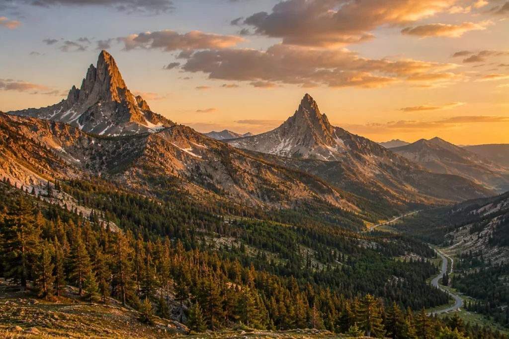
Pilot Peak (11,708 ft) is one of the most fantastical-looking peaks in the Rocky Mountains — a sharp, isolated spire visible from the Beartooth Highway near Cooke City.
Its visual signature is the result of erosion of a layered volcanic edifice into a near-vertical horn. Index Peak (11,313 ft) sits adjacent. Both are at the northeast entrance to Yellowstone National Park.
Eagle Peak (11,372 ft) — Highest Peak in Yellowstone National Park
Eagle Peak is the highest peak entirely within the boundary of Yellowstone National Park. It sits in the southern Absarokas, deep in the Yellowstone backcountry. Few travelers see it because of its remote location.
Avalanche Peak (10,568 ft)
Avalanche Peak is one of the most-hiked summits in the Wyoming Absarokas because of its proximity to the East Entrance road of Yellowstone and the popular ranger-led hikes. A strenuous 4-mile (one-way) day hike from a roadside trailhead.
Other Notable Peaks
Saddle Mountain, Sphinx Mountain, Ramshorn Peak, Steamboat Mountain, Republic Mountain, Trout Peak, and many more — the range is genuinely packed with major peaks.
The Thorofare: The Most Remote Place in the Contiguous U.S.
In the southern Absarokas, deep inside the Teton Wilderness (just south of Yellowstone), lies a region called the Thorofare. By distance from any road, it’s the most remote spot in the Lower 48 — more than 20 miles from any motorized access in any direction.
The Thorofare is named for the Thorofare Creek, which runs north into the south arm of Yellowstone Lake. Reaching it requires a multi-day backpack or pack-string trip.
The region is grizzly bear country at its densest, elk concentration ground, and one of the largest contiguous roadless areas in the U.S. Almost no one goes there.
The few who do — outfitters guiding pack trips, serious backcountry hunters, the rare backpacker — report a quality of isolation unavailable anywhere else in the contiguous U.S.
If you’re a serious wilderness traveler, the Thorofare is one of the great American destinations. If you’re a casual traveler, it’s a 5-day backpack from the nearest trailhead minimum.
The Absaroka-Beartooth Wilderness and Adjacent Protections
The Absarokas share their primary wilderness designation with the Beartooths. The combined Absaroka-Beartooth Wilderness covers approximately 944,000 acres in Montana and Wyoming. Adjacent wilderness areas include:
- Washakie Wilderness (704,000 acres, Wyoming) — south and east of Yellowstone
- North Absaroka Wilderness (351,000 acres, Wyoming)
- Teton Wilderness (585,000 acres, Wyoming) — contains the Thorofare
Together, these wildernesses plus Yellowstone National Park form one of the largest contiguous protected ecosystems in the temperate world.
The Shoshone National Forest alone — which manages much of the Wyoming side — covers 2.4 million acres and was the first National Forest established in the U.S. (1891).
The wilderness contains approximately 700 miles of maintained trails plus extensive off-trail backcountry.
The Best Hikes in the Absarokas
Avalanche Peak (Wyoming, Yellowstone)
The most popular Absaroka summit hike. About 4 miles one-way from the East Entrance road, gaining 2,100 feet. Strenuous but non-technical. Summit views of Yellowstone Lake.
Pine Creek Lake / Pine Creek Falls (Montana, Paradise Valley)
A classic moderate hike from the Pine Creek trailhead south of Livingston. About 5–6 miles round-trip to the falls and lake. Family-friendly with significant payoff.
Emigrant Peak (Montana)
A serious summit attempt. Long approach via Mill Creek, with Class 2 scrambling near the top. Most parties do it as a multi-day trip with overnight camping at high lakes.
Mill Creek (Montana, Paradise Valley)
Multiple trail options from the Mill Creek drainage — Pine Creek Lake, Emigrant Lake, the East Fork drainage. Some of the best alpine lake hiking in Montana’s Absarokas.
Hellroaring Creek (Yellowstone)
A trail from the Tower-Roosevelt area of Yellowstone descending into the Yellowstone River canyon — true backcountry hiking with grizzly bear precautions essential.
Greybull Pass / Thorofare (Wyoming)
The 6-day Greybull Pass thru-hike is the marquee deep-backcountry route, with serious commitment and bear-country protocols.
Specimen Ridge (Yellowstone)
A 17-mile point-to-point in Yellowstone’s northern range, traversing petrified forest country with views of the Lamar Valley and the Northern Range wildlife concentrations.
Wildlife in the Absarokas
The Absarokas are part of the Greater Yellowstone Ecosystem and support the full North American large-mammal community.
Grizzly bears — high density. The Greater Yellowstone Ecosystem has roughly 700 grizzlies, and the Absaroka backcountry is dense bear habitat. Carry bear spray. See our Montana bear guide.
Black bears — common.
Gray wolves — recolonized from Yellowstone reintroduction in 1995. The Northern Range packs use the Absaroka-Lamar corridor. See our Yellowstone wolf watching and Lamar Valley guides.
Elk — the Northern Yellowstone Elk Herd ranges through the Absarokas seasonally; one of North America’s most studied wild ungulate populations.
Bison — present in the Yellowstone portion of the range.
Moose, mule deer, white-tailed deer, mountain goats, bighorn sheep — all present.
Mountain lions, wolverines, lynx — all present, rarely seen.
Pronghorn — at lower elevations, particularly in the Paradise Valley grasslands.
Where to Base Yourself
Livingston — Northern Montana Gateway
Best for: Most travelers. The historic railroad town at the northern foot of the Absarokas. Population about 8,000, with strong restaurants, lodging, the Murray Hotel, and direct access to Paradise Valley and the northern Absarokas. Livingston is also a major fly fishing destination for the Yellowstone River.
Gardiner — Yellowstone North Entrance Gateway
Best for: Yellowstone Park access, southern Absaroka hiking, and combined Yellowstone-Absaroka trips.
Gardiner (population ~900) sits at the Yellowstone North Entrance — the only year-round park entrance. Limited but adequate lodging, with the historic Roosevelt Arch as the entrance landmark.
Cooke City — Northeast Yellowstone Gateway
Best for: Northern Absaroka access, Beartooth Highway combined trips, Lamar Valley wolf watching, Pilot/Index Peaks views.
Cooke City (population ~100 in winter, several hundred in summer) sits at the northeast entrance to Yellowstone, accessible via the Beartooth Highway (summer) or via Gardiner (winter only).
Chico Hot Springs — Paradise Valley Resort
Best for: Hot springs + Absaroka hiking + Paradise Valley luxury.
Chico Hot Springs in the heart of Paradise Valley is one of Montana’s most famous hot-springs resorts. Restaurant, hot pools, lodging, and direct access to Mill Creek trailheads.
Cody, Wyoming — Eastern Wyoming Gateway
Best for: Wyoming Absaroka access, the Buffalo Bill Cody Museum complex, and Yellowstone East Entrance.
Cody (population ~10,000) is the major Wyoming gateway to the eastern Absarokas. Strong Western heritage tourism.
Regional: Bozeman or Billings
Bozeman is the full-service Montana city (1 hour from Livingston). Billings is the larger regional city about 2 hours east.
Best Time to Visit
The Absarokas have a defined alpine hiking season due to high elevation and snow accumulation.
Late June through early July — lower trails are accessible; high passes still have snow.
Mid-July through September — prime hiking window. Wildflowers peak in late July. Watch for afternoon thunderstorms — common above timberline.
September through October — fall color in the aspens, cooler temperatures, fewer crowds. Elk hunting season opens in early September; wear orange and check season dates.
Winter — the high country closes. The Beartooth Highway is closed seasonally. Yellowstone’s east and northeast entrances close. The Yellowstone North Entrance and Paradise Valley remain accessible. Backcountry skiing for experienced parties.
For seasonal context, see Montana in July, Montana in August, and Montana in September.
Personal Tips: What I Wish I Knew About the Absarokas
Don’t confuse the Absarokas with the Beartooths. They’re adjacent but completely different ranges. The Beartooths are granitic; the Absarokas are volcanic. Most travelers see both during a single trip without realizing they’re standing on two different geological systems.
The Paradise Valley drive is the marquee Absaroka experience. US-89 from Livingston south to Gardiner is one of the most consistently beautiful drives in Montana, with the Absarokas rising on the west side and the Yellowstone River winding below. Plan a full day with stops at Chico Hot Springs, Pine Creek Trail, and Yellowstone River pullouts.
Avalanche Peak in Yellowstone is the easy classic. If you only have a day to experience the Absarokas, do Avalanche Peak. It’s roadside-accessible, strenuous but non-technical, and the views from the top are spectacular.
The Thorofare is for serious backcountry travelers only. If you’ve never been on a multi-day backpack with full grizzly-country protocols, this is not your starting trip. Build experience first.
Charlie Russell country. Paradise Valley and the Absaroka foothills are part of the country that defined Charlie Russell’s art. The Russell Museum in Great Falls is the place to see the paintings; the country itself is the inspiration.
Hot springs are part of the experience. Chico Hot Springs, Bozeman Hot Springs, and several smaller natural hot springs in the area make for excellent post-hike soaks.
Wolf watching is best in Lamar Valley. The Absaroka-Lamar corridor is part of the most-studied wolf country in the world. Dawn and dusk are the best times. See our Yellowstone wolf watching and Lamar Valley guides.
Bear spray is non-negotiable. This is one of the densest grizzly populations in the Lower 48. Carry spray on the hip, hike in groups, make noise, and follow proper food storage protocols. See the Montana bear guide.
The Crow Nation cultural connection matters. When you’re in these mountains, you’re in Apsáalooke homeland country. The Crow Indian Reservation lies east of the Absarokas. Visit respectfully, learn the name pronunciation, and acknowledge the cultural geography.
Cell service is limited. Livingston and Bozeman have full service. The Paradise Valley has spotty coverage. The wilderness has none.
Practical Info Box
| Item | Detail |
|---|---|
| Highest peak (overall range) | Francs Peak, 13,153 ft (Wyoming) |
| Highest peak (Montana side) | Mount Cowen, 11,212 ft |
| Most iconic Paradise Valley peak | Emigrant Peak, 10,921 ft |
| Highest peak in Yellowstone NP | Eagle Peak, 11,372 ft (in the Absarokas) |
| Range length | ~165 miles NW-SE |
| Range width | ~60 miles maximum |
| Named peaks | ~399 |
| Peaks over 12,000 ft | 47 |
| Volcanic activity | 53–43 Ma (Absaroka Volcanic Supergroup) |
| Volcanic eruption volume | ~29,000 cubic km of material |
| Named for | Apsáalooke (Crow Nation) |
| Local pronunciation | “Ab-sor-ka” |
| Wilderness areas | Absaroka-Beartooth (944,000 acres) + adjacent Washakie, North Absaroka, Teton |
| Most remote spot in Lower 48 | The Thorofare region (southern Absarokas) |
| National Forest (Wyoming) | Shoshone National Forest, 2.4 million acres (first NF in U.S.) |
| Best basecamps (Montana) | Livingston, Gardiner, Cooke City, Chico Hot Springs |
| Bear spray | Required gear |
| Cell service | Limited in valleys, none in wilderness |
| Nearest airport | Bozeman Yellowstone International (BZN) |
Final Thoughts
The Absarokas are the unsung half of the Greater Yellowstone ecosystem. Glacier National Park gets the famous photographs. The Beartooths get the high-altitude bragging rights.
The Tetons get the postcard skylines. The Absarokas — the volcanic wall that forms the entire eastern boundary of Yellowstone, that contains the most remote place in the Lower 48, that takes its name from the Crow Nation, and that sees more grizzlies per square mile than nearly anywhere else in the contiguous U.S. — sit quietly behind all of them.
If you’ve never been: drive Paradise Valley from Livingston to Gardiner on a clear evening. If you’ve been once: hike Avalanche Peak in Yellowstone or Mount Cowen in Montana.
If you’re committed: plan a multi-day backpack into the Thorofare or the Washakie Wilderness, with full grizzly-country protocols and a real wilderness commitment.
For broader context on how the Absarokas fit alongside Montana’s other ranges, see the full Montana mountain ranges guide.
Frequently Asked Questions
Where is the Absaroka Range?
The Absaroka Range runs about 165 miles northwest to southeast from Livingston, Montana to Dubois, Wyoming, forming the eastern boundary of Yellowstone National Park. The range crosses Park County in Montana and several Wyoming counties.
How do you pronounce “Absaroka”?
Locals typically say “Ab-sor-ka” (three syllables, stress on the first). Some Montanans use “Ab-SAH-ro-ka” (four syllables). Both are acceptable. The word comes from “Apsáalooke,” the Crow Nation’s name for themselves.
Who is the Absaroka Range named for?
The range is named for the Apsáalooke (Crow) Nation, whose name means “Children of the Large-Beaked Bird” — usually rendered in English as “Crow” or “People of the Crow.” The mountains are in traditional Crow homeland country.
What’s the highest peak in the Absaroka Range?
Francs Peak in Wyoming at 13,153 feet is the overall range high point. Mount Cowen at 11,212 feet is the highest peak in the Montana portion of the range. Eagle Peak at 11,372 feet is the highest peak entirely within Yellowstone National Park (also in the Absarokas).
Are the Absarokas volcanic?
Yes. The Absaroka Range is the eroded remnant of one of North America’s largest continental volcanic provinces, active 53 to 43 million years ago. The Absaroka Volcanic Supergroup erupted approximately 29,000 cubic kilometers of andesite, dacite, and rhyolite during that period.
Are the Absarokas the same as the Beartooths?
No. The Absaroka and Beartooth ranges are adjacent and share a wilderness area (the Absaroka-Beartooth Wilderness), but they’re geologically completely different. The Beartooths are granitic and form a high plateau. The Absarokas are volcanic and form dissected highlands. Both are part of the Greater Yellowstone Ecosystem.
Where is the Thorofare?
The Thorofare is a remote region in the southern Absarokas, mostly within the Teton Wilderness south of Yellowstone National Park. By distance from any road, it’s the most remote place in the contiguous United States — more than 20 miles from any motorized access. Reaching it requires multi-day backpacking or pack-stock travel.
Are there grizzly bears in the Absaroka Range?
Yes. The Absarokas are part of the Greater Yellowstone Ecosystem, which supports approximately 700 grizzly bears. The range has dense resident grizzly populations. Carry bear spray.
What’s the best Absaroka hike for a single day?
For families: Pine Creek Falls (Paradise Valley side, Montana). For day hikers: Avalanche Peak (East Yellowstone, Wyoming). For more demanding: Pine Creek Lake or Mill Creek (Montana). The choice depends on which side of the range you’re approaching from.
Where should I stay near the Absaroka Range?
Livingston is the best northern Montana base. Gardiner is the Yellowstone North Entrance base. Cooke City is the Yellowstone Northeast Entrance base. Cody, Wyoming is the eastern Absaroka base. Chico Hot Springs in Paradise Valley is a resort option for travelers seeking hot springs and luxury.