Most travelers blow past Beaverhead County on I-15 — headed to Yellowstone, or Glacier, or anywhere else that shows up in the brochures. That’s a genuine mistake, and one I made myself the first two times I drove through southwest Montana without stopping.
On my third trip, I finally pulled off at Dillon, drove north to the Big Hole Valley, and spent a week getting thoroughly disoriented by how much there was to do in a county I’d always treated as a corridor.
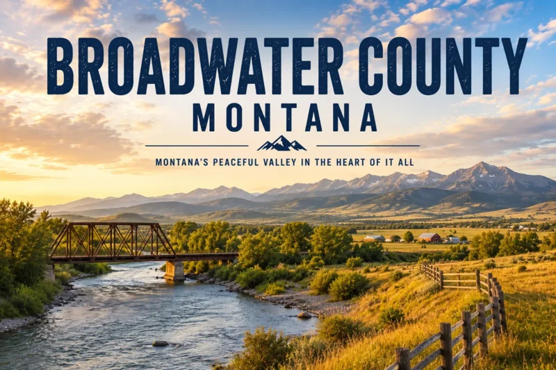
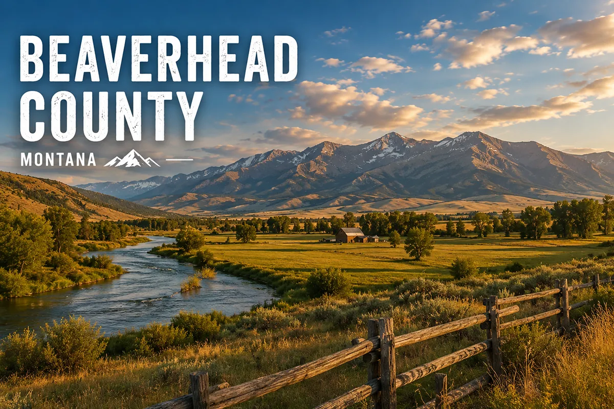
Beaverhead County is the largest county in Montana by area (5,542 square miles — bigger than Connecticut), and it’s one of the most rewarding for travelers willing to slow down. It holds Montana’s best-preserved ghost town, one of the most emotionally significant battlefields in the American West, two blue-ribbon trout fisheries including the last wild Arctic grayling stream in the lower 48, two separate hot springs, and a national forest that covers more land than many small U.S. states. The county seat is Dillon, a university town on I-15. This guide covers every major attraction in depth, with honest seasonal advice and the practical details that generic lists leave out.
Beaverhead County at a Glance
Beaverhead County covers the extreme southwest corner of Montana, bordered by Idaho to the west and the Continental Divide along much of its western and southern edges.
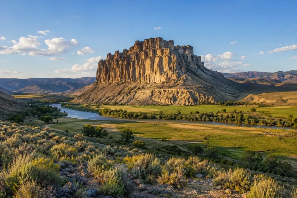
The county takes its name from Beaverhead Rock — a distinctive formation on the Beaverhead River that the Shoshone people recognized as resembling a beaver’s head lying on its side.
In August 1805, Sacajawea pointed it out to Meriwether Lewis and told him her tribe’s territory was nearby.
It was one of the most important navigational confirmations of the entire Lewis and Clark Expedition — it told them they were on the right track toward the Shoshone camps they desperately needed in order to obtain horses for the Continental Divide crossing.
You can still see Beaverhead Rock from Montana Highway 41, roughly halfway between Dillon and Twin Bridges.
The rock is a Montana State Park and has been on the National Register of Historic Places since 1970, though there’s no direct road access to the formation itself — just a roadside pull-off view that’s worth taking, especially if you know the story.
The numbers tell you something about this county immediately. More than two-thirds of its land is publicly owned — national forest, BLM, state parks, wildlife refuges. The Beaverhead-Deerlodge National Forest alone covers 3.35 million acres, making it the largest national forest in Montana.
That ratio of public land to private land shapes everything about visiting Beaverhead County: dispersed camping is genuinely accessible, fishing access is largely unrestricted, and the county has more wilderness quiet than almost anywhere else in the state.
Dillon (population ~4,000) is the county seat and the only town large enough to have reliable services.
The University of Montana Western gives Dillon a surprising cultural energy for its size — live music, community events, and a local arts scene that you wouldn’t necessarily expect in a southwest Montana ranching town.
Beyond Dillon, the county’s other communities — Wisdom, Jackson, Lima, Polaris, Wise River — are small enough that calling them towns is generous. But each has its own reason for being, and together they anchor a county that genuinely rewards exploration.
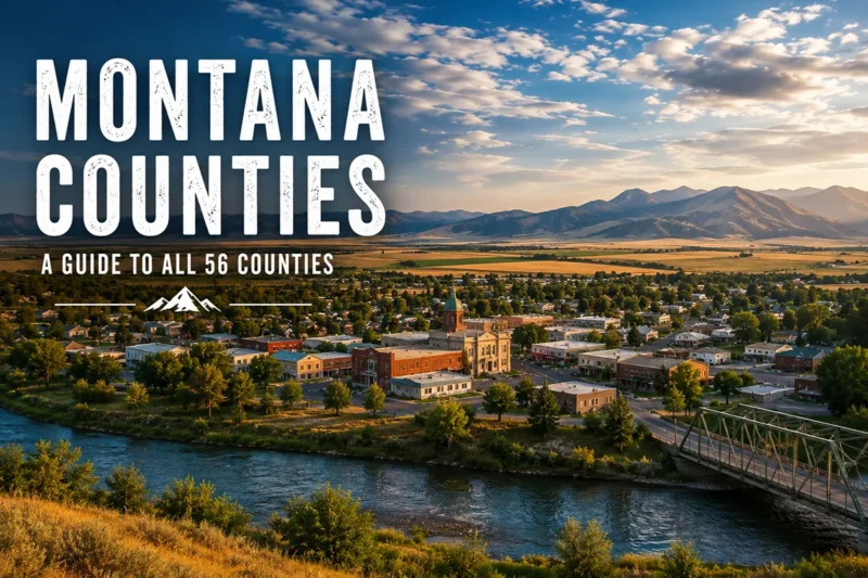
For a broader Montana context, see the complete guide to all 56 Montana counties and Montana cities and towns.
Bannack State Park: Montana’s Most Important Ghost Town
I’ve been to ghost towns all across the West, and Bannack is different from all of them. Most ghost towns are either too picked-clean to tell a coherent story, or too staged to feel authentic. Bannack is neither.
It’s a National Historic Landmark with around 60 original structures still standing — a hotel, a jail, a Masonic Hall that doubled as a school, a governor’s mansion — and when you walk the unpaved main street in the early morning before other visitors arrive, the place has a weight to it that’s hard to describe.
Bannack’s significance goes beyond the buildings. This is where Montana’s recorded history effectively begins.
On July 28, 1862, a group of prospectors led by John White discovered gold on Grasshopper Creek — a tributary of the Beaverhead — and by autumn, 3,000 people had flooded in from across the West.
Bannack grew almost overnight from nothing to a genuine settlement. In May 1864, when Montana Territory was formally established, Bannack became the first territorial capital.
The first governor, Sidney Edgerton, a friend of President Lincoln, operated from a log house here that still stands.
Bannack is also inseparable from the story of Sheriff Henry Plummer — elected lawman, secret leader of a road agent gang called the Innocents, and eventually hanged by the Montana Vigilantes in 1864 on the gallows he had ordered built.
It’s one of the more morally complicated stories in frontier history, and the interpretive materials in the park handle it honestly rather than sensationally.
I’ve read four books about the Plummer gang. Walking those streets after reading the history gives you a completely different experience than walking them cold — I’d recommend at least reading the intro materials at the visitor center before you start.
What to know before you go: Bannack is 25 miles west of Dillon on a well-maintained gravel road. The park is open year-round for self-guided tours. [Verify current entry fees and seasonal hours at stateparks.mt.gov.] The Bannack Days festival, held in July, brings the town briefly back to life with period demonstrations, living history events, and crowds — book early if you’re planning that weekend. The rest of the summer, crowds are manageable. I’ve been on a Tuesday morning in August when I had the main street to myself for a full hour.
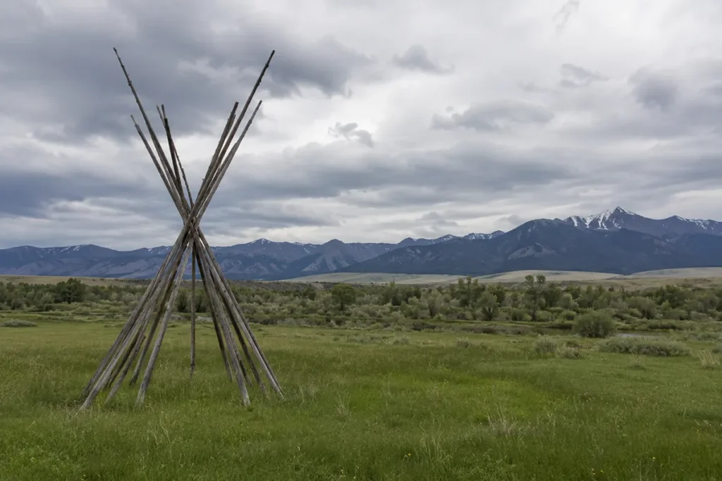
Big Hole National Battlefield: Where History Gets Honest
Ten miles west of Wisdom on Montana Highway 43, the road drops into the Big Hole Valley and you see it immediately — the kind of broad, quiet valley that makes you understand why the Nez Perce chose to stop here in August 1877.
They were six weeks into their flight from U.S. government forces attempting to force them onto a reservation in Idaho.
After five months of conflict across Oregon, Idaho, Wyoming, and Montana, they had 750 people — most of them women, children, and elders — plus hundreds of horses.
The Big Hole was peaceful, the grass was rich, and they made camp along the river. Before dawn on August 9, Colonel John Gibbon attacked with around 200 men.
The Nez Perce men mounted a fierce resistance that pinned Gibbon’s forces on a hillside for nearly two days. But in the initial assault on the sleeping camp, an estimated 60 to 90 Nez Perce were killed — the majority of them women and children.
It was the largest and most violent battle in the Nez Perce War of 1877. After the battle, the surviving Nez Perce fled east through Yellowstone National Park, then north toward Canada.
Chief Joseph surrendered at Bear Paw Mountain, just 40 miles from the Canadian border, in October 1877.
The battlefield is administered by the National Park Service as part of the larger Nez Perce National Historical Park, a 38-site network spanning five states along the Nez Perce flight route.
The visitor center’s 26-minute orientation film is worth watching before the trails — it provides context that makes the landscape legible.
The self-guided trail walks you through the Nez Perce camp site, where bare tipi poles stand in the river bottom as markers, and up to the siege area where Gibbon’s forces were pinned. The howitzer capture site is a short drive to a lower parking area.
Standing at the camp site in the evening, looking at those bare poles reflected in the river, is one of the more genuinely affecting experiences Montana has to offer. The site doesn’t editorialize excessively. It presents what happened and lets you sit with it. That restraint is the right call.
What to know: No entrance fee as of my last visit [verify current fees with NPS]. Open year-round; the visitor center has seasonal hours. The battlefield is 10 miles west of Wisdom, 50 miles from Dillon, on a paved highway. Cell service is minimal in the Big Hole Valley — download offline maps before you go.
Fly Fishing the Beaverhead and Big Hole Rivers
I’ll be direct about this: if you’re a fly angler, Beaverhead County may be the most important stretch of water in the American West, and most people outside the fishing community have no idea.
The Beaverhead River below Clark Canyon Dam is a tailwater fishery — the cold dam release keeps water temperatures stable year-round, which allows trout to grow large and hold through conditions that would shut down other rivers.
Brown trout in the 18-to-24-inch range are genuinely realistic targets on the Beaverhead, and 20+ fish have been documented here for decades.
The river is tight and technical — overhanging brush, intricate current seams, selective fish that have seen a lot of pressure.
This is not beginner water. I watched a guide from Dillon spend 40 minutes working one specific fish in a slot under a cutbank. He finally hooked it.
I watched the whole thing and still couldn’t fully explain what he was doing differently from my earlier attempts at the same fish.
Access is primarily from launch points along MT Highway 41 south of Dillon. Several outfitters in Dillon run guided float trips — I’d recommend floating with a guide at least once if you’re new to the river.
The upper section between the dam and Dillon is the most productive; the lower river approaching Twin Bridges transitions toward warmer conditions.
The Big Hole River is a different experience entirely — and it carries one of the most important biological distinctions in American freshwater fishing. The Big Hole is the last river in the continental United States with a wild, native, genetically distinct population of fluvial Arctic grayling.
These are not introduced fish. These are the same grayling that have lived in this drainage since before the last ice age, and they are now critically imperiled.
Montana Fish, Wildlife & Parks has implemented voluntary hoot owl restrictions on the Big Hole during hot summer periods — when water temperatures rise above certain thresholds, the FWP asks anglers to stop fishing by 2 p.m. to protect the fish. Most responsible anglers comply voluntarily. Check conditions before your trip.
Beyond the grayling, the Big Hole is an excellent brown and rainbow trout fishery. The upper river above Wisdom offers the best grayling opportunities. Below Wise River, the river opens up and the float fishing for browns is exceptional in September and October when the fish are pre-spawn aggressive.
Clark Canyon Reservoir, created by a dam on the Beaverhead River south of Dillon, is excellent for walleye and trout, and draws ice fishers in winter. It also has historical significance: the reservoir submerged the site of Camp Fortunate, where the Lewis and Clark Expedition met the Shoshone in 1805 and obtained the horses that allowed them to cross the Continental Divide.
See Montana outdoor activities and Montana ranches for guided fishing lodges operating out of the Big Hole Valley.
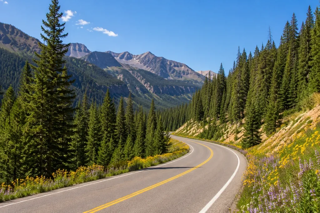
The Pioneer Mountains Scenic Byway
The 49-mile Pioneer Mountains Scenic Byway is one of the most underrated drives in Montana, and the fact that it’s entirely paved from end to end — running through the heart of the Beaverhead-Deerlodge National Forest — makes it accessible to any vehicle.
The byway runs roughly north-south between Wise River (on the Big Hole River) and Polaris, connecting the Big Hole Valley corridor to the Grasshopper Creek valley.
In terms of scenery, it’s consistently excellent — open mountain meadows, conifer forests, creek crossings, and views of the surrounding Pioneer Mountains throughout.
The elevation stays between 5,500 and 7,500 feet, which means warm-season driving is comfortable and the road is generally clear from June through October.
What’s along the byway:
The Coolidge Ghost Town sits about 15 miles north of Polaris, accessed by a short side road off the byway. Coolidge is a different kind of ghost town from Bannack — an early-20th-century silver mining operation with a mill building, a few cabins, and the physical remnants of a company town.
It’s not curated or interpreted; you just walk through the old buildings and figure it out yourself. I find that rawness more interesting, honestly.
Crystal Park at elevation 7,800 feet is genuinely one of the best family activities in southwest Montana that nobody talks about.
The Forest Service maintains a digging area where visitors can sift through decomposed granite and pull out quartz crystals, amethyst crystals, and full crystal prisms.
Bring small hand tools — a wire-mesh sifter and a hand trowel make the difference between an hour of frustrating scratching and a productive dig.
I’ve watched kids spend three hours here and not want to leave. The access road is good; the parking area has pit toilets.
The site is generally snow-free from late June through September. Admission is free. See Montana gemstones and gemstone mining in Montana.
Elkhorn Hot Springs near Polaris is a natural hot springs resort right on the byway — I cover it separately in the next section.
Hot Springs in Beaverhead County
Beaverhead County has two hot springs, and they’re different enough in character to be worth distinguishing.
Elkhorn Hot Springs near Polaris is the more well-known of the two, sitting at 7,400 feet elevation right on the Pioneer Mountains Scenic Byway. It’s a genuine mountain hot springs resort — rustic cabins, an outdoor soaking pool, a separate cooler plunge pool, a small bar and restaurant.
The pools are fed by natural springs and stay between 96°F and 102°F depending on the season [verify current temperatures].
I’ve soaked at Elkhorn after hiking in the Pioneers in September, when the aspens were turning gold and the air had gotten cold enough that steam rose off the water in a way that felt very Montana.
The food at the lodge is good, the atmosphere is unhurried, and the cabins are exactly what you’d want in that setting — not luxury, not neglected, just right.
Elkhorn is open year-round. The byway stays plowed to the resort in winter, making it a worthwhile snowmobile or cross-country ski destination. [Verify current cabin rates and soaking fees at elkhornhotsprings.com before your visit.]
Jackson Hot Springs Lodge in the tiny ranching community of Jackson (population roughly 35) is at the north end of the Big Hole Valley, about 60 miles north of Dillon.
It’s a different vibe from Elkhorn — more of a western lodge with a large outdoor soaking pool, motel-style rooms and cabins, a bar, and a cafe-style restaurant.
Jackson Hot Springs sits in the middle of the Big Hole Valley, which means the views from the pool encompass the entire valley ring of mountains. I’ve seen Sandhill cranes feeding in the fields adjacent to the property during spring migration.
Jackson Hot Springs is open year-round but services are limited — call ahead or check their website before driving 60 miles out of your way. See Montana hot springs for the broader state-wide guide.
Red Rock Lakes National Wildlife Refuge
The Red Rock Lakes National Wildlife Refuge occupies the extreme southwest corner of Beaverhead County — a remote, 40,000-acre wetland complex at 6,600 feet elevation in the Centennial Valley, near the Montana-Idaho border.
It was established in 1935 specifically to protect the trumpeter swan, which was nearly extinct at the time, and today it remains one of the most important trumpeter swan nesting areas in the lower 48 states.
Getting there requires a long drive on gravel roads — typically accessible from Lima (I-15) via a roughly 30-mile gravel road, or from West Yellowstone via the Centennial Valley road (longer and more remote).
There are very few maintained roads within the refuge itself, and most access is on foot or by non-motorized watercraft. This is not a casual detour. Plan for a full day minimum if you’re coming from Dillon.
What you’ll find: an enormous, lake-studded wetland complex with exceptional bird diversity. Trumpeter swans are reliable spring through fall.
Sandhill cranes, white pelicans, tundra swans during migration, and a remarkable diversity of shorebirds and waterfowl make this one of the best birdwatching destinations in Montana that almost nobody talks about.
Moose, pronghorn, and occasionally wolves round out the wildlife. Primitive camping is available.
The isolation is the point. The Centennial Valley sees very few visitors, cell service is nonexistent, and the refuge asks that visitors come prepared for self-sufficiency.
If you have a full spare tire, food and water for a day longer than you plan to stay, and no schedule you can’t miss, the Red Rock Lakes NWR delivers some of the most extraordinary wildlife habitat in the West.
Beaverhead-Deerlodge National Forest
The Beaverhead-Deerlodge National Forest is the largest national forest in Montana at 3.35 million acres, and it covers most of Beaverhead County’s mountainous terrain.
Within its boundaries: two designated wilderness areas (Anaconda-Pintler and the Lee Metcalf), more than a dozen mountain ranges, the Continental Divide, and the headwaters of several major river systems.
For most visitors, the practical entry points are through the Pioneer Mountains (via the Scenic Byway), the Beaverhead Mountains (from Dillon heading south), or the area around Lemhi Pass on the Idaho border.
Lemhi Pass deserves its own mention. At 7,323 feet on the Idaho-Montana border southwest of Dillon, Lemhi Pass is where Meriwether Lewis and a small party crossed the Continental Divide on August 12, 1805 — the first crossing by non-Indigenous people in recorded American history.
The pass is accessible by a steep, rough gravel road that’s best suited for high-clearance vehicles. At the top, a monument marks the site.
The views are expansive. The isolation is real — this is 30+ miles from the nearest services.
But if you have the vehicle and the time, standing at the exact spot where Lewis wrote about finally crossing the Divide and seeing not the short portage they had hoped for but another range of mountains stretching to the horizon… it’s one of those places that makes the abstract history of the West concrete. See key historical events in Montana.
For hunting, the Beaverhead-Deerlodge is exceptional — elk, bighorn sheep, pronghorn, antelope, moose, and black bear. The season runs September through February (with species-specific variations) — confirm all licensing and season details at fwp.mt.gov before your trip.
Maverick Mountain Ski Area
Maverick Mountain is 35 miles from Dillon in the Pioneer Mountains — which means it’s off the interstate, requires a deliberate drive, and sees a fraction of the traffic of Montana’s major ski hills. That’s exactly why it has a devoted following.
The vertical drop is 2,000 feet. There are no high-speed lifts — this is a double chair kind of place. The terrain is varied enough to keep an intermediate skier happy for a long weekend, and there’s genuine black diamond terrain on the back side.
The crowds are light enough that lapping your favorite run without a wait is standard, not exceptional.
What Maverick offers that Montana’s bigger hills don’t: the feeling that you’re skiing with locals rather than around tourists, reasonable ticket prices [verify current rates at maverickmt.com], and the kind of low-key atmosphere where the ski patrol knows your name by day two. It’s my favorite kind of ski area.
See Montana ski resorts for the full state comparison.
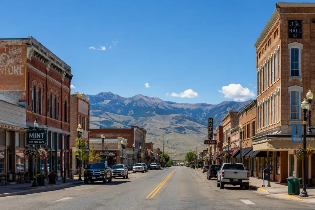
Dillon: The County Seat
Dillon (population ~4,000) is larger than most county seats in southwest Montana and more functional as a visitor base than many people expect.
The downtown has actual restaurants, a historic hotel (the Centennial Inn is worth a look), a locally owned coffee shop or two, and the University of Montana Western, which brings a student population that supports more commercial variety than you’d otherwise find in a ranching town this size.
The Beaverhead County Museum in downtown Dillon is excellent — housed in the original Dillon train depot building, it covers Lewis and Clark history, the regional gold rush era, the county’s long agricultural history, and early Dillon life with the kind of artifact depth that only decades of community collecting produces.
One former curator genuinely loves to talk about the county’s history in detail if you catch them at the right moment.
Clark’s Lookout State Park just north of Dillon on US Highway 91 marks a spot where William Clark climbed a rock outcrop in August 1805 to survey the valley below.
The hike to the lookout is short but steep — maybe 20 minutes round trip — and the view of the Beaverhead Valley from the top is genuinely impressive, especially if you imagine trying to navigate this terrain with 30 men and a pirogue canoe.
For food, Dillon has a handful of reliable options — the dining room at the Flyline Bar is the go-to for locals. The UM Western campus brings food-truck and event activity during the school year. See things to do in Dillon for a full breakdown.
Services note: Fill up in Dillon before heading into the Big Hole Valley or toward Red Rock Lakes. Gas exists in Wisdom and Lima but hours are limited and prices are higher. The Big Hole Valley has essentially no cell service between Wisdom and Jackson. Download your maps, make your phone calls, and check your fuel gauge before you leave town.
What I Wish I Knew Before Visiting Beaverhead County
Cell service drops to zero in the Big Hole Valley. Seriously — once you leave the Highway 43 corridor near Wisdom and head toward Jackson, you’re on your own. Download Google Maps offline for the county before you leave Dillon.
The Beaverhead River is harder than it looks. I’ve watched first-timers get frustrated on this river after expecting easy catches because of its reputation. Hire a guide at least once — they’ll shorten your learning curve by months. Most Dillon-based outfitters do half-day wading trips on the tailwater.
Don’t confuse Beaverhead County with Yellowstone access. The competitor site I researched before writing this says Beaverhead County is “very close to Yellowstone’s West Entrance.” It isn’t — West Yellowstone (Gallatin County) is roughly 80 miles northeast, and there’s no direct shortcut. You can include Beaverhead County in a southwest Montana loop that swings by Yellowstone’s south or east entrances via Wyoming, but plan your route before you assume proximity.
Bannack is best at the very beginning or end of the day. The morning light on those weathered buildings is extraordinary, and midday tourist traffic (particularly on weekends in July/August) is real. Get there by 9 a.m. if you want the place to yourself.
The Big Hole Valley hoot-owl fishing restrictions are real and important. Montana FWP requests that anglers stop fishing when water temperatures exceed 73°F on the Big Hole — check the FWP website for current voluntary restriction status before your trip, especially mid-summer. Fishing for threatened grayling during thermal stress conditions is both harmful to the fish and increasingly frowned upon by the fishing community here.
Winter access to Maverick Mountain and Elkhorn Hot Springs is possible but requires preparation. Both are accessible in winter, the Pioneer Mountains Scenic Byway stays plowed to Elkhorn, and Maverick is open through ski season. But I-15 between Dillon and Butte can be brutal in a winter storm. See Montana winter driving guide.
Practical Info
| County seat | Dillon |
| Area | 5,542 sq mi (Montana’s largest county) |
| Population | ~9,719 (2022 est.) |
| Tourism region | Gold West Country (Southwest Montana) |
| Nearest airport | Bert Mooney Airport, Butte (~65 miles north) |
| Main highway | I-15 (north-south), MT Hwy 43 (Big Hole Valley) |
| Best season to visit | June–September for most outdoor activities; December–March for skiing |
| Fly fishing peak | Beaverhead: September–November; Big Hole: late September–October |
| Crystal Park open | Late June–mid September (snow-dependent) |
| Bannack entry fee | [Verify at stateparks.mt.gov] |
| Big Hole NPS entry | [Verify at nps.gov/biho] |
| Cell service | Good in Dillon and on I-15; minimal to none in Big Hole Valley |
| Gas/services | Dillon, Wisdom (limited hours), Lima (limited hours) |
| Adjacent counties | Madison, Silver Bow, Deer Lodge, Granite, Ravalli (MT); Clark (ID) |
Getting to Beaverhead County
By car: I-15 runs north-south through the county, connecting Dillon to Butte (~65 miles north) and to the Idaho border and beyond.
From Billings, allow approximately 3.5 hours. From Missoula, allow approximately 2.5 hours via I-90 west and then south on MT Highway 1 or I-90/I-15 through Butte. From Bozeman, allow approximately 2 hours via I-90 west and I-15 south through Butte.
By air: Bert Mooney Airport in Butte (BTM) has regular service and is the closest commercial airport. Bozeman Yellowstone International (BZN) is approximately 2 hours north and has significantly more service options.
See Montana transportation guide and Montana airports for broader logistics.
Towns in Beaverhead County
- Dillon — county seat, university town, main service hub
- Wisdom — Big Hole Valley ranching community, gateway to Big Hole Battlefield
- Jackson — tiny ranch town at the north end of the Big Hole Valley; Jackson Hot Springs Lodge
- Lima — I-15 rest-stop town near the Idaho border; gateway to Red Rock Lakes
- Polaris — small community on the Pioneer Mountains Scenic Byway; near Elkhorn Hot Springs
- Wise River — at the confluence of the Wise River and Big Hole River; fishing access
- Dell — tiny I-15 community with a famous old bar (The Crossing)
- Glen — agricultural community south of Dillon
Adjacent Counties
Beaverhead County borders:
- Madison County to the east — Virginia City, Ennis, the Madison River
- Silver Bow County to the northeast — Butte, the Anaconda Range
- Deer Lodge County to the north — Anaconda, the Warm Springs area
- Granite County to the north — Philipsburg, Georgetown Lake
- Ravalli County to the northwest — Hamilton, the Bitterroot Valley
- Clark County, Idaho to the west
Plan Your Beaverhead County Trip
Whether you’re coming for the rivers, the history, or just to see a part of Montana that most visitors skip entirely, Beaverhead County rewards a slow pace.
Three days is a reasonable minimum — enough to see Bannack, drive the Pioneer Mountains Scenic Byway with a stop at Crystal Park and Elkhorn Hot Springs, and spend a day on either the Beaverhead or Big Hole River.
A week gives you everything on this list plus time to actually explore rather than just check boxes.
The county is at its best from late June through early October. The rivers fish well through November if you’re prepared for cold weather.
The Big Hole Valley in late September — golden cottonwoods, cool days, quiet roads, the grayling in their last productive season before ice — is as good as Montana gets.
For trip planning across the full southwest Montana region, see best time to visit Montana, Montana trip planning guide, and the Montana history guide for context on the gold rush and Lewis and Clark trail. Back to the complete Montana counties guide.