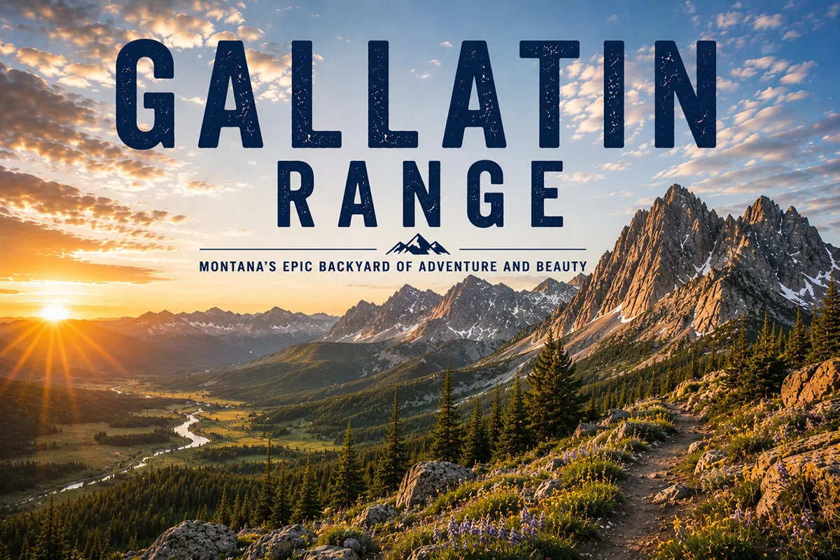
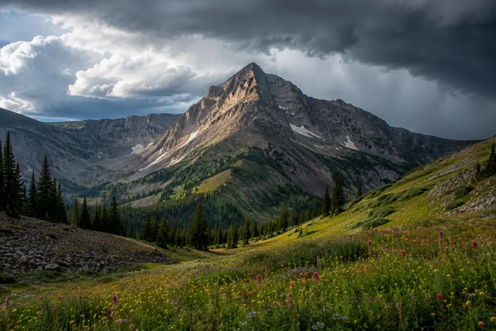
The Gallatin Range starts five minutes from downtown Bozeman and ends inside Yellowstone National Park. In between, it includes one of the largest Eocene petrified forests on Earth, one of the top ten ice climbing destinations in the world, a 37-mile ridge-walk that locals call the Devil’s Backbone, and 10,000-foot peaks you can see from your hotel window in Bozeman.
The Gallatin Range is the closest thing in Montana to a complete mountain experience packaged inside a single drive.
The Gallatin Range runs about 75 miles north–south from Bozeman down to Yellowstone National Park, with Electric Peak (10,969 ft) at the southern end as the high point. The range contains 105 named peaks, the world-famous Hyalite Canyon ice climbing area, the Gallatin Petrified Forest (one of the largest Eocene petrified forests in the world — and you can take a sample home with a free permit), and the Gallatin Crest Trail (Devil’s Backbone), one of Montana’s classic multi-day ridge walks. The range is named for Albert Gallatin, the longest-serving U.S. Secretary of the Treasury — not State, as several travel sites incorrectly claim. Best hiking window: mid-June through October.
Liked this article?
Add Roaming Montana as a preferred source so you see more of our articles and guides on Google.
Why the Gallatin Range Is Unique
Most Montana ranges have one or two signature features. The Gallatins have five.
- They straddle two management regimes. The northern half is Custer Gallatin National Forest country with full hiking, mountain biking, and motorized access where permitted. The southern half is inside Yellowstone National Park, with Park Service regulations including Bear Management Area restrictions. The split runs near Sage Peak.
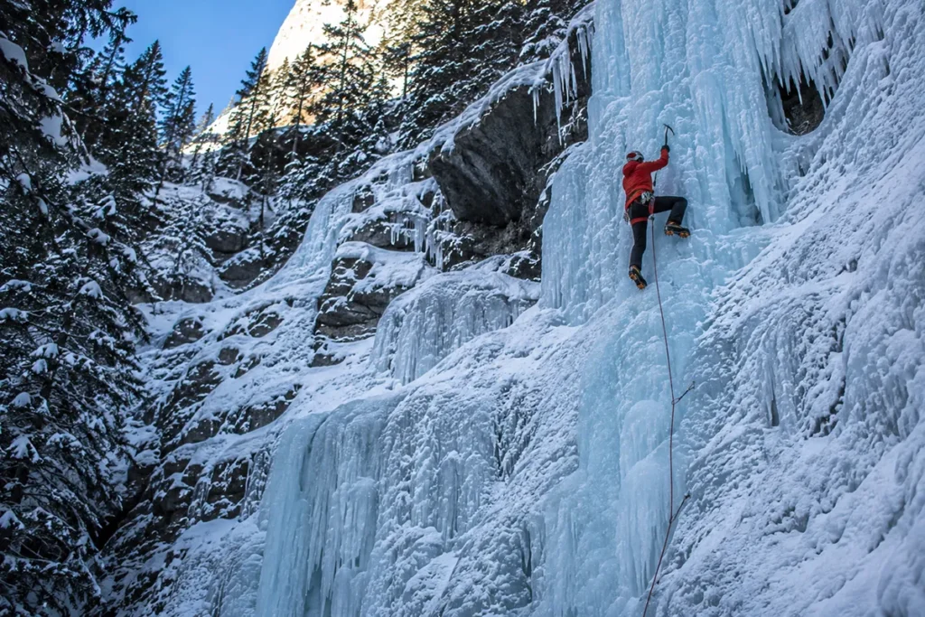
- They contain a world-class ice climbing destination. Hyalite Canyon has more than 250 documented ice climbs and hosts the annual Bozeman Ice Climbing Festival. Routes here are among the most consistent in North America, drawing international climbers December through March.
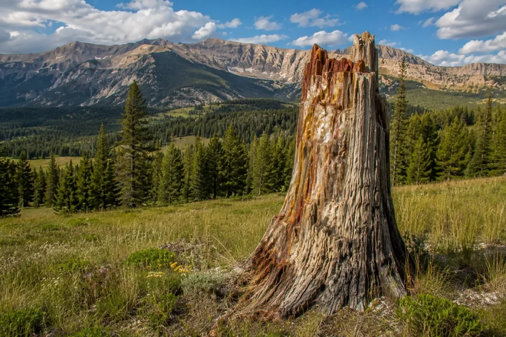
- They contain a major petrified forest. The Gallatin Petrified Forest preserves Eocene-era trees still standing upright where they grew 55 million years ago, buried by volcanic ash and mud flows. It’s one of the largest fossil forests in the world from that geological epoch.
- They include one of Montana’s longest ridge walks. The Gallatin Crest Trail — known to locals as the Devil’s Backbone — runs 37 miles along the spine of the range above timberline, one of the best multi-day backpacks in the state.
- They’re the only major Montana range with a 10,000-foot peak that’s a casual day hike from a major city. Hyalite Peak (10,299 ft) is reachable from Bozeman in a single day via the Hyalite Creek trail.
For broader Montana context, see my full Montana mountain ranges guide.
Where the Gallatins Are
The Gallatin Range runs roughly 75 miles north–south and averages about 20 miles east–west. The northern terminus is at the south edge of Bozeman; the southern terminus crosses into Wyoming inside Yellowstone National Park.
The range is bordered:
- West: Gallatin River and US-191 (the Gallatin Canyon route between Bozeman and West Yellowstone)
- East: Yellowstone River and the Paradise Valley along US-89
- North: Bozeman and the Gallatin Valley
- South: Gardiner Basin and the Mammoth Hot Springs area of Yellowstone
The range falls within Gallatin and Park counties in Montana, plus Park and Teton counties in Wyoming.
US-191 down the Gallatin Canyon is one of Montana’s most scenic drives — the river runs along the highway for 90 miles between Bozeman and West Yellowstone, with the Gallatin Range rising on the east side the entire way.
Who Was Albert Gallatin? (And the Most Common SERP Error)
The range is named for Albert Gallatin (1761–1849), a Swiss-born American statesman who served as the United States Secretary of the Treasury from 1801 to 1814 under presidents Thomas Jefferson and James Madison. His 13-year tenure is the longest in the history of that office, before or since.
This is a small but consistent factual error in the Montana travel press: several articles, including a piece on Visit Big Sky’s site, refer to Albert Gallatin as “longest-serving U.S. Secretary of State.” That’s wrong.
He was Secretary of the Treasury. (He did later serve as a diplomat, but never as Secretary of State.) The Lewis and Clark Expedition named the Gallatin River for him in 1805 because he was the sitting Treasury Secretary who had helped fund the expedition. The range took its name from the river.
The Geology: Three Billion Years in One Drive
The Gallatins have one of the most complete rock-record sequences exposed in any Montana range. Drive Hyalite Canyon Road from Bozeman, and you pass through three eras of Earth history in 20 miles:
- Archean basement rocks (2.7+ billion years old): gneiss and schist, deeply metamorphosed, once buried 15+ miles underground at temperatures over 750°C
- Paleozoic and Mesozoic sedimentary cover (~540 to ~66 million years old): more than 4,400 feet of stacked sandstone, shale, and limestone deposited when this region was a shallow sea
- Eocene volcanic capping (~50 million years old): the volcanic flows and ash deposits that built the upper Gallatins and buried the Gallatin Petrified Forest
You can see all three in a single hike up Hyalite Canyon. The 80-foot waterfall at Palisade Falls is pouring over a columnar joint pattern in cooled Eocene basalt — the same volcanic rock that capped the petrified forest.
Glacial action during the Pleistocene shaped the U-shaped Hyalite Canyon and removed an estimated 10,000 feet of overlying sediment from the southern Gallatins.
The Highest Peaks
The Gallatin Range contains 105 named mountains. The highest is in the southern portion inside Yellowstone:
- Electric Peak (10,969 ft) — the range high point, at the Yellowstone/Custer Gallatin boundary
- Hyalite Peak (10,299 ft) — the high point of the Bozeman-accessible portion
- Sage Peak — near the geological transition between the northern and southern Gallatins
- Mount Holmes
- Sepulcher Mountain (9,650 ft) — a popular day hike from Mammoth Hot Springs
- Bunsen Peak (8,564 ft) — the easy classic from Mammoth
- Divide Peak
- Overlook Mountain
- Gallatin Peak (~10,800 ft, technical Class 3 scramble — note this peak is sometimes confused with the Madison Range’s higher Gallatin Peak nearby)
The Gallatin Range generally gets higher and more rugged as you move south, with the most dramatic peaks concentrated in the Yellowstone portion.
The Gallatin Petrified Forest
The Gallatin Petrified Forest is one of the most extraordinary geological sites in Montana and one of the largest Eocene-age petrified forests on Earth. Roughly 50–55 million years ago, the Absaroka–Gallatin volcanic field was active, producing repeated ash falls, mudflows (lahars), and pyroclastic deposits that buried entire standing forests.
The trees were quickly entombed before they could rot, and over millions of years, mineral-rich groundwater replaced the wood cell-by-cell with silica — preserving the trees as fossilized standing stumps.
Today, the Gallatin Petrified Forest is part of the Custer Gallatin National Forest in the southern portion of the range. Access is via the Porcupine Creek trail, an approximately 8-mile hike from the trailhead off US-191, three miles south of Big Sky.
Here’s the unusual part: unlike most petrified forests (Yellowstone’s portion is protected, as is Arizona’s Petrified Forest National Park), the Gallatin Petrified Forest allows visitors to take a small sample home — with a free permit available from the District Ranger Office in Bozeman or Gardiner.
One sample per visitor, size restrictions apply. You can’t dig or remove standing logs, but a piece of fallen petrified wood is legal to take.
This is genuinely one of the more unique Montana experiences and it’s almost completely absent from mainstream travel coverage.
Hyalite Canyon: A World-Class Ice Climbing Venue
Hyalite Canyon, about 15 miles south of Bozeman, is the iconic recreational hub of the Gallatin Range. The canyon contains:
- Hyalite Reservoir — built in the 1940s, holds 8,000 acre-feet, supplies Bozeman’s drinking water
- More than 30 miles of summer hiking trails
- Multiple alpine lakes (Heather Lake, Emerald Lake, Hyalite Lake)
- The 80-foot Palisade Falls — wheelchair accessible via paved half-mile trail
- Grotto Falls — another accessible waterfall
- The Hyalite Peak trail — 10 miles to a 10,299-foot summit
But what makes Hyalite Canyon internationally famous is ice climbing. The canyon’s combination of high-elevation, north-facing rock walls, abundant water sources, and consistent cold creates ideal conditions for the formation of climbable ice.
The canyon hosts more than 250 documented ice climbs, and some sources count 325+ routes when including mixed climbs.
The Bozeman Ice Climbing Festival, held annually in early December, draws hundreds of climbers from around the world.
Hyalite is widely cited as one of the top five ice climbing destinations in North America and one of the top ten in the world. Routes like “Winter Dance” are considered among the elite frozen waterfall climbs anywhere.
Critically: ice climbing in Hyalite requires real avalanche awareness, technical skill, and gear. This is not a casual winter activity. The Gallatin National Forest Avalanche Center provides daily forecasts during the season.
For summer visitors, Hyalite Canyon’s hiking trails are some of the best-marked and most-accessible in southwest Montana. Three campgrounds (Hoodcreek, Chisholm, and Langhor) provide developed camping, and Hyalite Reservoir offers fishing and (yes, really) scuba diving training.
The Gallatin Crest Trail (Devil’s Backbone)
The Gallatin Crest Trail — locally called the Devil’s Backbone — is one of Montana’s classic multi-day ridge walks.
The trail runs 37 miles along the spine of the range from the Buffalo Horn trailhead (15 miles south of Big Sky off US-191) north through the Gallatin Petrified Forest, along high ridges above 9,000 feet, summiting 10,299-foot Hyalite Peak, and ending at the Hyalite Creek trailhead near Bozeman.
The trail is mostly above treeline. Water sources are limited along the ridge — plan to carry more than you think. The trail is best mid-July through early September. Most parties complete the traverse in 3–5 days.
This is one of Montana’s signature backpacking experiences. It’s also one of the most exposed — afternoon thunderstorms are a serious lightning risk, and there’s nowhere to escape to. Plan early starts and short days.
Bear Management Areas in the Yellowstone Portion
The southern portion of the Gallatin Range inside Yellowstone National Park is subject to Bear Management Area (BMA) restrictions — seasonal closures designed to protect grizzly bears during critical foraging periods.
BMAs typically affect:
- Off-trail travel during specific months
- Group size requirements (minimum group sizes required in some BMAs)
- Overnight camping restrictions
The specific BMAs that affect Gallatin Range trips include the Gallatin BMA, the Antelope Creek BMA, and others depending on your route. Restrictions change year to year.
Check current rules with the Yellowstone backcountry office before any trip into the southern Gallatins.
Carry bear spray everywhere in the Gallatins — north or south, in or out of the park. See our Montana bear guide.
The Best Hikes in the Gallatin Range
Hyalite Canyon Trail to Hyalite Lake and Hyalite Peak
The classic Bozeman day-or-overnight hike. From the Hyalite Creek trailhead at the end of Hyalite Canyon Road, the trail follows the creek 5 miles to Hyalite Lake, then continues another 5 miles to the summit of Hyalite Peak (10,299 ft).
Total: about 20 miles round-trip to the summit. Multiple waterfalls along the way. Can be done in segments — Hyalite Lake alone is a great day hike.
Palisade Falls Trail
A half-mile paved, wheelchair-accessible trail to a 80-foot waterfall pouring over Eocene volcanic cliffs. Best easy hike in southwest Montana for visitors with mobility constraints.
Grotto Falls Trail
Another easy 1.5-mile out-and-back to a Hyalite Canyon waterfall. Wheelchair accessible.
Heather Lake and Emerald Lake
Two subalpine lakes between Mt. Chisholm and Overlook Mountain, accessed via the East Fork Hyalite trail. Multi-use trail (mountain bikes, dirt bikes during portions of the season).
Bunsen Peak (Yellowstone Portion)
An easy classic from Mammoth Hot Springs to the summit of 8,564-foot Bunsen Peak. About 4 miles round-trip with 1,300 feet of gain. Great introductory hike to the southern Gallatins.
Sepulcher Mountain
A more demanding 10–12 mile hike from Mammoth to 9,650-foot Sepulcher Mountain with 2,200–3,400 feet of gain depending on route. One of the best day-hike summits in the Yellowstone portion.
Electric Peak
The Gallatin Range high-point hike. Typically done as a two- to three-day trip with basecamp at Sportsman Lake or similar, then a summit attempt on day two. The summit is non-technical but exposed to weather. From Mammoth side or Gardiner side approaches.
The Devil’s Backbone (Gallatin Crest Trail)
The 37-mile traverse described above. The most committing trip in the range.
Porcupine Creek to the Gallatin Petrified Forest
The 8-mile hike (one-way) to access the petrified forest. Get your free sample permit from the District Ranger Office first.
Wildlife in the Gallatin Range
The Gallatin Range is part of the Greater Yellowstone Ecosystem and supports the full Yellowstone large-mammal community.
Grizzly bears — significant resident population, particularly in the southern Gallatins. The Bear Management Areas exist for this reason.
Black bears — common throughout.
Gray wolves — recolonized from Yellowstone reintroduction in 1995. Multiple packs use the Gallatin–Madison corridor. The nearby Lamar Valley is one of the best wolf-watching destinations in the world.
Elk — abundant. The Gallatin Canyon supports one of Montana’s larger elk herds.
Mule deer, white-tailed deer, moose — all present.
Mountain goats — alpine zones, particularly on Electric Peak.
Bighorn sheep — present but scattered.
Mountain lions — present throughout, rarely seen.
Wolverines — alpine zones, very rare.
Fish: The Gallatin River is one of America’s blue-ribbon trout streams, with rainbow trout, brown trout, and cutthroat trout. Hyalite Reservoir holds brook trout, yellow cutthroat, and arctic grayling.
Where to Base Yourself
Bozeman — Best Northern Base
Best for: Hyalite Canyon, Hyalite Peak, north end of the Gallatin Crest Trail, ice climbing access, and a real city’s worth of restaurants and amenities.
Bozeman (population ~55,000) is Montana’s fastest-growing city, with strong restaurant and outdoor industry scenes, Montana State University, Bozeman Yellowstone International Airport (the busiest in the state), and direct trailhead access to the northern Gallatins. This is where most travelers will base.
Big Sky — Middle Range Base
Best for: Gallatin Petrified Forest, central Gallatin Crest Trail, the Madison Range as well, and ski access in winter (Big Sky Resort).
Big Sky is the destination resort community in the upper Gallatin Canyon. Higher-end lodging, premier ski terrain, direct access to Lone Mountain in the Madisons and Porcupine Creek (petrified forest) in the Gallatins.
Gardiner — Southern Gateway
Best for: Electric Peak, Sepulcher Mountain, Bunsen Peak, Yellowstone Park access via the North Entrance.
Gardiner sits at Yellowstone’s North Entrance — the only year-round park entrance. Population about 900, with motels, restaurants, and direct access to Mammoth Hot Springs and the southern Gallatins.
West Yellowstone — Southern Gateway (West Side)
Best for: South-side Gallatin access via Yellowstone’s West Entrance, with adjacent access to the Madison and Centennial Ranges.
Smaller Bases
Belgrade, Three Forks, and Livingston offer smaller-town alternatives within easy reach of the Gallatins.
Best Time to Visit
The Gallatin Range spans a wide elevation range, which means a longer usable season than higher ranges to the south.
Mid-May through June is excellent for lower-elevation trails — Hyalite Canyon’s lower trails, Palisade Falls, Grotto Falls. High country still has snow.
Mid-July through September is prime for the high country, the Gallatin Crest Trail, and summit hikes. Watch for afternoon thunderstorms — lightning on exposed ridges is the biggest hazard.
October can be glorious with aspen turn and cooler temperatures, but weather risk increases. The Gallatin Crest Trail is generally too risky after mid-September.
Winter (December through March) is the prime ice climbing season in Hyalite Canyon. Lower trails are accessible for cross-country skiing and snowshoeing. The Big Sky Resort in the adjacent Madisons brings winter sport infrastructure.
For seasonal context, see Montana in July, Montana in August, and Montana in December.
Personal Tips: What I Wish I Knew About the Gallatins
Plan your trip around the management boundary. A trip to the northern Gallatins (Hyalite area) and a trip to the southern Gallatins (Yellowstone area) are completely different planning exercises. Different permits, different rules, different access points. Decide which portion you’re targeting and plan accordingly.
The petrified forest is genuinely underrated. Pay the District Ranger office a visit in Bozeman to get your free sample permit. The hike is long (8 miles to the petrified forest area) but the experience of walking among 55-million-year-old fossilized trees is genuinely unique.
Bozeman Ice Climbing Festival is in early December. If you’re an experienced ice climber, this is one of the world’s premier festivals — three days of clinics, lectures, and climbing in Hyalite Canyon. Tickets sell out months ahead.
Hyalite Canyon Road can be rough. The road is gravel beyond Hyalite Reservoir and gets potholed by August. Driveable in a sedan when dry, but allow extra time and check Forest Service road conditions.
The Gallatin Crest is exposed to lightning. The Devil’s Backbone trail is one of the most consistent ridgewalks in Montana — and that’s a problem when storms build. Plan early-morning starts and be off ridges by noon-to-1pm. Carry a real raincoat regardless of forecast.
Bear spray is non-negotiable. This is grizzly country throughout. Carry spray on your hip, not in your pack. Practice deploying it before you go.
The Gallatin River is one of America’s great trout streams. If you’re not fishing during your Gallatin Range visit, you’re missing half the experience. The Gallatin Canyon between Bozeman and Big Sky has dozens of pullouts where you can wade in. State fishing license required.
The HPBH Wilderness Study Area matters. The Hyalite-Porcupine-Buffalohorn Wilderness Study Area covers 155,000 acres of the central Gallatins and is at the center of ongoing public-land conservation debate. The area is currently managed as de facto wilderness pending congressional action.
Watch the night sky from the high country. The Gallatin Crest and Hyalite Lake area offer some of the darkest skies in southwest Montana. See our Montana night sky guide.
Practical Info Box
| Item | Detail |
|---|---|
| Highest peak | Electric Peak, 10,969 ft (Yellowstone NP border) |
| Bozeman-accessible high point | Hyalite Peak, 10,299 ft |
| Number of named peaks | 105 |
| Range length | ~75 miles N–S |
| Range width | ~20 miles average E–W |
| National Forest | Custer Gallatin National Forest (north) |
| National Park | Yellowstone NP (southern third) |
| Wilderness Study Area | Hyalite-Porcupine-Buffalohorn (HPBH), 155,000 acres |
| Ice climbing routes (Hyalite) | 250–325+ |
| Counties | Gallatin, Park (MT); Park, Teton (WY) |
| Best basecamp | Bozeman (north); Gardiner (south) |
| Bear spray | Required gear |
| Named for | Albert Gallatin, U.S. Treasury Secretary 1801–1814 |
| Nearest airport | Bozeman Yellowstone International (BZN) |
| Petrified Forest | Sample permit available free from District Ranger |
Final Thoughts
The Gallatin Range is the most complete mountain experience packaged in a single Montana range.
You can climb world-class ice in December, walk a 55-million-year-old fossilized forest in July, traverse a 37-mile ridge in August, and base yourself in a real city with restaurants and an international airport.
Few mountain ranges in America deliver that range of experiences in one geography.
If it’s your first trip: do Hyalite Canyon as a day, take the Palisade Falls trail, hike up to Hyalite Lake, and have dinner in Bozeman. If you’ve been once: drive to the petrified forest. If you’re committed: the Gallatin Crest Trail in late August is one of the great Montana experiences.
For broader context on how the Gallatins fit alongside Montana’s other ranges, see the full Montana mountain ranges guide.
Frequently Asked Questions
Where is the Gallatin Range?
The Gallatin Range runs about 75 miles from Bozeman, Montana south to the northern interior of Yellowstone National Park. It’s bordered by the Gallatin River on the west and the Yellowstone River on the east.
Who is the Gallatin Range named for?
Albert Gallatin (1761–1849), a Swiss-born American statesman who served as U.S. Secretary of the Treasury from 1801 to 1814 under Jefferson and Madison — the longest-serving Treasury Secretary in U.S. history. Note: he was Treasury Secretary, not Secretary of State, despite a common error in some travel writeups.
What’s the highest peak in the Gallatin Range?
Electric Peak at 10,969 feet, at the Yellowstone/Custer Gallatin boundary in the southern portion of the range. Hyalite Peak at 10,299 feet is the highest peak in the Bozeman-accessible portion.
Is Hyalite Canyon in the Gallatin Range?
Yes. Hyalite Canyon is the main recreational area on the north end of the Gallatin Range, about 15 miles south of Bozeman. It’s internationally famous for ice climbing and contains the Hyalite Reservoir, Palisade Falls, Grotto Falls, and several alpine lakes.
Where is the Gallatin Petrified Forest?
In the southern Custer Gallatin National Forest portion of the range, accessed via the Porcupine Creek trailhead off US-191 about 3 miles south of Big Sky. The forest preserves one of the largest concentrations of Eocene-age (55 million years old) petrified trees in the world.
Can you take petrified wood home from the Gallatin Petrified Forest?
Yes. The Custer Gallatin National Forest allows one small sample per visitor per year, with a free permit from the District Ranger Office in Bozeman or Gardiner. Size restrictions apply.
Is the Gallatin Range in Yellowstone?
The southern portion of the range is inside Yellowstone National Park, with the boundary running near Sage Peak. The northern portion is in the Custer Gallatin National Forest.
Are there grizzly bears in the Gallatin Range?
Yes. The Gallatin Range is part of the Greater Yellowstone Ecosystem and has a healthy resident grizzly population, particularly in the southern half. Bear Management Area restrictions apply in the Yellowstone portion. Carry bear spray.
What’s the best hike in the Gallatin Range?
For families: Palisade Falls or Grotto Falls. For day hikers: Hyalite Lake. For summit baggers: Hyalite Peak (north) or Sepulcher Mountain (south). For backpackers: the Gallatin Crest Trail (Devil’s Backbone), 37 miles north to south along the spine of the range.
Where do you stay near the Gallatin Range?
Bozeman for northern access (Hyalite, Bozeman Creek, north Crest Trail). Big Sky for middle-range access (petrified forest, Porcupine Creek). Gardiner or West Yellowstone for southern access (Electric Peak, Sepulcher Mountain).