There’s a thin igneous dike running through the Little Belt Mountains that produces some of the most prestigious sapphires in the world — cornflower blue gemstones that have been set in the jewelry of First Ladies and that are valued by collectors as some of the finest natural sapphires anywhere.
Twenty-eight million carats are estimated to still be in the ground. Most travelers who drive US-89 between Great Falls and White Sulphur Springs don’t know any of this.
They see forested mountains, a ski hill, a few small towns, and don’t realize they’re driving past one of the most distinctive geological and gemological deposits in the world.
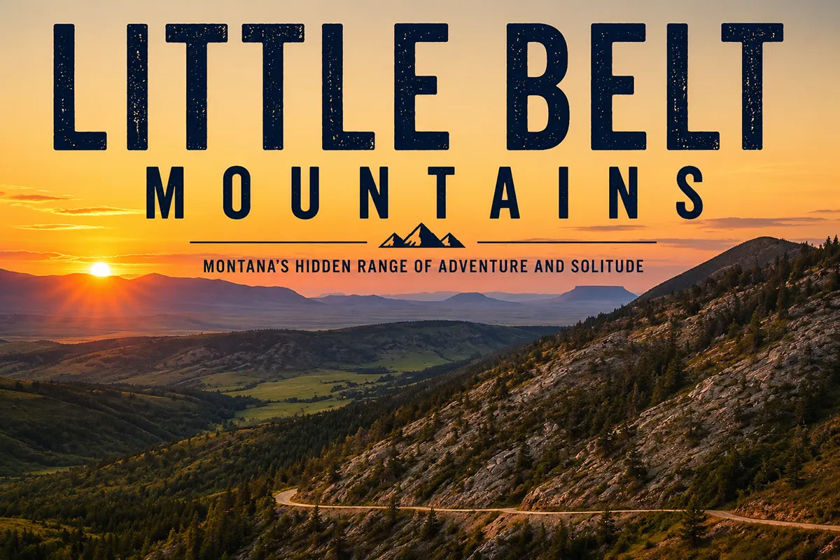
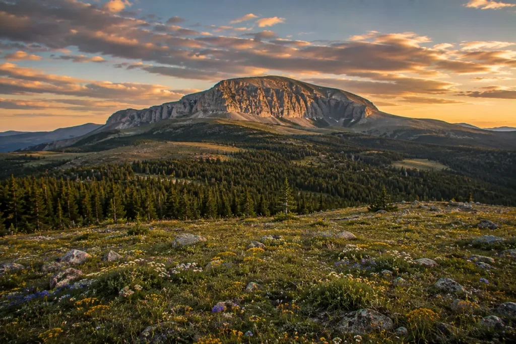
The Little Belt Mountains run across central Montana between Great Falls and White Sulphur Springs, anchored by Big Baldy Mountain (9,175 ft). The range is named after Belt Butte, which itself is named for a band of white rock encircling it like a belt. The Little Belts are home to the famous Yogo sapphire mine — producer of cornflower-blue sapphires considered among the finest in the world. The Smith River runs along the western edge — the only river in Montana requiring a permit for private parties. Showdown Ski Area holds Montana’s snowfall record (33 feet in a single winter). The 74-mile Kings Hill National Scenic Byway (US-89) bisects the range. Best window: late June through October.
Liked this article?
Add Roaming Montana as a preferred source so you see more of our articles and guides on Google.
Why the Little Belts Are Different
Most Montana mountain ranges are defined by what you can climb, ski, or fish. The Little Belts have all of those things, but their global identity comes from something much smaller — a single thin igneous dike, about 3 miles long and 8 feet wide, running through the eastern flank of the range.
That dike produces Yogo sapphires, possibly the finest gem-quality sapphires in the world. The Little Belts are the place where the rarest, most prized blue sapphire on Earth comes out of the ground.
Beyond Yogo, the Little Belts offer:
- The Smith River canyon on the western edge — the only Montana river requiring a private-party float permit, with a 10% lottery success rate.
- Showdown Ski Area — one of Montana’s oldest ski areas, still operating, with the state’s recorded snowfall record.
- The Kings Hill National Scenic Byway — 74 miles of mountain driving along US-89.
- 89 named peaks spread across nearly 1 million acres of Lewis and Clark National Forest.
- A genuinely underrated trail system within easy reach of Great Falls.
For broader context, see my full Montana mountain ranges guide and the companion Big Belt Mountains post (the Big Belts form the other wall of the Smith River canyon).
Where the Little Belts Are
The Little Belt Mountains sit in central Montana, between Great Falls (north) and White Sulphur Springs (south). The range covers approximately 1 million acres across four counties: Judith Basin, Wheatland, Meagher, and Cascade.
The range is bordered:
- North: Belt and the Highwood Creek area
- South: White Sulphur Springs and the Smith River drainage
- West: Smith River canyon and the Big Belt Mountains across it
- East: Lewistown and the Judith River basin
The defining geographic feature is US-89, the highway that runs through the heart of the range as the Kings Hill National Scenic Byway between Armington Junction (north) and White Sulphur Springs (south) — 74 miles of mountain driving with multiple recreational access points along the way.
The range is part of the Helena-Lewis and Clark National Forest (which manages nearly all the land).
The Name: Belt Butte and the White Rock Band
The Little Belts take their name from Belt Butte — a distinctive landmark in the range with a horizontal band of white rock encircling it like a belt. The exposed white limestone “belt” was visible from many miles away on the open prairie, and the butte was named for that feature.
The town of Belt at the western foot of the range and the larger Belt Supergroup geological formation (the billion-year-old sedimentary sequence found across northwest Montana) both take their names from the same butte.
The “Big Belt” Mountains and “Little Belt” Mountains are paired ranges — the Big Belts being the larger of the two, the Little Belts being the smaller but more extensive central Montana sister range.
Big Baldy Mountain: The High Point
Big Baldy Mountain at 9,175 feet is the highest peak in the Little Belt Mountains and the highest point in Judith Basin County.
The peak has a prominence of about 3,557 feet — a significant rise above the surrounding terrain. The name comes from its treeless alpine summit, which stands out in a range otherwise covered in conifer forest.
Climbing Big Baldy
The standard summer route is the Big Baldy Mountain Trail from FS Road 101, about an hour’s drive from Great Falls.
The full route is approximately 18 miles round-trip with about 3,300 feet of elevation gain. The trail follows ridgelines through Butcherknife Mountain before reaching the alpine plateau and final summit push via shale scree on the north face. Most parties do it as a long day hike.
A more committing option is the Big Baldy Loop — combining Butcherknife Mountain, Big Baldy, and Pioneer Ridge into a loop. The Wild Montana group calls this one of central Montana’s best high-alpine experiences.
The 360-degree views from the summit, on a clear day, take in:
- North: The Highwood Mountains, Bears Paw Mountains
- South: Crazy Mountains
- East: Big Snowy Mountains
- Southwest: The Absaroka Range south of Livingston and Big Timber (visible only in perfect conditions)
- Northwest: Rocky Mountain Front (in best conditions)
The summit has a peak register. Outstanding wildflowers on the alpine plateau in late July. Exposure to lightning is extreme above timberline — plan early starts and be off the summit by early afternoon.
Yogo Sapphires: One of the World’s Finest Gem Deposits
This is the story that makes the Little Belt Mountains globally significant.
What Makes Yogo Sapphires Special
Sapphires are corundum (aluminum oxide) crystals — typically blue, but found in many colors. Most sapphires worldwide are mined from alluvial deposits — gravel beds where the original source rock has eroded away, and the stones have been transported and tumbled by water.
The world’s major sapphire mines in Sri Lanka, Madagascar, and Australia are mostly alluvial.
Yogo sapphires are different. They come directly out of their primary igneous source rock — a thin lamprophyre dike that intruded into older Paleozoic limestone and shale in the Little Belt Mountains roughly 48 million years ago.
The dike is approximately 3 miles long and 8 feet wide. Because the sapphires haven’t been weathered or transported, they emerge with several remarkable properties:
- Uniform cornflower-blue color. The trace iron and titanium in the Yogo dike produced sapphires with extraordinarily consistent saturation and hue.
- Natural clarity. Most sapphires worldwide require heat treatment to improve color and remove inclusions. Yogo sapphires typically need no heat treatment to be gem-quality.
- Smaller average size. Most Yogo sapphires are under 1 carat. Larger stones are rare and command premium prices.
- Brilliance under artificial light. Yogos retain their blue color in incandescent light better than most sapphires.
These characteristics have made Yogo sapphires globally prestigious. Jewelry containing Yogo sapphires has been worn by First Ladies Florence Harding and Bess Truman. Several Yogo sapphires are part of the Smithsonian Institution’s gem collection.
Industry estimates suggest at least 28 million carats of Yogo sapphires still remain in the ground — most of them currently uneconomic to extract because the dike is so narrow and the rock so hard.
The Discovery and the Charlie Russell Connection
The Yogo sapphires were discovered in 1894 by Jake Hoover, a Montana prospector and rancher who lived in Pig-Eye Basin east of Yogo Creek. Hoover had been hand-panning Yogo Creek for gold when he came across small blue stones he thought were odd.
He sent samples to Tiffany & Co. in New York. The stones came back identified as sapphires of exceptional quality.
Hoover was also Charles M. Russell’s mining partner and friend in the early 1880s. Russell — the cowboy artist whose paintings define romanticized Montana to the world — lived and worked with Hoover during his formative years.
There’s a direct historical line from the Yogo discovery to the artist who painted the iconic Montana landscapes you see in our things to do in Great Falls and Montana history coverage.
For more on the geology and rockhounding context, see our Montana rockhounding sites and Montana sapphire guides.

The Smith River: Montana’s Only Permit Float
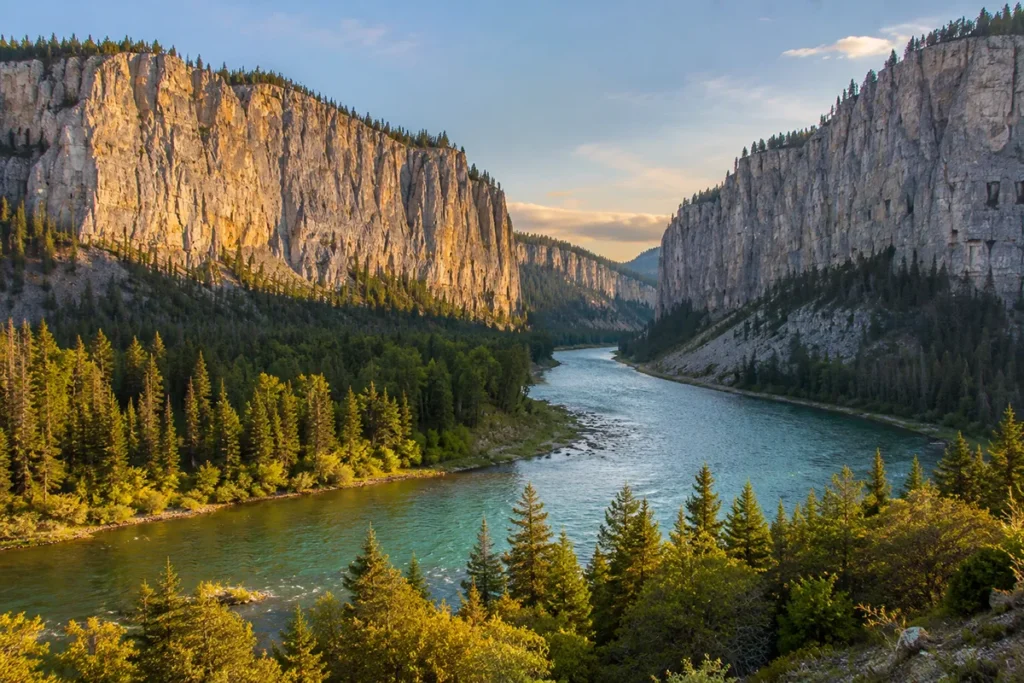
On the western edge of the Little Belt Mountains, the Smith River cuts a 59-mile canyon between the Little Belts and the Big Belt Mountains.
This stretch — from Camp Baker (put-in, north of White Sulphur Springs) to Eden Bridge (take-out, south of Ulm) — is the only river in Montana that requires a private-party permit to float.
Why the Permit?
The Smith River canyon is genuinely spectacular: 1,000-foot limestone cliffs, multiple side canyons, no road access for the entire 59 miles, blue-ribbon fly fishing (rainbow, brown, and brook trout), and dramatic camping.
By the late 1980s, public-use pressure on the Smith had grown beyond what the corridor could support. In 1990, Montana FWP established a permit-only floating system.
How the Lottery Works
- Applications open mid-January each year
- Lottery drawn in late February
- Roughly 10 percent of applicants receive a permit
- One Super Permit is awarded annually that allows launching on any date
- Up to four nights on designated camp sites
- Floats limited to canoes, kayaks, rafts, and drift boats (no motorized craft)
- Dogs not allowed
- No cell service in the canyon — bring satellite communicator
Without a Permit
If you don’t win the lottery, you can:
- Call the Smith River Reservation Line (406-454-5861) between 8 am and noon Monday–Friday to ask about cancellations
- Book a commercial outfitted trip with a licensed outfitter (more expensive, but doesn’t require winning the permit lottery)
- Day-float sections accessible from public access points (limited to short stretches)
The Smith River float is widely considered one of the great American river trips. If you ever win the lottery, take it.
Showdown Ski Area
Showdown Ski Area sits on the southwestern flank of the Little Belt Mountains near Porphyry Peak (~8,200 ft), about an hour southeast of Great Falls. Showdown is one of Montana’s oldest continuously operating ski areas and one of the more locally beloved.
Key facts:
- Montana state snowfall record: 33 feet in a single winter (officially recorded at Showdown)
- Modest size by major-resort standards, but consistent powder
- Cheap lift tickets relative to major Montana resorts
- Strong locals’ culture
- Family-friendly terrain plus some genuinely challenging steeps
Even in summer, the access road to Showdown is a useful entry point to the central Little Belts — particularly for hiking up Porphyry Peak Lookout and the connecting trail network.
For broader skiing context, see our Montana ski resorts overview.
Kings Hill National Scenic Byway
US Highway 89 between Armington Junction (north) and White Sulphur Springs (south) is officially designated the Kings Hill National Scenic Byway — 74 miles of mountain driving through the heart of the Little Belt Mountains. The byway crosses Kings Hill Pass (7,393 ft) and provides access to:
- Memorial Falls — see our existing Memorial Falls trail guide
- Showdown Ski Area
- The small communities of Neihart and Monarch
- Numerous Forest Service campgrounds (Logging Creek, Jumping Creek, Moose Creek, Aspen, and others)
- Belt Creek — a phenomenal small-stream trout fishery
The drive is genuinely scenic and takes about 1.5–2 hours without stops. With stops, it’s an easy half-day to full-day trip.
The Best Hikes in the Little Belts
Big Baldy Mountain Trail
The 18-mile out-and-back ascent of the range high point. Trailhead is on FS Road 101. Long day hike or comfortable overnight.
Big Baldy Loop
The 4-mile loop variant from the high country (after driving up to higher elevations). The “short” version of the Big Baldy summit experience for travelers with less time.
Memorial Falls Trail
A 0.5-mile out-and-back to two scenic waterfalls along a creek. Family-friendly, wheelchair-accessible in portions. Popular for cross-country skiing in winter. One of the best easy hikes in central Montana.
Pioneer Ridge / Hoover Ridge
Connecting ridges accessible from various points along the Big Baldy trail system. Less crowded than the main Big Baldy trail.
Belt Creek
Multiple fishing-access trails along Belt Creek as it flows north out of the Little Belts. The lower creek is famous among Montana fly fishers.
Taylor Hills Trail
An 11-mile out-and-back multi-use trail with views of both the Little Belts and Big Belts. ATVs and motorcycles are common.
Porphyry Peak Lookout
A short drive (in summer) up to the Porphyry Peak Lookout above Showdown Ski Area. One of the easiest ways to soak in the high country views.
Wildlife in the Little Belts
The Little Belts support a healthy central Montana wildlife community.
Elk and mule deer — both abundant; major hunting destination in fall.
White-tailed deer — common in the creek bottoms.
Black bears — common throughout.
Grizzly bears — reports of grizzlies have increased since 2017, as the regional grizzly population expands eastward from the Rocky Mountain Front. Resident populations are not yet established but the trend is real. Carry bear spray. See our Montana bear guide.
Mountain lions — present, rarely seen.
Wolves — recolonizing from adjacent ranges.
Bighorn sheep — limited populations on the higher rocky terrain.
Bird life — pileated woodpeckers, great gray owls, golden eagles, peregrine falcons.
Fishing — Belt Creek, the Judith River, Sheep Creek, and the Smith River are all major trout fisheries.
Where to Base Yourself
White Sulphur Springs — Southern Gateway
Best for: Smith River put-in (Camp Baker is north of WSS), Showdown Ski Area access, southern Little Belts hiking.
White Sulphur Springs (population ~950) sits at the southern foot of the Little Belts. Strong small-town character. The town’s namesake hot springs are the geological calling card — fed by the same regional fault system that built the surrounding mountains. The Spa Hot Springs Motel in town provides direct hot-springs access.
Belt, Montana — Northern Gateway
Best for: Northern Little Belts access via Armington Junction, Memorial Falls, Belt Creek fishing.
Belt is a small town (population ~600) about 25 miles east of Great Falls. The Harvest Moon Brewery in Belt is one of central Montana’s better small breweries — worth a stop after a day on the trails.
Neihart and Monarch — In-the-Mountains Communities
These small communities along US-89 in the middle of the Little Belts (Neihart population ~50, Monarch even smaller) put you closest to Showdown Ski Area and central trail access. Limited services, but real Montana mountain character.
Stanford — Eastern Gateway
Best for: Big Baldy trailhead access, eastern Little Belts.
Stanford (population ~400) is the small town east of the Little Belts on US-87, closest to the Big Baldy Mountain trailheads.
Regional: Great Falls or Lewistown
Great Falls (population ~58,000) is the largest city near the Little Belts, about 45 miles north. Full-service amenities, lodging, restaurants, and Great Falls International Airport (GTF).
Lewistown (population ~5,800) is east of the Little Belts, with a strong frontier-town character and good services.
Best Time to Visit
The Little Belts have a longer hiking season than higher Montana ranges due to modest elevation.
Late June through early July — Big Baldy alpine plateau melts out. Wildflowers begin. Mosquitoes peak mid-July.
Mid-July through September — prime hiking, fishing, and floating window. Smith River float season runs mid-March through mid-July, with peak conditions in late spring and early summer.
September and October — fall color in the aspens, cooler temperatures, fewer crowds. Hunting season begins in mid-September.
November through April — winter sports season. Showdown Ski Area typically opens late November and runs through early April. Cross-country skiing and snowshoeing accessible across the range.
For seasonal Montana context, see Montana in July, Montana in September, and Christmas in Montana.
Personal Tips: What I Wish I Knew About the Little Belts
The Smith River permit is the ticket of a lifetime. Apply every year if you live in Montana. The float through the Little Belt-Big Belt canyon is one of the great American river trips, and you may not get many chances.
Big Baldy in late July is wildflower heaven. The alpine plateau in late July is covered in lupines, paintbrush, mountain heather, and dozens of other species. Some of the best wildflower hiking in central Montana.
Showdown is the locals’ ski area for a reason. If you’ve skied Big Sky and Whitefish and want a different feel — cheap, friendly, no crowds, real Montana — Showdown delivers.
Yogo sapphires are not for casual rockhounding. The Yogo dike is on private mining-claim land. You can’t legally collect Yogo sapphires yourself. If you want a Yogo, buy from a reputable Montana gem dealer in Great Falls, Helena, or Bozeman.
Multi-use trails mean motorized traffic. The Little Belts have one of the more extensive multi-use trail networks in Montana. ATVs and motorcycles are common on summer weekends. Plan weekday visits or off-the-main-trails routes for solitude.
Kings Hill Scenic Byway is a half-day worth doing. Drive US-89 from Armington Junction south to White Sulphur Springs, stopping at Memorial Falls, Showdown, and several Forest Service campgrounds along the way.
Watch for thunderstorms on Big Baldy. The exposure above timberline is real. Be off the summit by early afternoon. Lightning at 9,000 feet is genuinely dangerous.
Bear spray is recommended. Grizzly bear reports have increased since 2017. The Little Belts don’t have a resident grizzly population yet, but as the Rocky Mountain Front grizzly population expands east, that’s changing.
Belt Creek is one of Montana’s underrated trout streams. The portion flowing north out of the Little Belts toward Belt and the Missouri River holds rainbow, brown, and brook trout. Fly fishing here is uncrowded.
Practical Info Box
| Item | Detail |
|---|---|
| Highest peak | Big Baldy Mountain, 9,175 ft |
| Named peaks | 89 |
| Range area | ~1 million acres |
| Named after | Belt Butte, named for a white rock “belt” encircling it |
| National Forest | Helena-Lewis and Clark National Forest |
| Counties | Judith Basin, Wheatland, Meagher, Cascade |
| Major scenic byway | Kings Hill National Scenic Byway (US-89), 74 miles |
| Major ski area | Showdown Ski Area (Montana snowfall record: 33 ft) |
| Major gemstone | Yogo sapphires — globally prestigious cornflower blue |
| Yogo sapphires in ground | ~28 million carats estimated |
| Major float trip | Smith River (permit lottery only, since 1990) |
| Best basecamps | White Sulphur Springs (south), Belt (north), Great Falls (regional) |
| Best hiking window | Late June through October |
| Bear spray | Recommended (increasing grizzly reports since 2017) |
| Cell service | Spotty along US-89, none in wilderness |
| Nearest airport | Great Falls International (GTF, ~45 min) |
Final Thoughts
The Little Belts are the most underrated range in central Montana. They have the world’s most prestigious sapphire deposit, Montana’s only permit-required float trip, Montana’s oldest continuously operating ski area, and 89 named peaks within easy reach of Great Falls — and most travelers passing through the area never stop.
If you live in Montana or are passing through central Montana on a longer trip, the Little Belts reward 1–3 days of real exploration.
If you’ve never been: drive the Kings Hill Scenic Byway, stop at Memorial Falls, hike up to Porphyry Peak Lookout, and stay a night in White Sulphur Springs. If you’re a Montana resident: apply for the Smith River permit every year, and ski Showdown at least once.
If you’re a gem traveler: visit a Montana sapphire dealer in Great Falls or Bozeman and see Yogo sapphires in person — the cornflower blue is something photographs don’t quite capture.
For broader context on how the Little Belts fit alongside Montana’s other ranges, see the full Montana mountain ranges guide.
Frequently Asked Questions
Where are the Little Belt Mountains?
The Little Belt Mountains are in central Montana, between Great Falls (north) and White Sulphur Springs (south). The range covers parts of Judith Basin, Wheatland, Meagher, and Cascade counties.
What’s the highest peak in the Little Belt Mountains?
Big Baldy Mountain at 9,175 feet — also the highest point in Judith Basin County. The peak’s treeless alpine summit offers 360-degree views of central Montana.
What are Yogo sapphires?
Yogo sapphires are cornflower-blue sapphires found only in a thin lamprophyre dike in the Little Belt Mountains, mined since 1894. They’re prized worldwide for their uniform color, natural clarity (no heat treatment needed), and brilliance under artificial light — qualities that distinguish them from most other sapphires globally.
Where is Yogo Gulch?
Yogo Gulch is on the eastern flank of the Little Belt Mountains in Judith Basin County, about 95 km (60 miles) southeast of Great Falls. The Yogo dike runs east-northeast through the gulch — its west end is about 3 miles north of Yogo Creek’s confluence with the Middle Fork of the Judith River.
Can you visit the Yogo sapphire mine?
The Yogo claims are on private land and not open to public mining. You can purchase Yogo sapphires from licensed Montana dealers, but you can’t legally collect them yourself.
How do you get a permit to float the Smith River?
Through the Montana Fish, Wildlife & Parks lottery system. Applications open mid-January each year for the following float season, with the drawing in late February. Roughly 10 percent of applicants receive permits. One Super Permit is also awarded annually that allows launching on any date.
Where is Showdown Ski Area?
Showdown Ski Area is in the central Little Belt Mountains near Porphyry Peak (~8,200 ft), about an hour southeast of Great Falls along US-89. Showdown holds Montana’s snowfall record at 33 feet in a single winter.
Are there grizzly bears in the Little Belt Mountains?
Resident populations are not established, but grizzly bear reports have increased since 2017 as the regional grizzly population expands eastward from the Rocky Mountain Front. Black bears are common. Carry bear spray.
Why are they called the Little Belt Mountains?
The range is named after Belt Butte, a distinctive landmark with a horizontal band of white rock encircling it like a belt. The companion Big Belt Mountains and the town of Belt also take their names from the same butte.
Where do you stay near the Little Belt Mountains?
White Sulphur Springs is the best southern base with hot springs and Smith River access. Belt is the northern base with the brewery and Harvest Moon connections. Neihart and Monarch are tiny in-the-mountains communities. Great Falls is the regional full-service city. Lewistown serves the eastern side.