Most visitors assume the Bitterroot River is named for its color or its temperament. It’s actually named for a small pink flower that Salish families once dug out of this exact valley floor to survive the winter.
- The Bitterroot River runs about 80 miles from the confluence of its East and West Forks near Darby down to the Clark Fork near Missoula.
- It’s one of Montana’s best dry fly rivers nearly year-round, and one of the easiest to float without technical whitewater.
- Angling pressure has more than tripled since 1989, and parts of the river are chronically dewatered by irrigation, so this isn’t a secret spot anymore.
- Lewis and Clark passed straight through this valley in 1805, meeting the Salish people at what’s now called Ross’ Hole.
- I’ll walk through the river section by section, the portages you need to know about, and the honest tradeoffs of fishing a river this close to a growing valley.
Liked this article?
Add Roaming Montana as a preferred source so you see more of our articles and guides on Google.
Where the Name Actually Comes From
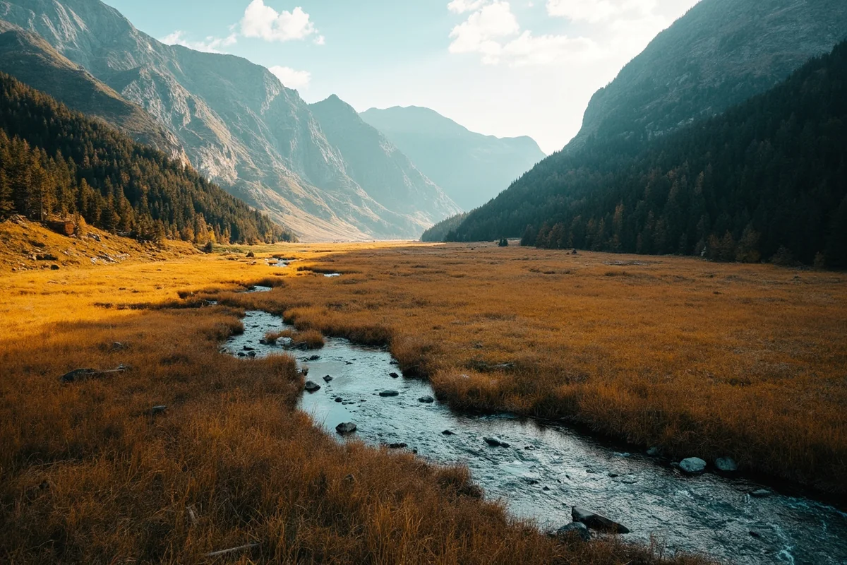
I fished the upper Bitterroot near Darby on a cool morning in early June, and the whole valley floor was dotted with small pink flowers low to the ground. Nobody I was with knew what they were at first.
Those flowers are bitterroot, Montana’s official state flower, and they’re the actual source of this river’s name. The Salish people who have called this valley home for generations relied on the plant’s starchy root as an important food source, especially in early spring before other food sources were available.
The root tastes bitter unless it’s properly prepared, which is exactly where the name comes from. If you want the fuller story of the plant itself, I’ve covered it separately on our Montana state flower page.
I like starting here because most fishing content about this river skips straight to hatch charts. The valley’s name carries real history, and it’s worth knowing before you start talking about salmonflies.
The Bitterroot Valley itself is one of the oldest continuously inhabited places in Montana, and the Salish people maintained a presence here for generations before European settlement, using the valley’s mild climate and abundant plant and animal resources across every season.
That history is easy to miss driving through on Highway 93 today, with its growing subdivisions and espresso stands, but it’s very much still part of this place.

Floating and Fishing the Bitterroot, Section by Section
The Bitterroot officially begins at the confluence of its East and West Forks near the tiny community of Connor, just south of Darby. From there it runs roughly 80 miles north through the valley to its confluence with the Clark Fork near Missoula.
The Forks. The East Fork rises above the small community of Sula and flows through scenic Ross’ Hole, a quiet, uncrowded stretch worth exploring if you want to get away from the main river’s traffic. The West Fork is generally bigger and holds larger fish, especially during its famous June salmonfly hatch, though its upper stretches can run genuinely dangerous during spring runoff.
Darby to Hamilton. This upper stretch, from Hannon Memorial down through Darby toward Hamilton, is considered a cutthroat stronghold, and it’s easy wading for anglers who’d rather walk than float. The water here runs riffly and quick, and it fishes well from both bank and boat depending on conditions.
Through Hamilton. Below Hamilton’s Main Street Bridge, there’s a diversion dam that requires an actual portage — don’t try to run it, and unload passengers on the right bank above the dam if you’re floating through. A similar portage is required around Sleeping Child Dam farther upstream near Angler’s Roost, though it’s an easy one.
Hamilton to Missoula. As the river continues north, the current slows, the channel braids into multiple side-channels, and the water grows better suited to bigger rainbows and browns holding under log jams and undercut banks. This is also the most popular stretch for casual tubing and rafting on a hot summer afternoon.
I’d budget a full day for most stretches between access points, since the Bitterroot’s braided channels make it easy to underestimate how long a float will actually take. Bring a paper map or download an offline version, since cell coverage disappears in several stretches of the valley away from Highway 93.
The River’s Honest Numbers: Crowding and Chronic Dewatering
I think it’s important to be straight with you about something most fishing content glosses over: the Bitterroot isn’t the quiet secret it once was, and parts of it face real water stress.
Angling pressure on the Bitterroot and its West Fork has more than tripled since the late 1980s, climbing from roughly 45,000 angler days per year in 1989 to well over 150,000 by 2020.
Most of that pressure concentrates on the upper river, where native westslope cutthroat trout are most abundant.
There’s also a less glamorous side to this river’s story. Roughly 17 miles of the mainstem and over 50 miles of its tributaries are classified as chronically dewatered due to agricultural irrigation demands.
this is a working valley, not a wilderness preserve, and the river has to share its water with the farms and ranches that have operated here for generations.
To help manage this, the state maintains contracts for stored water in both Painted Rocks Reservoir and Lake Como, releasing it during late summer specifically to support fish populations when natural flows would otherwise run too low and too warm.
It’s not a perfect system, but it’s a genuinely thoughtful piece of water management most visitors never hear about.
Rainbow trout populations near Stevensville have actually been declining in recent years, to the point where that section is now catch-and-release only for rainbows, while the Hamilton section’s more stable population still allows limited harvest.
If you care about which stretch to fish based on current fish health, that distinction matters.
Lewis and Clark in the Bitterroot Valley
In September 1805, the Lewis and Clark Expedition traveled straight through this valley on their way toward the brutal crossing of Lolo Pass into present-day Idaho.
Near what’s now called Ross’ Hole, close to the town of Sula, the expedition met with a band of Salish people, whom Lewis and Clark’s journals referred to as the “Flathead.”
The Salish provided the exhausted expedition with horses and guidance, help that proved essential to the Corps of Discovery’s survival heading into one of the hardest stretches of their entire journey.
You can read more about this chapter of the state’s story in our broader key historical events in Montana page.
If you’re tracing this history yourself, the route toward Lolo Pass eventually passes Lolo Hot Springs, a natural hot spring the expedition itself used to soothe sore muscles before the mountain crossing — a detail I always find remarkable, since modern travelers can still soak in roughly the same spot today.
Beyond the River: Lakes and Side Trips
If you want a break from moving water, the Bitterroot Valley has good options nearby. Painted Rocks Reservoir, upstream on the West Fork, offers boating and fishing in a quieter, less crowded setting than the main river.
Lake Como, a few miles south of Hamilton, is popular with both anglers and casual boaters, though it draws down significantly during low-water years. There are developed campgrounds on both sides of the lake if you want to extend your stay.
For hikers, several trails head up side canyons off the valley floor, including routes along One Horse Creek and toward Twin Lakes, though the roads to some trailheads require a high-clearance vehicle.
Wildlife Along the Bitterroot
This valley is genuinely one of the better wildlife-watching corridors in western Montana, and it’s easy to combine with a day of fishing or floating.
Ospreys are an almost constant companion on the water here, diving for trout in a way that’s fascinating to watch between casts — our Montana osprey page covers their nesting habits in more depth. Bald eagles, great blue herons, and Canada geese are all common sightings along the lower river’s slower stretches.
The surrounding Bitterroot National Forest, especially in the side canyons and up toward the forks, is also legitimate black bear and occasional grizzly country.
Review our Montana bear guide before any overnight camping trip in the upper drainage, particularly if you’re heading toward Ross’ Hole or the West Fork.
White-tailed deer are common on the valley floor year-round, and elk move down from higher elevations into the foothills in fall, which makes an autumn float or drive through the valley worth timing around, even if fishing isn’t your main goal.
Making Your Base Camp
Hamilton is the natural hub for a Bitterroot trip, with the widest range of lodging, dining, and fly shops in the valley. Darby, closer to the forks, puts you nearer the quieter upper river and Ross’ Hole.
Farther downstream, Stevensville, Victor, Florence, and Corvallis all sit along the valley’s lower stretch, closer to Missoula, and each makes a reasonable base if you’re planning to fish the lower river’s braided channels.
Personal Tips / What I Wish I Knew
Fish the upper river if you want fewer people. The stretch through Ross’ Hole and the East Fork sees a fraction of the pressure that the Hamilton-area river does, even in peak summer.
Know your portages before you launch. I’ve watched a group nearly run the diversion dam below Hamilton’s Main Street Bridge without realizing it was there. Check float maps ahead of time, not on the water.
Don’t fish the Skwala hatch without real rain gear. Early spring stonefly fishing on the Bitterroot can mean sunshine and 60 degrees in the morning and a snow squall by early afternoon. I’ve experienced both in the same day.
Ask locally about current flow releases in late summer. Painted Rocks and Lake Como releases directly affect fishability downstream, and timing your trip around them can make a real difference.
Respect private land along the lower river. Montana’s Stream Access Law lets you wade and fish up to the high-water mark, but much of the lower Bitterroot runs through private agricultural land, so stick to legal access points.
Bring bug spray for the side canyons. The main river corridor is generally fine, but the wetter side drainages near Lake Como and the forks can get genuinely thick with mosquitoes in June and early July.
Practical Info: Bitterroot River at a Glance
| Section | Best For | Difficulty | Notes |
|---|---|---|---|
| East Fork / Ross’ Hole | Quiet fishing | Easy | Least crowded stretch of the drainage |
| West Fork | Fishing, salmonfly hatch | Moderate–difficult | Dangerous during spring runoff |
| Darby to Hamilton | Wading, cutthroat fishing | Easy | Riffly, quick water |
| Through Hamilton | Floating with portage | Easy, one portage | Diversion dam below Main Street Bridge |
| Hamilton to Missoula | Floating, tubing, bigger fish | Easy | Braided channels, popular in summer |
[Verify current fishing regulations and reservoir release schedules directly with Montana FWP before planning your trip, as these are subject to change.]
Final Thoughts
The Bitterroot is one of the most livable rivers in Montana precisely because it runs through a real, working valley rather than a remote wilderness, and I think that’s worth appreciating rather than overlooking.
Fish the quiet upper stretches if solitude matters to you, float the lower river on a hot afternoon if you just want an easy day on the water, and take a minute to learn where this river’s name actually comes from before you go.
For how the Bitterroot fits alongside the rest of the state’s best water, check out our full guide to the best rivers in Montana.
Pin this guide before your trip, and let me know in the comments which stretch you end up fishing.