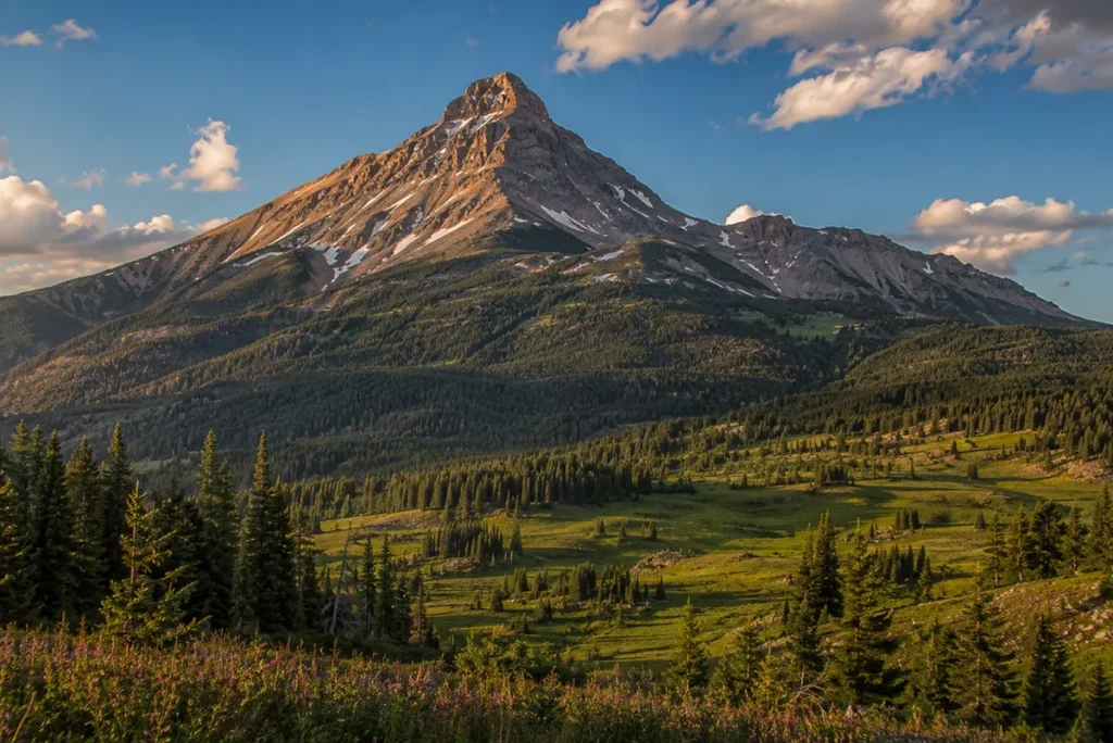
The Madison Range has the most dramatic single peak in Montana — Lone Mountain — sitting above Big Sky Resort and visible from sixty miles in three directions. It has the highest peak in the Lee Metcalf Wilderness, Hilgard Peak, at 11,321 feet.
It has 1.6-billion-year-old gneiss in the Spanish Peaks, where you can literally step across two billion years of missing earth history at a single fault line.
And on the night of August 17, 1959, it ripped a 50-million-cubic-yard landslide into the Madison River and killed 28 people in their tents at 11:37 PM. Few Montana ranges contain this many distinct stories.
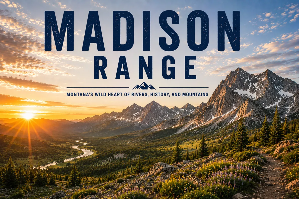
The Madison Range runs about 80 miles north–south between Bozeman and West Yellowstone, anchored by Hilgard Peak (11,321 ft) — the high point — and Lone Mountain (11,166 ft), the iconic ski-resort peak. The range contains the Lee Metcalf Wilderness in four non-contiguous units (Bear Trap Canyon, Spanish Peaks, Taylor-Hilgard, Monument Mountain), Big Sky Resort (one of the largest ski resorts in the U.S.), and the site of the 1959 Hebgen Lake Earthquake — the most consequential natural disaster in Montana history, which created Quake Lake overnight. Best hiking window: mid-July through September.
Liked this article?
Add Roaming Montana as a preferred source so you see more of our articles and guides on Google.
Why the Madison Range Is Different
The Madison Range packs more variety into 80 miles than any other Montana range. Most ranges are one thing — mostly granitic, mostly limestone, mostly cordilleran, mostly island. The Madisons are several things at once:
- The Spanish Peaks (north end) are some of the oldest exposed rock in Montana, 1.6 billion years old.
- The Lone Mountain – Big Sky complex (middle) is a destination ski resort built around an iconic conical peak.
- The Taylor-Hilgard Unit (south-central) is the largest wilderness section and contains the range high point.
- The Hebgen Lake / Madison Canyon area (far south) is the most geologically active region in Montana, with a major fault system, the 1959 earthquake scar still visible today, and Quake Lake — a lake that didn’t exist 70 years ago.
Add Big Sky Resort, the Madison River fly fishing, the dramatic visual presence of Lone Mountain from US-191, and the cultural anchor town of Ennis on the western side, and you have a range that genuinely rewards multiple visits.
For broader context, see my full Montana mountain ranges guide.
Where the Madison Range Is
The Madison Range runs about 80 miles north–south between Bozeman and West Yellowstone, separated from the Gallatin Range immediately to the east by the Gallatin River. The range is bordered:
- West: Madison River and Madison Valley (Highway 287)
- East: Gallatin River and US-191 (the Gallatin Canyon)
- North: the Norris area where the Madison River bends
- South: Hebgen Lake / Quake Lake area, just west of Yellowstone National Park
The range spans Madison and Gallatin counties in Montana, with the southern toe extending into Park County. Most of the range is within the Custer Gallatin National Forest and the Beaverhead-Deerlodge National Forest.
Major access points include Big Sky on the eastern side, Ennis on the western side, West Yellowstone at the southern end, and Three Forks and Bozeman as regional bases.
The High Country: Hilgard Peak, Lone Mountain, and the Spanish Peaks
There are two peaks in the Madison Range that travelers regularly mix up:
Hilgard Peak (11,321 ft) — the actual range high point, sitting in the Taylor-Hilgard Wilderness Unit in the south-central portion of the range. Remote, technical to climb (Class 3 standard route with significant exposure), and rarely seen by most visitors.
Lone Mountain (11,166 ft) — the iconic peak above Big Sky Resort. Distinctly conical, visually dominant from most of southwest Montana, and accessible by ski lift, tram, or a strenuous summer hike.
Lone Mountain is the famous peak. Hilgard Peak is the high peak. Both are worth knowing.
Other notable summits:
- Beehive Peak (10,740 ft) — the iconic granite spire visible from the Big Sky area, second-highest peak in the Spanish Peaks unit, with a Class 4 standard route popular among technical climbers
- Gallatin Peak (11,015 ft) — high point of the Spanish Peaks Unit, Class 3 scramble (not to be confused with the Gallatin Range’s Hyalite Peak)
- Mount Wilson
- Echo Peak
- Sphinx Mountain — striking pyramidal peak visible from US-191
The Geology: 2 Billion Years in a Single Fault
The Spanish Peaks at the north end of the Madison Range contain some of the oldest exposed rock in Montana — 1.6 to 2.5-billion-year-old gneiss.
This is Archean basement rock, the same age as the Beartooth Plateau granite, but completely different in character.
The Spanish Peaks gneiss is severely metamorphosed and folded, the result of multiple mountain-building events stretched across billions of years.
The most dramatic geological feature in the range is the Spanish Peaks Fault, which runs roughly east–west along the southern flank of the Spanish Peaks. The fault juxtaposes:
- South side: 300-million-year-old Mississippian Madison Limestone (a sedimentary rock that’s named for this range, not the other way around)
- North side: 2.5-billion-year-old Archean gneiss
In other words, you can walk across the fault and step from rock that’s 300 million years old onto rock that’s 2.5 billion years old. You’re crossing 2.2 billion years of missing earth history in a single step. Few places in North America offer this kind of geological compression.
The southern portion of the range — particularly the area around Hebgen Lake — is geologically much younger and far more seismically active.
The Hebgen Lake Fault, the Red Canyon Fault, and the Madison Fault are all part of the larger Intermountain Seismic Belt, an active extensional fault system that runs from northwest Montana to the Wasatch Mountains of Utah. These faults continue to move today.
The 1959 Hebgen Lake Earthquake
This is the story most travel guides to the Madison Range leave out, and it’s genuinely the most important thing that’s happened in this country in modern times.
On August 17, 1959, at 11:37 PM Mountain Standard Time, a magnitude 7.3 earthquake struck the southern Madison Range, with the epicenter about 15 miles north of West Yellowstone.
It was the strongest earthquake ever recorded in the Rocky Mountains at that time. It was felt as far away as the Pacific Coast westward, North Dakota eastward, and Hawaii and Puerto Rico.
The quake happened in peak tourist season. An estimated 300 people were camped in Madison River Canyon below Hebgen Dam, taking advantage of one of Montana’s most popular fishing and camping stretches. They were asleep.
Within seconds:
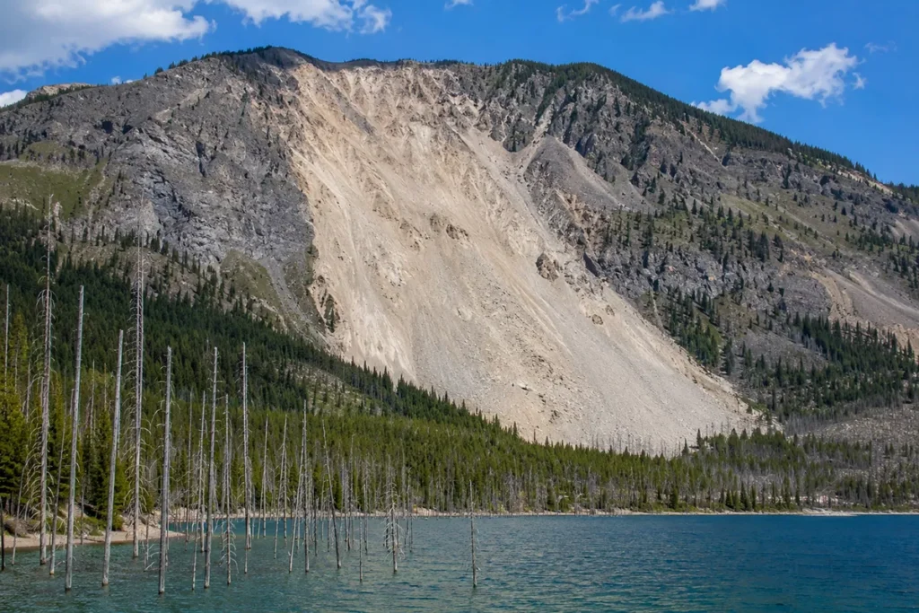
- A massive landslide detached from the south wall of Madison Canyon. Fifty million cubic yards of rock, mud, and debris cascaded down the mountainside at high speed, climbed 450 feet up the opposing canyon wall, and dammed the Madison River.
- The slide buried Rock Creek Campground on the canyon floor. Nineteen people died there, never recovered, still buried beneath the slide debris.
- Hebgen Lake, the reservoir behind Hebgen Dam, began oscillating in massive seiche waves — water sloshing back and forth like a tidal wave that breached the dam multiple times. Tourists thought the dam had failed. Miraculously, it held.
- 18 to 20 feet of vertical offset appeared on the Hebgen and Red Canyon faults — visible fault scarps that you can still see along Highway 287 today.
Twenty-eight people died. Eleven million 1959 dollars in damages (equivalent to about $121 million today).
Within days, water began backing up behind the natural landslide dam, forming a new lake — Earthquake Lake (Quake Lake). The Army Corps of Engineers excavated a spillway to control the rising water. Quake Lake is still there today, a permanent lake created in a few minutes on a summer night.
The earthquake also dramatically changed Yellowstone National Park: at least 289 springs in the geyser basins of the Firehole River erupted as geysers in the hours after the quake, with 160 of them being springs that had never erupted before. Old Faithful Inn’s massive chimney collapsed.
The Earthquake Lake Visitor Center, off Highway 287 on the south shore of Quake Lake, is the place to learn this story. The visitor center sits directly above the landslide scar — still barren of vegetation, still visible from miles away. The exhibits are sobering.
This is one of the must-stop locations in southwest Montana, and it sits on the southern boundary of the Madison Range.
For more context, see our Montana natural disasters and key historical events in Montana overviews.
The Lee Metcalf Wilderness: Four Units, One Compromise
The Madison Range is partially protected by the Lee Metcalf Wilderness, designated in 1983 and named for Lee Metcalf, the Montana U.S. Senator who was the primary advocate for the protection. The wilderness covers approximately 254,000 acres, but here’s the catch: it’s not contiguous.
Senator Metcalf originally proposed protecting about 600,000 contiguous acres of the Madison Range as wilderness. After Metcalf’s death in 1978, the protection effort continued but ran into resistance from timber, snowmobile, and development interests.
Senator John Melcher‘s subsequent compromise bill split the proposed wilderness into four non-contiguous units, with significant land transferred to private ownership or left available for resource extraction. The Melcher compromise prevailed.
The four units of the Lee Metcalf Wilderness today:
1. Bear Trap Canyon Unit (northwest)
A 6,000-acre wilderness unit along the Madison River, west of the main range. Famous for blue-ribbon trout fishing and Class III–IV whitewater rapids on the Madison River. The only BLM-managed wilderness unit in the system (the other three are USFS-managed).
2. Spanish Peaks Unit (north)
About 78,000 acres covering the Spanish Peaks at the north end of the range. Granite peaks, alpine lakes, and the 1.6-billion-year-old gneiss bedrock described above. Heavy use due to proximity to Bozeman and Big Sky.
3. Taylor-Hilgard Unit (south-central)
The largest unit at 141,000 acres — nearly twice the size of the Spanish Peaks Unit. Contains the highest peaks of the range including Hilgard Peak, and the majority of technical rock climbing in the Madisons. Less visited than the Spanish Peaks due to longer approaches.
4. Monument Mountain Unit (southeast)
About 29,000 acres in the southeastern portion of the range, adjacent to Yellowstone National Park. Used heavily by elk hunters in fall.
The fact that these units are not connected is a critical wildlife management problem. Grizzly bears, elk, and wolves need to move between the units, but they have to cross logging roads, private land, and developments to do so. This is a real ongoing conservation issue.
Big Sky Resort
If you’re visiting the Madison Range in winter, you’re probably going to Big Sky.
Big Sky Resort opened in 1973 on the southeastern flank of Lone Mountain. It now covers approximately 5,850 skiable acres — among the largest single ski resorts in the United States. The vertical drop is 4,350 feet, one of the largest in the country.
The defining feature is the Lone Peak Tram, opened in 1995 and rebuilt with a new larger tram in 2023. The tram runs from the Mountain Village base area to the summit of Lone Mountain at 11,166 feet.
Riding the tram costs roughly $85 per person in summer, and it puts you on the summit of an 11,000-foot peak in about 10 minutes. From the top, you can see the Grand Tetons, the Beartooths, the Bitterroots, and most of southwest Montana.
In summer, the tram also runs for sightseeing. You can also hike to the summit via the 2.8-mile Summit Trail from the Mountain Village base — a 3,700-foot vertical climb that takes 3–6 hours and is one of the most strenuous day hikes in Montana.
For winter visitors, Big Sky Resort offers some of the most extensive expert terrain in North America, including the steep chutes below Lone Peak. Beginners and intermediates have plenty of terrain on the lower mountain.
The Best Hikes in the Madison Range
Beehive Basin
The most popular day hike in the Big Sky area. From the Beehive Basin trailhead, hike 3 miles each way to a pair of alpine lakes in a granite cirque beneath Beehive Peak. Wildflower meadows in late July, accessible to most fitness levels.
Bear Basin / Spanish Peaks
A longer hike into the Spanish Peaks Unit from Big Sky, accessing higher granite-and-gneiss country. Connects with broader Spanish Peaks loop options.
Lone Mountain Summit Trail
The 2.8-mile summit hike described above. 3,700 feet of gain. Class 1 hike but expose to weather and altitude. Most hikers ride the tram up and walk a short distance from the upper terminal to the true summit (versus the 3-6 hour ascent from the base).
Ouzel Falls and Pioneer Falls
Easy family hikes near Big Sky to two scenic cascades. From Ouzel Falls Road, the trailhead leads to both falls.
Hilgard Basin
The classic Taylor-Hilgard Unit hike, accessing a basin full of alpine lakes beneath Hilgard Peak. Long approach (often a multi-day backpack), but the country is some of the most striking in the range. Access from the Madison Valley side.
Bear Trap Canyon
For a different kind of Madison Range experience — a Class III–IV whitewater run or a riverside hike through a deep canyon along the Madison River. Trailhead access from the Three Forks area on Highway 84.
Sphinx Mountain
A non-technical summit hike to a striking pyramidal peak south of the Spanish Peaks. Steep, exposed, weather-prone.
The Madison River: Blue-Ribbon Fly Fishing
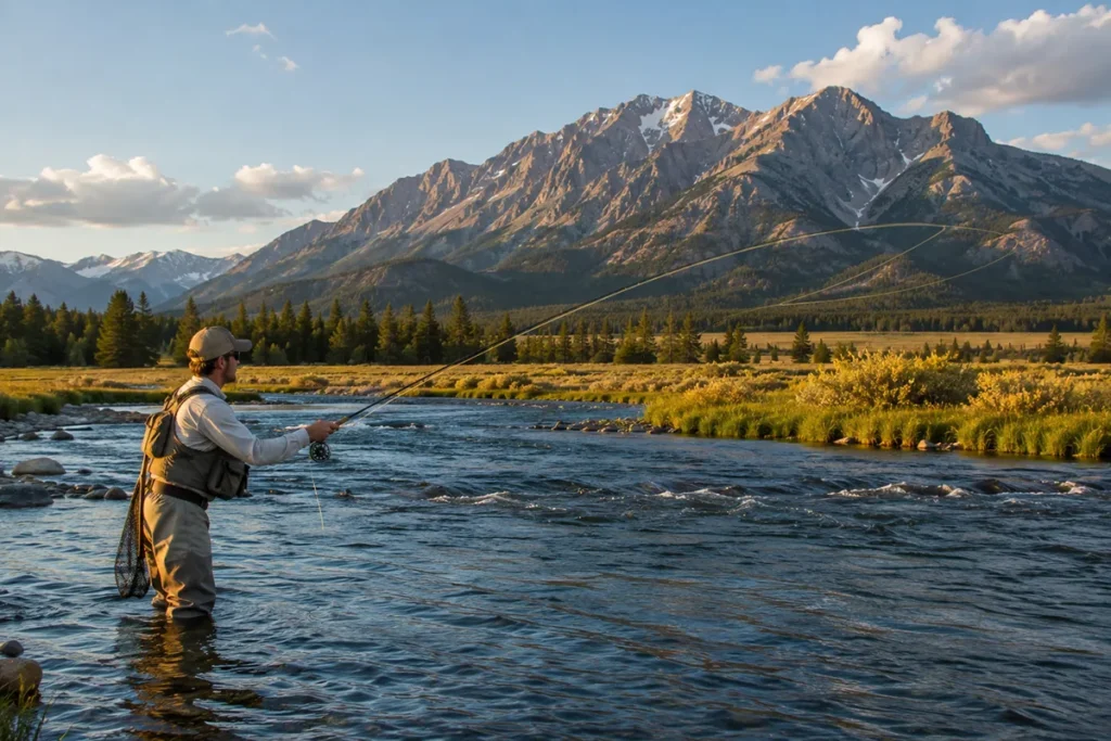
The Madison River, which gives the range its name, is one of the most famous fly fishing rivers in the United States. Wild rainbow trout, brown trout, and (in lower reaches) brook trout.
The river runs the length of the Madison Range’s western boundary, with classic stretches around Ennis and below Hebgen Lake.
The famous salmonfly hatch in late June and early July is one of the great fly fishing events of the year. Ennis is the regional fly fishing capital with multiple guide services, fly shops, and motels catering to anglers.
Wildlife in the Madison Range
The Madison Range is part of the Greater Yellowstone Ecosystem and supports the full large-mammal community:
Grizzly bears — significant resident population, particularly in the southern and central portions of the range. Bear spray is essential. See our Montana bear guide.
Black bears — common throughout.
Gray wolves — recolonized from Yellowstone reintroduction. The Madison Range provides important connectivity between Yellowstone wolf populations and ranges to the north and west. See our Yellowstone wolf watching guide.
Elk — one of Montana’s largest elk herds uses the Madison Range. The Gravelly-Snowcrest-Madison complex supports tens of thousands of animals.
Moose, mule deer, white-tailed deer — all present.
Mountain goats and bighorn sheep — on the highest peaks.
Mountain lions and wolverines — present, rarely seen.
The Madison Range is also one of the best ranges in Montana for bird life — bald eagles, golden eagles, peregrine falcons, and trumpeter swans (on Hebgen Lake) are all present.
Where to Base Yourself
Big Sky — Resort Base
Best for: Lone Mountain access, Beehive Basin, Spanish Peaks Unit, Big Sky Resort skiing in winter, central Madison Range hiking.
Big Sky is the resort community in the upper Gallatin Canyon at the foot of Lone Mountain. Population around 3,000 year-round, swelling to 10,000+ in peak ski season. Premium lodging, restaurants, ski-in/ski-out properties, and direct access to the Madison Range eastern slope.
Ennis — Madison Valley Base
Best for: Madison River fly fishing, Taylor-Hilgard Unit access, west-side hiking, quieter Montana character.
Ennis sits in the Madison Valley along Highway 287, population about 850. Strong fly fishing scene, several outfitters, basic lodging, and an authentic small-town Montana feel. This is where I’d base if fishing or quieter west-side hiking is the priority.
West Yellowstone — Southern Gateway
Best for: Southern Madison Range, Quake Lake / Earthquake Lake area, combined with Yellowstone Park access via the West Entrance.
West Yellowstone (population ~1,300) is the small town just outside Yellowstone’s West Entrance. Strong tourist infrastructure, snowmobiling capital of the West, and direct access to the Madison Range south end including the Hebgen Lake area.
Three Forks — Northern Base
Best for: Bear Trap Canyon, Spanish Peaks via Madison side, northern Madison River.
Three Forks sits at the confluence of the Jefferson, Madison, and Gallatin rivers — the headwaters of the Missouri River. Population about 2,000.
Regional: Bozeman
Bozeman is the full-service city, about 45–50 miles from Big Sky and about 90 minutes from Ennis. Use Bozeman if you want urban amenities + access to both the Madison and Gallatin ranges.
Best Time to Visit
The Madison Range has a long usable season due to the variety of elevations and the resort infrastructure at Big Sky.
Mid-June through early July is excellent for the lower hikes and the Madison River salmonfly hatch. High country still has snow.
Mid-July through September is prime for the high country, the Spanish Peaks, and the Taylor-Hilgard backpacks. Wildflowers peak in late July.
October is great for the Madison River fishing — the brown trout migration up the river is spectacular — and for the lower hikes. The high country gets weather-risky.
Mid-November through April is Big Sky Resort ski season. Backcountry skiing in the Spanish Peaks and Bear Trap area for the experienced. Hebgen Lake and Quake Lake mostly freeze.
For seasonal Montana context, see Montana in July, Montana in October, and Christmas in Montana.
Personal Tips: What I Wish I Knew
Visit the Earthquake Lake Visitor Center. Even if you’re not interested in geology, it’s one of the most affecting historical sites in Montana. The view of the landslide scar from the visitor center deck doesn’t get old.
The Madison River salmonfly hatch is the year’s best fly fishing window. Late June into early July. If you can time your trip for it, do.
Lone Peak Tram saves a brutal hike — but you miss the experience. The $85 price stings, but riding the tram up and walking the Summit Trail down is a great half-day option that gets you on the summit without all 3,700 vertical feet of climbing.
Spanish Peaks Unit is best in late August. Snow lingers in the high lakes into mid-July. Wildflowers peak in late July. By late August, the trails are clear, the bugs are gone, and the weather is most reliable.
Bear Trap Canyon is the most underrated piece. Almost no one talks about Bear Trap, but it’s a striking deep canyon hike with great fishing and class III–IV whitewater. The hike is a flat-ish river-side route — great for travelers who can’t do steep alpine climbs.
Carry bear spray. This is grizzly country, including the Spanish Peaks Unit. Carry spray on your hip, not in your pack.
Take the long way to Hebgen Lake. Highway 287 along the south side of Quake Lake and Hebgen Lake is one of the most scenic and least-traveled drives in Montana. Fault scarps are visible along the road. Worth a slow drive.
The Madison Range is wolf country. Wolves move between the Madison, Gallatin, and Yellowstone populations along this corridor. You won’t easily see them in the high country, but pack reports from outfitters consistently confirm their presence. Howling at dawn is genuinely one of the great Montana experiences.
Cell service is poor. Big Sky has decent coverage. Almost everywhere else in the range has spotty-to-zero service.
Practical Info Box
| Item | Detail |
|---|---|
| Highest peak | Hilgard Peak, 11,321 ft |
| Most famous peak | Lone Mountain, 11,166 ft |
| Range length | ~80 miles N–S |
| Wilderness | Lee Metcalf Wilderness, ~254,000 acres in 4 non-contiguous units |
| Major ski resort | Big Sky Resort, ~5,850 skiable acres, 4,350-ft vertical |
| Major historical event | 1959 Hebgen Lake Earthquake (M7.3), 28 fatalities |
| Major lake (created 1959) | Quake Lake / Earthquake Lake |
| Major reservoir | Hebgen Lake |
| Geology high point | Spanish Peaks gneiss, ~1.6 billion years old |
| Best fly fishing | Madison River (blue-ribbon trout stream) |
| National Forests | Custer Gallatin, Beaverhead-Deerlodge |
| Counties | Madison, Gallatin, Park |
| Best basecamps | Big Sky (east), Ennis (west), West Yellowstone (south), Three Forks (north) |
| Nearest airport | Bozeman Yellowstone International (BZN) |
| Bear spray | Required gear |
Final Thoughts
The Madison Range is the most variable range in Montana. You can ski Big Sky’s 4,350-foot vertical in March, fish the Madison River salmonfly hatch in July, hike Hilgard Basin in August, stand at the Earthquake Lake Visitor Center and contemplate 28 people buried under a 50-million-cubic-yard landslide one moment, then step across a fault line that compresses two billion years of earth history the next. Few mountain ranges deliver that range of experiences.
If it’s your first trip: hike Beehive Basin, drive to the Earthquake Lake Visitor Center, eat dinner in Big Sky. If you’ve been once: backpack into the Hilgard Basin in the Taylor-Hilgard Unit. If you’re committed: do a Madison River float during salmonfly week and combine it with three days of hiking.
For broader context on how the Madisons fit alongside Montana’s other ranges, see the full Montana mountain ranges guide.
Frequently Asked Questions
Where is the Madison Range?
The Madison Range runs about 80 miles north–south between Bozeman and West Yellowstone in southwest Montana, between the Madison River (west) and the Gallatin River (east). Big Sky Resort sits on the eastern flank.
What’s the highest peak in the Madison Range?
Hilgard Peak at 11,321 feet in the Taylor-Hilgard Wilderness Unit. The more famous Lone Mountain at 11,166 feet sits above Big Sky Resort.
What are the Spanish Peaks?
The Spanish Peaks are the northern sub-range of the Madison Range. The crest is composed of 1.6-billion-year-old gneiss — some of the oldest exposed rock in Montana. The name’s origin is uncertain but likely relates to Mexican prospectors who came north during the Montana gold rush.
Is the Madison Range part of the Rocky Mountains?
Yes. The Madison Range is a sub-range of the Northern Rocky Mountains, part of the Greater Yellowstone Ecosystem.
What happened at Quake Lake?
On August 17, 1959, a magnitude 7.3 earthquake triggered a massive landslide that dammed the Madison River, creating a new lake (Earthquake Lake or Quake Lake) overnight. The earthquake and landslide killed 28 people, mostly campers at Rock Creek Campground. The Earthquake Lake Visitor Center on Highway 287 tells the full story.
Where is Big Sky Resort?
Big Sky Resort is on the southeastern flank of Lone Mountain in the central Madison Range, accessed from US-191 about 50 miles south of Bozeman. With ~5,850 skiable acres and a 4,350-foot vertical drop, it’s one of the largest ski resorts in the United States.
Can you hike to the top of Lone Mountain?
Yes. The Summit Trail from the Big Sky Resort Mountain Village base climbs about 3,700 feet over 2.8 miles to the 11,166-foot summit. Takes 3–6 hours. Alternatively, the Lone Peak Tram takes 10 minutes and costs approximately $85 per person.
What is the Lee Metcalf Wilderness?
The Lee Metcalf Wilderness is a federally designated wilderness area in the Madison Range, named for Senator Lee Metcalf of Montana. It covers approximately 254,000 acres in four non-contiguous units: Bear Trap Canyon, Spanish Peaks, Taylor-Hilgard (the largest), and Monument Mountain.
Are there grizzly bears in the Madison Range?
Yes. The Madison Range is part of the Greater Yellowstone Ecosystem and has a significant resident grizzly bear population. Carry bear spray.
Where should I stay near the Madison Range?
Big Sky for eastern slope and ski access; Ennis for Madison River fishing and the west side; West Yellowstone for the south end and Yellowstone Park; Three Forks for the north end. Bozeman as a regional full-service base.