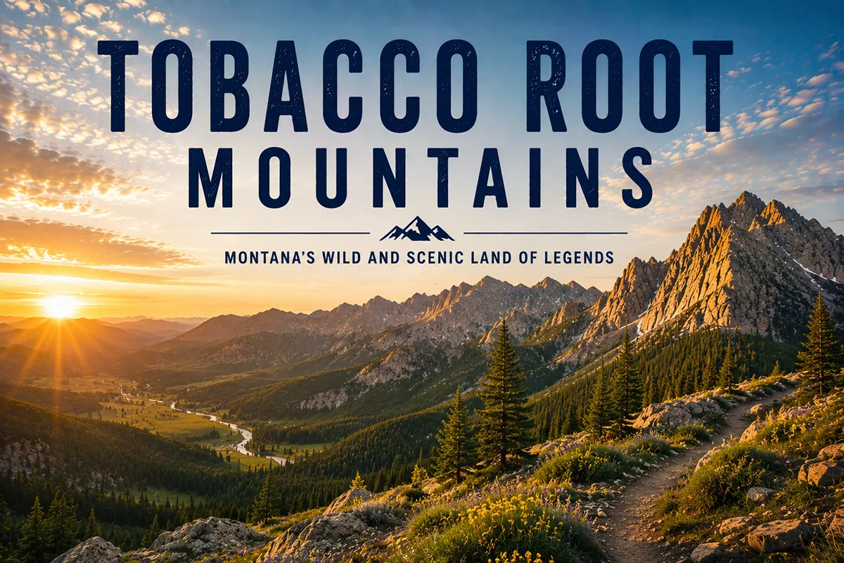
If I had to pick one Montana mountain range that consistently overdelivers and gets the least attention for it, I’d pick the Tobacco Roots.
Forty-three peaks over 10,000 feet, dozens of alpine lakes, one of the best-preserved historic mining towns in the state at the foot of the highest peak, and almost nobody on the trails on a Tuesday in August.
Most travelers driving I-90 between Butte and Bozeman barely register them — they’re looking south at the Madisons or back at the Bridgers. The Tobacco Roots are the range you can have to yourself.
The Tobacco Root Mountains rise between the Madison and Jefferson rivers in southwest Montana, about 45 miles west of Bozeman. Hollowtop Mountain (10,604 ft) is the high point, and the range packs 43 peaks over 10,000 feet into a compact 26-by-18-mile footprint. The Tobacco Roots are famous (locally) for three things: alpine lakes, gold-mining history, and the historic town of Pony at the base of Hollowtop. The name comes from a mullein species that 1860s prospectors smoked when tobacco was scarce. Best hiking window: mid-July through September. Many trails are multi-use (ATVs and motorcycles), so plan accordingly.
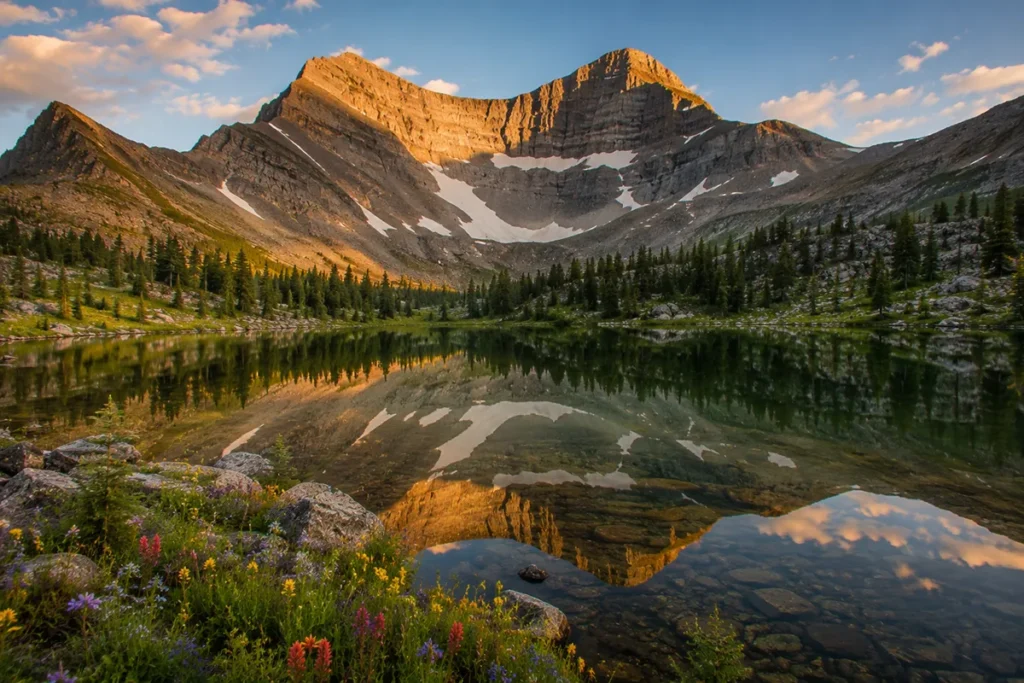
Liked this article?
Add Roaming Montana as a preferred source so you see more of our articles and guides on Google.
Why the Tobacco Roots Are Underrated
The Tobacco Roots get less attention than the surrounding ranges for one main reason: they’re surrounded by even more famous ranges.
The Bridgers are right next door with a major ski area outside Bozeman. The Madisons have Lone Mountain and Big Sky.
The Gallatins have Yellowstone. The Beartooths are an hour southeast and have Granite Peak. Most travelers route through the Madison or Gallatin Valley and never see the Tobacco Roots, even though they’re equally spectacular.
What you get when you actually visit them:
- Density of 10,000-foot peaks unmatched by any other comparable Montana range. 43 named peaks over 10K feet packed into 468 square miles.
- Two dozen-plus alpine lakes, most stocked with cutthroat or brook trout.
- Real solitude. I’ve done weekend backpacks here in August and seen no other parties.
- Compact geography. You can drive around the entire range in a day.
- Living history. Pony, Mammoth, and Sheridan are all still working towns at the foot of the range, with 19th-century mining infrastructure preserved.
For broader context, see my full Montana mountain ranges guide.
Where the Tobacco Roots Are
The Tobacco Root Mountains sit in southwest Montana, roughly 45 miles west of Bozeman and 35 miles east of Butte. They’re bordered:
- East: Madison River and Madison Range
- West: Jefferson River
- North: Elkhorn and Boulder Mountains across the Jefferson valley
- South: Gravelly Range
The range runs about 26 miles north–south by 18 miles east–west. Madison County contains the bulk of the range. The entire area sits within the Beaverhead-Deerlodge National Forest, Montana’s largest National Forest.
Major access points include the town of Pony on the east side, Sheridan and Twin Bridges on the west side, and Virginia City just south of the range. Bozeman, Butte, and Three Forks are the closest larger towns.
The Name: Why “Tobacco Root”?
This is one of the better mountain range origin stories in Montana and almost nobody tells it correctly.
In 1860 — four years before Montana was even a territory — a prospector named John R. Edwards from the Flint Creek area was passing through what was then unnamed mountain country.
He found a particular species of mullein (a flowering plant in the snapdragon family) growing in the range.
Old-timer prospectors smoked dried mullein root when actual tobacco was unavailable, which in 1860s Montana was a lot of the time.
Edwards reportedly named the range “Tobacco Root” after the plant they smoked.
Hayden’s Sixth Annual Report of the U.S. Geological Survey, published in 1873, made the name official. There are some competing claims about the etymology, but the mullein-smoking story is the most consistent across Montana historical sources.
Lewis and Clark, by the way, passed by the Tobacco Roots in 1805 — but they never named or really commented on them in any meaningful way. (DiscoveringMontana’s competitor page claiming Lewis & Clark “discovered” the range is misleading.)
The High Country: 43 Peaks Over 10,000 Feet
The Tobacco Roots punch above their weight in alpine real estate. Hollowtop Mountain (10,604 ft) is the highest point and the 20th most prominent peak in Montana.
The name comes from the peak’s distinctive bowl-shaped appearance when viewed from the north or northeast — there’s a cirque carved into the north face that gives the summit the visual impression of being hollowed out.
Other notable peaks (most over 10,000 feet):
- Potosi Peak — gives its name to the nearby Potosi Hot Springs
- Mount Jefferson — third-highest in the range
- Ward Peak
- Granite Peak (not to be confused with the Beartooths’ Granite Peak)
- Thompson Peak
- Mount Bradley
- Branham Peak
Hollowtop and Mount Jefferson are the marquee summit hikes. Both are non-technical ascents but involve loose scree, route-finding above treeline, and significant elevation gain.
The standard Hollowtop route from the West (via South Boulder River Road) is less than three miles one-way — but gains 3,700 feet. That math works out to about a 25 percent average grade. It’s steep.
The Geology and the Hot Springs Connection
The Tobacco Roots are part of the Northern Rocky Mountains, with bedrock dominated by Precambrian metamorphic rock — gneiss, schist, and quartzite — some of the oldest exposed rock in Montana.
Late Cretaceous granite intrusions (the Hollowtop and Tobacco Root batholiths) pushed up through this basement during the same mountain-building events that created the rest of the Northern Rockies.
This combination of ancient metamorphic rock and granitic intrusion is what made the range so mineralized.
The contact zones between the granite and the older rock concentrated gold, silver, copper, and other ores — fueling the gold rush we’ll get to in a moment.
There’s another consequence of all this faulting: hot springs. The same fault system that built the range opens conduits for groundwater to circulate deep into the earth, heat up, and rise back to the surface.
Potosi Hot Springs near Pony is one of the most beautiful natural hot springs in southwest Montana, fed directly by the Tobacco Root fault system. Worth working into any Tobacco Roots trip.
The Mining History: Pony, Mammoth, and the 1860s–1930s Gold Rush
Hard-rock and placer gold mining defined the Tobacco Roots from the 1860s through the 1930s. The range produced gold, silver, copper, and lead from dozens of mines. Three communities still mark this era:
Pony, Montana
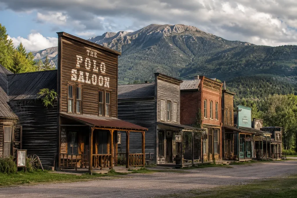
Pony sits at the eastern foot of Hollowtop Mountain and is one of the best-preserved historic mining communities in Montana. The town was founded in the 1860s and named after Tecumseth “Pony” Smith — a Civil War Union veteran who stood just 5 feet 2¼ inches tall, earning him the nickname Pony.
By the 1870s, gold rushers had flooded into the area. By the 1880s, Pony had grown to roughly 5,000 residents at its peak. Mining continued in fits and starts through the 1930s, with the Bismarck Mine as the largest producer (primarily copper, though gold was the original draw).
When the mines shut down by World War II, most of Pony cleared out. But the town never fully died — agriculture and ranching kept a community there, and unlike most Montana ghost towns, the residents who stayed actively preserved the historic buildings.
Today Pony has around 200 residents and looks remarkably like it did in 1900.
The Pony State Bank, the Pony Schoolhouse, several saloons, and original mining structures are all still standing.
The Pony Homecoming Club, founded in 1961, organizes preservation efforts and an annual community event. Pony is technically classified as a ghost town in some Montana tourism literature, but locals object — there are too many real residents and too much active community. It’s better described as a living historic mining town.
Mammoth, Montana
Mammoth sits west of Pony at higher elevation. It was a smaller mining community that processed ore from area mines.
Today it’s essentially a ghost town with limited remaining structures, but the area around Mammoth has good campsites and access to several backcountry trails.
Connection to Virginia City and Alder Gulch
The Tobacco Root mining boom was directly connected to the much larger Alder Gulch / Virginia City strike of 1863 just south of the range.
Alder Gulch was one of the largest placer gold strikes in U.S. history, and prospectors from Alder Gulch fanned out into the surrounding country — including the Tobacco Roots — looking for more. Many of the smaller Tobacco Root mining camps were essentially satellites of the Virginia City economy.
For broader Montana gold rush context, see our Roaming Montanald Rush guide.
The Best Hikes in the Tobacco Roots
The Tobacco Roots have one feature that distinguishes them from most other Montana wilderness ranges: many trails are multi-use.
ATVs, motorcycles, and dirt bikes are legal on a significant portion of the trail network, particularly in the lower elevations.
This is unusual for a high alpine range, and it’s controversial. Some hikers love the access; others find the motorized noise intrusive. Plan accordingly.
Here are the trails I’d send hikers to:
Hollowtop Lake
The classic Tobacco Roots hike. A 12.5-mile loop from the North Willow Creek trailhead near Pony, climbing through a wildflower-rich valley to Hollowtop Lake at the foot of the high peaks.
The first 1.5 miles are multi-use (ATVs and motorcycles allowed); beyond that, foot and horse traffic only. Camping is available lakeside.
Mason Lakes
From Pony via North Willow Creek and Cataract Creek roads to the Mason Lake trailhead. The trail to Mason Lake is open to motorized use; beyond Mason Lake, foot only continues to Upper Mason Lake. Beautiful alpine setting.
Louise Lake National Scenic Trail
A National Recreation Trail recognized for outstanding scenery — roughly 7 miles round-trip with moderate difficulty. Good for day hikes or easy overnights. Trailhead access from the east side.
Branham Lakes and Thompson Peak
A relatively easy drive to Upper Branham Lake (passable for Subarus and most lower-clearance vehicles), followed by a route up Thompson Peak via the connecting ridge. The hike to Thompson Peak is roughly 3 miles one-way but involves open alpine tundra and route-finding from a cairn near the summit.
Hollowtop Mountain Summit
The high-point hike. The classic route is the West Approach via South Boulder River Road, described as “steep but scenic.” Less than 3 miles one-way, but 3,700 feet of elevation gain. The Tobacco Roots’ state-high-point summit.
Curly Lake
An easy-to-moderate hike to a popular alpine lake on the east side. Good first-Tobacco-Roots hike for families.
Twin Lakes
A pair of alpine lakes accessed from the east side, with good fishing and reasonable camping.
Lost Cabin Lake
A gradual trail with several stream crossings to a quieter lake on the east slope.
Skytop Lake, Deep Lake, Gneiss Lake
A more committing backpack accessing several high lakes from a single basin. Best for experienced wilderness hikers comfortable with route-finding.
Wildlife in the Tobacco Roots
The Tobacco Roots support a healthy but somewhat lower-density wildlife community compared to the western Montana cordilleran ranges.
Black bears are common throughout the range. Grizzly bears do not have an established resident population in the Tobacco Roots, but dispersing grizzlies from the Greater Yellowstone Ecosystem have been documented occasionally as the regional grizzly population expands. Carry bear spray.
See our Montana bear guide.
Mountain goats are present in the high alpine zones, particularly around Hollowtop and Mount Jefferson. Certain areas of the range are closed in spring (typically May–June) for mountain goat kidding. Check with the Beaverhead-Deerlodge National Forest before planning early-season trips.
Elk and mule deer are abundant. The Tobacco Roots are popular elk hunting country in fall.
Mountain lions are present throughout but rarely seen.
Pikas, marmots, and pine martens are common in the alpine zone.
Fish: More than two dozen alpine lakes hold trout — primarily westslope cutthroat and brook trout. Many were originally stocked by Montana Fish & Game starting around 1900, often by miners packing fingerlings up to the lakes on horseback. The stocking history is genuinely one of the more charming parts of the Tobacco Roots’ modern character.
Where to Base Yourself
The Tobacco Roots can be approached from four sides, each with a different town and trail system.
East Side: Pony, Harrison, and Norris
Pony is the closest community to Hollowtop and the most direct access for the Hollowtop Lake, Mason Lakes, and Mt. Jefferson trails.
Limited services — no formal lodging in town, but cabin rentals and the Pony Hotel Bar & Grill operate seasonally. Harrison and Norris are slightly larger towns north of Pony along Montana Highway 287.
West Side: Sheridan and Twin Bridges
Sheridan and Twin Bridges sit at the western foot of the range along Montana Highway 287. Both are small ranching towns with basic services.
Twin Bridges is famous for fly fishing — the confluence of the Beaverhead, Big Hole, and Ruby rivers form the Jefferson River here, and the town is a fly fishing destination in its own right.
South Side: Virginia City and Ennis
Virginia City is the historic gold-rush capital just south of the range — a National Historic Landmark with extensive 1860s-1880s preserved architecture.
Ennis sits on the Madison River and is the fly fishing capital of Montana. Both make good multi-day basecamps that combine Tobacco Roots hiking with other activities.
North Side: Three Forks
Three Forks sits north of the range at the headwaters of the Missouri (Jefferson, Madison, and Gallatin rivers all converge here). Practical base if you’re combining the Tobacco Roots with the headwaters area.
Regional: Bozeman or Butte
Bozeman is about 45 miles east and offers full-service lodging, restaurants, and an airport. Butte is about 35 miles west, smaller but with strong mining history of its own.
Best Time to Visit
The Tobacco Roots have a relatively short prime hiking window due to elevation and snow.
Late May through June is generally too early for the high country. Snow persists on the high lakes into early July. Lower-elevation foothill trails (and Pony itself) are accessible.
Mid-July through September is prime. The high lakes ice out, wildflowers peak in late July, and the multi-use trails get busy on weekends.
Late September through early October is excellent — fall colors in the aspen, fewer people, but increased weather risk. Forest Service roads typically remain passable through early October without 4WD.
Late October through April the high country is snowed in. Lower trails accessible for snowshoeing.
For seasonal Montana context, see Montana in July, Montana in August, and Montana in September.
Personal Tips: What I Wish I Knew About the Tobacco Roots
The multi-use trails matter more than you’d expect. ATVs and motorcycles are legal on a meaningful portion of the trail network — particularly the first 1-2 miles of many trailheads. Weekends in summer can be loud on those lower stretches. Once you’re past the motorized portions, the noise drops off. Plan early-week visits or hike past the multi-use sections if you want quiet.
Pony is worth a real visit, not just a drive-through. The town’s preserved 19th-century streetscape is one of the best in Montana, and the locals are friendly to respectful visitors. Don’t just snap a photo and leave — wander, read the historic plaques, and grab a meal at the Pony Bar if it’s open. (Hours can be limited.)
Combine your trip with Potosi Hot Springs. Potosi Hot Springs is a few miles outside Pony and is one of the most beautifully sited natural hot spring developments in Montana. A trail hike + hot springs soak is a perfect Tobacco Roots day.
The Forest Service roads vary in quality. Some can be driven in a sedan; others want high clearance or 4WD. Always check road conditions with the Beaverhead-Deerlodge Forest before relying on a specific trailhead access.
This range produces real gemstones. Garnets, gold, and other minerals are still found in the Tobacco Roots’ drainages. Mineral collecting on Forest Service land follows specific rules — see our Montana rockhounding sites guide before you head out.
Bear awareness is still required. Even though grizzlies aren’t established here, black bears are common, and lone dispersing grizzlies do occasionally pass through. Carry bear spray; store food properly.
Lake fishing is excellent but requires a hike. Most of the Tobacco Roots’ alpine lakes hold trout. You need a Montana fishing license. Pack-in fishing trips are one of the great Tobacco Roots experiences.
Practical Info Box
| Item | Detail |
|---|---|
| Highest peak | Hollowtop Mountain, 10,604 ft |
| Number of 10,000+ ft peaks | 43 |
| Range dimensions | 26 miles N–S × 18 miles E–W |
| National Forest | Beaverhead-Deerlodge National Forest |
| County | Madison (primarily) |
| Wilderness designation | None (recommended Wilderness Study Areas only) |
| Multi-use trails | Many open to ATVs/motorcycles in lower elevations |
| Best hiking window | Mid-July through September |
| Alpine lakes | 24+ named lakes, most fishable |
| Mining era | 1860s–1930s |
| Historic town | Pony (founded 1860s, ~200 residents today) |
| Closest hot springs | Potosi Hot Springs (Pony) |
| Bear spray | Recommended |
| Cell service | Spotty in valleys, none in high country |
| Nearest airport | Bozeman Yellowstone International (BZN) |
Final Thoughts
The Tobacco Roots are the Montana range that locals fight over whether to publicize. They’re spectacular, accessible, packed with history, and still relatively uncrowded — and most Montana hikers would like to keep them that way.
I’ve gone back and forth on whether to write this guide at all, and I’ve landed on this: the Tobacco Roots reward thoughtful visitors.
The trails that matter are not the busy ones. The peaks that matter aren’t on Instagram’s algorithm.
And the town at the foot of the range, Pony, is one of the better preserved historic communities in the state for good reason — its people care.
If it’s your first trip, start with Hollowtop Lake and a soak at Potosi Hot Springs. If you’ve been once, do the Hollowtop summit.
If you’ve been a few times, plan a multi-night backpack to the Mason Lakes or the Skytop-Gneiss-Deep Lake basin and don’t tell anyone where you went.
For broader context on how the Tobacco Roots fit alongside Montana’s other ranges, see the full Montana mountain ranges guide.
Frequently Asked Questions
Where are the Tobacco Root Mountains?
The Tobacco Root Mountains are in southwest Montana, between the Madison and Jefferson rivers, about 45 miles west of Bozeman and 35 miles east of Butte. Madison County contains the bulk of the range.
How did the Tobacco Root Mountains get their name?
The range was named in 1860 by prospector John R. Edwards from the Flint Creek area, after a species of mullein plant whose dried root was smoked by 1860s prospectors when actual tobacco was unavailable. The name was made official in Hayden’s 1873 USGS Annual Report.
What’s the highest peak in the Tobacco Roots?
Hollowtop Mountain at 10,604 feet — also the 20th most topographically prominent peak in Montana. The range contains 43 named peaks above 10,000 feet.
Why is Hollowtop called Hollowtop?
The peak has a distinctive bowl-shaped appearance when viewed from the north or northeast, due to a deep glacial cirque carved into the north face.
What’s the best hike in the Tobacco Root Mountains?
For a long day or easy overnight: Hollowtop Lake loop (12.5 miles). For a summit hike: Hollowtop Mountain via the West Approach (~3 miles one-way, 3,700 feet gain). For families: Curly Lake. For solitude: Mason Lakes.
Is Pony, Montana a ghost town?
Sort of. Pony is sometimes labeled a ghost town because most of its 19th-century population is gone, but roughly 200 residents still live there and actively preserve the town’s historic character. It’s better described as a living historic mining community.
Are there grizzly bears in the Tobacco Roots?
A resident grizzly population is not established. Occasional dispersing grizzlies from the Greater Yellowstone Ecosystem have been documented. Black bears are common. Carry bear spray.
Can you ride an ATV in the Tobacco Root Mountains?
Yes, on portions of the trail network. The Tobacco Roots have more multi-use motorized trails than most Montana alpine ranges. Check Beaverhead-Deerlodge National Forest travel maps for current legal routes.
Are the Tobacco Root Mountains part of the Rockies?
Yes. They’re a sub-range of the Northern Rocky Mountains, part of the central Montana Rocky Mountain system.
Where do you stay near the Tobacco Roots?
Pony (east side, limited services), Sheridan or Twin Bridges (west side), Virginia City or Ennis (south side, historic + fly fishing), Three Forks (north side). Bozeman or Butte for full-service regional bases.