Great Falls doesn’t get the attention it deserves.
Most Montana road-trippers drive I-15 through it on the way to Glacier or Yellowstone, stop for gas, and keep moving. I did it twice before a friend who grew up there sat me down and gave me an itinerary.
I spent three days. I still didn’t see everything.
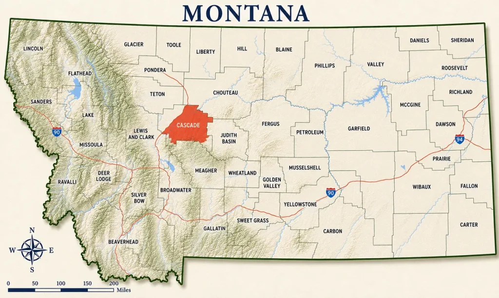
- Cascade County covers 2,698 square miles in north-central Montana — the geographic and logistical hub of the state
- The county seat is Great Falls (~60,000) — Montana’s third-largest city, nicknamed “The Electric City” for its hydroelectric power history
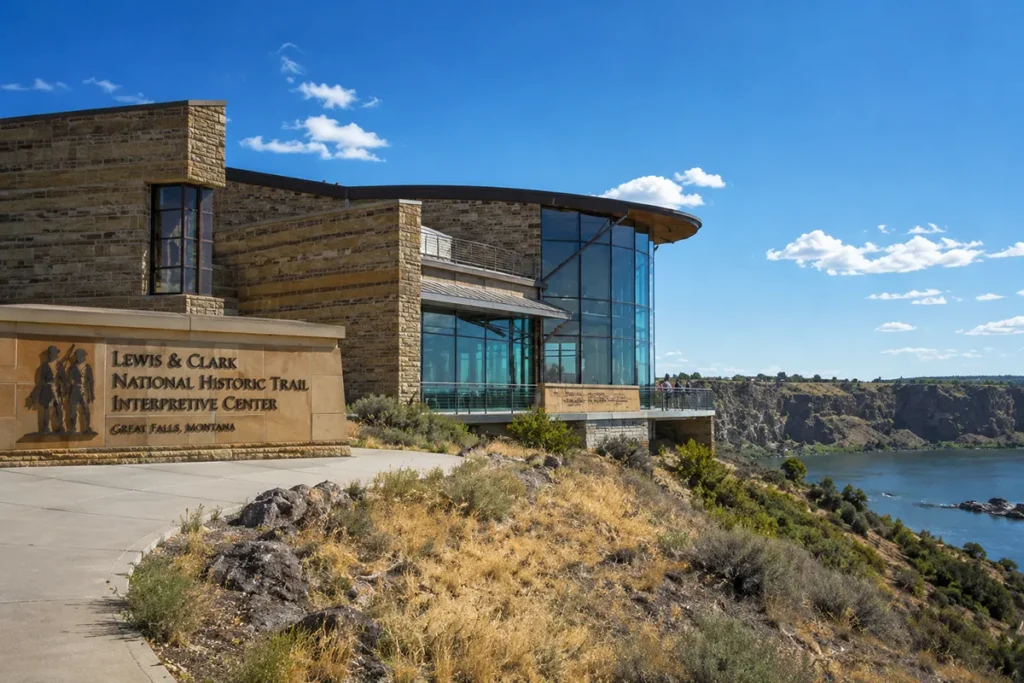
- The Lewis & Clark National Historic Trail Interpretive Center is one of the best free museums in Montana and one of the finest Lewis & Clark sites in the country
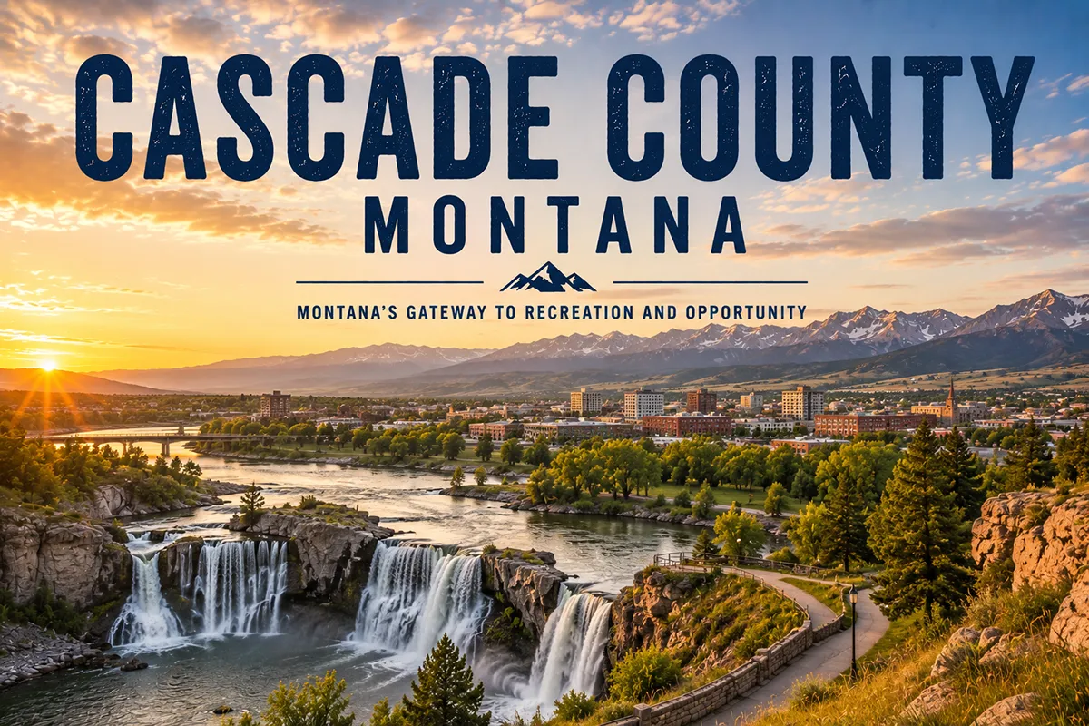
- The Missouri River flows through Great Falls over five waterfalls dropping a combined 550 feet — the same falls that stopped the Corps of Discovery for an entire month in 1805
- The C.M. Russell Museum contains the world’s largest collection of works by Charles Russell — one of the most important western artists who ever lived
- Giant Springs State Park holds one of the largest freshwater springs in the United States, discovered by Lewis & Clark in 1805
- The First Peoples Buffalo Jump at Ulm Pishkun is one of the largest known buffalo jump sites in North America
- The Kings Hill Scenic Byway south of Great Falls leads to the Little Belt Mountains, Showdown Ski Area, and historic mining towns
- Sluice Boxes State Park and the Belt Creek canyon offer accessible backcountry hiking 30 miles from downtown
- Malmstrom Air Force Base hosts a free public museum and air park, including a Minuteman III ICBM display
- Great Falls International Airport (GTF) makes Cascade County one of the most accessible counties in Montana
Liked this article?
Add Roaming Montana as a preferred source so you see more of our articles and guides on Google.
Cascade County at a Glance
Cascade County was established in 1887, carved from Chouteau and Meagher counties.
The county takes its name from the village of Cascade, which was itself named for the cascades of the Missouri River.
Geographically, Cascade County straddles the transition between the Rocky Mountain Front and the Great Plains. The county sits at the confluence of the Missouri and Sun rivers.
That strategic position shaped its history from the time of the first Indigenous peoples through the Lewis & Clark Expedition, the railroad era, and today’s military and agricultural economy.
The county is surrounded by four mountain ranges: the Rocky Mountain Front to the west, the Highwood Mountains to the east, the Little Belt Mountains to the south, and the Sweet Grass Hills on the northern horizon.
Cascade County’s population of around 85,390 makes it Montana’s third most populous county. Great Falls serves as the service hub for a vast stretch of central Montana.
For full Montana context, see the complete guide to all 56 Montana counties.
Great Falls: Montana’s Electric City
Great Falls was founded in 1884 by Paris Gibson, a Minnesota businessman who recognized the hydroelectric potential of the Missouri River’s falls.
Gibson partnered with railroad magnate James J. Hill to build a planned city from scratch. Within a decade, Great Falls had electric streetcars, a smelter, and a power network fed by five successive dams on the Missouri.
The “Electric City” nickname stuck because Great Falls was one of the first electrified cities in the Mountain West.
Today Great Falls (~60,000) is Montana’s third-largest city — smaller than Billings and Missoula but with an airport, a full medical center, and a cultural infrastructure that surprises first-time visitors.
The city sits at the confluence of the Missouri and Sun rivers, with the Highwood Mountains visible to the northeast and the Rocky Mountain Front on the western horizon. On a clear evening from the River’s Edge Trail, the view takes in mountain ranges in three directions simultaneously.
RoamingMontana has a full Great Falls city guide — this county post focuses on the broader Cascade County experience. For RV travelers, see RV parks in Great Falls.
Lewis & Clark National Historic Trail Interpretive Center
If you visit one museum in central Montana, make it this one.
The Lewis & Clark National Historic Trail Interpretive Center sits on a bluff overlooking the Missouri River inside Giant Springs Heritage State Park. The building alone — designed to echo the cliffs of the Missouri River canyon — signals that this is not an ordinary regional history museum.
Inside, the exhibits trace the full arc of the Lewis & Clark Expedition from President Jefferson’s commission through the return to St. Louis. The Great Falls portage — the most physically grueling section of the entire journey — is covered in depth here, which makes sense since it happened directly below the building.
The portage context: In the summer of 1805, the Corps of Discovery encountered the Great Falls of the Missouri and expected a half-day portage. It took 18 days and covered 10 miles of rough terrain.
The men built crude wagons from cottonwood trunks, hauled canoes and equipment through prickly pear cactus and grizzly bear country in summer heat, and contended with flash floods and hailstorms. It remains one of the most difficult episodes of the entire expedition and it happened in this county.
The center is covered by the America the Beautiful National Parks Pass, making it effectively free for passholders.
Summer hours: Monday–Sunday 10 a.m. to 5 p.m. Winter hours: Thursday–Monday 10 a.m. to 5 p.m. [Verify current hours and fees at lewisandclark.gov]
The Five Waterfalls
Great Falls is named for a waterfall it largely hid behind a dam.
The five waterfalls of the Missouri River drop a combined 550 feet over roughly 10 miles through the city. Lewis & Clark named each one in their journals: the Great Falls, Rainbow Falls, Crooked Falls, Colter Falls (now submerged), and Black Eagle Falls.
Ryan Dam was built directly at the Great Falls, creating a combined 148-foot cascade of dam water and original waterfall. A suspension bridge leads to Ryan Island Park in the middle of the river for a direct viewing angle. I’ve stood on that bridge in November when the air was cold and the river was running fast — the sound alone is worth the stop.
Rainbow Falls is downstream and accessible along the River’s Edge Trail. At 40 feet, it’s visually the most classically “waterfall” of the five — a clear curtain drop into a deep pool.
Black Eagle Falls is partially natural, partially altered by the Black Eagle Dam. The original rock formation that Lewis & Clark described is visible.
The hydroelectric dams on these falls generate power for much of north-central Montana. The complex is an engineering landmark in its own right — but standing at the falls and reading the journal passages about what the Corps encountered here adds a dimension that pure engineering tourism doesn’t provide.
C.M. Russell Museum
Charles Marion Russell (1864–1926) arrived in Montana at 16 as a ranch hand from Missouri and spent the next decade working as a wrangler and night herder in the Judith Basin.
He was largely self-taught. He spent his off-hours sketching and painting the cowboys, horses, Native Americans, and landscapes he observed around him.
By the time he died in Great Falls in 1926, his paintings were selling for what would today be hundreds of thousands of dollars. He was internationally famous. He had testified before Congress on behalf of Indigenous peoples. He had corresponded with Teddy Roosevelt and Will Rogers.
The C.M. Russell Museum holds the world’s largest collection of Russell’s work — over 2,000 original pieces including paintings, sculptures, illustrated letters, and personal artifacts.
Russell’s original log home and working studio are preserved as part of the museum complex and are among the most evocative artist spaces I’ve walked through in the American West.
The studio in particular deserves time. The brushes, the models, the animal skull collection on the shelves — it all conveys the specific texture of Russell’s working life in a way that reproductions never do.
Open Monday–Friday 10 a.m.–4 p.m. [Verify current hours and admission at cmrussell.org]
Giant Springs State Park
Lewis & Clark discovered Giant Springs on June 18, 1805, while scouting the Missouri River portage route.
Meriwether Lewis described it in his journal as “the largest spring I ever beheld” — a description that holds up. The spring discharges at roughly 156 million gallons per day from a fracture in the limestone bedrock, maintaining a constant temperature of 54°F year-round.
The spring is part of Giant Springs Heritage State Park, which encompasses over 4,600 acres and 20 miles of trail along the Missouri River corridor.
Adjacent to the spring is the Roe River — a 200-foot-long channel connecting the spring to the Missouri that held the Guinness record as the world’s shortest river for years.
The state fish hatchery within the park raises rainbow trout for stocking across the region. Fishing access along the Missouri in and around the park is excellent.
Walking from the Lewis & Clark Interpretive Center through the park to Giant Springs and back is one of the better urban nature walks in Montana. The riverbank cottonwoods, the sound of the spring overflow, and the long Missouri views make it genuinely peaceful.
Open year-round. [Verify current entrance fees at stateparks.mt.gov]
River’s Edge Trail
The River’s Edge Trail is Great Falls’ most significant civic achievement and one of the best urban trail systems in Montana.
The trail runs 53 miles along both banks of the Missouri River, connecting Giant Springs, the Lewis & Clark Center, Rainbow Falls, downtown Great Falls, and Gibson Park in a continuous paved and gravel network.
Biking the full river corridor takes two to three hours at a comfortable pace. Walking shorter sections is easy — trailheads and parking areas are marked throughout the system.
Wildlife along the trail includes great horned owls, white pelicans, river otters, and bald eagles in the winter months. The section through the cottonwood river bottoms between the Lewis & Clark Center and Giant Springs is particularly productive for birds.
The trail connects directly to downtown Great Falls, where over 25 large-scale wall murals turn the downtown streets into what the city markets as “Montana’s Biggest Art Gallery.” The murals range from Western historical scenes to contemporary Indigenous art.
First Peoples Buffalo Jump (Ulm Pishkun)
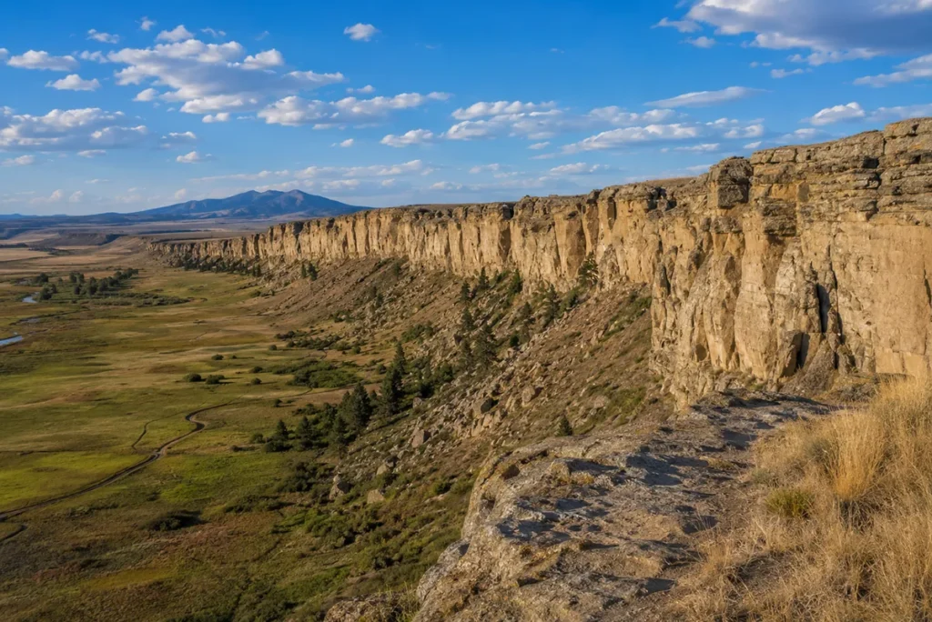
Nine miles southwest of Great Falls near the town of Ulm, Ulm Pishkun State Park preserves one of the largest known buffalo jump sites in North America.
“Pishkun” is Blackfoot for “deep blood kettle.”
For thousands of years, Indigenous hunters drove bison herds over the edge of a 30-foot sandstone cliff that runs nearly half a mile across. The animals that survived the fall were dispatched below. The site produced enormous quantities of meat, bone, hide, and sinew for the surrounding communities.
The interpretive center is excellent — it contextualizes the site within the broader Great Plains bison culture and explains the specific techniques of surrounds and drives that made a jump work. The trail to the cliff top is short but gives a visceral sense of the scale.
This is the most underrated attraction in Cascade County. Most Great Falls visitors miss it entirely, which is a real loss.
Summer hours: 8 a.m.–6 p.m. Winter hours: 10 a.m.–4 p.m. (closed Monday/Tuesday). [Verify current hours and fees at stateparks.mt.gov]
Kings Hill Scenic Byway & the Little Belt Mountains
US Highway 89 south of Great Falls climbs into the Little Belt Mountains through the small towns of Belt and Monarch, reaching Kings Hill Pass at 7,393 feet before descending to White Sulphur Springs in Meagher County.
The Kings Hill Scenic Byway is 71 miles of genuine mountain scenery — limestone canyon walls, mixed conifer forest, and views east across the plains from the pass.
Showdown Montana Ski Area at Kings Hill is a genuinely good regional hill — 1,400 feet of vertical, reliable snow, and far less crowding than Montana’s major resorts. It’s one of the most accessible ski areas from Great Falls and draws a dedicated local following. See Montana ski resorts for the full comparison.
Sluice Boxes State Park sits along Belt Creek south of the town of Belt, before the main climb into the mountains. The Belt Creek canyon cuts through limestone formations, creating narrow passages, small waterfalls, and excellent wildlife habitat. The 3.5-mile trail follows the canyon bottom — it’s accessible for most fitness levels and gives a taste of genuine backcountry character within 30 miles of downtown Great Falls.
The historic mining towns of Monarch and Neihart sit along the highway with basic food and lodging. Neihart is the trailhead for Memorial Falls — a short, steep hike in the Lewis & Clark National Forest. See Memorial Falls for the hike guide.
Malmstrom Air Force Base
Malmstrom AFB sits on the eastern edge of Great Falls and is home to the 341st Missile Wing — the Air Force unit responsible for a significant portion of the nation’s Minuteman III ICBM arsenal, spread across silos in the surrounding Montana and Wyoming countryside.
The Malmstrom Museum and Air Park is free and open to the public (non-base personnel access through the visitor’s gate — bring a valid ID). The collection includes a deactivated Minuteman III missile displayed in a launch tube, historic aircraft in the outdoor air park, and exhibits on the Air Force’s Cold War history in Montana.
It’s a different kind of Montana history — not Lewis & Clark or gold rush, but the 50-year period when the state’s flat eastern geography made it a primary location for nuclear deterrence infrastructure.
[Verify current public access procedures and hours at malmstrom.af.mil before your visit — military base access requirements can change.]
The Highwood Mountains
The Highwood Mountains rise from the plains northeast of Great Falls as an isolated volcanic field — one of several “island ranges” scattered across central Montana.
They’re accessible from Highway 80 east of Great Falls and offer hiking, dispersed camping, and excellent wildlife habitat in a compact mountain system that most visitors to the region never notice.
The highest point, Highwood Baldy, reaches 7,670 feet. Elk, mule deer, and hawks are reliable.
For travelers with an extra half-day, the drive through the Highwoods via the Highwood Road loop is a scenic detour through genuinely off-the-beaten-track terrain.
What I Wish I Knew Before Visiting Cascade County
The Lewis & Clark Center is better than you’ve heard. Most people who mention it describe it as “worth an hour.” I’ve spent three hours there and still felt rushed. The portage section alone deserves 45 minutes.
Ulm Pishkun is the most undervisited major attraction in the county. It takes 20 minutes to reach from downtown Great Falls and most visitors to the area have no idea it exists. Put it on day one of any Great Falls itinerary.
Giant Springs is not swimmable. A few visitors show up expecting a swimming hole. The spring is viewable but not accessible for swimming — it flows directly into the Missouri River.
The River’s Edge Trail is best by bike. Walking the full 53 miles is not realistic for most visitors. Rent a bike in Great Falls and cover 15–20 miles of the best sections in a half-day.
Malmstrom public access requires a photo ID. Don’t assume you can walk onto the base — go through the visitor control center with valid government-issued ID. The museum is free once you’re through.
Great Falls is significantly windier than it looks. The city’s nickname as “Windier than Chicago” is earned. The wind chill on a 40°F November day can feel like 20°F. The River’s Edge Trail in wind is a different experience than the Trail on a calm summer morning.
Kings Hill and Showdown are genuinely underrated. Montana skiers who haven’t skied Showdown tend to skip it for Big Sky. That’s their loss. The mountain gets good snow and almost no lines.
Practical Info
| County seat | Great Falls |
| Area | 2,698 sq mi |
| Population | ~85,390 (2024–26 est.) |
| Tourism region | Central Montana |
| Formed | 1887 |
| Main highways | I-15 (north-south), US-87, US-89 |
| Airport | Great Falls International Airport (GTF) — regular service |
| Lewis & Clark Center | Giant Springs Heritage State Park, Great Falls |
| C.M. Russell Museum | 400 13th St N, Great Falls [verify hours] |
| Giant Springs | Giant Springs Heritage State Park [verify fees] |
| Ulm Pishkun | 9 miles SW of Great Falls near Ulm |
| Kings Hill Pass | 7,393 ft, US-89 south of Great Falls |
| Showdown Ski Area | Kings Hill, ~60 miles south of Great Falls |
| Cell service | Excellent in Great Falls; variable in mountains and rural areas |
| Best season | Year-round; skiing Dec–March; hiking May–October |
Getting to Cascade County
From Helena: I-15 north — 90 miles, about 1 hour to Great Falls.
From Billings: US-87 northwest through Lewistown, or I-90 west to US-89 north — about 225 miles, 3 hours.
From Missoula: US-12 east to Helena, then I-15 north — about 225 miles, 3 hours.
By air: Great Falls International Airport (GTF) has regular commercial service from Denver, Salt Lake City, and Seattle. Car rental is available at the airport.
See Montana airports and Montana transportation guide.
Towns in Cascade County
- Great Falls — county seat; full visitor services, international airport
- Belt — small town on Kings Hill Byway; gateway to Sluice Boxes State Park
- Cascade — small community on I-15/Missouri River south of Great Falls; Tower Rock State Park nearby
- Ulm — unincorporated community near the First Peoples Buffalo Jump
- Monarch — small community in the Little Belt Mountains on US-89
- Neihart — small mining-era town in the Little Belts; Memorial Falls trailhead
Adjacent Counties
- Lewis and Clark County to the south — Helena, the state capital
- Teton County to the northwest — Choteau, Rocky Mountain Front
- Chouteau County to the north — Fort Benton, Missouri River
- Judith Basin County to the southeast — Stanford
- Meagher County to the south — White Sulphur Springs, Smith River
Plan Your Cascade County Trip
Cascade County is the most logistically accessible county in Montana and one of the most content-dense.
A strong three-day trip: Day one — Lewis & Clark Interpretive Center and Giant Springs in the morning, C.M. Russell Museum in the afternoon, River’s Edge Trail bike ride in the evening.
Day two — Ulm Pishkun in the morning, the five waterfalls loop in the afternoon, downtown Great Falls mural walk.
Day three — drive Kings Hill Scenic Byway to Sluice Boxes State Park and Showdown (in ski season) or hiking in the Little Belts.
The RV parks in Great Falls are among the best-positioned in the state for exploring central Montana. See RV parks in Great Falls.
For trip planning, see best time to visit Montana and Montana trip planning guide.
For historical context, see key historical events in Montana and Montana history. Back to the complete Montana counties guide.