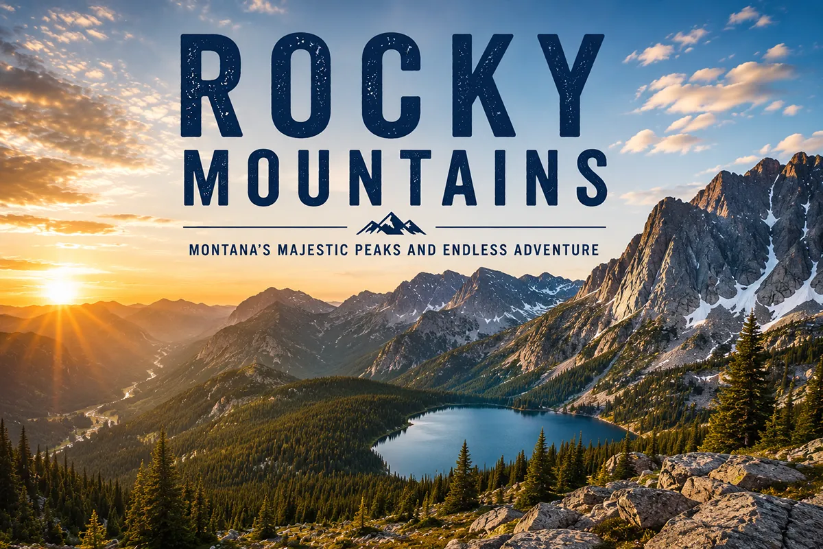
Here’s something I have to clear up before this post goes anywhere else: the Rocky Mountains aren’t a single Montana mountain range. They’re the system that contains most of Montana’s mountain ranges.
Every guidebook that lists “the Rockies” next to “the Beartooths” and “the Bitterroots” as if they’re three separate things has the structure wrong — the Beartooths and Bitterroots are part of the Rockies.
So this post is going to do something different: it’s going to explain what the Rocky Mountains actually are in Montana, how they’re organized, and how to experience them, with honest links to each of the sub-ranges they contain.
The Rocky Mountains run through western Montana as part of the larger Northern Rocky Mountains, which extend from northern New Mexico into British Columbia. In Montana, the Rockies cover roughly the western third of the state and contain more than 50 sub-ranges including the Bitterroots, Missions, Cabinets, Swan, Beartooths, Absarokas, Gallatins, Madisons, and the entire Glacier National Park complex. The Continental Divide cuts through them, dividing waters that flow to the Pacific from those flowing to the Atlantic and Gulf. The best Montana Rocky Mountain experiences are Glacier National Park, the Bob Marshall Wilderness, the Beartooth Highway, and the Continental Divide Trail.
What the Rocky Mountains Actually Are
The Rocky Mountains are the largest mountain system in North America. They run roughly 3,000 miles from northern New Mexico north into British Columbia and the Northwest Territories of Canada, forming the eastern arm of the North American Cordillera.
They contain hundreds of named sub-ranges, every major Continental Divide pass between Mexico and Canada, and the headwaters of the Missouri, Columbia, Colorado, Rio Grande, Yellowstone, and Snake rivers — among others.
The Rockies are typically divided into four regional sections:
- The Southern Rockies (Colorado, northern New Mexico, southern Wyoming)
- The Middle Rockies (most of Wyoming, parts of Utah, southern Montana)
- The Northern Rockies (most of Montana, northern Idaho, southeastern British Columbia)
- The Canadian Rockies (British Columbia and Alberta)
Montana sits primarily in the Northern Rockies, with the southwestern corner of the state arguably bridging into the Middle Rockies (the Beartooth–Absaroka complex is geologically tied to the Greater Yellowstone region rather than the dense ridge-and-valley cordillera farther north).
Geologists argue about exact boundaries; for trip planning purposes, the distinction doesn’t matter much.
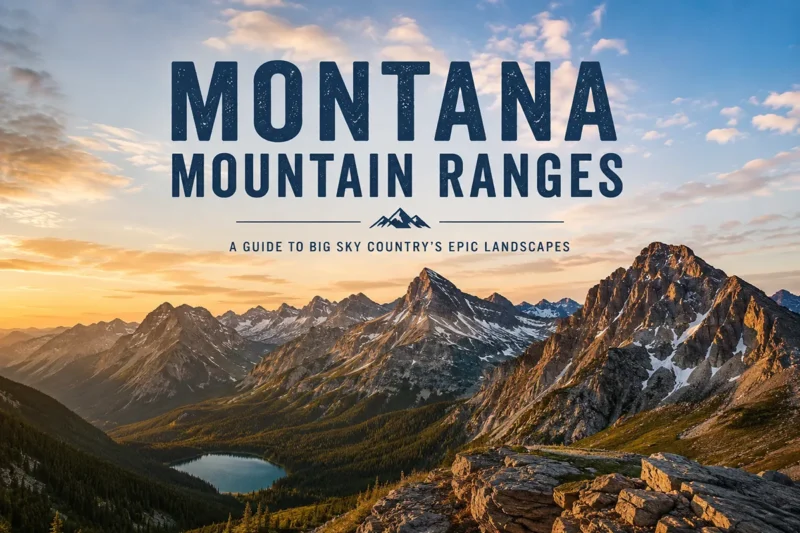
For a full overview of every named range in the state — Rocky Mountain or otherwise — see Montana’s full mountain ranges guide.
Where the Rocky Mountains Are in Montana
The Rocky Mountains cover roughly the western third of Montana, with the eastern boundary running approximately along a line from Glacier National Park in the north, south through the Rocky Mountain Front near Choteau, down past Helena, and into the Beartooth complex in the south.
East of that line, Montana opens up into the Great Plains — the iconic “Big Sky Country” prairie that surrounds the state’s eastern island ranges like the Crazies, the Sweet Grass Hills, and the Bears Paw.
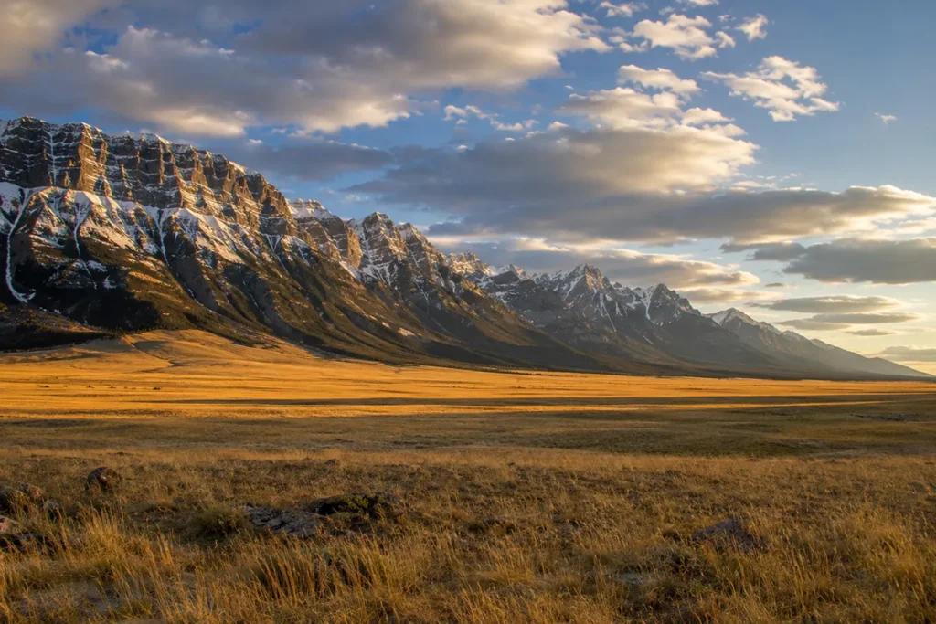
The line between mountains and plains is unusually sharp in Montana. Drive west from Great Falls toward Choteau and you watch the Rockies appear on the horizon as a literal wall — that abrupt rise is called the Rocky Mountain Front, and it’s one of the few places in the world where you can see the geology of a continental collision happen in a single eyeful.
The Continental Divide
The most important feature of the Rocky Mountains in Montana is the Continental Divide — the hydrological backbone that runs roughly north–south along the spine of the Rockies and divides the waters of North America.
Rain falling on the west side of the Divide eventually reaches the Pacific Ocean (via the Columbia River system); rain falling on the east side reaches the Atlantic (via the Missouri–Mississippi system) or the Gulf of Mexico.
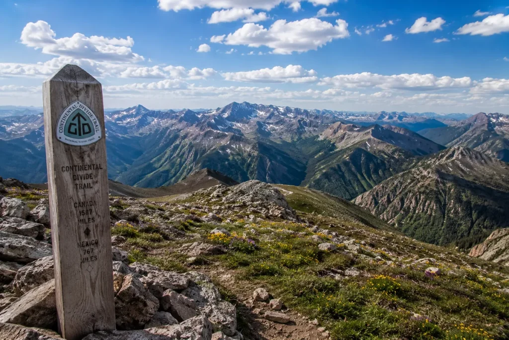
The Divide enters Montana from Wyoming near Yellowstone and exits into Canada at Waterton Lakes National Park, traveling roughly 800 miles through the state.
It’s the longest stretch of the Continental Divide in any U.S. state. Major Divide passes in Montana include:
- Marias Pass (5,213 feet) — the lowest Continental Divide crossing in the U.S. Rockies, used by US-2 and the BNSF railway between East Glacier and West Glacier
- Logan Pass (6,646 feet) — the high point of Going-to-the-Sun Road in Glacier National Park
- Rogers Pass (5,610 feet) — on Montana Highway 200 between Lincoln and Great Falls; site of the coldest temperature ever recorded in the contiguous United States at -70°F in January 1954
- MacDonald Pass (6,325 feet) — west of Helena on US-12
- Homestake Pass (6,329 feet) — east of Butte on I-90
- Lost Trail Pass (7,014 feet) — south of Hamilton on US-93, used by Lewis and Clark in 1805
There’s a more spectacular hydrological curiosity in Montana too: Triple Divide Peak in Glacier National Park, where snowmelt theoretically flows to three oceans — the Pacific, the Atlantic (via the Gulf of Mexico), and the Arctic (via Hudson Bay). It’s the only spot in North America with this distinction.
The Sub-Ranges: How Montana’s Rockies Are Organized
If you want to actually visit “the Rockies” in Montana, you’re really visiting one of the dozens of sub-ranges they contain. Here are the major ones, grouped roughly by region.
Northern Montana Rockies (Glacier Country)
- The Lewis Range — the eastern spine of Glacier National Park, with Mount Cleveland (10,479 ft) as its high point
- The Livingston Range — Glacier’s western spine, containing Kintla Peak (10,101 ft)
- The Whitefish Range — west of Glacier, running to the Canadian border
- The Salish Mountains — the low forested country west of Flathead Lake
- The Purcell Mountains — far northwest Montana, technically part of the Columbia Mountains system but functionally tied to the Northern Rockies
- The Cabinet Mountains — west of Libby, one of the wildest ranges in the Lower 48
- The Swan Range — running north–south between the Mission Mountains and the Bob Marshall Wilderness
- The Mission Mountains — sometimes called the American Alps
Central and Southwest Montana Rockies
- The Bitterroot Mountains — the entire Montana–Idaho border west of the Bitterroot Valley
- The Sapphire Mountains — between the Bitterroot Valley and the Rock Creek drainage
- The Flint Creek Range — northeast of Philipsburg
- The Anaconda Range (Anaconda–Pintler) — running east–west between Butte and Wisdom
- The Pioneer Mountains — south of Butte
- The Beaverhead Mountains — along the southwestern Montana–Idaho border, forming the Continental Divide
- The Tobacco Root Mountains — between the Jefferson and Madison rivers
- The Elkhorn Mountains — between Helena and Townsend
- The Big Belt Mountains — east of Helena and Canyon Ferry Reservoir
- The Little Belt Mountains — between Great Falls and White Sulphur Springs
- The Highwood Mountains — east of Great Falls (an island-range outlier)
Southern Montana Rockies (Yellowstone Country)
- The Bridger Range — Bozeman’s eastern wall
- The Gallatin Range — from Bozeman south into Yellowstone
- The Madison Range — west of the Gallatins, containing Lone Mountain and Big Sky
- The Absaroka Range — forming Yellowstone’s eastern boundary
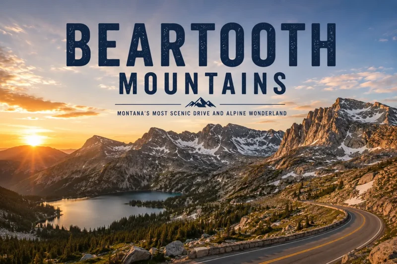
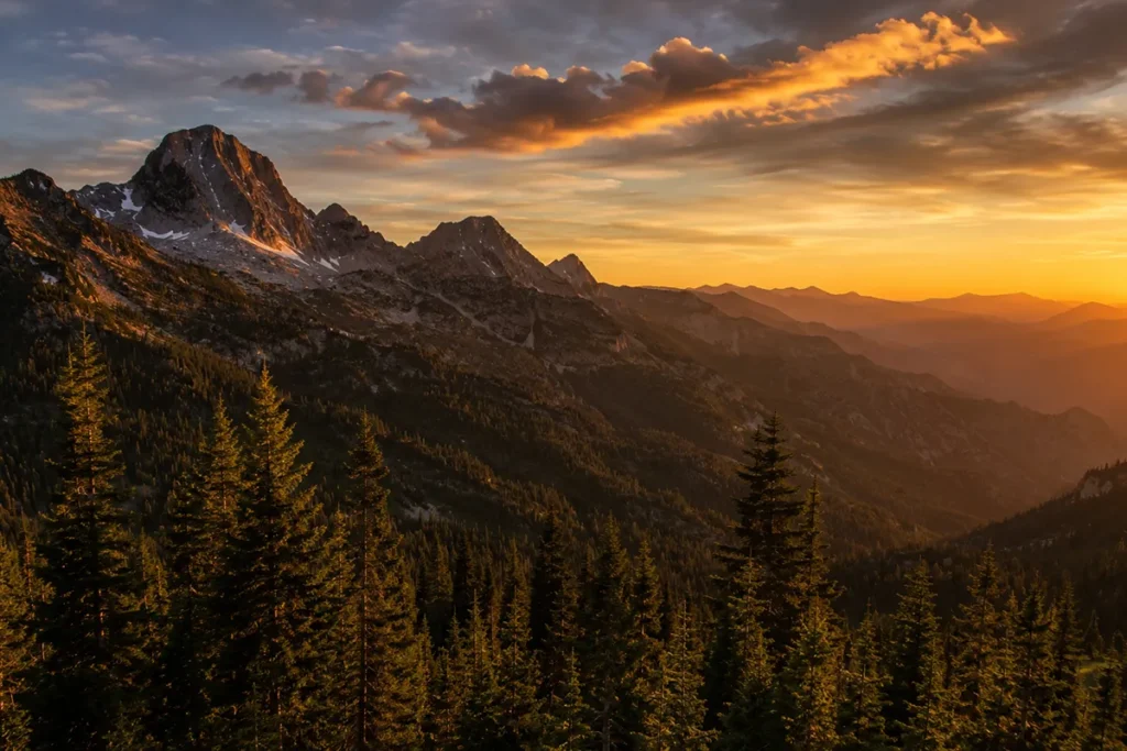
- The Beartooth Mountains — containing Granite Peak (12,807 ft), Montana’s highest
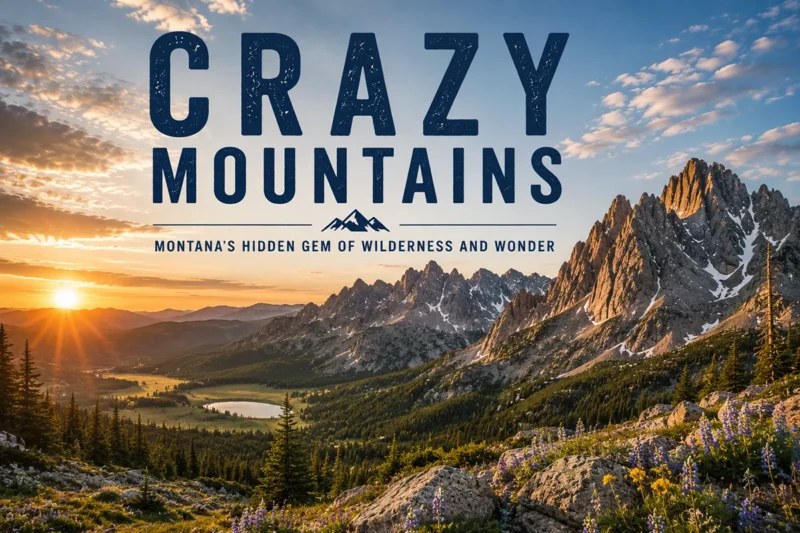
- The Crazy Mountains — technically an island range, but geologically related to the Rockies
That’s not a complete list — Montana has more than 50 named sub-ranges within the Rocky Mountain system — but those are the ones most travelers will encounter.
How the Montana Rockies Were Formed
The Rocky Mountains are old, but they’re not quite as old as their reputation suggests. The current uplift dates to the Laramide Orogeny, a mountain-building event that lasted from roughly 80 million to 35 million years ago — relatively recent in geologic terms.
The rocks themselves, though, are much older. The Beartooth basement granite has been dated to about 2.8 billion years, making it some of the oldest exposed rock in North America.
The sedimentary layers of the Belt Supergroup — visible in Glacier National Park and across northwest Montana — were deposited between 1.4 and 1.6 billion years ago, when this part of the continent was a shallow inland sea.
When you look at the layered, rust-and-cream cliff faces along Going-to-the-Sun Road, you’re looking at billion-year-old mudstone.
The mountains got their modern shape primarily from glaciation during the Pleistocene ice ages, ending about 10,000 years ago. The U-shaped valleys, the cirques and tarns, the moraines and hanging valleys — those are all signatures of ice.
The active glaciers still hanging on in Glacier National Park are remnants of the Little Ice Age (roughly 1300–1850 CE), not the Pleistocene. They’re disappearing — Glacier had an estimated 150 glaciers in 1850 and has roughly 25 today, and they’re projected to mostly vanish within decades.
The Bob Marshall Wilderness Complex
If you want to experience the Rocky Mountains in Montana at their wildest, this is the answer.
The Bob Marshall–Great Bear–Scapegoat Wilderness Complex covers more than 1.5 million acres along the Continental Divide between Glacier National Park and roughly Helena.
Combined with adjacent designated wilderness in Glacier and the Lewis and Clark National Forest, it forms the largest contiguous block of wilderness in the Lower 48.
Inside the Bob, there are no roads. No structures. No motorized vehicles, no mountain bikes, no chainsaws. Travel is by foot or pack animal, and a typical trip is five to ten days.
The Chinese Wall — a 22-mile cliff face running along the Continental Divide, rising 1,000 feet above the surrounding terrain — is the iconic destination.
I’ve been once, on a five-day backpacking trip with a horse pack-in, and I’d characterize it as the wildest place I’ve ever been in the Lower 48.
This is grizzly bear country at its most concentrated. Carry spray. Hang food properly. Read our Montana bear guide before you go.
Wildlife in the Montana Rockies
The Montana Rockies support one of the most intact large-mammal communities in the temperate world. The full suite is present:
- Grizzly bears — perhaps 2,000 in Montana, concentrated in the Northern Continental Divide ecosystem (Glacier and the Bob complex) and the Greater Yellowstone ecosystem
- Black bears — far more numerous and widespread
- Gray wolves — recolonized from Yellowstone reintroduction in 1995 and from Canada; now present across most of western Montana
- Mountain lions (cougars) — present throughout, rarely seen
- Wolverines — present in alpine and subalpine zones, extremely rare
- Lynx — present in deep forest, federally threatened
- Moose — common in wet drainages and willow flats
- Elk — abundant throughout
- Mule deer and white-tailed deer — abundant
- Bighorn sheep — present in many ranges, with several major herds
- Mountain goats — alpine specialists, native to most northern ranges
- Pronghorn — lower elevations only, an iconic plains species
The Montana Rockies are also the only place in the contiguous United States with all of the original large carnivores intact — grizzlies, wolves, black bears, mountain lions, lynx, and wolverines all coexisting. That fact alone is worth a trip.
How to Actually Experience the Montana Rockies
There are a hundred ways to do this. Here are the four trips I’d recommend depending on what you have time for.
A Half-Day: The Rocky Mountain Front Drive
Drive US-89 north from Choteau toward East Glacier. The Rockies form a continuous 80-mile wall on your left side, with the prairie rolling away on your right.
This is the most dramatic mountains-meet-plains visual in the country. Stop at the Pine Butte Swamp Preserve, the Ear Mountain Outstanding Natural Area, or just any pullout.
A Day: Going-to-the-Sun Road
Drive Going-to-the-Sun Road across Logan Pass in Glacier National Park.
Fifty miles of paved road, hairpin turns above 5,000-foot drop-offs, glaciers visible from pullouts, and the most-photographed mountain landscape in the state.
Plan for a full day with stops. The road is open roughly late June through mid-October depending on snow.
A Long Weekend: Beartooth Highway + Yellowstone Loop
Drive from Bozeman south to Yellowstone via Paradise Valley, north through Lamar Valley, exit at the Northeast Entrance, climb the Beartooth Highway, descend into Red Lodge, and return via I-90.
Three to four days. This covers three different Rocky Mountain sub-ranges (Absaroka, Beartooth, Gallatin) plus Yellowstone’s geothermal sections.
A Week or More: Bob Marshall Wilderness Trip
A serious wilderness backpacking or horseback trip into the Bob Marshall, ideally with a local outfitter for the first attempt.
Five to ten days, no cell service, no roads, full grizzly country immersion. This is the highest-effort, highest-reward Rocky Mountain experience in Montana.
Personal Tips: What I Wish I Knew About the Montana Rockies
Weather windows are short. The high country of the Northern Rockies is reliably snow-free roughly mid-July through mid-September. The driving passes — Logan Pass, Beartooth Pass, Lost Trail Pass, Lolo Pass — close or become unsafe outside that window. Plan accordingly.
The Rocky Mountain Front is underrated. Most travelers focus on Glacier and the Bob, but the Front itself — the visual transition from plains to peaks — is one of the most distinctive landscapes in the country, and it’s almost empty of tourists.
Smoke is the wild card. Late July through September is also wildfire season. Some years are crystal clear; some years the western half of the state is choked in smoke that ruins photography and irritates lungs. See our guide on Montana wildfires.
The Continental Divide Trail is real. The CDT runs 800 miles through Montana from the Wyoming border to Canada. You can section-hike it. Most through-hikers do the Montana section in August.
Native lands and history matter. The Montana Rockies are the traditional homelands of the Blackfeet (east of the Divide), the Salish, Pend d’Oreille, and Kootenai (west of the Divide), the Crow (south), and others. Many of the most iconic peak names — Two Medicine, Chief Mountain, Going-to-the-Sun — come from these cultures. Read the Montana history overview for context.
The east side and west side feel completely different. Same range, opposite weather. The west side gets Pacific moisture and forms dense cedar–hemlock forests. The east side sits in the rain shadow and feels almost like prairie clinging to mountain walls. Plan a trip that includes both.
For more on how the seasons hit the high country, see Montana in July, Montana in August, and Montana in September.
Practical Info Box
| Item | Detail |
|---|---|
| Total length of Rockies in Montana | ~800 miles north–south |
| Coverage | Roughly western 1/3 of the state |
| Highest peak in Montana Rockies | Granite Peak, 12,807 ft (Beartooth Mountains) |
| Number of named sub-ranges | 50+ |
| Continental Divide length in Montana | ~800 miles (longest in any U.S. state) |
| Lowest Continental Divide pass in U.S. Rockies | Marias Pass, 5,213 ft (Montana) |
| Major wilderness complexes | Bob Marshall–Great Bear–Scapegoat (1.5M acres), Absaroka–Beartooth (944K acres), Mission Mountains, Cabinet Mountains, Selway–Bitterroot |
| Best driving experience | Going-to-the-Sun Road or Beartooth Highway |
| Driving season for high passes | Late June through mid-October |
Frequently Asked Questions
Are the Rocky Mountains in Montana?
Yes. The Northern Rocky Mountains run through approximately the western third of Montana, containing more than 50 sub-ranges and the longest stretch of the Continental Divide in any U.S. state.
Where are the Rocky Mountains in Montana exactly?
The Rockies cover western Montana from the Idaho border on the west to roughly a line from Glacier National Park south through Choteau, Helena, and the Beartooth Mountains on the east. East of that line, Montana is mostly plains.
What’s the highest peak in the Montana Rockies?
Granite Peak in the Beartooth Mountains at 12,807 feet — also the highest point in the state of Montana.
Are the Beartooths part of the Rocky Mountains?
Yes. The Beartooths are a sub-range of the Northern Rockies, though geologically they’re often grouped with the adjacent Absaroka Range and the broader Greater Yellowstone Ecosystem.
Is Glacier National Park in the Rocky Mountains?
Yes. Glacier National Park sits in the Northern Rocky Mountains, with the Lewis Range forming the park’s eastern spine and the Livingston Range forming the western spine. Both are Rocky Mountain sub-ranges.
What’s the difference between the Rocky Mountains and the Northern Rockies?
The Rocky Mountains are the entire 3,000-mile system from New Mexico to Canada. The Northern Rockies are the section running through northern Idaho, western Montana, and southeastern British Columbia — roughly the segment north of Yellowstone.
Can you drive across the Continental Divide in Montana?
Yes, at many places. The most scenic is Going-to-the-Sun Road over Logan Pass (open seasonally). The lowest is Marias Pass on US-2 (open year-round). I-90 crosses at Homestake Pass east of Butte (open year-round).
Are there glaciers in the Montana Rockies?
Yes, but fewer every decade. Glacier National Park has roughly 25 remaining active glaciers (down from ~150 in 1850), and a few small glaciers persist in the Mission Mountains and Beartooth complex. Most are projected to disappear within decades.
Final Thoughts
The Rocky Mountains in Montana aren’t a destination — they’re a geographic context. They’re the reason the western half of this state looks the way it does, the reason the rivers flow where they do, the reason the wildlife communities are intact, and the reason the weather can flip from prairie heat to alpine storm in the span of one drive.
To “see the Montana Rockies,” you really pick a sub-range and go deep on it. Glacier in summer. The Beartooths in August. The Bob Marshall on a horse pack-in.
Use this post as the anchor for your trip and follow the links to the individual sub-ranges. Each one has its own character, its own access points, its own best season.
And keep the full Montana mountain ranges guide handy — between this and that, you’ve got the entire mountain geography of the state in two pages.