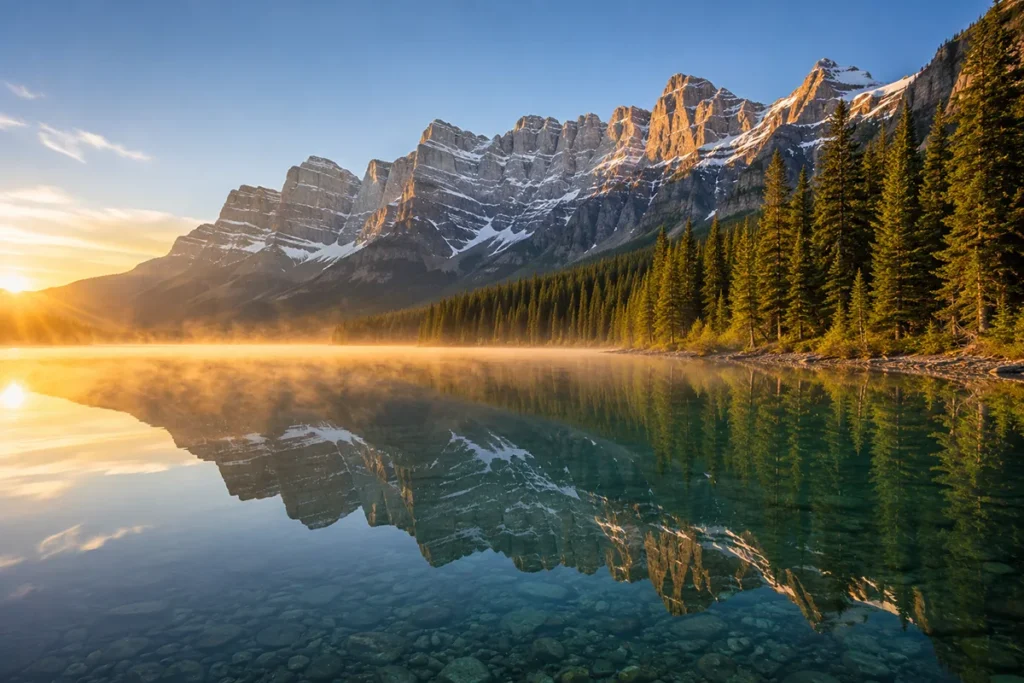
The first time I drove the Going-to-the-Sun Road, I rounded a switchback near Logan Pass and had to pull over because I genuinely couldn’t keep driving while looking at what was in front of me.
A bighorn ewe was standing six feet from my passenger door, the entire Garden Wall was reflecting the late-afternoon sun behind her, and somewhere down in the valley a waterfall was throwing mist into the air. I sat there for ten minutes. Welcome to Glacier Country.
TL;DR
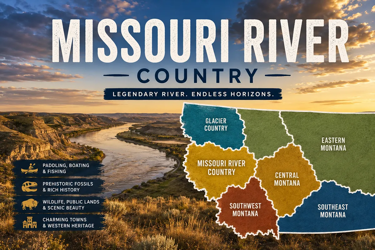
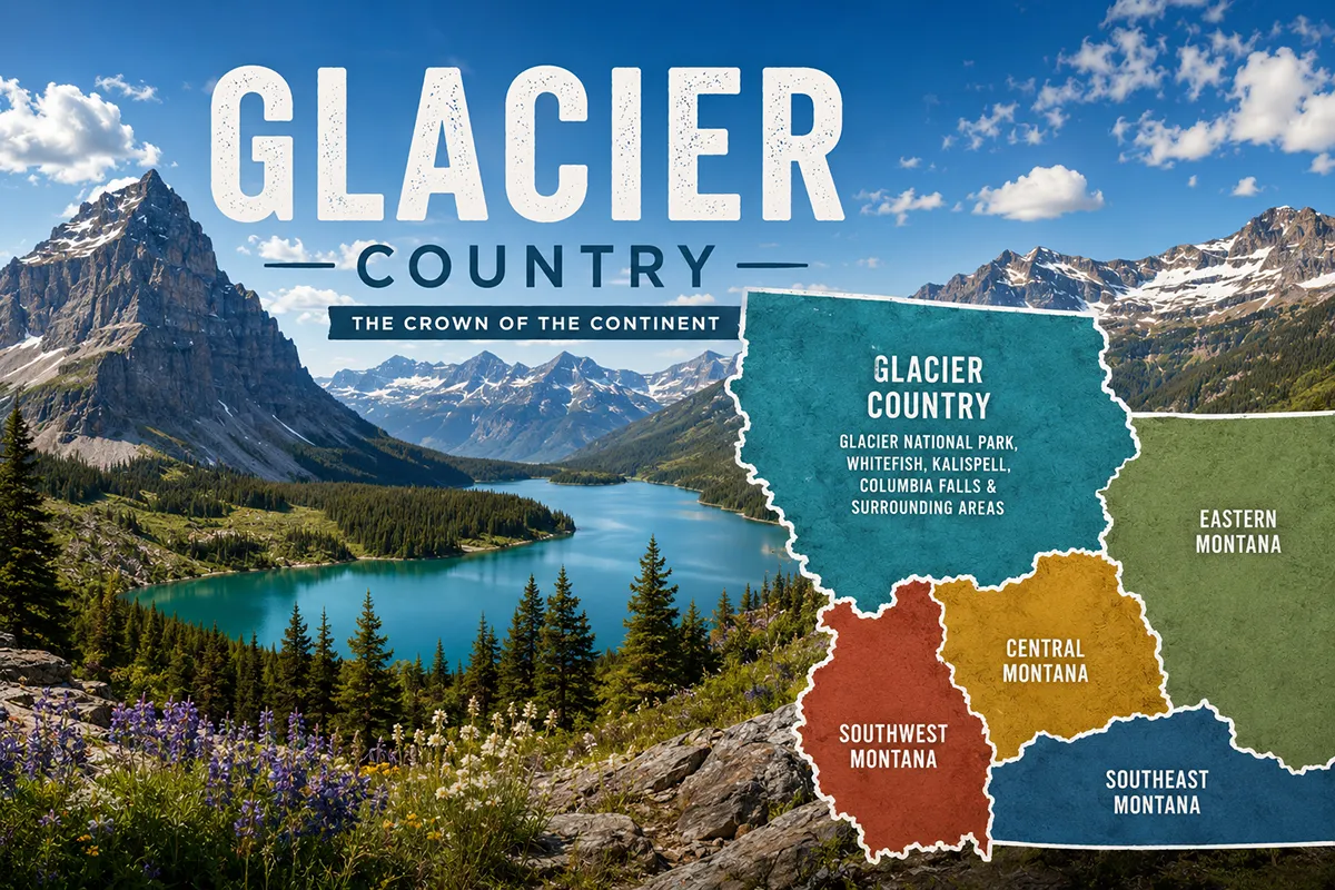
Glacier Country covers Montana’s northwest corner and is the most-visited of the state’s six tourism regions. It’s anchored by Glacier National Park — the “Crown of the Continent” — and includes Missoula, Whitefish, Kalispell, Bigfork, Flathead Lake, and the wild Bitterroot Valley. The sweet spot for most visitors is mid-July through mid-September, you absolutely need a vehicle reservation for Going-to-the-Sun Road in summer, and the smartest base depends entirely on what kind of trip you’re planning. This guide breaks down every town, every season, the hot springs, the waterfalls, the bear-country basics, and the mistakes I see first-timers make every single year.
What Is Glacier Country, Exactly?
Glacier Country is one of Montana’s six official tourism regions, established by the Montana Legislature in 1986–87.
Geographically, it occupies the northwest corner of the state and includes seven counties: Flathead, Lake, Lincoln, Mineral, Missoula, Ravalli, and Sanders. It runs from the Canadian border in the north all the way down through the Bitterroot Valley near the Idaho line.
The region is officially marketed as “Western Montana’s Glacier Country” by its Destination Marketing Organization.
You’ll hear it called the Crown of the Continent — a name coined by conservationist George Bird Grinnell in the late 1800s because the watersheds here drain to three different oceans: the Pacific, the Atlantic (via Hudson Bay), and the Gulf of Mexico. That’s a geological detail almost no other place on Earth can claim.
Inside Glacier Country sit two national forests (Flathead and Kootenai), the Bob Marshall Wilderness Complex, three Indian reservations or portions thereof (Flathead, Blackfeet, and a sliver of the Kootenai), Glacier National Park, and the largest natural freshwater lake west of the Mississippi — Flathead Lake.
It is, in short, a lot to absorb.
The Towns of Glacier Country (And Which One to Base In)
This is the most important decision you’ll make. Your base town shapes your trip. Here’s the honest local breakdown.
Missoula
The largest city in Glacier Country and the second-largest in Montana. Missoula is a college town (University of Montana), and it shows — there’s an arts scene, an excellent food scene, and the densest concentration of Missoula breweries per capita anywhere in the state.
The city sits at the confluence of five river valleys, which is why locals call it “the Hub of Five Valleys.” Fly fishing here is genuinely world-class — the Clark Fork, Bitterroot, and Blackfoot rivers all meet within minutes of downtown.
Base in Missoula if: You’re doing a multi-region trip, you want a real city experience, you want fly fishing as your main activity, or you’re flying into MSO and don’t want a long drive on day one.
Don’t base in Missoula if: Glacier National Park is your main goal. The park is 2.5–3 hours north. You’ll spend half your trip in the car.
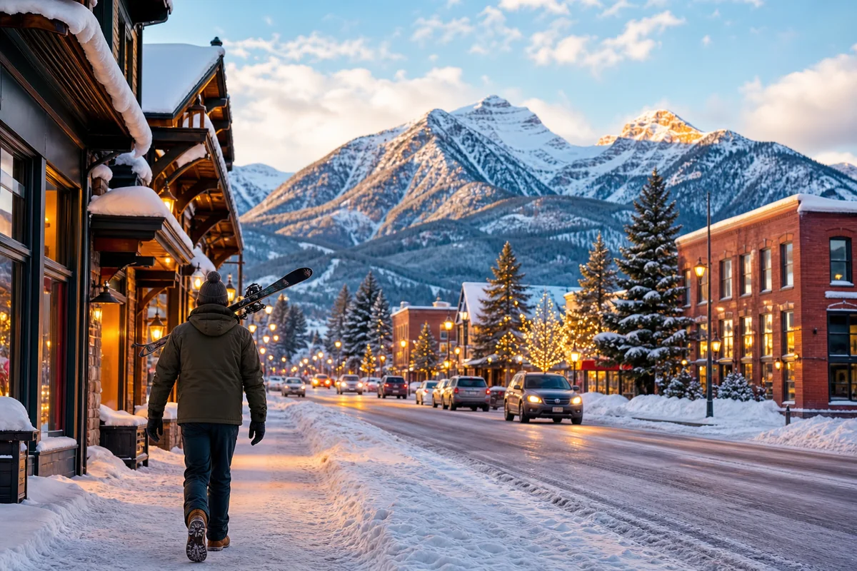
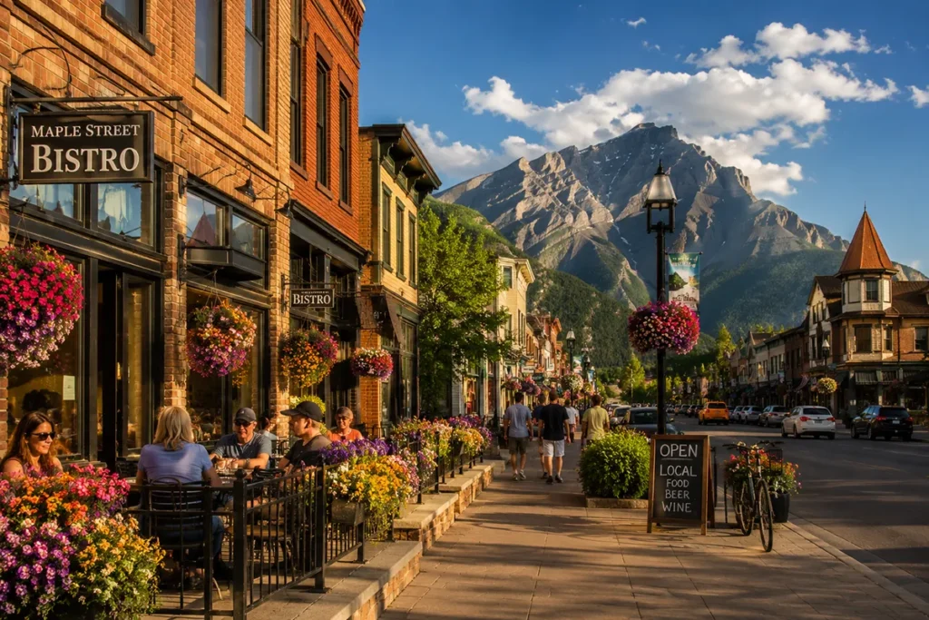
Whitefish
The resort town. Whitefish is small (about 8,000 people year-round) but punches way above its weight in restaurants, breweries, boutiques, and lakeside charm.
It sits at the base of Whitefish Mountain Resort — one of the best ski resorts in Montana and easily one of the most underrated in North America — and Whitefish Lake is right in town. The drive to Glacier’s West Entrance is about 30 minutes.
Base in Whitefish if: You want walkable evenings, good food, easy access to the park, and you don’t mind spending a bit more.
Don’t base in Whitefish if: You’re traveling on a tight budget in July or August. Rates spike hard.
➡️ Things to do in Whitefish | Where to stay in Whitefish | Whitefish in winter
Kalispell
The practical hub. Kalispell is the biggest town near the park (around 25,000 people), has the regional airport (Glacier Park International, code FCA), and is the one place where you can run any errand you might need to run before heading into the wilderness. It’s about 45 minutes from the West Entrance and a straight shot up Highway 93 to Whitefish.
Base in Kalispell if: You’re flying in, you have a family with logistics to manage, you want lower lodging prices than Whitefish, or you’re planning to also explore Flathead Lake.
Bigfork
My personal favorite small town in Montana. Bigfork sits on the northeast shore of Flathead Lake and has the prettiest little downtown anywhere west of the Mississippi — a tight cluster of art galleries, restaurants, and a tiny harbor on Bigfork Bay. The Bigfork Summer Playhouse is a legitimate cultural institution.
Base in Bigfork if: You want lake life and don’t mind being slightly further from the park (about 1 hour 15 minutes to the West Entrance).
Columbia Falls
The “gateway town” to Glacier’s West Entrance — about 15 minutes away. Columbia Falls is more workmanlike than Whitefish (it grew up as a timber and aluminum town), but it has solid lodging, decent food, and the shortest drive to the park gates of any meaningful town.
Base in Columbia Falls if: You want park-first proximity without paying Whitefish prices.
➡️ RV parks near Columbia Falls and West Glacier
Polebridge
Way up the North Fork of the Flathead River, accessible only by a teeth-rattling gravel road that closes seasonally. Polebridge has no electricity grid, one bakery (Polebridge Mercantile — the huckleberry bear claws are famous for a reason), and one bar (the Northern Lights Saloon). It’s a one-of-a-kind experience and feels like stepping into 1955.
Visit Polebridge if: You want to see what off-grid Montana looks like and you have a high-clearance vehicle.
Other Towns Worth Knowing
- Hamilton — heart of the Bitterroot Valley, anchor of one of Montana’s prettiest agricultural valleys, an hour south of Missoula
- Polson — at the south end of Flathead Lake; gateway to cherry country
- Libby and Troy — far-northwest timber country, near Kootenai Falls (one of the largest free-flowing waterfalls in the U.S.) and the Cabinet Mountains Wilderness
- Eureka — right against the Canadian border, gateway to Lake Koocanusa
- Seeley Lake — between Missoula and Glacier, surrounded by the Bob Marshall Wilderness and Swan Mountains
- Thompson Falls — quiet riverside town in Sanders County
- East Glacier Park Village and Browning — gateway towns on the east side of Glacier National Park, on the Blackfeet Indian Reservation
- Stevensville, Florence, Victor, Corvallis, Darby — Bitterroot Valley towns I’d recommend exploring on a slow drive
Glacier National Park: What You Actually Need to Know
Most people come to Glacier Country for Glacier National Park. So let me cut through the noise.
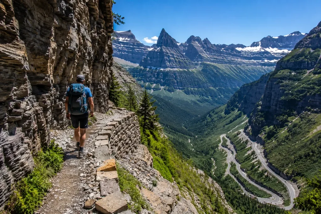
The Going-to-the-Sun Road Reality
The Going-to-the-Sun Road is the headline experience — a 50-mile mountain road that crosses the park west to east, climbing over Logan Pass at 6,646 feet. Engineering Wonder of the World, etc. Everything you’ve heard is true.
You need a timed-entry vehicle reservation to drive it in the busy season (typically late May through early September). These are released in waves on Recreation.gov and they go fast. Book the moment your dates open.
If you miss out, you can still enter without a reservation before 6 AM or after 3 PM — and honestly, those are the better times to drive it anyway. The light is better. The wildlife is more active. The pullouts aren’t packed.
The road typically opens fully (Logan Pass clear of snow) by mid-to-late June and closes around mid-October. Plowing the upper sections in spring is a multi-week operation involving 60-foot snow walls.
When to Visit Glacier National Park
| Month | What to expect |
|---|---|
| Jan–Mar | Park is mostly closed to vehicles past Lake McDonald Lodge. Cross-country skiing, snowshoeing. Pure solitude. |
| April | Lower elevations melting out. Roads still snowed in. Wildflowers beginning at valley bottoms. |
| May | Going-to-the-Sun partially open. Waterfalls at peak. Trails muddy. Few crowds. |
| Late May–Mid-June | Waterfalls thunderous, wildflowers in lower meadows, fewer crowds, but Logan Pass area still snowy. |
| Mid-June–Mid-July | Peak wildflowers at higher elevations. Crowds building. Mosquitos at lower lakes. |
| Mid-July–Mid-August | Peak season. All trails accessible. Maximum crowds. Smoke risk from wildfires. |
| Mid-Aug–Mid-September | My favorite window. Crowds thinning, weather still good, fall color starting. |
| Late September | Larches turn gold, especially around the North Fork. Some services close. |
| October | Going-to-the-Sun closes mid-month. Cool, beautiful, very few visitors. |
| Nov–Dec | Snow returns. Park transitions to winter mode. |
The Best Glacier Hikes
A few I’ve personally done multiple times:
- Highline Trail — the iconic 11.8-mile point-to-point ridge walk from Logan Pass. Cliff exposure early on. Do it northbound.
- Avalanche Lake — 4.6 miles round-trip, family-friendly, gorgeous payoff. Gets very crowded.
- Iceberg Lake — 9.7 miles round-trip. The lake genuinely has icebergs floating in it through July. Bring bear spray.
- Grinnell Glacier — 10.6 miles round-trip from Many Glacier. Pick this if you want to actually see a glacier.
- Hidden Lake Overlook — 2.7 miles round-trip from Logan Pass. Best moderate hike for a short visit.
Full breakdown: best hikes in Glacier National Park.
Glacier’s Best Waterfalls
The park has hundreds of waterfalls. The accessible standouts:
- Lake McDonald Falls — short walk on the west side
- Running Eagle Falls — the famous “two-eyed” falls in Two Medicine
- Saint Mary Falls and Virginia Falls — both on the same short loop
- Redrock Falls — Many Glacier valley, very photogenic
- Hidden Falls, Piegan Falls, Oberlin Falls, Sacred Dancing Cascade, Salamander Falls — all hike-accessible
➡️ Fun facts about Glacier National Park
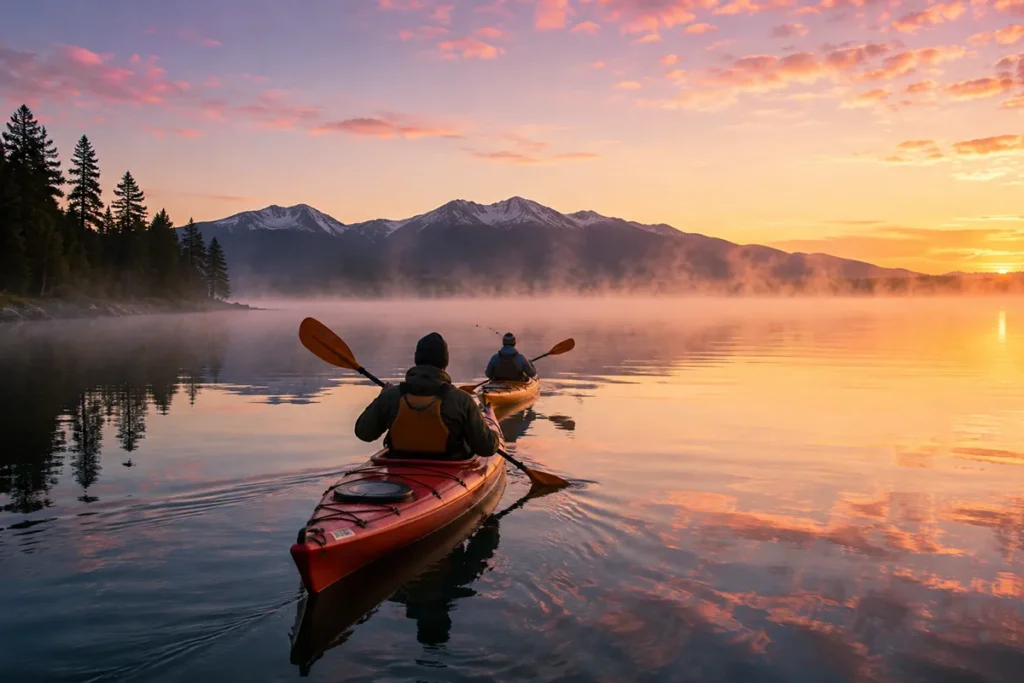
Flathead Lake: The Underrated Jewel
Flathead Lake is the largest natural freshwater lake west of the Mississippi River by surface area — roughly 200 square miles. It’s so big that it shows up clearly in satellite photos of the Pacific Northwest. The water is famously clear and famously cold, even in August.
Cherry orchards line the east shore (a microclimate created by the lake). The west shore has the easier road access — Highway 93 hugs it for 30 miles. Wild Horse Island sits in the middle of the lake and is a state park with wild horses, bighorn sheep, and prehistoric pictographs.
The south end is on the Flathead Indian Reservation. Polson is the main town at the south end. Bigfork at the northeast corner. Somers and Lakeside on the west.
My favorite Flathead Lake move: Drive the loop. It’s about 90 miles all the way around. Stop in Lakeside for lunch, stop at cherry stands in July, swim somewhere on the east side, end with sunset from Bigfork.
Hot Springs in Glacier Country
A genuinely underrated category. The region has more developed hot springs than most travelers realize.
- Lolo Hot Springs — west of Missoula on US-12, family-friendly, easy access
- Quinn’s Hot Springs Resort — Paradise, MT, multi-pool tiered setup, excellent restaurant on site
- Symes Hot Springs Hotel — Hot Springs, MT, art-deco historic building with mineral pools
- Wild Horse Hot Springs — also in Hot Springs, MT; private soaking rooms
- Lost Trail Hot Springs — far south end of the Bitterroot Valley near the Idaho border
Full list: best natural hot springs in Montana.
Wildlife: What You’ll Actually See
Glacier Country is bear country. Both grizzly bears and black bears are present in serious numbers. You will see one if you spend enough time outdoors, especially in the park.
Other wildlife you’re likely to spot:
- Bighorn sheep — common along Going-to-the-Sun Road near Logan Pass
- Mountain goats — Hidden Lake Overlook is famous for them
- Moose — Many Glacier and the swampy lower valleys
- Elk — Bitterroot Valley, North Fork
- Bison — at the Bison Range in the Mission Valley (the largest free-roaming herd in the country outside Yellowstone)
- Bald eagles — along all the major rivers and lakes
- Wolves — present but rarely seen
Bear safety is non-negotiable. Carry bear spray on every hike (you cannot fly with it; buy locally). Make noise. Hike in groups when possible. Store food properly. Read our bear safety guide before you go.
A Quick Honest Take on the Crowds
The crowd problem in Glacier Country is real but localized.
Most crowded: Logan Pass area (Going-to-the-Sun Road), Lake McDonald, Avalanche Lake trail, Many Glacier in July–August
Way less crowded: North Fork (Polebridge area), Two Medicine, the Bob Marshall Wilderness, anything east of the park on the Blackfeet Reservation, the Bitterroot Valley
If you want the Glacier National Park experience without the bus-tour bottleneck, base in Two Medicine or do a North Fork day trip. Both feel like the park did 30 years ago.
A Sample 7-Day Glacier Country Itinerary
This is what I’d send a first-time visitor:
- Day 1: Fly into FCA. Drive to Whitefish or Kalispell. Settle in. Walk downtown. Dinner.
- Day 2: Drive the full Going-to-the-Sun Road (early or late). Stop at Logan Pass for a short hike. Overnight near the park.
- Day 3: Many Glacier day. Hike Iceberg Lake or Grinnell Glacier. Dinner at Many Glacier Hotel if you can get in.
- Day 4: Two Medicine day. Boat tour, hike to Running Eagle Falls, picnic at Pray Lake.
- Day 5: Flathead Lake loop. Cherry stands, swimming, dinner in Bigfork.
- Day 6: Bitterroot Valley drive. Hamilton, Stevensville, lunch in Hamilton, soak at Lolo Hot Springs on the way back to Missoula.
- Day 7: Missoula morning — Clark Fork riverfront, breakfast downtown, fly out of MSO. Or stay another day and fish.
Practical Info Box: Glacier Country at a Glance
| Item | Details |
|---|---|
| Nearest major airports | Glacier Park International (FCA) — Kalispell; Missoula Montana Airport (MSO) |
| Best season to visit | Mid-July through mid-September for park; January–March for skiing |
| Park entrance fee | [Verify current Glacier NP entrance fee]; America the Beautiful Pass accepted |
| Vehicle reservation required? | Yes, for Going-to-the-Sun Road in peak season — book months ahead |
| Bear country? | Yes, grizzly and black bears — carry bear spray |
| Cell service | Patchy in the park, good in towns |
| Major rivers | Flathead, Clark Fork, Bitterroot, Blackfoot, Kootenai |
| Counties included | Flathead, Lake, Lincoln, Mineral, Missoula, Ravalli, Sanders |
| Tribal nations | Confederated Salish & Kootenai Tribes (Flathead Reservation), Blackfeet Nation |
| Time zone | Mountain Time (MST/MDT) |
What I Wish I’d Known Before My First Trip
A few things that would have saved me real time, money, and frustration.
Book lodging way before you book flights. The hotels in and near Glacier sell out 8–10 months in advance for July and August. If you have a date locked in, lodging first, then flights. The reverse will burn you.
You can’t actually see most of Glacier in one day. First-timers often plan one big day in the park. That’s like trying to see Yosemite in one day — technically possible, but a waste. Plan three days minimum.
The east side and west side of the park are very different. The west side (Lake McDonald, Apgar, Avalanche, Going-to-the-Sun) is greener, foresty, and feels Pacific Northwest. The east side (Two Medicine, Many Glacier, St. Mary) is drier, more dramatic, more “Rocky Mountain.” Do both if you can.
Smoke is a real wildfire-season risk. August and September wildfires can fill the valleys with smoke and obscure views for days. Check the air quality index before you go and have a backup plan (head south to the Bitterroot, soak at hot springs, do town days).
The North Fork is worth the drive. Polebridge feels like a different decade. The huckleberry bear claws are not hype.
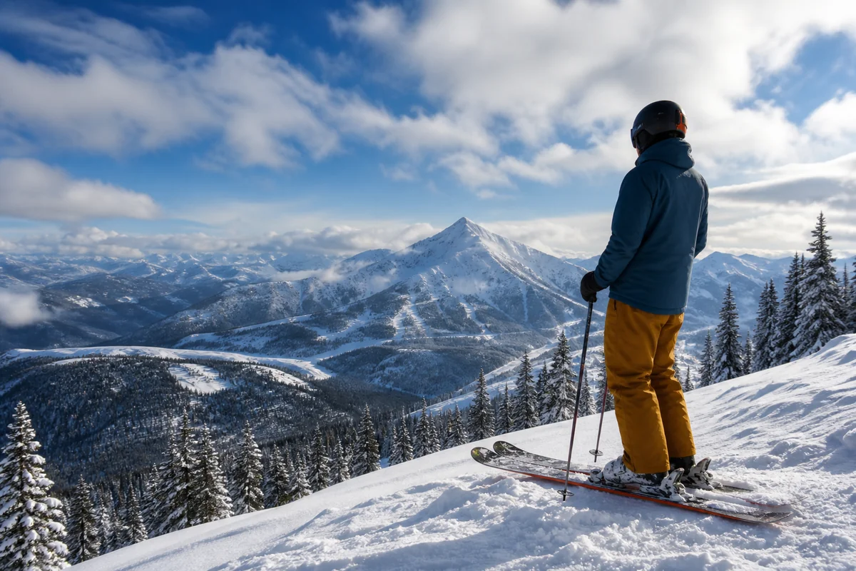
Whitefish in winter is its own thing. If you can’t do summer, winter in Whitefish is a real alternative — skiing, snowshoeing, hot tubs, fewer people, much cheaper.
Bear spray is mandatory. Buy locally — you can’t fly with it. $50 well spent.
Gas up in town. Some scenic drives don’t have gas stations for 60+ miles.
Where to Stay (Quick Reference)
| Stay style | Best location |
|---|---|
| Park lodges (rustic, iconic) | Lake McDonald Lodge, Many Glacier Hotel — book a year ahead |
| Walkable downtown | Whitefish, Bigfork, Missoula |
| Budget-conscious | Kalispell, Columbia Falls, hostels in Missoula |
| RV / camping | Apgar, St. Mary, Two Medicine campgrounds; private RV parks in Columbia Falls |
| Off-grid experience | Polebridge (limited lodging, plan early) |
➡️ Where to stay in Glacier National Park | Where to stay in Whitefish | RV parks near Glacier | RV parks in Missoula
Should You Visit Glacier Country?
If you’re picking your first Montana region, this is the easy answer. Glacier Country is where you’ll find the Montana of your imagination — the jagged peaks, the iridescent lakes, the bears and bighorns, the small towns with one bakery and a saloon.
It’s also where the crowds are densest, the lodging is priciest, and the trip planning is most front-loaded. Worth it? In my opinion, completely.
If it’s your second or third Montana trip, this is also where to come back — but to different parts. Skip Logan Pass and do the North Fork. Skip Lake McDonald and do Two Medicine. Skip Whitefish and base in Bigfork or Hamilton. There are versions of this region most visitors never see.
Save this guide for your trip planning, or pin it for later. If you have a specific question I didn’t answer, drop it in the comments — I read every single one. And when you’re ready to dig deeper, the next region to explore is Yellowstone Country, just to the south.
➡️ Back to the main Montana Regions guide
Written by Sarah Bennett. I’ve made the drive from Missoula to Glacier so many times the rental car companies probably have me flagged. The huckleberry bear claws at Polebridge are still worth every mile.