The drive out to Makoshika is 220 miles from Billings, 300+ miles from Bozeman, and 500+ miles from Glacier. Almost no one comes here on a first Montana trip. Which is exactly why you should.
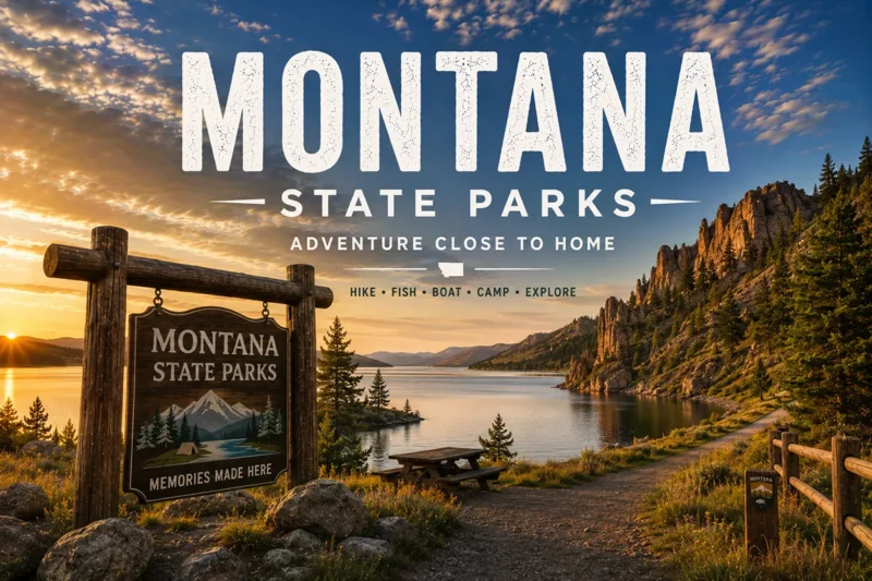
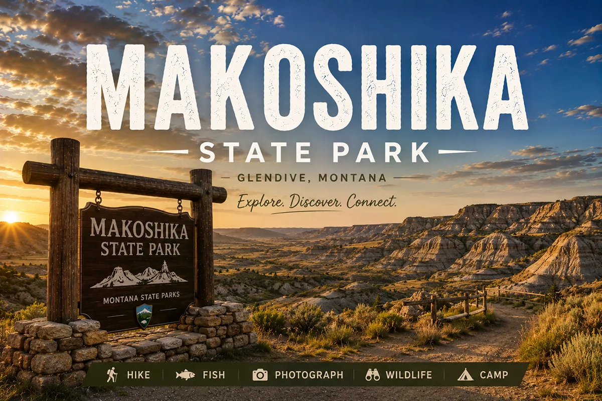
TL;DR: Makoshika is Montana’s largest state park — 11,538 acres of dinosaur-fossil-bearing badlands on the edge of Glendive in far-east Montana. The geology is Hell Creek Formation, same as the formation that produced “Sue” the T. rex. Tyrannosaurus rex, Triceratops, and Thescelosaurus fossils have all been excavated within the park boundaries. The visitor center is genuinely good, the trails are quiet, the night skies are world-class, and the drive is long. This is a destination park, not a drive-by. Plan a minimum of one full day, ideally two with an overnight in the park’s tipi or campground.
I’m Robert Hayes, and I’ve been driving the back roads of eastern Montana long enough to have strong opinions about which corners are worth the gas. Makoshika is one of them — easily.
The Lakota named this country Makoshika (Ma-ko’-shi-ka), meaning “bad land” or “bad spirits,” for the strangeness of the landscape.
The same geology produced some of the most significant dinosaur finds in North American paleontology. The park itself is genuinely strange, often empty, and bigger than most travelers expect.
This is the deep-dive guide for Makoshika. For where it fits in the broader Montana parks system, see my Montana state parks pillar guide, which covers all 55+ of the state’s parks and how to choose between them.
For the federal counterpart in this region, Fort Union Trading Post National Historic Site is 90 minutes northeast and pairs naturally with Makoshika for a complete far-east Montana itinerary.
Quick Stats
| Stat | Detail |
|---|---|
| Size | 11,538 acres (Montana’s largest state park) |
| Elevation | 2,415 feet |
| Location | Just south of Glendive, eastern Montana |
| Geology | Hell Creek Formation (Late Cretaceous) |
| Major fossils found | Tyrannosaurus rex, Triceratops, Thescelosaurus, Edmontosaurus |
| Established | 1939 (as a state park) |
| Day-use fee [verify 2026] | $8 per vehicle (non-resident); free for residents with park pass |
| Camping | 15 designated sites + tipi camping |
| Best months | May, June, September, October |
| Worst months | July-August (brutal heat) and deep winter |
| Cell service | Spotty inside the park; reliable in Glendive |
Is It Worth the Drive?
The honest question every traveler asks. My honest answer: yes, but only if you understand what you’re driving to.
Makoshika is not a “drive-by on the way somewhere else” park. Glendive sits at the I-94 exit furthest east in Montana — 35 miles from the North Dakota border, 220 miles from Billings, and effectively at the end of the line for most Montana itineraries.
If you’re driving I-94 east-to-west or west-to-east, Glendive is on your route and Makoshika is a 30-minute detour. If you’re not on I-94, you’re making a special trip.
What you get for that drive:
- Badlands geology that rivals Theodore Roosevelt National Park across the border, with a fraction of the visitors
- World-class paleontology — Hell Creek Formation is one of the most productive dinosaur fossil beds on Earth
- Genuine solitude — mid-week off-season, you may not see another vehicle
- Dark skies — Glendive is far enough from major light pollution that the Milky Way is genuinely visible
- Quiet camping in a setting most state parks can’t match
What you don’t get:
- Dramatic mountain scenery (this is plains and badlands country)
- Major water features (no lakes, limited streams)
- Quick access (this trip is committed, not casual)
- High-volume amenities (Glendive is small)
If you’re a paleontology enthusiast, a badlands photographer, a stargazer, or a solitude-seeker — yes, drive the four hours from Billings. If you’re a casual Montana visitor with five days and a list focused on Glacier — Makoshika can wait for a return trip.
The Hell Creek Formation: Why the Fossils Matter
The geology under your feet at Makoshika is the same Hell Creek Formation that produced the most famous T. rex fossil in existence — “Sue,” now at the Field Museum in Chicago.
The formation dates to roughly 66–68 million years ago, the very end of the Cretaceous Period, right up against the K-Pg extinction event that killed off non-avian dinosaurs.
What makes Hell Creek extraordinary is the density and diversity of late-Cretaceous fossils preserved here. Researchers have documented T. rex, Triceratops, Edmontosaurus (duck-billed dinosaur — Montana’s state fossil), Pachycephalosaurus, Ankylosaurus, and the small bipedal Thescelosaurus within these badlands.
The visitor center at the park entrance has fossils on display, including a Triceratops skull and a Tyrannosaurus rex specimen.
Important: Fossil collecting is strictly prohibited within state park boundaries. No metal detectors, no digging, no removal of anything. If you spot exposed bone — and it happens — note the location, photograph it, and report it to the visitor center.
The Main Trails: What to Hike
Makoshika has roughly a dozen named trails, most of them short. The trail system is best understood as a series of overlook hikes connected by the park’s main scenic drive. You’ll do a lot of walking from your vehicle out to viewpoints.
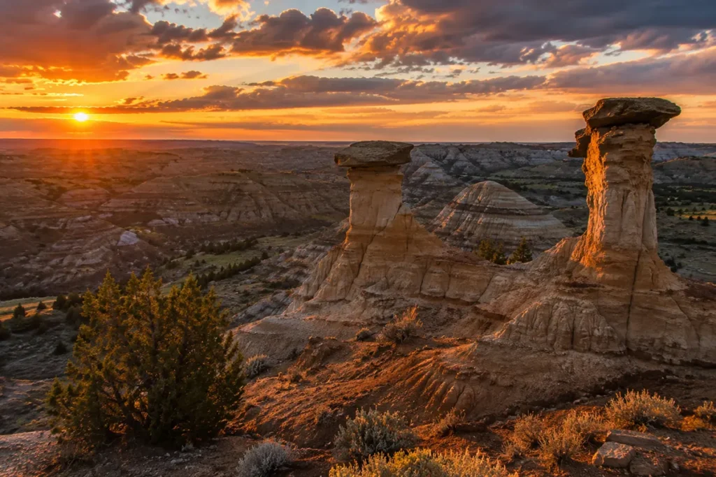
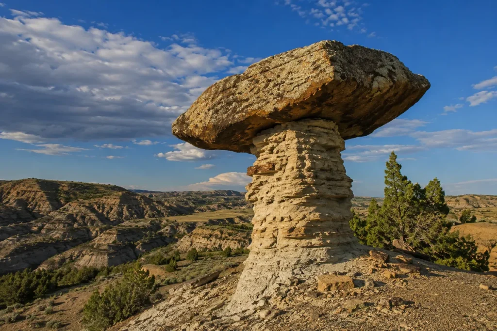
Cap Rock Trail (~0.5 miles, easy)
The signature short hike. Cap rocks are the iconic Makoshika feature — large boulders sitting atop pillars of softer sandstone that have eroded out from underneath. Cap Rock Trail walks you through and under several of them. The natural arch on this trail is one of the most photographed features in the park.
Best time: Late afternoon for the light. Worth it for: Photographers, geology fans, families.
Diane Gabriel Trail (~0.8 miles, easy-moderate)
Named after a local fossil hunter, this loop trail passes near actual fossil sites and features a viewing area where a Hadrosaur fossil was excavated. Plenty of overlooks; minimal shade.
Best time: Morning to beat the heat. Worth it for: Anyone interested in the paleontology story.
Kinney Coulee Trail (~1.0 miles, moderate)
A steeper descent into a coulee (Montana slang for a small, dry canyon) with views back up to the badlands cliffs. Loose footing in places. Less trafficked than Cap Rock.
Best time: Early morning or late afternoon. Worth it for: Hikers wanting to actually descend into the badlands rather than overlook them from above.
Bluebird Trail / Birdseye Overlook (~1.0 miles, easy)
Starts near the visitor center and climbs to one of the most expansive views in the park. The trail is gentle enough for kids; the view is one of the highlights.
Best time: Sunrise or sunset. Worth it for: First-timers wanting one big view without major effort.
Paramount Trail (longer, moderate)
The connector trail between the visitor center area and the Diane Gabriel trailhead. Useful if you want to extend a day-hike.
Backcountry Drive
The park’s scenic drive winds through the badlands with multiple pullouts, the outdoor amphitheater, and access to the Cap Rock area in the upper section. Sections are gravel; check road conditions in spring and after heavy rain. RVs and trailers should stick to the main drive — some upper sections aren’t suitable.
The Visitor Center
Genuinely good. Most state park visitor centers are utilitarian; Makoshika’s is the exception. You’ll find:
- A full Tyrannosaurus rex fossil on display
- A complete Triceratops skull
- A cast of Thescelosaurus, the herbivore dinosaur found within park boundaries
- Interpretive exhibits explaining the Hell Creek Formation geology
- A small gift shop with locally made items and field guides
- Restrooms and water (drinking water available year-round)
Open daily 9 a.m. to 5 p.m. in summer; reduced hours in shoulder seasons; closed some winter days. [verify current 2026 hours]
If you have kids, the visitor center alone justifies stopping by — the dinosaur fossils on display are real, the exhibits are well-curated, and the rangers are knowledgeable.
Wildlife at Makoshika
The wildlife here is plains country wildlife, not mountain wildlife. What you’re likely to see:
- Mule deer — common, especially at dusk near the campground
- Wild turkeys — large flocks, often near the entrance
- Golden eagles — soaring above the cliffs, year-round
- Turkey vultures — return every spring (more on this below)
- Prairie rattlesnakes — yes, they’re here; watch your step on trails in summer. See my Montana rattlesnakes guide for safety basics.
- Coyotes — heard more than seen, especially at dawn and dusk
- Pronghorn antelope — at the park edges and adjacent prairie
You won’t see grizzlies, wolves, or moose here — those are western Montana animals. But the badlands ecosystem supports its own quiet biodiversity. Endangered and threatened species in Montana covers the conservation context for the broader region.
Buzzard Day: Makoshika’s Quirky Annual Tradition
Every spring, turkey vultures return to Makoshika after their winter migration. The park hosts an informal “Buzzard Day” celebration in June — typically the first or second weekend — to welcome them back.
It involves interpretive talks, bird-watching activities, food vendors, and the kind of community feel you only get at small-town park events.
If you want a quintessentially eastern-Montana state park experience, time your visit for Buzzard Day. [verify exact 2026 dates with Montana FWP]
Stargazing and Dark Skies
This is one of Makoshika’s underrated features. Glendive is far enough from major cities — Billings is 220 miles away, Bismarck (ND) is 200+ miles — that the night sky is genuinely dark.
On a clear moonless night, you can see the Milky Way’s structure with the naked eye, including the dark dust lanes most travelers from cities have never seen.
The park’s amphitheater area in the upper section is the best spot. Some summer evenings include ranger-led astronomy programs. For broader stargazing context, Montana’s night sky guide covers the best dark-sky destinations across the state.
Pro tip: Plan an overnight in the park if dark skies are a priority. Driving back to Glendive after dark means lights, headlights, and missed views.
Camping and Facilities
Makoshika has 15 designated campsites, available on a first-come-first-served and reservation basis through stateparks.mt.gov. Sites range from basic tent-only to RV-capable.
Tipi camping is one of Makoshika’s distinctive offerings — you can reserve a furnished tipi for an overnight stay, complete with cots, for a unique sleeping experience. Books up well in advance for summer weekends.
Facilities include:
- Flush and vault toilets
- Drinking water year-round
- Picnic tables and grills
- Group-use shelter
- Outdoor amphitheater
- Archery range
- Disc golf course (yes, really)
There are no showers in the park. For showers and full RV hookups, head into Glendive — see Montana’s best RV parks for nearby options.
Best Time to Visit: Month by Month
May: Excellent. Wildflowers, mild temperatures (50s–70s), shoulder-season crowds. Montana in May covers the broader picture.
June: My favorite month. Long days, Buzzard Day events, warm but not punishing. Montana in June.
July–August: Avoid if possible. Eastern Montana badlands routinely hit 95–100°F. There is no shade. Hiking in this is genuinely dangerous. Montana in July and Montana in August explain the broader heat.
September: Probably the best month overall. Cool nights, warm days, clear skies, fall light on the badlands. Montana in September.
October: Fantastic if you catch the right week. Cold mornings, dramatic light, almost no other visitors. Montana in October.
November–March: Park is open but largely empty. Cold (down to -20°F some winter nights), occasional snow. The badlands in snow are surreal but you’ll have them entirely to yourself.
For the broader Montana seasonal calendar, best time to visit Montana covers the regional patterns.
Pairing Makoshika with Other Eastern Montana Destinations
Makoshika doesn’t stand alone — it anchors a far-east Montana loop most travelers never take. Here’s how to build the trip:
The Fort Union Loop (2–3 days)
Makoshika → drive north to Sidney → Fort Union Trading Post National Historic Site at the ND border → loop back via the Yellowstone River corridor. This is the essential far-east Montana experience.
The Theodore Roosevelt Extension (4+ days)
Cross into North Dakota and add Theodore Roosevelt National Park’s South Unit (Medora) and North Unit. Same Hell Creek geology, NPS amenities, and another full day of badlands hiking. This is the most natural multi-park badlands trip in the West.
The Glendive Town Stop
Glendive itself has more than most travelers expect — the Frontier Gateway Museum, the paddlefish-snagging fishery on the Yellowstone River (one of the largest paddlefish runs in North America), a working downtown with restaurants and a brewery. Plan a half-day in town to combine with your park visit.
Pair with Other Eastern Montana Towns
Driving back west, Miles City is a natural overnight stop with the World-Famous Miles City Bucking Horse Sale (third weekend of May) and the Range Riders Museum.
Personal Tips: What I Wish I’d Known on My First Visit
A handful of hard-earned lessons from multiple Makoshika trips:
Drive in the afternoon, hike in the morning. The badlands light is best in late afternoon, but the heat is worst in midday. Arrive at the visitor center around 4 p.m., do the easy stuff, camp overnight, hike the major trails by 9 a.m. the next day before it gets hot.
Bring more water than you think you need. There’s no shade on most trails. The badlands amplify heat. Carry at least a liter per person per hour of hiking time in summer.
Watch for prairie rattlesnakes. They’re here, they’re in the trail corridors, and they don’t always rattle before striking. Wear closed-toe shoes, watch where you step, and don’t reach into rock crevices.
Cell service disappears in the park. Coverage is fine in Glendive but spotty within Makoshika. Download offline maps before you arrive.
The scenic drive’s upper section is rougher than it looks. Sections are gravel, and after heavy rain, they can be muddy. Standard passenger cars are fine in good weather; check conditions at the visitor center first.
Fossil viewing isn’t constant. The cool thing about Hell Creek geology is the fossils continue eroding out — but you may walk a full trail without seeing exposed bone. The visitor center display is the guaranteed dinosaur-fossil experience.
Pack food for Glendive. Glendive has restaurants, but they’re not abundant. If you’re picky or have dietary restrictions, stock up in Billings or Miles City before arrival.
The bug season matters. Montana’s bug season guide — mosquitoes are minimal in the badlands but ticks are present in grassy areas in spring.
Pair with Other State Park Children
For the broader cluster, consider:
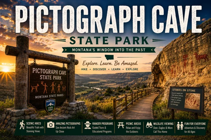
- History-focused traveler: Pair Makoshika with Bannack State Park (western Montana ghost town) and Pictograph Cave State Park (ancient rock art near Billings) for Montana’s deepest-history loop
- Geology-focused traveler: Pair Makoshika with Lewis & Clark Caverns (limestone caves) and Yellowstone’s geothermal features for the Montana geology grand tour
- Solitude-seeker: Pair Makoshika with Sluice Boxes State Park (central Montana limestone canyon) and Bear Paw Battlefield for the empty-Montana experience
Practical Info Box
| Topic | Quick Answer |
|---|---|
| Day-use fee | $8/vehicle (non-resident) [verify 2026] |
| Camping reservations | stateparks.mt.gov |
| Visitor center hours | 9 a.m.–5 p.m. summer; reduced shoulder season |
| Driving distance from Billings | 220 miles (~3.5 hours) |
| Driving distance from Bozeman | 360 miles (~5.5 hours) |
| Driving distance from Glacier | 540 miles (~8 hours) |
| Closest airport | Billings Logan (BIL) — see Montana airports |
| Cell service | Spotty inside park; reliable in Glendive |
| Best entry season | May–June or September–October |
| Tipi camping available? | Yes — book well in advance for summer |
| Pair with | Fort Union NHS, Theodore Roosevelt NP (ND), Miles City |
| Pair with state park child | Pictograph Cave, Bannack |
Conclusion: The Best State Park Most Travelers Never See
Makoshika is the easiest state park to skip and one of the hardest to forget once you’ve been. The drive filters out casual visitors.
What remains is one of the most distinctive landscapes in Montana, world-class paleontology, dark skies that rival anywhere in the Lower 48, and a degree of solitude you can’t find in Glacier or Yellowstone at any time of year.
If you’re a first-time Montana visitor, Makoshika probably isn’t on your trip. If you’re returning to Montana with the goal of seeing what you missed — or you live here and haven’t crossed the state — Makoshika should be high on the list.
Plan it as a two-day commitment, camp at least one night for the stargazing, and use the visit to anchor a full eastern Montana loop with Fort Union, Miles City, and Glendive itself.
This is the deep-dive guide. For the broader Montana parks system:
- Montana state parks pillar guide — all 55+ state parks and how to choose
- Montana national parks pillar guide — the federal counterpart
- Things to do in Montana — broader trip ideas
- Montana bucket list — the essential Montana experiences
Drop any questions about Makoshika in the comments — I’ll answer from experience.
FAQs About Makoshika State Park
What is Makoshika State Park famous for?
Makoshika State Park is famous for its dramatic badlands landscapes, dinosaur fossils, unique rock formations, and scenic hiking trails. It is Montana’s largest state park and one of the best places in the state to explore prehistoric history.
Where is Makoshika State Park located?
Makoshika State Park is located just southeast of Glendive in eastern Montana. The park sits within the rugged badlands of the Missouri Plateau and offers easy access from Interstate 94.
What does “Makoshika” mean?
The name “Makoshika” comes from a Lakota phrase meaning “bad land” or “bad earth.” The name refers to the rugged terrain, steep ridges, and deeply eroded badlands found throughout the park.
How large is Makoshika State Park?
Makoshika State Park covers approximately 11,500 acres, making it the largest state park in Montana. Its vast landscape includes badlands formations, canyons, prairies, and fossil-rich areas.
Can you find dinosaur fossils in Makoshika State Park?
Yes. Makoshika State Park is renowned for its dinosaur fossil discoveries. Fossils from species such as Tyrannosaurus rex, Triceratops, and Edmontosaurus have been found in the region, although collecting fossils within the park is prohibited.
What are the best things to do at Makoshika State Park?
Popular activities include hiking, camping, wildlife viewing, photography, mountain biking, fossil exhibits, scenic drives, and attending educational programs offered by the park.
Are there hiking trails in Makoshika State Park?
Yes. Makoshika State Park features several hiking trails that wind through badlands formations, ridgelines, and fossil-rich landscapes. Trails range from short interpretive walks to longer backcountry adventures.
Can you camp at Makoshika State Park?
Yes. The park offers campgrounds with tent and RV sites, picnic tables, restrooms, and beautiful views of the surrounding badlands. Campsites can be reserved during the peak travel season.
What wildlife can you see in Makoshika State Park?
Visitors may encounter mule deer, white-tailed deer, prairie dogs, coyotes, foxes, rattlesnakes, hawks, golden eagles, and numerous other bird species throughout the park.
Is Makoshika State Park worth visiting?
Absolutely. Makoshika State Park offers a unique landscape unlike anywhere else in Montana. Its colorful badlands, rich fossil history, scenic overlooks, and outdoor recreation opportunities make it a hidden gem for nature lovers and photographers.
How much does it cost to enter Makoshika State Park?
Montana residents generally receive park access through the state parks fee included with vehicle registration. Non-residents typically pay a daily entrance fee or may purchase an annual Montana State Parks Pass.
What is the best time to visit Makoshika State Park?
Spring and fall are considered the best times to visit because of milder temperatures and excellent hiking conditions. Summer is also popular, although daytime temperatures can become quite hot.
Is Makoshika State Park family-friendly?
Yes. Families can enjoy easy trails, scenic overlooks, fossil exhibits, wildlife viewing, educational programs, and campground facilities suitable for visitors of all ages.
How far is Makoshika State Park from Glendive?
Makoshika State Park is located only a few miles southeast of downtown Glendive, making it one of the easiest and most accessible outdoor attractions in eastern Montana.
Can you mountain bike in Makoshika State Park?
Yes. Certain trails and designated areas within the park allow mountain biking, offering riders a chance to explore the rugged badlands terrain while enjoying panoramic views of the surrounding landscape.
Written by Robert Hayes, who has been driving eastern Montana’s back roads chasing fossils, history, and dark skies for over two decades.