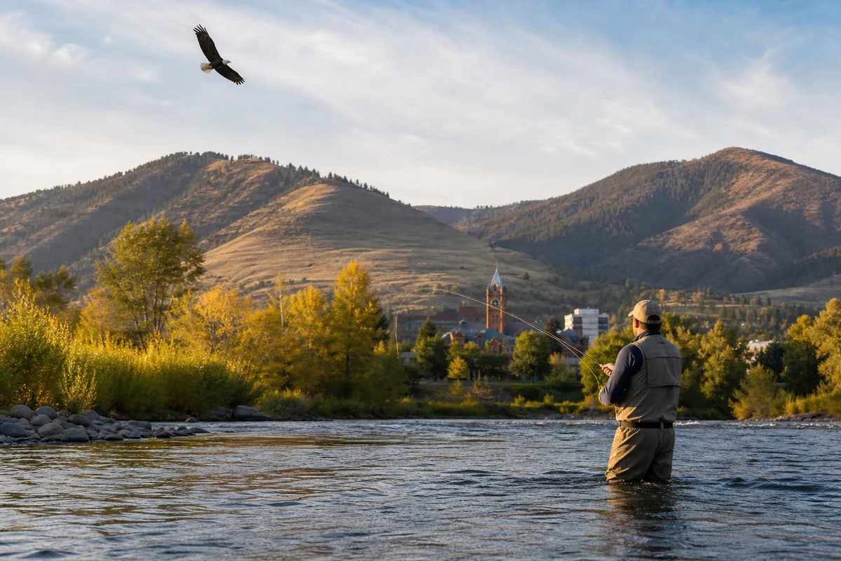
Standing at the edge of the Clark Fork River on a crisp September morning, watching a fly fisherman wade through knee-deep water while a bald eagle circled overhead, it hit me — Missoula County isn’t just a place to pass through on the way to Glacier.
It’s a destination that earns every hour you give it. Explore all 56 Montana Counties and you’ll find plenty of remarkable places, but Missoula County has a particular kind of pull that’s hard to shake once you’ve felt it.
- Missoula County sits in western Montana at the convergence of five valleys — a geography that makes it strikingly beautiful and surprisingly accessible year-round.
- The city of Missoula anchors the county with a lively arts scene, top-tier craft breweries, and a University of Montana campus that keeps the energy young and creative.
- Outdoor recreation ranges from world-class fly fishing and hiking to skiing at Montana Snowbowl and cycling on the Kim Williams Nature Trail.
- Budget roughly 3–4 days minimum to do the county justice — two days in the city and two exploring the surrounding wilderness areas.
- Summer and fall are the best seasons to visit, though winter has its own appeal for snow sports enthusiasts.
- Book accommodation early — Missoula hotels and campgrounds fill fast from June through September.
Liked this article?
Add Roaming Montana as a preferred source so you see more of our articles and guides on Google.
Where Exactly Is Missoula County?
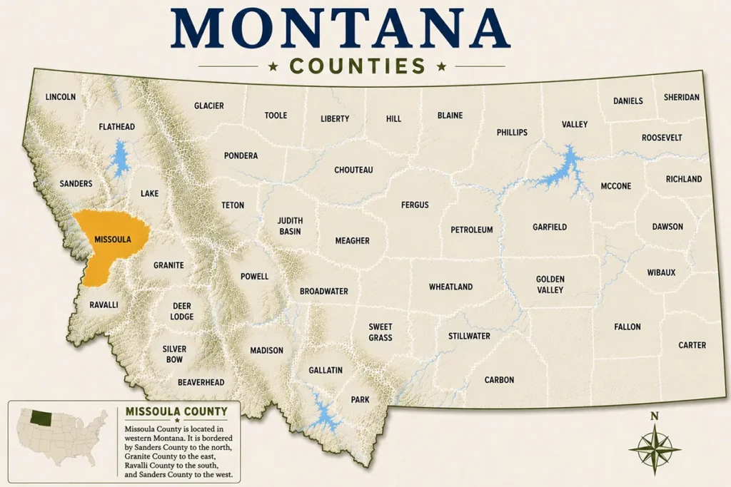
Missoula County covers roughly 2,618 square miles in western Montana, positioned at the confluence of five river valleys. The Clark Fork, Blackfoot, Bitterroot, Rattlesnake, and Hell Gate rivers all converge near the city of Missoula, creating a landscape that is both dramatic and ecologically diverse.
The county borders Mineral County to the west, Powell County to the east, Granite County to the south, and Flathead and Lake counties to the north.
That central location in western Montana makes it one of the more accessible counties in the state — Interstate 90 runs straight through the heart of it, putting Missoula within a five-hour drive of both Spokane, Washington, and Billings, Montana.
The county seat is the city of Missoula, which is home to the University of Montana and roughly 75,000 people. Smaller communities like Lolo, Clinton, Frenchtown, and East Missoula round out the county’s human geography.
A Quick History Worth Knowing
The Salish and Pend d’Oreille peoples inhabited this valley for thousands of years before European contact, and their presence shaped the landscape’s use in ways that still echo today. The name “Missoula” is generally traced to a Salish phrase meaning “near the cold chilling waters” — a fitting description for a county defined by rivers.
Lewis and Clark passed through the area in 1805 and 1806, and the Hell Gate trading post established in the 1860s gave the region its first foothold of permanent Euro-American settlement.
The arrival of the Northern Pacific Railway in 1883 transformed Missoula from a frontier trading post into a genuine regional hub almost overnight.
The University of Montana opened its doors in 1895 and has been shaping the city’s intellectual and cultural character ever since.
What surprised me on a deeper dive into local history was just how early Missoula’s environmental consciousness took root — the Rattlesnake Wilderness, established in 1982, was one of the first urban wilderness areas designated in the entire country.
The City of Missoula: What to Expect
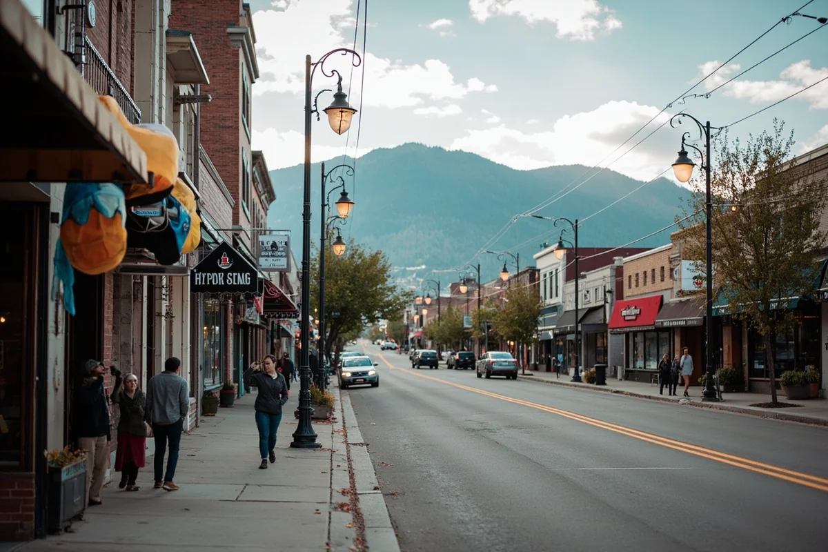
Missoula punches well above its weight for a city its size. The downtown core is compact and walkable, anchored by Higgins Avenue and the pedestrian-friendly Orange Street Bridge area.
Bookstores, coffee shops, farm-to-table restaurants, and independent galleries line the streets in a way that feels genuinely lived-in rather than curated for tourists.
The University of Montana campus sits just east of downtown and is absolutely worth a walk-through. The oval at the center of campus is one of the prettiest in the American West, especially in autumn when the cottonwoods turn gold.
On game days, the atmosphere around Washington-Grizzly Stadium is electric in a way that only small-city college football can be.
What most guides skip is how strong Missoula’s arts scene actually is. The Montana Repertory Theatre, the Missoula Art Museum (which charges no admission), and the annual International Wildlife Film Festival all contribute to a cultural calendar that rivals cities twice the size.
During my last visit, the Missoula Farmers Market on Saturday mornings near the Clark Fork was one of the best people-watching spots I’d found in the entire state.
Outdoor Recreation in Missoula County
Hiking and Trail Running
The trail system accessible from within Missoula city limits is genuinely remarkable. Mount Sentinel, the mountain with the large “M” visible from downtown, has a popular trail that climbs steeply to the top — the trailhead parking fills up before 8 a.m. on summer weekends, so plan accordingly.
The Rattlesnake National Recreation Area and Wilderness begins just a few miles north of downtown and offers everything from easy, flat creek walks to multi-day backcountry routes.
The Spring Gulch area within Rattlesnake NRA is a favorite among trail runners for its looping network of single-track through old-growth ponderosa pine.
The Kim Williams Nature Trail runs along the Clark Fork River east of downtown and is perfect for walkers, runners, and cyclists who want a mellow, flat experience with great river views. On a midweek morning, you’ll share it with local dog walkers and fly fishermen heading to their spots.
Fly Fishing
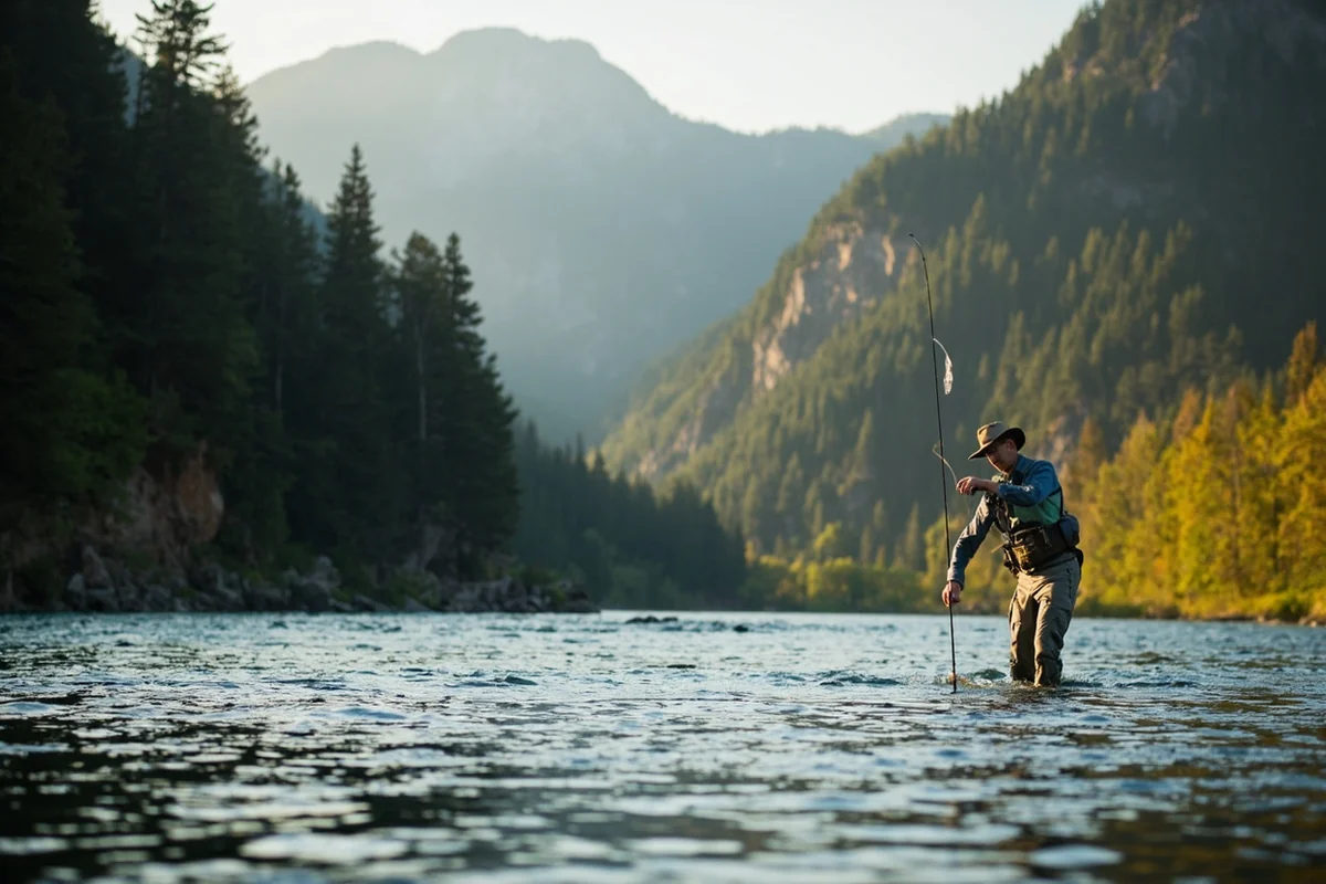
Missoula County sits at the center of some of Montana’s finest fly fishing water. The Clark Fork River, the Blackfoot River (made famous by Norman Maclean’s A River Runs Through It), and the Bitterroot River all flow through or near the county.
According to Montana Fish, Wildlife & Parks, the Clark Fork supports healthy populations of brown and rainbow trout throughout the county section.
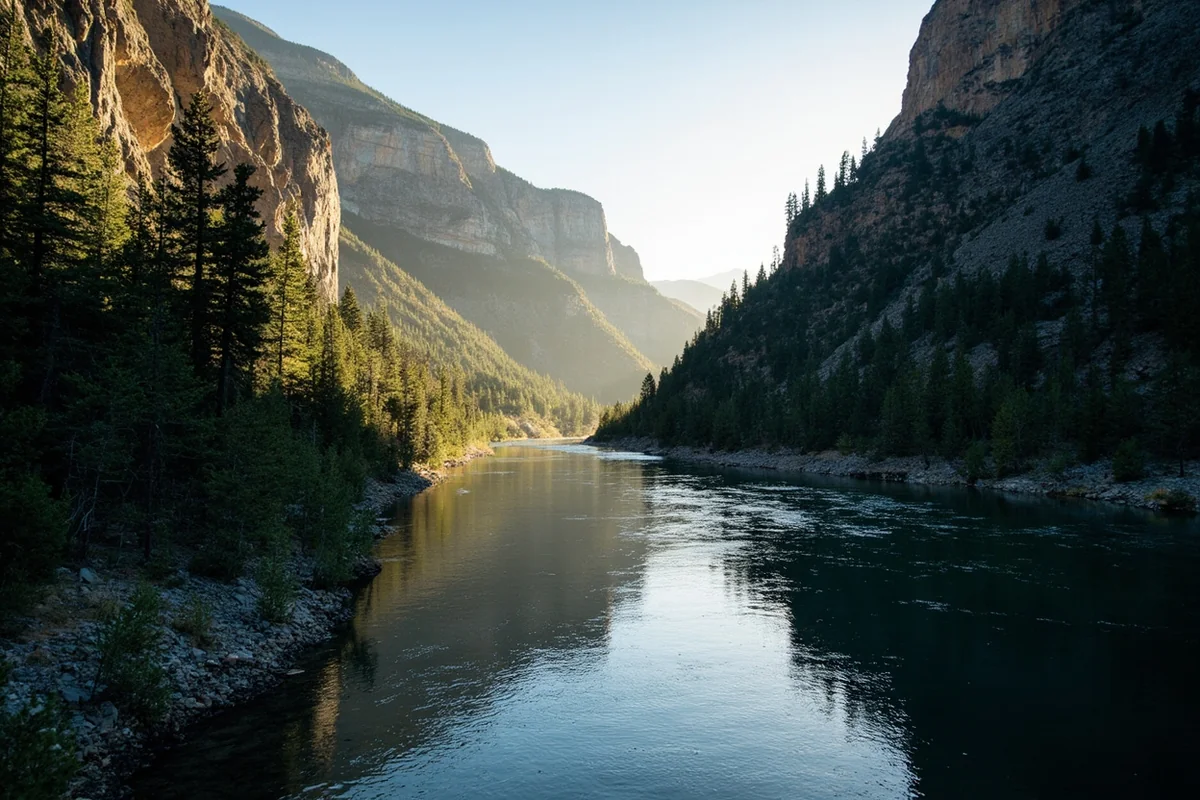
The Blackfoot River is a particular standout — what I didn’t expect was how remote it feels even just 20 miles from downtown Missoula, with canyon walls dropping straight to the water and almost no development visible from the river itself.
Local outfitters offer guided half-day and full-day float trips that range in price but typically run from roughly $200 to $400 per person depending on group size and duration. Booking a week or more in advance during peak summer season is strongly advised — the better guides fill their calendars fast.
Skiing and Winter Recreation
Montana Snowbowl is Missoula County’s downhill ski area, located about 12 miles north of downtown. It’s a smaller, locals-heavy mountain with a personality that stands out from Montana’s bigger resort areas.
The runs are genuinely challenging — Snowbowl has some of the steepest in-bounds terrain in the state — and the lack of crowds means you actually get to ski it.
Lift tickets typically run less than many comparable Montana ski areas, making it an appealing budget option. The snowpack varies year to year, but the mountain generally operates from late November through April.
Cross-country skiing and snowshoeing in the Rattlesnake NRA provide lower-key winter alternatives directly from the city.
Cycling
Missoula has repeatedly been recognized as one of the most bike-friendly cities in the American West. The network of bike lanes and paths is unusually well-developed for a Montana city, and the relatively flat terrain near the river makes urban cycling genuinely practical.
The Bitterroot Trail, a paved multi-use path that extends south from Missoula toward Hamilton in Ravalli County, is a particular favorite for longer recreational rides. Rental shops near downtown make it easy to arrive without a bike and still spend a quality afternoon on two wheels.
Natural Areas and Scenic Drives
Rattlesnake National Recreation Area
It’s hard to overstate how unusual it is to have a federally designated wilderness area beginning within city limits. The Rattlesnake NRA protects nearly 62,000 acres of forested mountains, alpine lakes, and creek drainages just north of Missoula.
The paved road into the lower recreation area transitions quickly to trails through Douglas fir and western larch, with excellent wildlife viewing opportunities for deer, black bear, and occasionally moose.
Lolo Pass and the Bitterroot Range
Driving south from Missoula on US-93 toward Lolo and then west on US-12 toward Lolo Pass is one of the county’s great scenic experiences.
The pass sits at 5,233 feet on the Idaho border and was the same route Lewis and Clark struggled over in 1805. The views back across the Bitterroot Valley on a clear day are genuinely breathtaking.
The Lolo National Forest encompasses much of the western and northern portions of Missoula County, giving the county an extraordinary public land footprint.
According to the U.S. Forest Service, Lolo National Forest covers approximately 2.1 million acres — much of that in Missoula County — making this one of the more accessible national forests in Montana.
The Clark Fork River Corridor
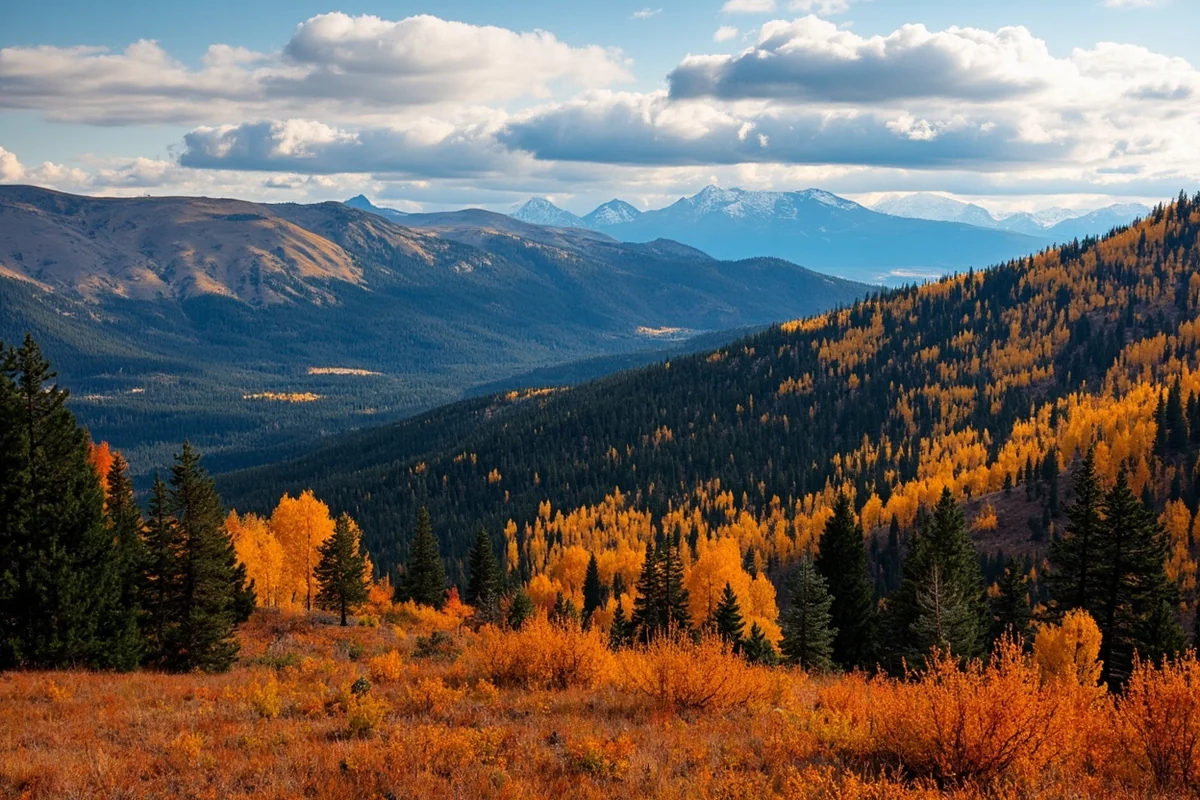
The Clark Fork River runs through the heart of the county, and following it by car or bike reveals a constantly changing landscape.
From the urban river parks in downtown Missoula to the remote canyon stretches east of town near Clinton, the river corridor rewards those who take the time to stop and explore rather than simply drive through.
Food, Drink, and Local Culture
Missoula’s food scene is better than many first-time visitors expect. The farm-to-table movement took hold here early, and several restaurants have maintained strong sourcing relationships with local producers for over a decade.
The downtown core has options ranging from casual breakfast spots to genuinely impressive dinner restaurants, with price points that tend to be more reasonable than comparable meals in Bozeman or Whitefish.
The craft beer culture deserves its own mention. The city is home to a remarkable concentration of quality breweries for its size — check out our dedicated guide to Missoula breweries for a full rundown.
On a recent trip, making an afternoon loop of three or four taprooms along the river became one of the highlights of the visit, partly for the beer and partly for the conversations with locals who were clearly proud of what their city had built.
Garden City Meats, the Missoula Public Library’s rooftop garden, the Clark Fork Market — these are the kinds of details that make Missoula feel authentically local rather than tourist-branded.
Where to Stay in Missoula County
Accommodation options run the full spectrum. Downtown Missoula has a good selection of hotels ranging from budget chains to boutique properties — for a comprehensive look, our guide to hotels in Missoula, MT covers the best current options across different price ranges.
Expect to pay more during University of Montana football games and graduation weekends — those dates book out months in advance.
For RV travelers, Missoula has several well-located campgrounds. Our full guide to RV parks in Missoula, Montana is worth reading before you book. The sites along the Clark Fork River corridor are particularly popular and fill quickly in summer.
Vacation rentals through short-term platforms have expanded significantly in the county over the past five years, giving visitors more flexibility in areas like Lolo and the Rattlesnake neighborhood. Booking 4–6 weeks ahead for summer travel is a reasonable minimum; 8–10 weeks is safer if you’re particular about location.

Practical Information at a Glance
| Category | Details |
|---|---|
| County Seat | Missoula |
| Population (approx.) | ~120,000 (county-wide) |
| Area | ~2,618 square miles |
| Nearest Airport | Missoula Montana Airport (MSO) — served by major US carriers |
| Best Time to Visit | June–September (hiking/fishing); December–March (skiing) |
| Average Summer High | Mid-80s°F (late June through August) |
| Average Winter Low | Around 20°F (December–February) |
| Cell Coverage | Strong in city; limited in Rattlesnake Wilderness and remote river canyons |
| Key Road | Interstate 90 (east–west); US-93 (north–south) |
| Public Land Manager | Lolo National Forest (U.S. Forest Service) |
Suggested Itinerary
Missoula County warrants at least a weekend — ideally four days if you want to explore beyond the city. Here’s how to structure two solid days without feeling rushed.
Day 1: The City and the River
Start the morning at the Clark Fork Farmers Market (Saturdays only, May through October) or grab breakfast at one of the diners near the university. The Higgins Avenue Bridge and the river walk take less than an hour and set the geographical context for the whole county beautifully.
Mid-morning is ideal for the Missoula Art Museum — it’s free, compact, and has a strong permanent collection of Montana and Indigenous art.
From there, walk up to the base of Mount Sentinel and decide based on your energy level whether you want to tackle the “M” trail (steep, rewarding, about 45 minutes up) or save it for another day.
Spend the afternoon exploring the downtown bookstores, coffee shops, and gallery district before heading to one or two breweries in the late afternoon. By evening, book a table at one of the farm-to-table restaurants near the river — reservations on Friday and Saturday nights are essential in summer.
Day 2: Into the Wilderness and Along the Blackfoot
An early start matters here. Drive east out of Missoula on Highway 200 along the Blackfoot River by 7:30 a.m. and you’ll have the canyon largely to yourself.
There are several roadside pullouts where the river access is excellent for a morning fishing session — a valid Montana fishing license is required and available online through Montana Fish, Wildlife & Parks.
Stop at Johnsrud Park (about 25 miles from Missoula) for a picnic lunch and a short nature walk. The ponderosa pine forest here is particularly striking in late summer when the air carries that distinctive vanilla scent from the bark.
In the afternoon, loop back through Missoula and head north into the Rattlesnake NRA for a mellow late-afternoon hike along Rattlesnake Creek before dinner.
What Most Visitors Get Wrong About Missoula County
The biggest mistake is treating Missoula as just a one-night stopover on the way to Glacier or Yellowstone.
That’s understandable — the city is conveniently positioned on I-90 and it’s easy to rationalize a quick dinner and a night’s sleep. But visitors who do this almost universally wish they’d given it more time.
A close second is underestimating wildfire smoke season. Late July and August in western Montana can bring significant smoke from regional wildfires, reducing air quality and limiting mountain views on some days.
Checking the AirNow.gov forecast before planning outdoor activities became a routine part of my summer visits after one surprisingly hazy week caught me off guard in late July.
Also, don’t assume the Blackfoot River is always gentle. Water levels and conditions change significantly between spring runoff (often dangerously high through May) and late summer low flows. Checking current conditions through the USGS National Water Information System before floating or wading is a habit worth forming.
Finally, parking downtown on weekends and during University events is more challenging than the city’s manageable size might suggest. The parking structures off Ryman Street and Pattee Street are your best bets — street parking on Higgins Avenue turns over quickly but is rarely guaranteed.
Missoula County in the Context of Western Montana
It’s worth situating Missoula County within the broader western Montana travel picture. Missoula is one of Montana’s fastest-growing areas — as noted in our piece on Montana’s fastest growing cities and counties — which means infrastructure and services have generally kept pace with visitor demand better than in some more rural parts of the state.
Travelers building a longer Montana itinerary often combine Missoula County with nearby destinations. Flathead County and Glacier are roughly 1.5 to 2 hours north.
Granite County is just to the south and offers a quieter, less-visited complement to Missoula’s busier scene. Deer Lodge County to the east adds history depth with the Grant-Kohrs Ranch National Historic Site.
Those interested in exploring further afield might consider the dramatic open spaces of Garfield County or the wide-open grasslands of Blaine County — a stark and rewarding contrast to Missoula’s forested mountain world.
For something completely different in character and landscape, Beaverhead County and Carbon County each deliver their own compelling version of Montana.
Wildlife Watching in Missoula County
The county’s wildlife viewing opportunities are underappreciated compared to the more famous wildlife corridors around Yellowstone or Glacier.
Black bears are regularly spotted in the Rattlesnake NRA and along the Lolo National Forest roads — during a late September hike in the Rattlesnake, a black bear crossed the trail about 80 feet ahead of me, paused to assess the situation, and moved calmly into the undergrowth. No drama, but a reminder to carry bear spray.
White-tailed deer and mule deer are common throughout the county, particularly active at dawn and dusk. Osprey and bald eagles are visible along the Clark Fork and Blackfoot rivers throughout summer and fall. Elk populations are strong in the Rattlesnake and along the Lolo Creek drainage, and fall bugling season (mid-September through October) is particularly atmospheric in the forest above Missoula.
The Missoula area also attracts serious birders. According to the Rocky Mountain Bird Observatory, western Montana’s river valleys host exceptional diversity during spring migration, and the Rattlesnake NRA alone has recorded over 140 bird species.
Getting to Missoula County
Missoula Montana Airport (MSO) is served by several major carriers including Alaska Airlines, Delta, United, and Southwest. Nonstop flights connect Missoula to Seattle, Salt Lake City, Denver, Los Angeles, Phoenix, and a handful of other hubs. Fares tend to be reasonable by Montana airport standards, though booking early for summer travel is always advisable.
Driving into Missoula County on I-90 from the west (Spokane direction) or the east (Butte/Bozeman direction) is straightforward year-round. Winter driving on mountain passes — particularly Lookout Pass on the Idaho border — can be challenging in heavy snow conditions. The Montana Department of Transportation’s 511 system is the most reliable source for current road conditions.
Amtrak’s Empire Builder route passes through the northern edge of Montana but does not serve Missoula directly. Greyhound bus service does connect Missoula to regional hubs, though schedules are limited.
Final Thoughts
Missoula County is the kind of place that earns your loyalty gradually. The first day you’re charmed by the city’s energy and the river. By the second day you’re deep in a forest wondering why you ever thought you’d leave. By the time you actually have to go, you’re already planning the return.
What makes this county stand out among the 56 Montana Counties is the rare combination of genuine outdoor wilderness and genuine urban culture — both at a quality level that’s hard to find together in a state where you usually have to choose one or the other. Other counties like Cascade County, Gallatin County, and Jefferson County offer their own compelling mixes, but Missoula’s particular balance feels especially well-calibrated for the modern traveler.
Come for the rivers. Stay for the bookstores. Leave already thinking about the trails you didn’t get to. That’s Missoula County in a sentence.
How We Researched This Guide
This guide is based on multiple personal visits to Missoula County across different seasons — including summer, early fall, and winter — combined with firsthand exploration of the major attractions, trails, and neighborhoods covered above.
Information was verified with the U.S. Forest Service (Lolo National Forest), Montana Fish, Wildlife & Parks, the Montana Department of Transportation, and the official Destination Missoula tourism board.
Conversations with local outfitters, brewery staff, and longtime Missoula residents helped shape the practical recommendations and insider observations throughout.
Frequently Asked Questions
What is the best time of year to visit Missoula County, Montana?
The best time to visit Missoula County is late spring through early fall, roughly May through September, when temperatures are mild and outdoor activities like hiking, fishing, and rafting are in full swing. July and August offer the warmest weather with highs in the low 80s°F, though the area can get busy with summer tourists. If you prefer fewer crowds and don’t mind cooler temps, late September and early October are stunning for fall foliage along the Clark Fork River corridor.
How far is Missoula County from major US cities and how do most travelers get there?
Missoula sits roughly 500 miles northeast of Seattle, about 340 miles west of Billings, and around 115 miles west of Helena, making it one of the more accessible entry points into western Montana. Most US travelers fly into Missoula Montana Airport (MSO), which has direct flights from Seattle, Denver, Salt Lake City, Los Angeles, and Minneapolis. Driving is also popular from the Pacific Northwest, with Missoula reachable in about 7-8 hours from Seattle via I-90 East.
What are the top outdoor things to do in Missoula County for first-time visitors?
First-time visitors to Missoula County should not miss hiking the popular ‘M’ Trail on Mount Sentinel for sweeping views over the city, fishing or floating the Clark Fork and Bitterroot Rivers, and exploring the Rattlesnake National Recreation Area just minutes from downtown. The Rattlesnake Wilderness offers over 30 miles of trails ranging from easy walks to strenuous backcountry routes, perfect for hikers of all experience levels. Wildlife watching is also excellent here, with white-tailed deer, black bears, and osprey commonly spotted throughout the county.
How much does a trip to Missoula County, Montana typically cost per day?
Budget travelers can get by on roughly $80-$120 per day in Missoula County by staying at one of the area’s well-reviewed hostels or budget motels, eating at local diners and food trucks, and taking advantage of the many free trails and parks. Mid-range travelers should plan on $150-$250 per day, which covers a decent hotel near downtown, sit-down meals at Missoula’s excellent farm-to-table restaurants, and guided outdoor activities like fly fishing or river rafting tours starting around $75-$150 per person. Accommodation ranges from around $70/night for budget options to $200+ per night at boutique hotels during peak summer season.
Is Missoula County a good base for exploring other parts of Montana?
Yes, Missoula County makes an excellent base for exploring western Montana, with Glacier National Park just 1.5-2 hours north via US-93, the stunning Bitterroot Valley about 30 minutes south, and the ghost towns and hot springs of the Garnet Range within an hour’s drive. The city of Missoula itself sits at a geographic crossroads where several major valleys meet, giving you easy access to multiple mountain ranges and recreational areas without long daily drives. If you’re road-tripping across Montana, Missoula is a natural midpoint stop on an I-90 route between Spokane and Billings.
What should I pack for a trip to Missoula County, Montana?
Pack in layers for Missoula County regardless of the season, as mountain weather can shift quickly with warm afternoons turning into cool evenings even in July. Sturdy hiking boots, sun protection, and a reusable water bottle are essential for exploring the county’s many trails, while a light rain jacket handles the occasional summer afternoon thunderstorm. If you’re visiting between June and August, bring bug spray for riverside areas, and if you’re planning any backcountry hiking in the Rattlesnake Wilderness, carry bear spray and a paper map since cell service can be spotty.
Are there family-friendly activities in Missoula County that are worth planning around?
Missoula County is genuinely one of the more family-friendly destinations in Montana, with Caras Park along the Clark Fork River hosting free summer events, a popular carousel, and easy riverside walking paths that work great for younger kids. The Missoula Children’s Theatre, the Montana Natural History Center, and the Smokejumper Visitor Center near the airport all offer engaging, low-cost experiences for families traveling with kids of various ages. For active families, the Riverfront Trail system connects several miles of paved paths through the city, making it easy to bike or walk with children without needing a car.