Have you ever wondered where exactly “Big Sky Country” is located on a map? Montana, the fourth-largest state in the U.S., often eludes precise placement in the minds of many. But pinpointing this majestic state is more than just a geography lesson—it’s the key to unlocking a world of breathtaking landscapes, rich history, and outdoor adventures.
From its towering Rocky Mountains to its vast eastern plains, Montana’s location shapes its unique character and allure. In this comprehensive guide, we’ll not only help you find Montana on the map but also explore its geographic coordinates, bordering states, land mass, population distribution, and the incredible natural wonders that make it a must-visit destination.
Whether you’re planning a trip or simply satisfying your curiosity, join us as we embark on a journey to discover the exact location and geographic significance of the Treasure State.
Table of Contents
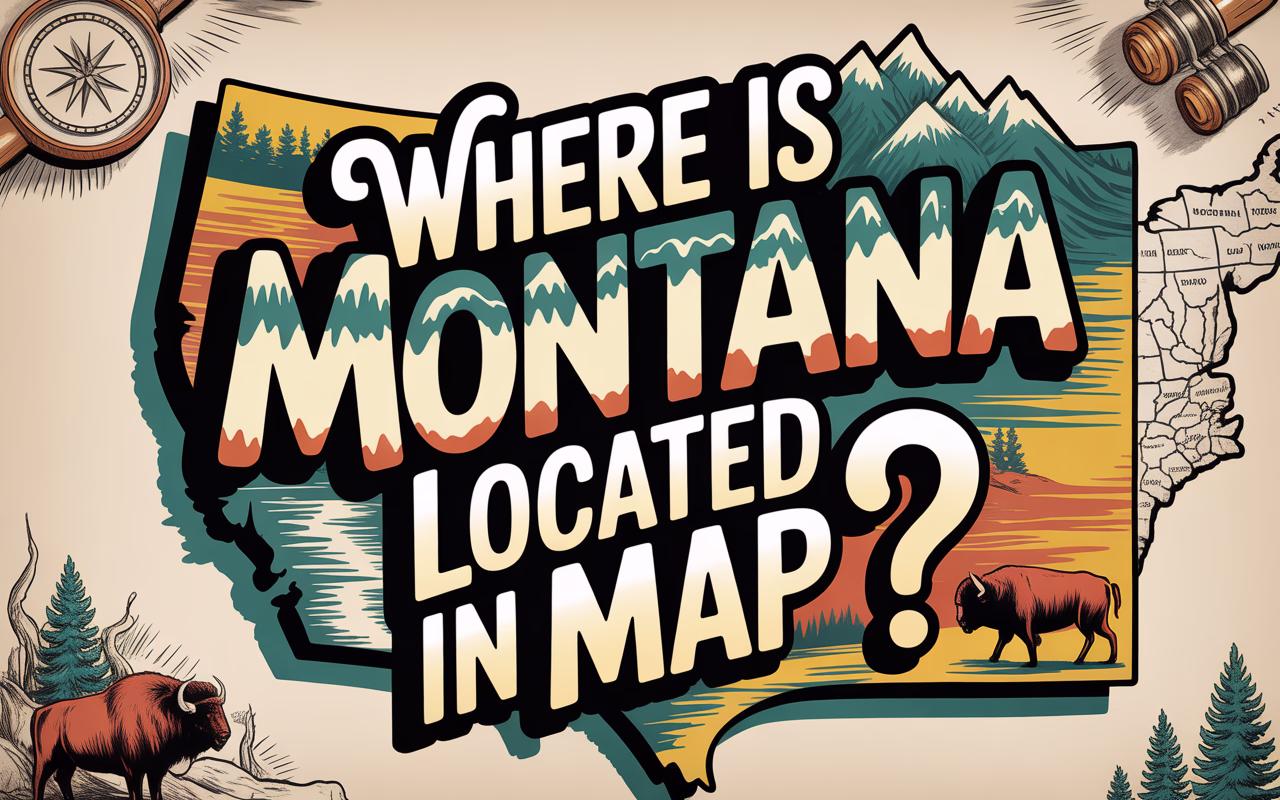
Where Is Montana Located? Finding It on a Map
Montana occupies a distinctive position in the northwestern United States, stretching across vast landscapes that embody the rugged beauty of America’s frontier. Known affectionately as “Big Sky Country,” Montana earned this nickname from its expansive horizons where the azure sky seems to extend endlessly above its diverse terrain. The state sits in the heart of the American Northwest, a region characterized by mountainous landscapes, sweeping plains, and pristine wilderness areas.
Geographically speaking, Montana is the fourth largest state in the nation, covering an impressive 147,040 square miles. It’s positioned as a northern border state, with Canada’s provinces of British Columbia, Alberta, and Saskatchewan running along its northern edge. This strategic location has historically influenced Montana’s development, from its early fur trading days to modern cross-border commerce.
Understanding Montana’s location provides crucial context for appreciating its unique cultural identity, economic activities, and natural resources. The state’s position has shaped everything from its climate patterns to its historical development. As a gateway to the northern Rockies, Montana serves as both a destination for outdoor enthusiasts and a crucial connector between the Midwest and Pacific Northwest.
For travelers and geography enthusiasts alike, pinpointing Montana on a map is the first step to discovering one of America’s most geographically diverse and visually stunning states. Whether you’re planning a visit to Glacier National Park in the northwest corner or exploring the eastern plains, knowing Montana’s exact location helps frame the remarkable experiences this state has to offer.
Montana Geographic Coordinates: Exact Location
Montana stretches across a significant portion of the northwestern United States, with precise geographic coordinates that place it firmly in the northern reaches of the country. The state is located between 44°21’N and 49°N latitude, and 104°2’W and 116°2’W longitude.
These coordinates reveal Montana’s position relative to the equator and the prime meridian. The latitude coordinates (44°21’N to 49°N) indicate that Montana sits nearly halfway between the equator and the North Pole, placing it well into the northern hemisphere. The northernmost boundary at 49°N marks the international border with Canada, representing part of the straight-line border established by the 1846 Oregon Treaty.
The longitude coordinates (104°2’W to 116°2’W) position Montana in the western portion of North America, far from the prime meridian that runs through Greenwich, London. This western longitude places Montana in the Mountain Time Zone for most of the state, with a small portion in the Pacific Time Zone.
The geographic center of Montana—the point that would balance the state if it were a flat surface of uniform weight—is located in Fergus County, approximately 12 miles west of Lewistown. This central point sits at approximately 47°03’N latitude and 109°38’W longitude. Interestingly, this location is not marked by any major city or landmark, instead residing in the rolling grasslands that characterize much of central Montana.
Montana’s position in the northern latitudes contributes significantly to its climate patterns, with cold winters and relatively mild summers compared to states further south. The state’s location also places it in the rain shadow of multiple mountain ranges, creating diverse microclimates across its vast territory.
Montana’s Position in the United States
Montana proudly holds its place as the fourth-largest state in the United States, sprawling across the northwestern region of the country. This vast treasure of land encompasses an impressive 147,040 square miles, trailing only behind Alaska, Texas, and California in total area. Montana’s nickname as “Big Sky Country” is well-earned, as it stretches wide across the northern tier of the western United States.
Positioned in what’s often called the Mountain West region, Montana sits nestled against the Canadian border to the north, creating part of America’s northern boundary. The state occupies a unique geographic position that places it at considerable distances from many of America’s major population centers. From Montana’s capital of Helena, you’d need to travel approximately 850 miles to reach Seattle, 900 miles to Denver, 1,300 miles to Chicago, and over 2,000 miles to reach either New York City or Los Angeles.
This relative isolation contributes to Montana’s reputation as one of America’s last great wilderness frontiers. The state serves as a gateway to some of the country’s most pristine natural areas, including Yellowstone National Park at its southern border and Glacier National Park in the northwest. Its position also places it squarely within the Rocky Mountain range, with the Continental Divide running through the western portion of the state.
Montana’s northwestern location means it experiences four distinct seasons and varied climate patterns, from the alpine conditions of its western mountains to the prairie ecosystems of its eastern plains. This geographic positioning has shaped everything from the state’s history and economy to its culture and lifestyle, creating a unique corner of America that balances rugged individualism with natural splendor.
Montana Bordering States: Who Are Its Neighbors?
Montana shares its borders with four U.S. states and one Canadian province, creating a diverse geographical neighborhood that contributes to the state’s unique character and accessibility.
To the west, Idaho shares the longest border with Montana, stretching approximately 545 miles. This mountainous boundary follows the rugged Bitterroot Range for much of its length, creating a natural dividing line between the two states. Several mountain passes connect these neighbors, including Lolo Pass which follows the historic route of the Lewis and Clark expedition. The Idaho-Montana border region features spectacular wilderness areas including the Selway-Bitterroot Wilderness and parts of the greater Yellowstone ecosystem.
Along Montana’s southern edge lies Wyoming, with a border extending about 375 miles. This boundary includes some of America’s most spectacular landscapes, most notably where the two states meet in Yellowstone National Park. The border runs through the northeast corner of the park, with the iconic Beartooth Highway crossing between the states. The Montana-Wyoming border also encompasses the stunning Absaroka Range and portions of the Great Plains as it stretches eastward.
To the east, North Dakota shares approximately 270 miles of border with Montana. This boundary is largely defined by prairie landscapes and agricultural land. The border region features the meeting of the Yellowstone and Missouri Rivers near the town of Fairview, a significant geographical landmark. Unlike Montana’s western borders, the eastern boundary with North Dakota crosses relatively flat terrain, characterized by rolling grasslands and farmland.
In the southeast, South Dakota shares Montana’s shortest state border at roughly 245 miles. This boundary cuts across the northern Great Plains, featuring mixed grasslands and badlands formations. The border region includes parts of the Little Missouri National Grassland and is characterized by its rural nature and sparse population.
Each of these neighboring states contributes to Montana’s accessibility and regional identity. The borders themselves often reflect natural geographical features, particularly in the mountainous west, while the eastern borders follow more arbitrary straight lines established during territorial divisions. These neighboring states, along with Canada to the north, create important economic, cultural, and ecological connections that have shaped Montana’s development throughout its history.
Montana’s International Border with Canada
Montana shares a 545-mile international border with Canada along its northern edge, creating one of America’s most scenic and historically significant boundary lines. This border connects Montana with two Canadian provinces: Alberta to the northwest and Saskatchewan to the northeast.
The Montana-Canada border was established in 1846 as part of the Oregon Treaty between the United States and Great Britain, which set the 49th parallel as the official boundary. This straight-line border is part of the longest international border in the world between two countries.
There are 13 official ports of entry connecting Montana to Canada, ranging from busy commercial crossings to smaller, limited-hour checkpoints. The busiest crossing is at Sweetgrass-Coutts, connecting Interstate 15 with Alberta Highway 4, which sees significant commercial traffic and tourism year-round. Other notable crossings include Roosville, Piegan-Carway, and Raymond.
The border region features dramatic landscape transitions, from the peaks of Glacier National Park (which connects to Canada’s Waterton Lakes National Park to form the world’s first International Peace Park) to the eastern plains where agricultural lands stretch across both countries. This shared ecosystem has led to numerous conservation partnerships between the two nations.
Border communities have developed unique cross-border cultures and economies, with residents often crossing regularly for shopping, healthcare, and family visits. Many Montana border towns have sister cities in Alberta or Saskatchewan, hosting joint cultural celebrations that highlight their shared heritage.
The Montana-Canada border also plays a crucial role in trade, with billions of dollars in goods crossing annually. Agricultural products, energy resources, and manufactured goods flow in both directions, creating economic interdependence between Montana and its northern neighbors.
Despite its remoteness in many sections, the border is carefully monitored by U.S. Customs and Border Protection, with technology and personnel working to balance security concerns with the needs of cross-border commerce and tourism.
Montana’s Topography and Geographic Features
Montana lives up to its nickname “Big Sky Country” with a landscape that showcases remarkable diversity across its vast territory. The state’s topography can be divided into two distinct regions that create a stunning contrast of natural features.
In the western third of Montana, the Rocky Mountains dominate the landscape with dramatic peaks, dense forests, and pristine alpine lakes. This mountainous region is home to multiple ranges including the Bitterroot Range, the Cabinet Mountains, and portions of the Absaroka Range. The mountains create a rugged, spectacular backdrop that defines much of Montana’s iconic imagery.
The state’s highest point, Granite Peak, towers at an impressive 12,799 feet above sea level in the Beartooth Mountains near the Wyoming border. This challenging summit attracts mountaineers from around the world seeking to conquer its technical climbing routes.
Eastern Montana presents a striking contrast with vast expanses of rolling plains and badlands that stretch toward the horizon. This region forms part of the Great Plains that extend through the center of North America. The terrain features gently rolling hills, wide-open grasslands, and dramatic river valleys carved through the landscape over millennia.
Montana’s lowest elevation point is found where the Kootenai River exits the state into Idaho, sitting at approximately 1,800 feet above sea level—still relatively high compared to many other states’ low points.
Water features prominently throughout Montana’s geography. The Continental Divide runs through the western portion of the state, determining whether water flows ultimately toward the Pacific Ocean or the Atlantic. Major river systems include the mighty Missouri River, which originates in Montana at the confluence of the Jefferson, Madison, and Gallatin Rivers near Three Forks. The Yellowstone River, the longest undammed river in the contiguous United States, flows for nearly 700 miles through Montana.
Glacier-carved valleys create some of Montana’s most breathtaking scenery, particularly in Glacier National Park, where U-shaped valleys, hanging valleys, and cirques showcase the powerful forces that shaped this landscape during the last ice age.
The state also features remarkable geological formations like the Madison River Canyon, the Missouri River Breaks, and unique badland formations in eastern Montana that reveal millions of years of geological history through their colorful, eroded layers.
These diverse topographical features not only create Montana’s stunning visual appeal but also influence its climate, wildlife habitats, human settlement patterns, and economic activities throughout the state.
Montana: Land Mass and Population
Montana earns its nickname “Big Sky Country” honestly—it’s the fourth largest state in the United States with a total land area of 147,040 square miles. This vast expanse makes Montana larger than entire countries like Japan, Germany, or Italy. Despite its impressive size, Montana’s population remains remarkably small, with just over 1.1 million residents as of the most recent census data.
This combination of extensive territory and limited population gives Montana one of the lowest population densities in the nation at approximately 7.4 people per square mile. To put this in perspective, states like New Jersey have over 1,200 people per square mile. This sparse distribution creates Montana’s characteristic wide-open spaces and untouched wilderness that draws visitors from around the world.
The population distribution across Montana reveals an interesting pattern. While the state is predominantly rural, most Montanans live in a handful of population centers. Billings stands as the largest city with approximately 110,000 residents, followed by Missoula, Great Falls, and Bozeman. These urban hubs serve as commercial, cultural, and educational centers for the surrounding regions.
Montana’s urban-rural divide is particularly pronounced when examining demographic patterns. About 55% of Montanans live in urban areas or urban clusters, while 45% reside in rural settings. This nearly even split contrasts sharply with the national average, where over 80% of Americans live in urban areas. The rural character of Montana significantly shapes its culture, politics, and way of life.
The state’s population growth has been steady but modest in recent decades, with much of the increase concentrated in western Montana’s valleys and around Billings in the east. Counties containing college towns like Missoula and Bozeman have seen particularly strong growth, while some agricultural counties in eastern Montana have experienced population decline as farming becomes more mechanized and requires fewer workers.
Montana’s demographic makeup also includes 7 Indian reservations and the state-recognized Little Shell Tribe of Chippewa Indians, representing about 6.5% of the state’s population. These sovereign nations contribute significantly to Montana’s cultural heritage and contemporary identity.
Major Cities and Regions of Montana
Montana’s landscape is not only divided by its diverse geography but also punctuated by several notable cities and distinct regions, each with its own character and appeal.
Billings stands as Montana’s largest city with approximately 110,000 residents. Located in the south-central portion of the state, it serves as Montana’s economic hub, nestled in the Yellowstone Valley along the Yellowstone River. The city’s economy thrives on energy, healthcare, and agriculture, while the dramatic rimrocks (sandstone cliffs) provide a stunning backdrop to the urban landscape.
Missoula, the second-largest city, is home to about 75,000 residents and the University of Montana. Known as the “Garden City” for its dense trees and greenery, Missoula sits at the convergence of five mountain ranges and three rivers. This western Montana city has developed a reputation as a cultural center with a vibrant arts scene, outdoor recreation opportunities, and progressive atmosphere.
Great Falls, Montana’s third-largest city with around 60,000 residents, derives its name from the series of five waterfalls along the Missouri River. Located in the north-central part of the state, Great Falls has historically been shaped by its proximity to Malmstrom Air Force Base and agricultural industries. The city serves as a regional commercial center for the central Montana plains.
Bozeman, though smaller in population, has experienced rapid growth due to Montana State University and its proximity to outdoor recreation areas including Yellowstone National Park. Helena, the state capital, maintains its historic character with Victorian architecture and a downtown area built during the gold rush era.
Geographically, Montana can be divided into two distinct regions that showcase the state’s dramatic diversity:
The Western Region is characterized by the Rocky Mountains, with numerous ranges creating valleys that house most of Montana’s larger cities. This mountainous landscape features dense forests, alpine lakes, and dramatic peaks. Western Montana enjoys a milder climate influenced by Pacific weather patterns and contains much of the state’s tourism infrastructure, including Glacier National Park and numerous ski resorts.
The Eastern Region transitions to high plains and prairie, forming part of the Great Plains that stretch across North America’s interior. This region is characterized by rolling grasslands, badlands formations, and river breaks. Eastern Montana is less populated but economically significant for its agricultural production and energy resources, including oil, gas, and coal deposits.
The Continental Divide runs through western Montana, creating a natural boundary that determines whether water flows toward the Pacific Ocean or the Atlantic. This geographic feature has influenced settlement patterns and transportation routes throughout Montana’s history.
Montana’s Natural Resources and Land Use
Montana’s vast landscape harbors an impressive array of natural resources that have shaped the state’s economy and identity. Often called the “Treasure State,” Montana earned this nickname for good reason.
The state’s mineral wealth includes significant deposits of copper, gold, silver, lead, zinc, and platinum. The historic copper mines of Butte once produced enough copper to earn it the nickname “The Richest Hill on Earth.” Today, while mining remains important, it operates alongside more sustainable resource management practices.
Montana’s land use reflects a balance between conservation and utilization. Approximately 30% of Montana is public land, managed by various federal and state agencies. This includes:
- National Parks: Glacier National Park and portions of Yellowstone National Park showcase Montana’s most spectacular landscapes, protecting unique ecosystems while providing recreational opportunities.
- National Forests: Montana contains parts of 10 national forests, including the Bitterroot, Flathead, and Lewis and Clark National Forests, covering over 16 million acres.
- Wilderness Areas: The state boasts 15 designated wilderness areas, including the Bob Marshall Wilderness Complex, one of the largest intact ecosystems in the lower 48 states.
Agriculture dominates Montana’s private land use, with nearly two-thirds of the state dedicated to farming and ranching. The eastern plains support extensive wheat cultivation and cattle ranching, while the western valleys accommodate diverse crops and livestock operations.
Water resources play a crucial role in Montana’s landscape. The state contains the headwaters of three major continental watersheds: the Columbia, Missouri, and Saskatchewan river systems. These water resources support agriculture, wildlife, recreation, and hydroelectric power generation.
Montana’s forests cover approximately 25 million acres, primarily in the western portion of the state. These forests support a timber industry while providing habitat for wildlife, watershed protection, and recreational opportunities.
Energy resources have become increasingly important in Montana’s economy. The state possesses significant coal reserves in the Powder River Basin, oil and natural gas deposits in the east, and growing renewable energy development, particularly wind farms along the eastern front of the Rocky Mountains.
This blend of extractive industries, agriculture, and protected lands creates a complex mosaic of land use that reflects Montana’s ongoing balance between economic development and environmental stewardship.
Climate and Weather Patterns in Montana
Montana’s climate is as diverse as its landscape, creating a fascinating patchwork of weather conditions across the state. The old saying that “if you don’t like the weather in Montana, wait five minutes” rings particularly true in this northern Rocky Mountain state.
Montana experiences a primarily semi-arid continental climate, but this varies significantly by region. The state can be divided into roughly three climate zones: the western mountainous region, the central valleys, and the eastern plains.
In western Montana, the Rocky Mountains create a modified climate zone where temperatures are generally milder than the rest of the state. The mountains act as a barrier to Arctic air masses, while Pacific air influences bring more moisture. This region receives significantly more precipitation, with some mountain areas accumulating over 100 inches of snowfall annually.
Central Montana features intermountain valleys and experiences a transitional climate. Here, the rain shadow effect of the mountains results in drier conditions than the west, but still more precipitation than the eastern plains.
Eastern Montana presents a classic continental climate with greater temperature extremes and less precipitation. This region, part of the Northern Great Plains, experiences hot summers and very cold winters with relatively low annual rainfall (typically 10-15 inches).
Seasonal variations in Montana are pronounced. Winters can be brutally cold, especially in the eastern plains and at higher elevations. January temperatures often drop below zero Fahrenheit, with record lows approaching -70°F in some locations. Chinook winds—warm, dry downslope winds—occasionally provide brief winter respite, causing temperature increases of up to 40°F in just hours.
Summers bring pleasant conditions to much of the state, with July average temperatures ranging from 70°F to 85°F in lower elevations. However, eastern Montana can experience scorching heat waves with temperatures exceeding 100°F. The western mountains remain cooler, offering relief during summer months.
Montana’s elevation plays a crucial role in its weather patterns. The state’s average elevation is about 3,400 feet above sea level, but ranges from 1,800 feet to over 12,000 feet at Granite Peak. This elevation variation creates distinct microclimates throughout the state, with temperature typically decreasing 3-5°F for every 1,000 feet of elevation gain.
Precipitation patterns follow the topography, with mountain ranges receiving substantially more moisture than valleys and plains. Western Montana receives 15-30 inches of precipitation annually, while the eastern plains typically receive just 10-15 inches. Most precipitation falls as snow during winter months, though summer thunderstorms can be intense, particularly in eastern regions.
Montana’s position in the northern United States means daylight hours vary dramatically by season. Summer days are long, with some areas experiencing nearly 16 hours of daylight around the summer solstice. Winter days are correspondingly short, creating stark seasonal contrasts that influence both climate and lifestyle.
Transportation: Getting to and Around Montana
Montana’s vast landscape presents unique transportation challenges and opportunities. Despite being the fourth largest state by area, Montana’s transportation network efficiently connects its scattered communities and provides access to its breathtaking natural attractions.
Interstate highways form the backbone of Montana’s road system. I-90 spans the state from west to east, connecting major cities like Missoula, Butte, Bozeman, and Billings. I-15 runs north-south through the western portion of the state, linking Helena and Great Falls to the Canadian border and Idaho. These major arteries are complemented by several important U.S. highways, including U.S. Route 2 (the Hi-Line) which traverses the northern part of the state, and U.S. Route 12, which winds through some of Montana’s most scenic terrain.
The distances between destinations in Montana can be substantial. From Missoula to Billings, travelers face a 346-mile journey that takes approximately 5 hours by car. The trip from Helena to Kalispell spans 189 miles and requires about 3 hours of driving time. Even more striking is the distance from the eastern border town of Sidney to the western community of Libby—a staggering 700-mile journey that would take nearly 11 hours without stops.
Air travel provides a faster alternative for covering Montana’s expansive territory. The state hosts several commercial airports, with the busiest being:
- Bozeman Yellowstone International Airport (BZN)
- Billings Logan International Airport (BIL)
- Missoula International Airport (MSO)
- Great Falls International Airport (GTF)
- Helena Regional Airport (HLN)
These airports connect Montana to major U.S. hubs, though direct flights to smaller Montana communities can be limited, and seasonal variations in service are common, especially for tourist destinations.
Rail service in Montana is provided by Amtrak’s Empire Builder route, which runs along the northern part of the state, stopping in communities like Wolf Point, Havre, Shelby, Cut Bank, Browning, East Glacier Park, Essex, West Glacier, Whitefish, and Libby. This historic rail line offers a scenic alternative to driving and connects Montana to Chicago to the east and Seattle/Portland to the west.
Public transportation within Montana’s cities is limited compared to more densely populated states. Larger communities like Billings, Missoula, and Bozeman operate bus systems, but service frequency and coverage are modest. Intercity bus service is available through carriers like Greyhound and Jefferson Lines, though routes and schedules have decreased over the decades.
For outdoor enthusiasts, Montana’s transportation infrastructure includes numerous scenic byways and specialized routes. The Going-to-the-Sun Road in Glacier National Park stands as perhaps the most famous, offering 50 miles of spectacular mountain vistas. The Beartooth Highway, often called “the most beautiful drive in America,” climbs to nearly 11,000 feet with breathtaking views along the Montana-Wyoming border.
Montana’s transportation challenges include winter weather conditions that can temporarily close mountain passes and rural roads, and the ongoing maintenance needs of infrastructure spanning such a large territory with a relatively small tax base. Nevertheless, the state’s transportation network effectively serves both residents and the millions of visitors who come to experience Montana’s natural wonders each year.
Montana State Activities and Tourism
Montana offers an impressive array of activities and attractions that draw millions of visitors each year. Known as “Big Sky Country,” the state’s tourism industry thrives on its natural beauty and outdoor recreation opportunities.
Glacier National Park stands as one of Montana’s crown jewels, attracting adventure seekers with its more than 700 miles of hiking trails, pristine lakes, and stunning alpine scenery. The famous Going-to-the-Sun Road provides visitors with breathtaking views as it winds through the park’s mountainous terrain. Not to be outdone, Yellowstone National Park, which Montana shares with Wyoming and Idaho, draws crowds to its geothermal features, wildlife viewing, and vast wilderness.
Fishing enthusiasts flock to Montana’s blue-ribbon trout streams, with the Madison, Yellowstone, and Bighorn Rivers offering world-class fly fishing experiences. During winter months, the state transforms into a powder paradise with renowned ski resorts like Big Sky and Whitefish Mountain providing exceptional downhill skiing and snowboarding opportunities.
Montana’s tourism industry contributes significantly to the state’s economy, generating over $3 billion annually and supporting thousands of jobs. The summer season sees the highest visitor numbers, though winter activities have grown increasingly popular, creating a more year-round tourism economy.
For those seeking cultural experiences, Montana’s rich history is showcased in attractions like the Little Bighorn Battlefield National Monument and numerous ghost towns that preserve the state’s mining and frontier heritage. The Museum of the Rockies in Bozeman houses one of the largest collections of dinosaur fossils in the world, highlighting Montana’s paleontological significance.
Outdoor recreation extends beyond the national parks to include:
- Horseback riding across vast ranches and wilderness areas
- Mountain biking on extensive trail networks
- Rock climbing in areas like Hyalite Canyon
- Whitewater rafting on the Gallatin and Flathead Rivers
- Wildlife viewing, particularly in the Lamar Valley
- Hot springs soaking in natural thermal pools
Montana’s tourism industry emphasizes sustainable practices to preserve the natural resources that make the state so appealing. Many outfitters and guides prioritize environmental stewardship while providing visitors with authentic Montana experiences.
The state’s wide-open spaces and relatively low population density have made it increasingly attractive to travelers seeking uncrowded destinations where social distancing comes naturally. Whether visitors come for adrenaline-pumping adventures or peaceful communion with nature, Montana’s diverse landscape offers something for every outdoor enthusiast.
Unique Geographic Facts About Montana
Montana holds a treasure trove of fascinating geographic peculiarities that set it apart from other states. At Triple Divide Peak in Glacier National Park, rainwater can flow to three different oceans—the Pacific, Atlantic, and Arctic—making it one of only a few such hydrological divides on Earth. This rare geographic feature creates a continental watershed unlike almost anywhere else in North America.
The state claims the headwaters of the Missouri River, the longest river system in North America. The Missouri begins at the confluence of the Jefferson, Madison, and Gallatin rivers near Three Forks, Montana, before journeying 2,341 miles to join the Mississippi.
Montana’s Granite Peak stands as the state’s highest point at 12,799 feet, while the Kootenai River represents its lowest elevation at 1,800 feet—creating a remarkable elevation difference of nearly 11,000 feet across the state. This dramatic range contributes to Montana’s diverse ecosystems and microclimates.
The Berkeley Pit in Butte presents one of the most unusual geographic features—a former open-pit copper mine now filled with highly acidic water. This human-made geographic anomaly is so toxic it requires constant monitoring and management.
Montana also boasts the largest migratory elk herd in the United States, with the animals traversing vast geographic territories seasonally. The state contains portions of both Yellowstone (the world’s first national park) and Glacier National Parks, with the latter featuring some of the few remaining active glaciers in the continental United States—though they’re rapidly disappearing due to climate change.
Perhaps most surprising is Montana’s possession of the largest freshwater lake west of the Mississippi—Flathead Lake. Covering nearly 200 square miles and reaching depths of 370 feet, this natural lake was carved by ancient glaciers and represents one of the cleanest lakes of its size anywhere in the populated world.
Finding Montana on a Map: Final Thoughts
Montana’s distinctive rectangular shape in the northwestern United States makes it relatively easy to locate on a map once you know what to look for. Positioned as the fourth largest state in the nation, Montana occupies a unique geographic space where the Great Plains meet the Rocky Mountains, creating a dramatic landscape that has shaped the state’s identity and development.
Understanding Montana’s location offers insight into its character and importance. As a border state with Canada, Montana serves as an international gateway, while its connections to Wyoming, Idaho, North and South Dakota create a web of regional relationships that have influenced its history and economy. The state’s position has determined everything from its climate patterns—with cold northern winds sweeping down from Canada—to its role as a transportation corridor between the Pacific Northwest and the Midwest.
Montana’s geographic significance extends beyond its borders. The headwaters of major river systems originating in Montana’s mountains feed watersheds that extend throughout much of North America. Its vast wilderness areas represent some of the last intact ecosystems in the lower 48 states, making it a crucial conservation priority.
For travelers and geography enthusiasts alike, locating Montana on a map is just the beginning of understanding this multifaceted state. Whether you’re planning to visit its stunning national parks, explore its historic mining towns, or simply appreciate its position in the American landscape, knowing where Montana sits in relation to its neighbors provides essential context for appreciating the Big Sky Country’s unique place in the nation.
Montana may occupy a seemingly remote corner of the United States, but its geographic position has made it a crossroads of history, culture, and natural wonder—truly a place worth finding on any map.
Frequently Asked Questions
What states border Montana?
Montana shares borders with four U.S. states: Idaho to the west, Wyoming to the south, and North and South Dakota to the east. Additionally, Montana has an international border with Canada to the north, specifically the provinces of British Columbia, Alberta, and Saskatchewan.
What is the capital of Montana?
The capital of Montana is Helena. While not the largest city in the state, Helena serves as the seat of Montana’s government and is known for its historic downtown area built during the gold rush era.
How big is Montana compared to other states?
Montana is the fourth largest state in the United States by land area, covering 147,040 square miles. It’s larger than countries like Japan, Germany, or Italy. Despite its size, Montana has a relatively small population, resulting in one of the lowest population densities in the nation.
What are the major geographical features of Montana?
Montana’s geography is diverse, featuring the Rocky Mountains in the western third of the state and vast plains in the east. The state is home to Glacier National Park, part of Yellowstone National Park, numerous mountain ranges, and major river systems including the Missouri and Yellowstone Rivers. The Continental Divide also runs through western Montana.
What is the climate like in Montana?
Montana’s climate varies significantly across the state. The western mountainous region generally has milder temperatures and more precipitation, while the eastern plains experience greater temperature extremes and less rainfall. Winters can be brutally cold, especially in the east, while summers are generally pleasant with warm temperatures.
How do you get to Montana?
Montana can be accessed by car via several interstate highways, including I-90 and I-15. The state also has multiple commercial airports, with the busiest being in Bozeman, Billings, and Missoula. Amtrak’s Empire Builder train route serves northern Montana, connecting it to Chicago and Seattle/Portland.
What are some popular tourist attractions in Montana?
Popular attractions in Montana include Glacier National Park, Yellowstone National Park, world-class fly fishing rivers, ski resorts like Big Sky, and historic sites such as Little Bighorn Battlefield National Monument. The state is also known for its outdoor recreation opportunities, including hiking, mountain biking, and wildlife viewing.
Sources
- https://mco.cfc.umt.edu/ghcn/station/US1MTFH0017.html
- https://www.census.gov/geographies/reference-files/2010/geo/state-local-geo-guides-2010/montana.html
- https://www.msudenver.edu/wp-content/uploads/2022/06/Statesnativelanguagesdiverse.pdf
- https://www.umt.edu/this-is-montana/columns/stories/montana-winters.php
- https://scholarworks.umt.edu/cgi/viewcontent.cgi?article=1084&context=ruralinst_independent_living_community_participation
- https://www.usgs.gov/educational-resources/highest-and-lowest-elevations