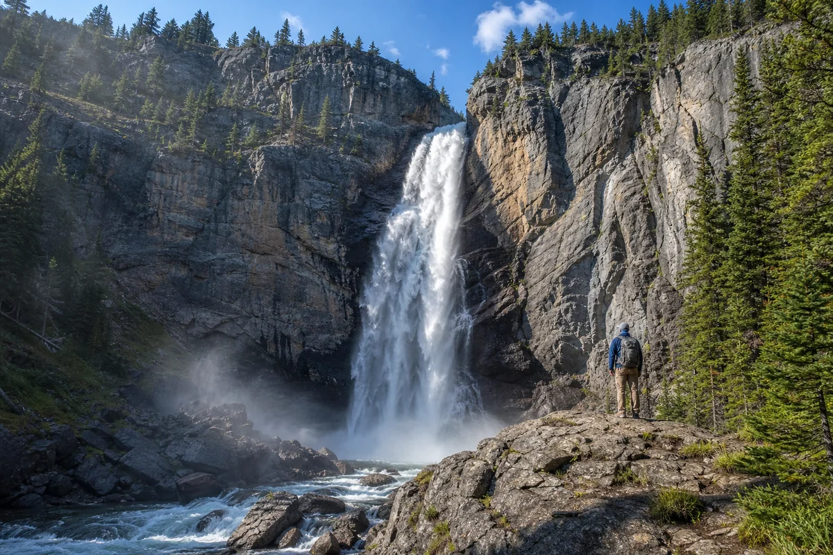
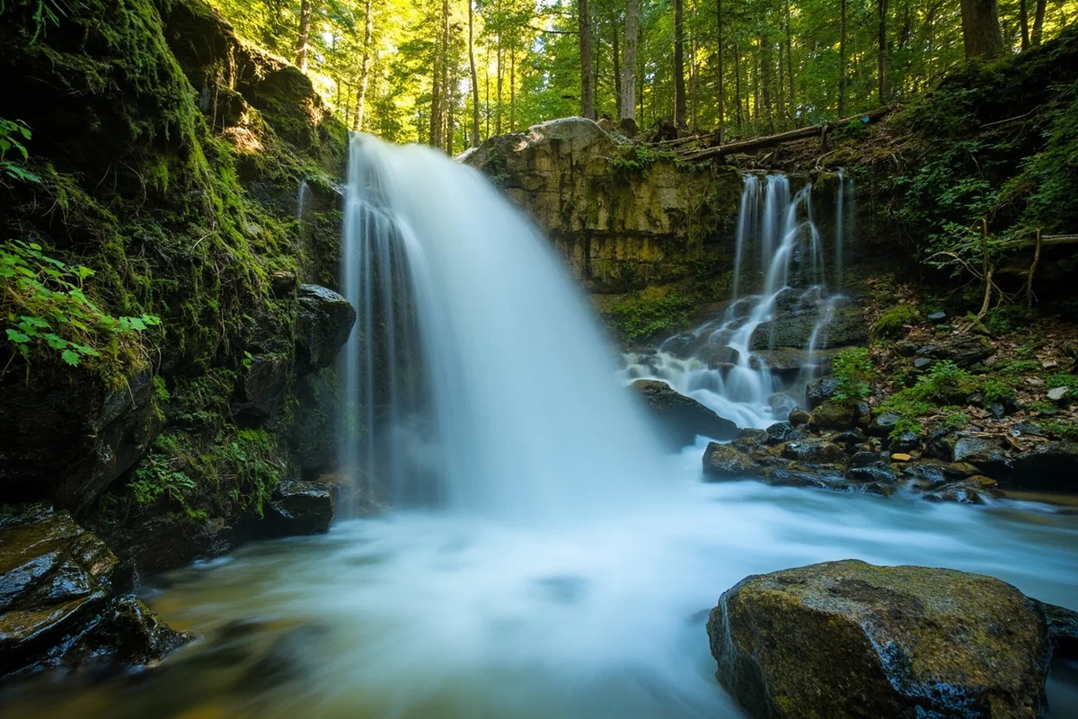
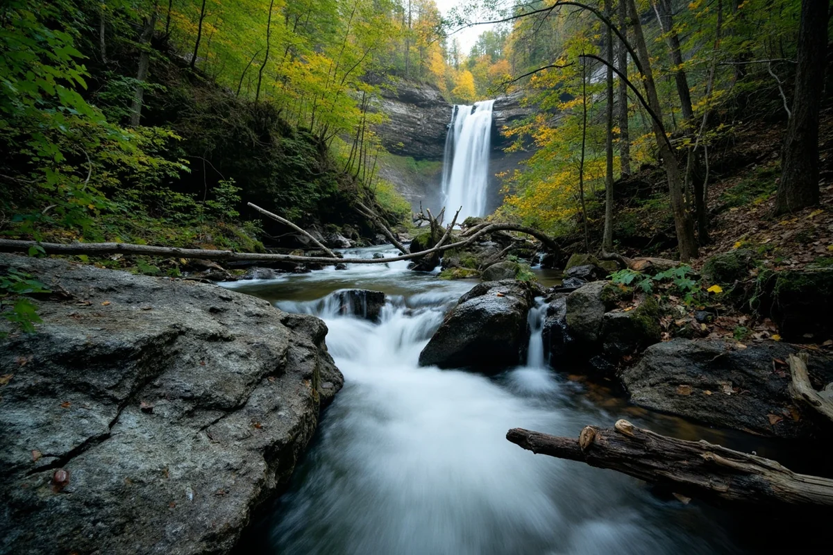
The mist hit my face before I even saw the falls—a fine spray carried on the wind through a gap in the towering cedars, announcing that something spectacular waited just around the bend.
Standing at the base of Horsetail Falls last summer, watching the water cascade nearly 50 feet down a moss-covered cliff face in delicate, wispy strands that genuinely resemble a horse’s tail, I understood immediately why this hidden gem deserves a spot on every Montana waterfall hunter’s list.
Among the many stunning Montana waterfalls I’ve explored, Horsetail Falls offers something uniquely intimate—a sense of discovery that the more famous cascades simply can’t match.
- Horsetail Falls is located in Glacier National Park’s McDonald Creek drainage area
- The falls drop approximately 45-50 feet in distinctive wispy strands
- Best visited May through July when snowmelt feeds peak water flow
- Moderate difficulty hike of roughly 2 miles round trip
- Early morning visits offer best lighting and fewer crowds
- No permits required beyond standard Glacier National Park entrance fee
- Bring waterproof layers—spray reaches the viewing area
Where Exactly Is Horsetail Falls in Montana?
Let me clear up some confusion right away. When I first started researching Horsetail Falls Montana, I found conflicting information online that sent me chasing dead ends.
The falls I’m discussing here sits within Glacier National Park, specifically in the McDonald Creek drainage on the park’s west side. This isn’t the more famous Horsetail Falls in Yosemite—Montana has its own version, and in my opinion, it’s far more peaceful to visit.
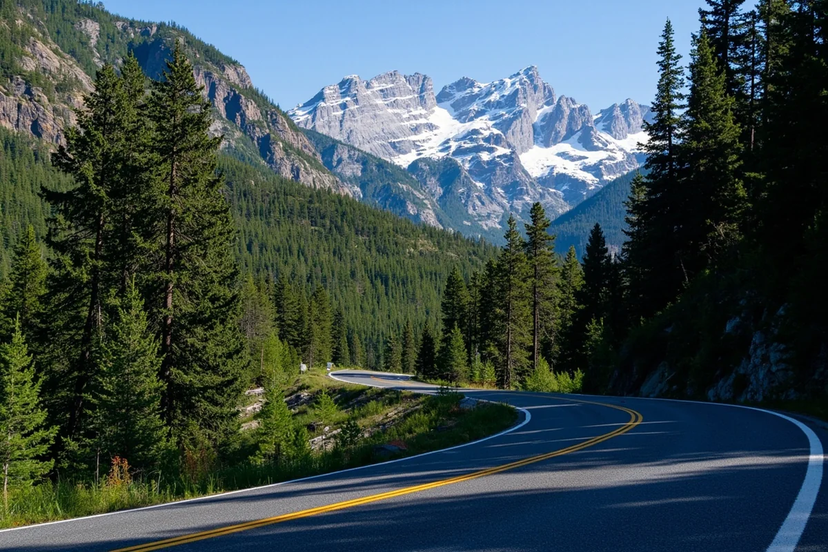
To reach the trailhead, you’ll enter Glacier National Park through the West Entrance near West Glacier. From there, head east on Going-to-the-Sun Road for approximately 10 miles until you reach the designated parking area.
The GPS coordinates for the trailhead are approximately 48.6547°N, 113.8234°W. I always recommend downloading offline maps before your visit since cell service is spotty throughout this section of the park.
Getting to the Trailhead: Practical Driving Directions
During my visit last June, I stayed in Whitefish—about 35 miles from the trailhead. Here’s the exact route I took.
From Whitefish, take US-93 South to Highway 2. Follow Highway 2 East through Columbia Falls and continue toward West Glacier. The drive takes approximately 45 minutes without traffic.
Once inside the park, Going-to-the-Sun Road becomes your sole option. Watch for the parking area on your left—it’s small and fills quickly during peak season.
If you’re coming from Kalispell, add another 10-15 minutes to that estimate. From Missoula, you’re looking at roughly 2.5 hours of driving through some of Montana’s most scenic corridors.
Trail Details: What to Expect on Your Hike
I’ll be honest—this isn’t the most clearly marked trail in Glacier National Park. That’s part of what makes it special, but it also means you need to pay attention.
Distance and Elevation
The total round-trip distance measures approximately 2 miles. Elevation gain sits around 400 feet, making this a moderate hike suitable for most fitness levels.
When I hiked it last summer, the trail took me about 90 minutes total, including 30 minutes at the falls for photos and lunch. Stronger hikers can complete it in under an hour.
Trail Conditions and Terrain
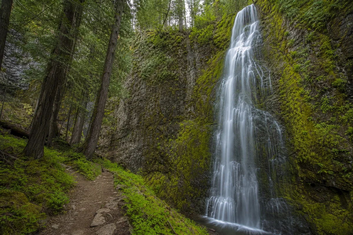
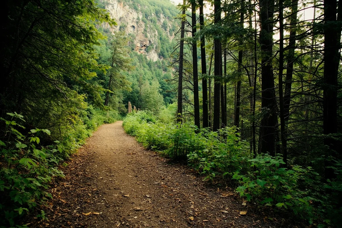
The first half mile follows a well-maintained path through dense cedar and hemlock forest. The air here smells incredible—that distinctive Pacific Northwest dampness mixed with evergreen.
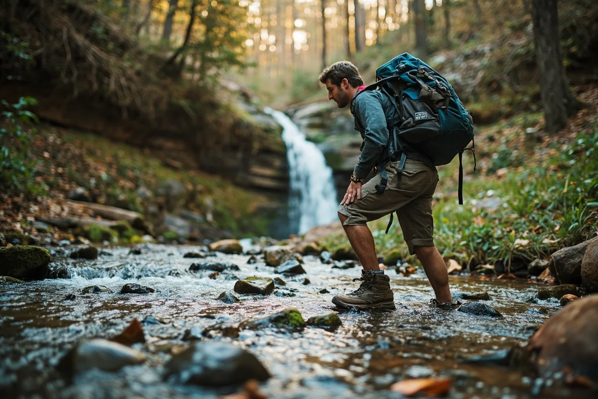
After the initial stretch, the trail becomes less defined. You’ll navigate some rocky sections and a few areas where fallen trees require minor scrambling. I wore my mid-height hiking boots and was grateful for the ankle support.
The final approach to the falls involves crossing a small stream. During my June visit, the water was shin-deep in spots. Trekking poles helped me maintain balance on the slippery rocks.
Trail Markers and Navigation
Here’s something important—don’t rely solely on trail markers for this hike. Some sections have faded blazes that are easy to miss.
I recommend downloading the trail to your phone using apps like AllTrails or Gaia GPS before losing cell service. Having the route cached made a huge difference when I reached a confusing junction about halfway to the falls.
| Trail Specification | Details |
|---|---|
| Round Trip Distance | Approximately 2 miles |
| Elevation Gain | ~400 feet |
| Difficulty Rating | Moderate |
| Average Hiking Time | 1-2 hours |
| Trail Surface | Mixed—dirt, rocks, stream crossings |
| Shade Coverage | Heavy forest canopy (80%+) |
| Dog Friendly | No—Glacier National Park rules apply |
Best Time to Visit Horsetail Falls
Timing your visit correctly makes an enormous difference. I’ve now seen Horsetail Falls in three different seasons, and each offers a distinct experience.
Peak Flow: May Through Early July
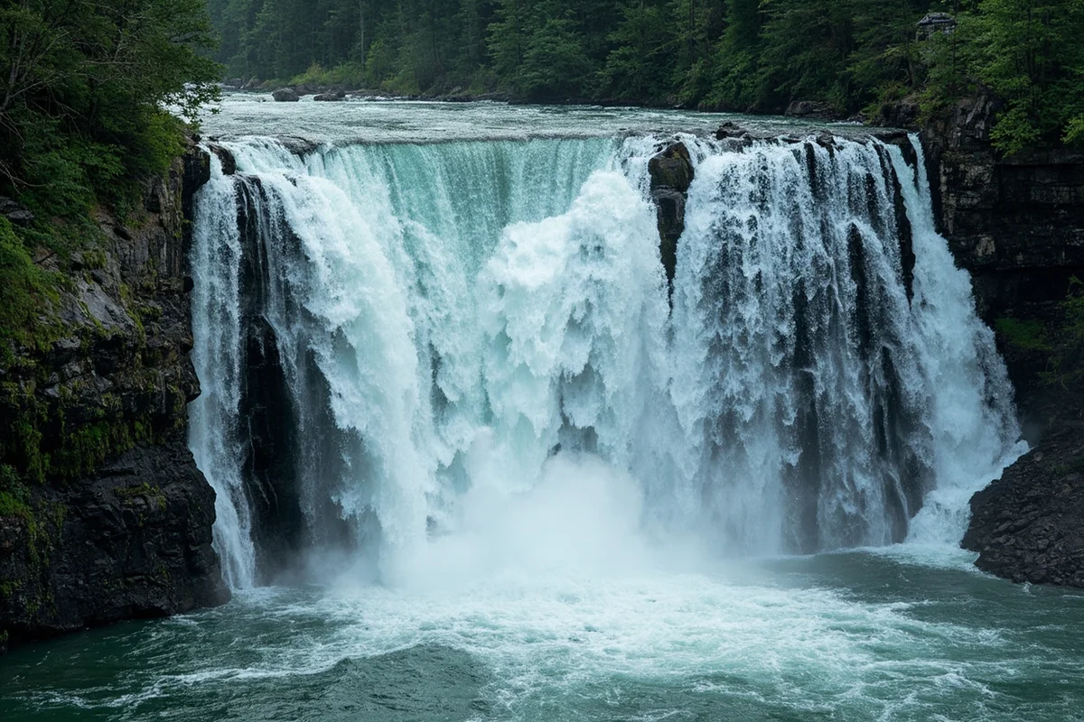
If you want to see Horsetail Falls at its most impressive, visit during late spring or early summer. The snowmelt from higher elevations feeds the creek, creating dramatic water volume.
During my June visit, the falls thundered with energy. The spray reached the viewing area 40 feet away, and I could hear the roar long before seeing the cascade.
This timing does come with tradeoffs. The trail can be muddy and stream crossings more challenging. Snow may linger on higher sections into June some years.
Summer and Early Fall: July Through September
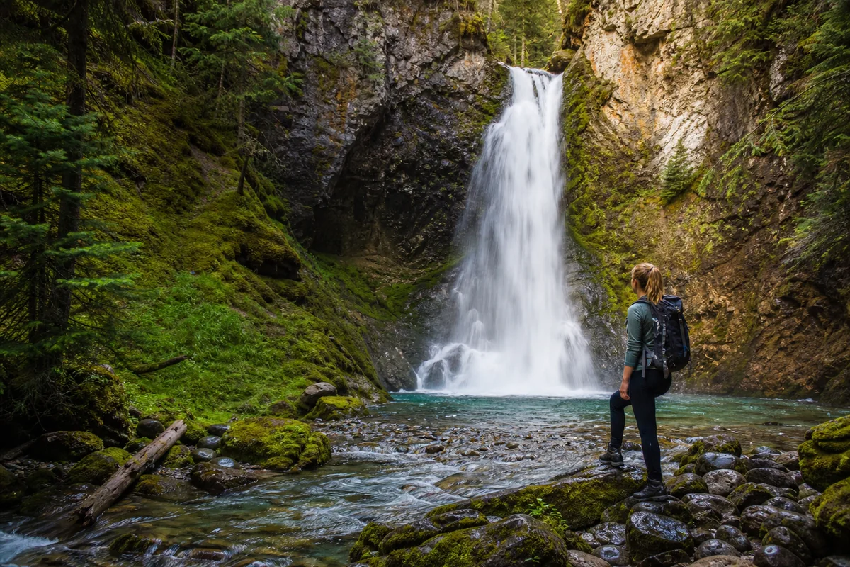
Water flow decreases noticeably by mid-July, but the falls remain beautiful. This is when you’ll see the distinctive “horsetail” effect most clearly—thin, wispy strands of water that give the falls its name.
I actually prefer the aesthetic during this period. The reduced water volume reveals the intricate rock formations behind the cascade, and the surrounding vegetation reaches its peak green.
Late August and September bring fewer crowds and gorgeous fall colors beginning to emerge. If you’re combining this hike with Holland Lake Falls or other western Montana cascades, this shoulder season works beautifully for a multi-waterfall trip.
What About Winter?
I haven’t attempted Horsetail Falls in winter, and I don’t recommend it for casual visitors. The access road closes to vehicles, requiring either cross-country skiing or snowshoeing several miles just to reach the trailhead.
That said, local photographers have captured stunning images of the partially frozen falls. If you’re experienced in winter backcountry travel and prepared for avalanche terrain, winter visits are theoretically possible.
Photography Tips: Capturing Horsetail Falls
I’m not a professional photographer, but I’ve learned some lessons through trial and error at this location.
Best Lighting Conditions
The falls face northeast, which means direct sunlight is limited and harsh shadows are rarely an issue. Overcast days actually produce the best results—the soft, diffused light brings out the emerald greens of the surrounding moss.
During my most recent visit, I arrived at 7 AM on a partly cloudy morning. The light filtering through the forest canopy created an almost ethereal glow around the cascade.
Camera Settings and Equipment
For that classic silky water effect, you’ll need a tripod and neutral density filter. I used a 3-stop ND filter with a shutter speed around 1/4 second—that smoothed the water while keeping the surrounding foliage sharp.
If you’re shooting with a smartphone, most modern devices have a “long exposure” or “live photo” mode that can approximate this effect. It’s not quite as refined, but it works surprisingly well.
Bring lens cloths—lots of them. The spray near the falls coats everything within minutes. I went through four cloths during my photo session.
Composition Ideas
The obvious shot is straight-on from the base, but don’t stop there. Some of my favorite images came from lower angles, including the creek in the foreground as a leading line toward the cascade.
The moss-covered rocks flanking the falls also make compelling subjects. During my visit, I spent 20 minutes photographing a single boulder with tiny ferns growing from its cracks while the falls provided a blurred background.
What to Pack for Your Horsetail Falls Hike
Based on my experiences, here’s what I consider essential for this particular trail.
Footwear
Waterproof hiking boots are non-negotiable. The stream crossing at the end will likely get water over the top of trail runners, and the rocks stay slippery even in drier conditions.
I wore my Salomon X Ultra boots and was glad for the aggressive tread. A hiking partner wearing lightweight trail shoes struggled on several sections and nearly slipped at the falls themselves.
Layers and Rain Gear
Even on sunny days, the temperature drops noticeably in the shaded forest. I recommend a moisture-wicking base layer and a packable rain jacket regardless of the forecast.
At the falls, expect to get wet if you approach the base. I brought a cheap poncho specifically for photos near the cascade and kept my camera gear protected in a dry bag.
Food and Water
Two liters of water per person is plenty for this relatively short hike. I always bring my filter anyway—there’s something satisfying about drinking straight from a Montana mountain stream.
Pack snacks for enjoying at the falls. The flat rocks near the viewing area make perfect lunch spots. On my last visit, I ate a sandwich while watching the spray create miniature rainbows in the morning light.
Ten Essentials
Even for short hikes in Glacier, I carry the backcountry basics: navigation tools, sun protection, first aid kit, knife, fire starter, emergency shelter, extra food, extra water, extra clothing, and a headlamp.
Am I paranoid? Maybe. But weather changes fast in these mountains, and trails can be harder to follow than expected. This gear has saved my comfort—and potentially my safety—more than once.
Wildlife and Safety Considerations
Glacier National Park is bear country. Period. I take this seriously, and you should too.
Bear Awareness
I carry bear spray on every hike in Glacier and keep it accessible—clipped to my hip belt, not buried in my pack. During my hikes to Horsetail Falls, I’ve never encountered a bear, but I’ve seen fresh scat on the trail twice.
Make noise while hiking, especially around blind corners and through dense vegetation. I do the classic “hey bear” call every few minutes on less-traveled trails like this one.
If you’re also planning to visit cascades like Grotto Falls or McDonald Falls in the same area, you’ll be in prime grizzly habitat. Stay alert and travel in groups when possible.
Stream Crossing Safety
The creek crossing near Horsetail Falls deserves respect, particularly during high water. I’ve seen the flow change dramatically between morning and afternoon as daytime temperatures increase snowmelt.
Use trekking poles for stability. Face upstream while crossing and move slowly, feeling for secure footing with each step. Unbuckle your pack’s hip belt and sternum strap so you can ditch it quickly if you lose balance.
If the water looks too high or too fast, turn back. No waterfall photo is worth a cold-water rescue.
Weather Hazards
Mountain weather in Glacier changes rapidly. I’ve started hikes under blue skies and returned through thunderstorms multiple times.
Check the forecast before leaving, but don’t trust it completely. If you hear thunder or see clouds building on the peaks, head back to the trailhead. Lightning is a serious threat on exposed sections.
Nearby Attractions and Extended Itineraries
Horsetail Falls makes an excellent anchor for a full day of exploring Glacier’s west side. Here’s how I typically structure my visits.
Morning: Horsetail Falls
I hit the trail early—usually by 7 AM—to beat crowds and catch optimal photography light. The hike plus photography time takes about two hours.
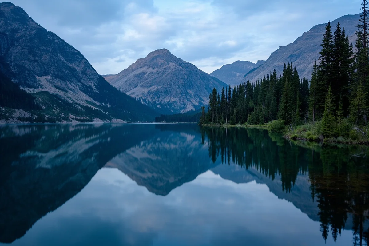
Midday: Lake McDonald Area
After the hike, I drive to Lake McDonald Lodge for a late breakfast or early lunch. The historic lodge has incredible atmosphere, and the food is surprisingly good for a national park facility.
The lake itself offers opportunities for kayaking, swimming (if you can handle the cold), or simply sitting on the shore absorbing the mountain views.
Afternoon: Additional Falls
If you still have energy, several other waterfalls are easily accessible from Going-to-the-Sun Road. Sacred Dancing Cascade is practically roadside, while Saint Mary Falls on the east side offers a moderate hike with stunning views.
For something more adventurous, consider Ptarmigan Falls or Redrock Falls in the Many Glacier area—though these require more driving and longer hiking commitments.
Multi-Day Waterfall Itineraries
If you’re dedicating several days to Montana waterfalls, I recommend splitting time between Glacier National Park and other regions.
In the park, prioritize Running Eagle Falls for its unique geology and Rockwell Falls for its dramatic setting. Both offer different experiences than Horsetail Falls.
Outside Glacier, Kootenai Falls near Libby is absolutely worth the drive. It’s the largest undammed waterfall in Montana and has appeared in several Hollywood films. Morrell Falls near Seeley Lake is another personal favorite—a powerful cascade accessible via a beautiful forest trail.
For something off the beaten path, Hidden Falls lives up to its name as a lesser-known gem, while Memorial Falls offers spectacular scenery in the Little Belt Mountains.
Practical Planning Information
Park Entrance Fees
As of my last visit, Glacier National Park charges $35 per vehicle for a seven-day pass. Annual passes are $70 and make sense if you’ll visit multiple times or explore other national parks.
The America the Beautiful Pass ($80 annually) covers all federal lands and represents excellent value for frequent travelers. I’ve had mine for years.
Parking Realities
This is the honest truth about visiting Glacier in summer: parking is a nightmare. The lot near Horsetail Falls trailhead holds maybe 15 vehicles.
By 9 AM on summer weekends, it’s full. Your options then are limited to pulling off in unmarked areas (not recommended and potentially illegal) or driving to a different trailhead entirely.
My strategy is simple—arrive early. On my June trip, I hit the trailhead at 6:45 AM and had my pick of spots. By the time I returned around 9:30 AM, cars lined the road in both directions.
Reservation Requirements
Glacier implemented a vehicle reservation system for Going-to-the-Sun Road during peak season. Rules change annually, so check the official NPS website before your trip.
Generally, reservations are required from late May through early September during daytime hours. Entering before 6 AM bypasses the reservation requirement—another reason I recommend early starts.
Accommodation Options
Within the park, Lake McDonald Lodge and Village Inn offer the closest accommodations. Both book months in advance for summer dates, so plan accordingly.
I typically stay in West Glacier or Hungry Horse. Options range from basic motels to vacation rentals and campgrounds. Prices are lower than in-park lodging, and you’re only 15-20 minutes from the trailhead.
Whitefish, about 35 miles away, offers more dining and nightlife options if that matters to you. It’s where I base most of my Glacier trips.
Comparing Horsetail Falls to Other Montana Waterfalls
Having explored dozens of Montana waterfalls, I can honestly say Horsetail Falls occupies a unique niche.
Size and Spectacle
At roughly 50 feet, Horsetail Falls isn’t the tallest in Montana. Ousel Falls near Big Sky drops further, and Palisade Falls near Bozeman has more dramatic geology.
What makes Horsetail Falls special is its intimate setting and distinctive flow pattern. The wispy, separated streams create a delicate beauty that differs from the thundering power of cascades like Gros Ventre Falls.
Accessibility Comparison
The moderate hike to Horsetail Falls sits between roadside viewpoints and backcountry adventures in terms of effort.
For easier access, Mill Falls and Skalkaho Falls require minimal walking. For more challenging pursuits, Ipasha Falls and Mokowanis Cascade demand serious backcountry commitment.
Crowd Levels
This is where Horsetail Falls really shines. During my visits, I’ve never encountered more than a handful of other hikers at the falls themselves.
Compare that to Running Eagle Falls, where tour buses regularly unload visitors, or the overlooks along Going-to-the-Sun Road that become absolute zoos by midday.
If solitude matters to you—and it certainly does to me—Horsetail Falls delivers in ways that more famous cascades cannot. Other quieter options worth exploring include Needle Falls, Passage Creek Falls, and Pinkham Creek Falls throughout different regions of Montana.
Personal Reflections: Why Horsetail Falls Matters
I’ve thought a lot about why certain waterfalls stick with me while others fade into the general blur of “beautiful places I’ve seen.”
Horsetail Falls stays vivid in my memory partly because of the effort required to reach it. The moderate challenge filters out casual visitors and creates a sense of earned reward when you finally see the cascade.
But there’s something more. The falls feel hidden, almost secretive. Standing at the base, surrounded by ancient forest with spray on my face and no other humans in sight, I felt connected to something primal.
Montana has flashier waterfalls, taller waterfalls, more accessible waterfalls. What it doesn’t have many of are waterfalls that feel like discoveries—places where you can imagine you’re the first person to stumble upon them.
Horsetail Falls gave me that feeling. For that alone, it’s worth the trip.
Tips From My Mistakes
I’ll wrap up with lessons I learned the hard way so you don’t have to.
First, I underestimated the stream crossing on my initial visit and wore trail runners. My feet were soaked for the entire hike back. Don’t make my mistake—bring waterproof boots.
Second, I didn’t bring enough lens cloths for photography. The spray is persistent and relentless. I eventually gave up on the telephoto shots because I couldn’t keep the glass clear. Now I pack at least six microfiber cloths.
Third, I tried visiting in late August my first year and found the water flow disappointing. The distinctive horsetail pattern was visible, but the overall effect was muted compared to my later June visit. Plan for peak flow if you want maximum impact.
Finally, I once attempted to reach the falls via an “alternate route” I found online. Three hours of bushwhacking later, I emerged scratched, exhausted, and still without reaching the falls. Stick to the established trail.
If you’re planning a comprehensive waterfall tour of Montana, consider adding Hole in the Wall Falls, Hoodoo Cascade Falls, and Impasse Falls to your Glacier itinerary. Outside the park, Pioneer Falls, Rock Creek Falls, and Pintler Falls offer excellent experiences in western Montana’s wilderness areas.
For unique geological features, Silken Skein Falls and Rainbow Falls showcase Montana’s diverse waterfall formations. And if you’re venturing into the park’s backcountry, Oberlin Falls, Piegan Falls, and Siksika Falls reward those willing to put in extra miles.
Additional cascades worth researching include Salamander Falls, Sentinel Falls, Raven Quiver Falls, and Morning Eagle Falls within Glacier National Park. Beyond park boundaries, Knowles Falls near Yellowstone, Lange Falls, Little North Fork Falls, Lost Creek Falls, Martin Falls, Miche Wabun Falls, Mission Falls, Monture Falls, Mud Creek Waterfall, and Paradise Falls each offer unique characteristics worth exploring on extended Montana adventures.
Horsetail Falls won’t make anyone’s list of Montana’s most famous destinations. You won’t find it on postcards or crowded with selfie-stick-wielding tourists. And honestly? That’s exactly why I keep going back.
Frequently Asked Questions
Where is Horsetail Falls located in Montana?
Horsetail Falls is located in the Bitterroot National Forest near Sula, Montana, approximately 75 miles south of Missoula. The trailhead is accessible via Highway 93, making it a convenient day trip destination for travelers exploring western Montana’s scenic mountain region.
How long is the hike to Horsetail Falls Montana?
The hike to Horsetail Falls is approximately 2.4 miles round trip with about 500 feet of elevation gain, making it a moderate and family-friendly trail. I found it takes most hikers between 1 to 2 hours to complete, depending on how much time you spend photographing the falls.
What is the best time of year to visit Horsetail Falls Montana?
The best time to visit Horsetail Falls is late spring through early summer, typically May through July, when snowmelt creates the most dramatic water flow. I recommend visiting in June for peak water volume, though the trail is accessible through October before winter snow closes access roads.
Is there a fee to hike to Horsetail Falls in the Bitterroot National Forest?
There is no entrance fee or parking fee required to visit Horsetail Falls, as it’s located on public Bitterroot National Forest land. However, you should bring cash for any nearby campgrounds if you plan to stay overnight, which typically run $10-20 per night.
What should I bring for the Horsetail Falls hike in Montana?
Bring sturdy hiking shoes with good traction since the trail can be rocky and slippery near the falls, plus plenty of water and bear spray for safety in grizzly country. I always pack layers even in summer because temperatures drop significantly near the waterfall, and a camera is essential for capturing this stunning cascade.
Can you swim at Horsetail Falls Montana?
While there’s a small pool at the base of Horsetail Falls, swimming isn’t recommended due to extremely cold water temperatures and slippery rocks. The snowmelt-fed water rarely warms above 50°F even in summer, so most visitors simply wade or enjoy the mist while taking photos.
Is the Horsetail Falls trail dog-friendly?
Yes, dogs are allowed on the Horsetail Falls trail but must be kept on a leash to protect local wildlife and other hikers. The terrain can be rough on paws in some sections, so I recommend bringing booties for sensitive dogs and packing extra water for your four-legged hiking companion.