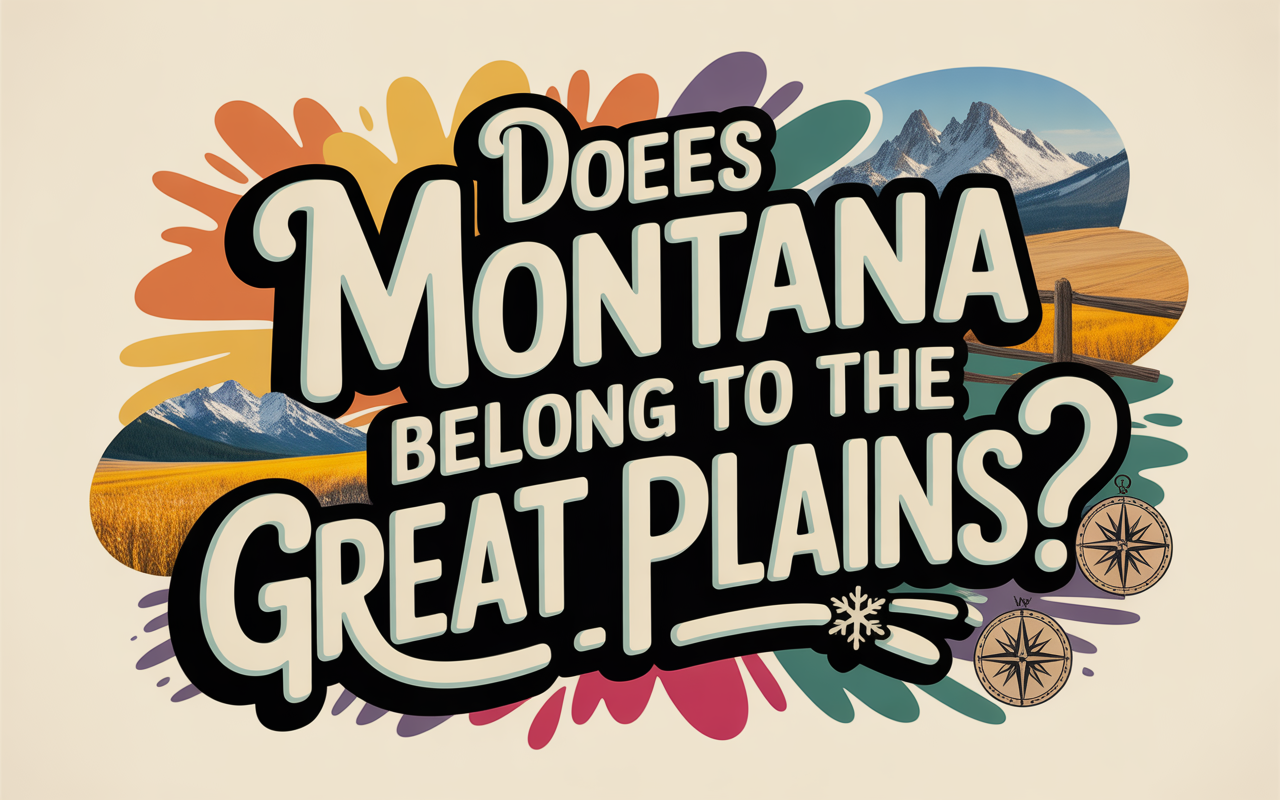
Is Montana a Mountain state or a Great Plains state? If you’ve ever driven across this vast territory—the fourth-largest in the nation—you’ve likely experienced the answer firsthand: it’s definitively both.
While glossy tourism brochures showcase Montana’s iconic alpine peaks and pristine mountain lakes, a surprising truth emerges from the data: approximately 60% of Montana’s landmass lies east of the Rocky Mountain Front, situated squarely within the Great Plains physiographic province.
This isn’t just a trivial geographic detail—it’s a fundamental reality that shapes everything from agricultural production and climate patterns to political alignments and cultural identity. Yet Montana’s eastern two-thirds remain largely invisible to outsiders, overshadowed by the photogenic Rockies that dominate the popular imagination.
In this comprehensive analysis, we’ll explore the geological foundations, ecological systems, economic patterns, and cultural divisions that make Montana the definitive “continental seam”—the dramatic place where America’s horizontal grasslands collide with its vertical mountain spine.
- Related article: Montana on US Map
You’ll discover why understanding Montana’s Great Plains identity is essential to understanding the state itself, and why this geographic duality is creating a widening cultural and political divide that some locals have dubbed the “Two Montanas” problem.
Table of Contents
The Continental Seam: Montana’s Geographic Duality
Montana stands as America’s definitive continental seam—a place where the horizontal expanse of the Great Plains collides with the vertical majesty of the Rocky Mountains. While tourism campaigns and popular media often portray Montana exclusively as a mountain paradise of alpine glaciers and coniferous forests, the reality is far more complex. Approximately 60% of Montana’s vast landmass lies east of the Rocky Mountain Front, situated squarely within the Great Plains physiographic province.
This duality creates a state that exists in two worlds simultaneously. Montana is physically and climatically a Great Plains state for the majority of its acreage, yet its cultural and economic identity increasingly bifurcates between its Plains heritage and its Mountain future. The state functions as a transition zone—a “Central Front”—where the agrarian, resource-extractive economy of the Plains gradually shifts into the amenity-driven, service-oriented economy of the Rockies.
This geographic split isn’t merely academic—it shapes everything from agricultural practices and economic development to political alignments and cultural identities. To understand Montana is to recognize that it contains both the dramatic conclusion of the Great Plains and the beginning of the Mountain West, creating a unique regional identity where the “American Serengeti” of the east coexists with, and increasingly contests, the “New West” of the mountains.
Defining the Great Plains: Where Montana Fits
The Great Plains represent one of North America’s most distinctive physiographic regions—a vast expanse of flatland stretching from the Rio Grande in the south to the Mackenzie River delta in the north. This massive geographical province is bounded by the Interior Lowland to the east and the Rocky Mountains to the west. By this standard definition, approximately 60 percent of Montana’s landmass falls squarely within the Great Plains province.
What makes Montana unique among Great Plains states is the dramatic boundary where plains meet mountains. Unlike the gradual transitions found elsewhere, Montana’s Rocky Mountain Front rises abruptly from the prairie floor, creating what the Blackfeet people called the “Backbone of the World.” This limestone escarpment marks the precise western terminus of the Great Plains, providing a visual boundary that’s impossible to miss.
East of this dramatic front, Montana’s geology transforms completely. The landscape becomes a vast horizontal sweep of Cretaceous and early Tertiary sedimentary rocks—sandstones, shales, and limestones—that lie nearly flat, having escaped the intense folding and faulting that created the mountains to the west. These formations aren’t just topographically distinct; they’re economically significant, hosting the massive coal seams of the Powder River Basin and the oil-rich Williston Basin. This geological makeup aligns Eastern Montana more closely with North Dakota and Wyoming than with the mineral-rich, hard-rock geology of Western Montana.
A Tale of Two Landscapes: Montana’s Plains Geography
When you look at a map of Montana, the state’s split personality becomes immediately apparent. While the western third showcases the dramatic peaks of the Rocky Mountains, approximately 60% of Montana’s landmass lies east of the Continental Divide, firmly within the Great Plains province. This eastern region isn’t a monolithic landscape but contains distinct geographical subdivisions that create Montana’s unique plains identity.
North of the Missouri River stretches the Glaciated Plains, a region sculpted by the massive Laurentide Ice Sheet during the Pleistocene era. This area, which includes Montana’s “Hi-Line” counties (Hill, Blaine, Phillips, Valley, Daniels, Sheridan), features a distinctive hummocky topography characterized by glacial till, pothole lakes, and erratic boulders. The soil here, enriched by glacial deposits, supports Montana’s massive spring wheat production, forming the northern arc of the state’s “Golden Triangle” agricultural region. The drainage patterns remain immature, creating the wetland habitats critical for migratory waterfowl that connect this region to the broader Prairie Pothole Region extending into the Dakotas.
South of the Missouri River, the landscape transforms into the Unglaciated Plains, where the topography has been shaped by millions of years of wind and water erosion rather than glacial scouring. This creates the dramatic, dissected landscapes known as “Badlands” and river breaks, exemplified by the Missouri River Breaks and Makoshika State Park near Glendive. These quintessential Great Plains landforms are structurally identical to the badlands found in South Dakota and Nebraska. The “breaks” topography creates rugged, sometimes inaccessible terrain that historically served as refuge for outlaws and wildlife, and today primarily supports extensive cattle grazing rather than crop agriculture due to the steep, erodible soils.
What makes Montana’s plains truly unique are the “Island Ranges” – isolated volcanic or tectonic uplifts that puncture the prairie floor hundreds of miles east of the Continental Divide. These include the Sweet Grass Hills, Bear Paw Mountains, Highwood Mountains, Judith Mountains, Moccasin Mountains, Big Snowy Mountains, and the Crazy Mountains. While these ranges support montane ecology with coniferous forests and alpine meadows, they’re completely surrounded by semi-arid steppe, functioning as an archipelago of mountain ecosystems within a sea of grass. This distinctive feature reinforces Montana’s plains identity by demonstrating that even its central mountains are encircled by the Great Plains ecosystem.
Climate and Ecology: The Prairie Identity
Eastern Montana’s climate tells a compelling story about its Great Plains identity. The Continental Divide creates a stark meteorological boundary, with the eastern three-fifths of Montana experiencing a definitively continental climate. This region lies in a profound rain shadow, receiving less than 15 inches of precipitation annually—classifying it as semi-arid steppe.
The climate here is characterized by extreme temperature fluctuations and low humidity. Summer days can be scorching, while winter brings bitter cold. However, one of the most distinctive weather phenomena is the Chinook wind—warm, dry air that descends the eastern slopes of the Rockies after losing moisture on the western side. These winds can raise temperatures dramatically in just hours, sometimes melting snow cover and creating the volatile winter conditions that define the High Plains experience.
This climate supports a unique ecosystem often called the “American Serengeti.” The dominant vegetation is mixed-grass prairie, featuring western wheatgrass, blue grama, and needle-and-thread grass interspersed with Wyoming big sagebrush. Unlike the mountains to the west, trees here are largely restricted to riparian corridors along rivers like the Yellowstone and Missouri, where cottonwoods and willows create green ribbons across the golden landscape.
The wildlife further confirms Montana’s Plains credentials. While both regions host deer and elk, the eastern plains are the stronghold of the pronghorn antelope—a species evolved for the open grasslands. The presence of obligate grassland birds like the Sprague’s pipit, thick-billed longspur, and greater sage-grouse further identifies this region as functionally part of the Great Plains ecosystem. Historically, these plains supported millions of bison, creating one of North America’s most spectacular wildlife displays before European settlement.
The Three Montanas Theory: Economic and Demographic Divide
Montana’s complex identity is perhaps best understood through regional economist Larry Swanson’s “Three Montanas” framework. Rather than viewing the state as a simple east-west divide, this model recognizes three distinct regions with their own economic and demographic patterns.
The Eastern Plains encompasses roughly 21 counties in the eastern third of Montana, functioning as the demographic and economic extension of the Dakotas. This region faces significant challenges, including long-term population decline, an aging workforce, and an economy heavily dependent on agriculture and energy extraction. Many counties are experiencing what demographers call “natural population decrease,” where deaths exceed births—a trend unique to the Great Plains portion of the state.
In stark contrast, the Western Mountains region (also approximately 21 counties) contains Montana’s fastest-growing population centers: Missoula, Bozeman, and Kalispell. The economy here has largely shifted away from traditional resource extraction industries like logging and mining toward services, technology, healthcare, and tourism. This area exemplifies what scholars call the “New West,” attracting “amenity migrants”—people moving for lifestyle rather than industrial employment. Unlike the aging east, the western region sees births exceeding deaths, driven by younger families.
Between these two worlds lies the Central Front, including major hubs like Billings, Great Falls, and Helena. This transitional zone of about 14 counties captures the “Island Ranges” and foothills where the prairie meets the mountains. Billings, Montana’s largest city, functions as the economic capital of the Northern Great Plains, with a trade area extending deep into Wyoming and the Dakotas. Its economy is built on processing the raw materials of the plains—oil refining, sugar beet processing, and livestock marketing.
This three-region framework reveals a state undergoing profound economic transformation, with each region following distinctly different trajectories. While the Eastern Plains struggles with population loss and economic stagnation, the Western Mountains experiences rapid growth and diversification. The Central Front maintains a more balanced position, benefiting from its role as an interface between these contrasting worlds.
Agricultural Stronghold: Montana’s Plains Economy
Montana’s inclusion in the Great Plains becomes irrefutable when examining its agricultural output. The state ranks among the nation’s top producers of wheat, barley, lentils, and beef—commodities that are hallmarks of the Great Plains economy.
The “Golden Triangle,” a region roughly bounded by Great Falls, Havre, and Shelby, along with the vast counties of the Hi-Line (Chouteau, Hill, Valley), serves as Montana’s breadbasket. Chouteau County alone stands as one of the top wheat-producing counties in the entire United States. This production is geologically determined; the sedimentary soils of the glaciated plains are ideal for dryland farming techniques that conserve the meager moisture of the semi-arid climate.
In recent decades, Eastern Montana has diversified into pulse crops, becoming the nation’s #1 producer of lentils. This agricultural shift mirrors trends in Saskatchewan and North Dakota, further integrating Montana into the Great Plains agricultural complex. These crops fix nitrogen and fit perfectly into rotation with wheat in dryland systems, adapting to the Great Plains climate.
While wheat dominates the glaciated north, the unglaciated plains and rugged breaks of the south support massive cattle operations. Montana’s cattle inventory stands at approximately 2.16 million head, nearly double the human population. The “cow-to-person” ratios in eastern counties epitomize the Great Plains ranching ethos:
- Petroleum County: 62 cattle per person
- Garfield County: 59 cattle per person
In stark contrast, urbanized Missoula County has just 1 cow per 15 people, highlighting the economic divergence between regions. Towns like Miles City and Billings historically grew as railroad hubs where cattle from the plains were consolidated for shipment to eastern markets, infrastructure that remains vital today.
Energy Resources: Connecting to the Plains Economy
Eastern Montana’s economic identity is deeply intertwined with the vast fossil fuel reserves it shares with neighboring Great Plains states. The Bakken Formation, stretching across northeastern Montana and into North Dakota, transformed counties like Richland and Roosevelt during the oil boom of the 2010s. At its peak, the Bakken produced over 1.2 million barrels of oil per day, bringing unprecedented prosperity but also the boom-and-bust volatility characteristic of Plains energy towns.
The economic patterns in these communities mirror those of western North Dakota rather than western Montana. When oil prices crashed, the region experienced population outflows, housing vacancies, and economic contraction—dynamics completely foreign to the amenity-rich mountain economies of Missoula or Bozeman.
Southeastern Montana sits atop another energy treasure: the Powder River Basin coal reserves. Counties like Big Horn and Rosebud contain some of America’s largest coal deposits, with Montana ranking 6th nationally in coal production. These massive strip mines supply power plants across the Midwest, creating an economic dependency that aligns Montana’s energy politics with Wyoming and the Dakotas.
This energy landscape creates a stark contrast within Montana itself. While eastern counties debate pipeline routes and coal mine expansions, western counties focus on renewable energy and conservation. The energy sector reinforces Montana’s split personality—the eastern plains are integrated into the fossil fuel economy of the Great Plains, while the western mountains increasingly embrace the green energy transition of the Pacific Northwest.
Political Geography: The East-West Divide
Montana’s geographic split between Plains and Mountains has created a profound political divide that was formally recognized following the 2020 Census when Montana regained its second seat in the U.S. House of Representatives. The redistricting process sparked intense debate, ultimately resulting in a map that largely respects the Continental Divide.
The Eastern District (MT-02) encompasses most of Montana’s Great Plains territory and functions as a stronghold of Plains conservatism. In contrast, the Western District (MT-01) contains the state’s major mountain ranges and is politically competitive, with significant “blue” pockets in college towns like Missoula and Bozeman.
The 2024 election results highlighted this bifurcation dramatically. While Donald Trump won Montana by approximately 20 points overall, his margins in the eastern counties were overwhelming—often exceeding 70-80%. The Western District displayed a “jelly donut” pattern (blue urban cores surrounded by red rural areas), while the east presented a solid block of Republican dominance, interrupted only by Indigenous reservations.
This political division mirrors the economic and cultural differences between the two regions. Eastern Montana’s agricultural economy, sparse population, and traditional values align with the conservative politics common throughout the Great Plains. The 2024 defeat of incumbent Democrat Jon Tester by Republican Tim Sheehy further illustrated this shift, with the deep red wave of the Eastern Plains overwhelming the more moderate voting patterns of the past.
| Contest | Western District (MT-01) | Eastern District (MT-02) | Analysis |
|---|---|---|---|
| US House Representative | Zinke (R) 52% – Tranel (D) 45% | Downing (R) 66% – Driscoll (D) 34% | East is +14 points more Republican than West |
| Political Geography | Competitive “Purple” with Blue Urban Cores | Solid “Ruby Red” with high rural margins | Reflects the Urban/Rural & Mountain/Plains divide |
The political landscape thus reinforces Montana’s dual identity—with the eastern two-thirds functioning politically as part of the Great Plains conservative heartland, while the western third maintains closer political alignment with the more diverse Intermountain West.
Indigenous Nations of the Montana Plains
Montana’s Great Plains identity is powerfully expressed through its Indigenous nations. The reservations located east of the Continental Divide—Blackfeet, Fort Peck, Crow, and Northern Cheyenne—are home to peoples whose cultures and histories are fundamentally tied to the Plains ecosystem.
These tribes were historically horse-mounted bison hunters whose way of life was intrinsically connected to the vast grasslands. The Blackfeet, positioned along the Rocky Mountain Front, control the dramatic transition zone where mountains meet prairie. Their territory includes what they call the “Backbone of the World,” but their cultural identity was forged through their relationship with the buffalo of the plains.
The Crow (Apsáalooke) and Northern Cheyenne nations occupy reservations in south-central Montana, covering millions of acres of grazing land. The Battle of the Little Bighorn, fought in the heart of Crow country, stands as the defining historical narrative of the Northern Great Plains Wars.
In the northeast, the Fort Peck Reservation (Assiniboine and Sioux) is geographically and culturally part of the Dakota sphere. The Fort Belknap Reservation (Gros Ventre and Assiniboine) in north-central Montana further cements the indigenous Plains identity of the Hi-Line region.
Today, these nations are active participants in the modern Plains economy and ecology. The Blackfeet and Fort Peck tribes are leading groundbreaking efforts in bison restoration, effectively “rewilding” the Great Plains ecosystem. These initiatives are restoring the ecological function of what has been called the “American Serengeti” and reconnecting tribal communities with their cultural heritage.
The reservation geography reflects the diversity within the Plains itself. The Northern Cheyenne reservation is characterized by the rugged Tongue River country, while Fort Peck encompasses the glaciated plains along the Missouri River. This varied landscape has shaped distinctive tribal identities while maintaining their shared connection to Plains culture.
| Reservation | Primary Tribes | Geography | Cultural Focus |
|---|---|---|---|
| Blackfeet | Blackfeet (Pikuni) | Rocky Mountain Front / High Plains | Bison culture, “Backbone of the World” |
| Crow | Crow (Apsáalooke) | South Central Plains / Bighorn Mountains | Coal resources, Little Bighorn history |
| Northern Cheyenne | Northern Cheyenne (Tsis tsis’tas) | Tongue River / Powder River Basin | Resistance history, Plains horse culture |
| Fort Peck | Assiniboine & Sioux | Northeast Glaciated Plains | Bison restoration, connection to Dakota tribes |
These nations represent not just a historical footnote but a living continuation of the Great Plains cultural identity within Montana’s borders.
The ‘West Dakota’ Phenomenon: Cultural Identity Crisis
The divide between Montana’s eastern plains and western mountains has become so pronounced that locals often refer to the eastern region as “West Dakota” – a telling colloquialism that speaks volumes about regional identity. This nickname reflects a growing sense of alienation from the state’s western political and cultural power centers like Helena, Missoula, and Bozeman.
Eastern Montanans often feel more culturally aligned with North and South Dakota than with their western counterparts. The shared agricultural economy, similar landscapes, and conservative values create natural bonds that cross state lines. Meanwhile, the physical distance from the state capital in Helena (often a 7+ hour drive from eastern communities) reinforces this disconnect.
The rural-urban divide further deepens this cultural schism. While Western Montana experiences rapid urbanization and an influx of out-of-state transplants, Eastern Montana remains deeply rural with close-knit communities where families have farmed and ranched for generations. As one resident put it, “We’re forgotten out here unless they need our wheat or our votes.”
This cultural divergence manifests in everyday life. Eastern Montanans are more likely to shop in North Dakota cities like Williston than travel across their own state to Missoula. Local news in places like Sidney or Wolf Point often covers Dakota events alongside Montana happenings, reflecting these cross-border connections.
The redistricting battle following the 2020 Census formalized this divide, creating an Eastern District (MT-02) that is overwhelmingly Republican and a Western District (MT-01) that is more politically competitive. The 2024 election results confirmed this bifurcation, with the Eastern District voting Republican by massive margins that mirror patterns in the Dakotas rather than Western Montana.
Tourism Divide: Mountains vs. Plains
Montana’s tourism industry reveals perhaps the starkest contrast between its western and eastern identities. The “Montana brand” marketed to visitors worldwide is overwhelmingly focused on the western mountains, with Glacier National Park and Yellowstone National Park serving as the crown jewels that draw millions of visitors annually.
This preference is clearly reflected in visitor spending patterns. According to recent tourism data, Glacier Country in the west captures a whopping 34% of all nonresident travel expenditures, while Yellowstone Country in the south-central region accounts for another 23%. Combined, these two mountain regions claim 57% of all tourism dollars flowing into Montana, leaving the vast eastern plains counties to compete for the remaining scraps.
Eastern Montana has long been relegated to “drive-through country” status—a place travelers pass through on their way to somewhere else. While Western Montana struggles with the consequences of “overtourism,” with crowded trails, traffic congestion, and housing shortages in gateway communities, Eastern Montana sees tourism as an untapped economic opportunity.
The contrasting attitudes toward tourism are telling: 46% of western Montana residents agree the state is becoming overcrowded with visitors, while eastern communities actively seek more tourism development. Recent initiatives like the Eastern Montana Initiative aim to rebrand the plains region by highlighting its unique attributes—vast open spaces, dark night skies, dramatic badlands formations, and authentic ranching heritage.
This tourism divide reinforces the dual identity of Montana. Western Montana offers the postcard-perfect mountain experience that has become increasingly gentrified and commercialized, while Eastern Montana preserves a more authentic connection to the state’s Great Plains heritage—a genuine “Old West” experience that has largely disappeared from the resort towns nestled in the Rockies.
Montana’s Future: Bridging the Divide or Growing Apart?
As Montana moves further into the 21st century, the divergence between its eastern plains and western mountains appears to be accelerating rather than diminishing. This split isn’t merely geographic but increasingly economic and cultural.
The economic forecasts for each region tell different stories. Western Montana, with its amenity-driven economy centered around Missoula, Bozeman, and Kalispell, continues to attract remote workers, retirees, and outdoor enthusiasts. Population projections show continued growth in these areas, with technology sectors, healthcare, and tourism driving economic expansion. Housing prices in these regions have skyrocketed, creating affordability crises that mirror those in other desirable Western destinations.
Meanwhile, Eastern Montana faces more challenging prospects. The agricultural economy remains stable but increasingly vulnerable to climate variability and global market fluctuations. Counties along the Hi-Line and in the northeastern corner continue to experience population decline, with young people migrating westward or out of state entirely. However, energy development in the Bakken region provides periodic economic boosts, though these follow boom-and-bust cycles typical of resource extraction economies.
The Plains identity of Eastern Montana may evolve in several directions. One possibility is further integration with the Dakotas and Wyoming in economic partnerships that strengthen the regional identity separate from Western Montana. Another scenario involves reimagining the Plains as a destination for those seeking authenticity, wide-open spaces, and lower costs of living—essentially marketing the very qualities that distinguish it from the increasingly crowded mountain valleys.
What seems increasingly unlikely is a reunification of Montana’s dual identity. As the economic bases diverge further, and as political polarization continues to map onto this geographic divide, the “Two Montanas” may function less as complementary halves of one state and more as distinct regions that happen to share a name and a government in Helena.
Frequently Asked Questions: Montana and the Great Plains
Here are answers to common questions about Montana’s geography and its relationship with the Great Plains region.
Is the entire state of Montana considered part of the Great Plains?
No. Montana is unique because it is geographically split between two major regions. Roughly the eastern two-thirds of the state belong to the Great Plains, while the western third belongs to the Rocky Mountains region.
Where is the dividing line between the plains and the mountains in Montana?
The division isn’t a straight line, but it is often marked by a dramatic geological feature known as the Rocky Mountain Front. This is an abrupt transition where the prairies seem to suddenly crash into towering mountain walls. This transition runs roughly north-to-south through the center-west portion of the state, near towns like Augusta, Choteau, and Browning.
What does Eastern Montana (the plains section) look like?
While many people think “plains” mean perfectly flat land, Eastern Montana is quite diverse. It is characterized by vast, rolling grasslands, deep coulees (ravines), stunning badlands formations (like Makoshika State Park), and river “breaks” along the Missouri and Yellowstone rivers. It is best known for its immense, endless horizons—the true “Big Sky Country.”
Is the culture different in the eastern plains versus the western mountains?
Generally, yes. While all of Montana shares a certain character, the eastern (plains) side is predominantly agricultural, focused heavily on farming (wheat, pulse crops) and large-scale cattle ranching. It is more rural and sparsely populated. The western (mountain) side has an economy more driven by tourism, recreation, timber, and higher population centers closer to universities and national parks.
Why do most people only picture mountains when they think of Montana?
Western Montana is home to major international tourist destinations like Glacier National Park, Yellowstone National Park (the northern entrances), and major ski resorts. This mountain imagery is marketed much more aggressively to tourists than the agricultural eastern side, leading to the perception that the whole state is mountainous.
Are there major cities in the Great Plains section of Montana?
Yes. Billings, which is Montana’s largest city, sits in the Yellowstone Valley in the south-central part of the state and is considered a hub of the northern Great Plains. Other key cities in the plains or transition zones include Great Falls, Havre, Glendive, and Miles City.
Is Eastern Montana classified as a desert?
Not exactly. Most of Eastern Montana is classified as a semi-arid steppe climate. It receives relatively low annual precipitation—much less than the mountainous western half—and experiences wider temperature extremes between summer and winter. While it is dry, it supports vast amounts of shortgrass prairie rather than being a true desert.
Sources:
- Great Plains | Map, Facts, Definition, Climate, & Cities | Britannica, accessed on December 9, 2025, https://www.britannica.com/place/Great-Plains
- Montana – Wikipedia, accessed on December 9, 2025, https://en.wikipedia.org/wiki/Montana
- Montana: One State with Three Changing Regions (Part 1 of 3), accessed on December 9, 2025, https://www.umt.edu/this-is-montana/columns/stories/montana_regions_1of3.php
- Montana | Geography, History, Capital, Population, Climate, Map, & Facts | Britannica, accessed on December 9, 2025, https://www.britannica.com/place/Montana-state
- Montana East of the Mountains: An Uncommon Landscape, accessed on December 9, 2025, https://www.umt.edu/this-is-montana/columns/stories/montanaeastofthemountains.php
- Blackfeet Nation – Wikipedia, accessed on December 9, 2025, https://en.wikipedia.org/wiki/Blackfeet_Nation
- Great Plains – Wikipedia, accessed on December 9, 2025, https://en.wikipedia.org/wiki/Great_Plains
- Montana’s Economy at a Glance | Montana Business Quarterly – Knoff Group Real Estate, accessed on December 9, 2025, https://www.knoffgroup.com/montanas-economy-at-a-glance-montana-business-quarterly/
- 2015 Ag Commodity Map.indd – Agriculture, accessed on December 9, 2025, https://agr.mt.gov/_docs/aginclass-docs/MDAPublications/2014MT_AgrCommodityMap.pdf
- Great Plains Cliff and Outcrop – Montana Field Guide, accessed on December 9, 2025, https://fieldguide.mt.gov/displayES_Detail.aspx?ES=3142
- Can parts of Montana be considered part of the Great Plains States? – Reddit, accessed on December 9, 2025, https://www.reddit.com/r/Montana/comments/paa6b3/can_parts_of_montana_be_considered_part_of_the/
- Geography of Montana – Wikipedia, accessed on December 9, 2025, https://en.wikipedia.org/wiki/Geography_of_Montana
- WRCC: Montana Climate, accessed on December 9, 2025, https://wrcc.dri.edu/Climate/narrative_mt.php
- A Guide to the Weather in Montana – Big Sky Fishing.Com, accessed on December 9, 2025, https://www.bigskyfishing.com/Montana-Info/montana_weather.shtm
- The Geography of Montana – Blue Green Atlas, accessed on December 9, 2025, https://bluegreenatlas.com/usa_montana.html
- Montana – State Climate Summaries 2022, accessed on December 9, 2025, https://statesummaries.ncics.org/chapter/mt/
- This is Montana, accessed on December 9, 2025, https://mhs.mt.gov/education/Elementary/Chap1.pdf
- Rocky Mountains and Great Plains | Defenders of Wildlife, accessed on December 9, 2025, https://defenders.org/regions/rocky-mountains-and-great-plains
- Explore Montana Ecosystems, accessed on December 9, 2025, https://www.montananaturalist.org/exhibits/explore-montana-ecosystems/
- Northern Rocky Mountain Lower Montane Riparian Woodland and Shrubland – Montana Field Guide, accessed on December 9, 2025, https://fieldguide.mt.gov/displayES_Detail.aspx?ES=9155
- Key Trends in Growth and Change in Montana, accessed on December 9, 2025, https://archive.legmt.gov/content/committees/interim/2007_2008/rev_trans/meeting_documents/Swanson%20Demo%202007.pdf
- The difference between East and West Montana. – Reddit, accessed on December 9, 2025, https://www.reddit.com/r/Montana/comments/zqm9u7/the_difference_between_east_and_west_montana/
- Montana’s Industrious Economy – Labor Market Information, accessed on December 9, 2025, https://lmi.mt.gov/_docs/Publications/EAG-Articles/EAG-0523_Final.pdf
- LOLO REGIONAL PLAN – Missoula County, accessed on December 9, 2025, https://www.missoulacounty.gov/media/e3gb02kn/lolo-regional-plan-2002.pdf
- Montana Maps & Facts – World Atlas, accessed on December 9, 2025, https://www.worldatlas.com/maps/united-states/montana
- 2023 Montana Economic Report, accessed on December 9, 2025, https://www.bber.umt.edu/pubs/Seminars/2023/EconRpt2023.pdf
- Montana Department of Agriculture – NASDA, accessed on December 9, 2025, https://www.nasda.org/state-department/montana-department-of-agriculture/
- AGRICULTURAL FACTS 2022 – Montana State Legislature, accessed on December 9, 2025, https://archive.legmt.gov/content/Committees/Interim/2023-2024/Economic-Affairs/Meetings/January-2024/2.1-Montana-Agriculture-Facts-2022.pdf
- USDA/NASS 2024 State Agriculture Overview for Montana, accessed on December 9, 2025, https://www.nass.usda.gov/Quick_Stats/Ag_Overview/stateOverview.php?state=MONTANA
- Montana still has more cows than people, but the cows’ lead is narrowing, accessed on December 9, 2025, https://montanafreepress.org/2025/07/18/montana-still-has-more-cows-than-people-but-the-cows-lead-is-narrowing/
- Even with power shift, public lands still sacrosanct in Mont. – POLITICO Pro, accessed on December 9, 2025, http://subscriber.politicopro.com/article/eenews/1060052323
- Two Montanas? New maps highlight state’s split personality | AP News, accessed on December 9, 2025, https://apnews.com/article/montana-redistricting-missoula-political-parties-bozeman-d8b17606280d9ebdfdbcf785b2054c79
- Montana commission finalizes congressional district lines | Explore Big Sky, accessed on December 9, 2025, https://www.explorebigsky.com/montana-commission-finalizes-congressional-district-lines/41555
- Official 2024 Presidential General Election Results – FEC, accessed on December 9, 2025, https://www.fec.gov/documents/5644/2024presgeresults.pdf
- 2024 United States presidential election in Montana – Wikipedia, accessed on December 9, 2025, https://en.wikipedia.org/wiki/2024_United_States_presidential_election_in_Montana
- Where Montana voted red and blue in 2022, precinct by precinct, accessed on December 9, 2025, https://montanafreepress.org/2022/11/28/where-montana-voted-red-and-blue-in-2022-precinct-by-precin/
- Montana’s 2024 general election results, accessed on December 9, 2025, https://montanafreepress.org/2024/11/05/montana-2024-general-election-results/
- The Changing Landscape of Eastern Montana: Trends and Insights 2024, accessed on December 9, 2025, https://scholarworks.umt.edu/cgi/viewcontent.cgi?article=1495&context=itrr_pubs
- Brief History – Montana.gov, accessed on December 9, 2025, https://mt.gov/discover/brief_history
- Introduction to Native American Units – National Park Service, accessed on December 9, 2025, https://www.nps.gov/glac/learn/education/intro-to-native-american.htm
- Geology and Physiography of the Crow Reservation – SERC (Carleton), accessed on December 9, 2025, https://serc.carleton.edu/research_education/nativelands/crow/geology.html
- Northern Cheyenne Reservation | University of Montana, accessed on December 9, 2025, https://www.umt.edu/native-garden/circles/northern-cheyenne.php
- Fort Peck Assiniboine & Sioux Tribal History, accessed on December 9, 2025, https://fortpecktribes.org/visitor-opportunities/tribal-history/
- Fort Peck Indian Reservation – Wikipedia, accessed on December 9, 2025, https://en.wikipedia.org/wiki/Fort_Peck_Indian_Reservation
- The Blackfeet Nation Has Long, Epic History | University of Montana, accessed on December 9, 2025, https://www.umt.edu/this-is-montana/columns/stories/blackfeet.php
- Crow people – Wikipedia, accessed on December 9, 2025, https://en.wikipedia.org/wiki/Crow_people
- Tourism Report: Flathead County Records Highest Annual Nonresident Spending in Montana, accessed on December 9, 2025, https://flatheadbeacon.com/2024/10/29/tourism-report-flathead-county-records-highest-annual-nonresident-spending-in-montana/
- Eastern Montana is emerging as a stronger tourism player, even without the marquee national parks that define the western experience. | MATR, accessed on December 9, 2025, https://matr.net/news/eastern-montana-is-emerging-as-a-stronger-tourism-player-even-without-the-marquee-national-parks-that-define-the-western-experience/
- 2024 – Montana Secretary of State, accessed on December 9, 2025, https://electionresults.mt.gov/resultsSW.aspx?type=FED&map=CTY
